Sioux County is a county located along the southern border of the U.S. state of North Dakota. As of the 2020 census, the population was 3,898. Its eastern border is the Missouri River and its county seat is Fort Yates.

Cannon Ball is a census-designated place (CDP) on the Standing Rock Indian Reservation and in Sioux County, North Dakota, United States. It is located in the northeastern part of Sioux County, having developed at the confluence of the Cannonball River and Lake Oahe of the Missouri River. The population was 875 at the 2010 census.

Selfridge is a town in Sioux County, North Dakota, United States and on the Standing Rock Indian Reservation. Selfridge was founded in 1911. The population was 127 at the 2020 census. Other settlements near this town include Fort Yates and Porcupine. Previous settlements that have since dissolved are Maple Leaf and Chadwick.

Marty is a census-designated place (CDP) in southern Charles Mix County, South Dakota, United States. The population was 677 at the 2020 census.

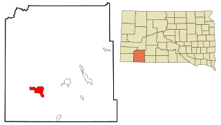
Oglala is a census-designated place (CDP) in West Oglala Lakota Unorganized Territory equivalent, Oglala Lakota County, South Dakota, United States. The population was 1,282 at the 2020 census. Its location is in the northwest of the Pine Ridge Indian Reservation.

Porcupine is a census-designated place (CDP) in Oglala Lakota County, South Dakota, United States. The population was 925 at the 2020 census.
Chester is an unincorporated community and census-designated place (CDP) in Lake County, South Dakota, United States. The population was 257 as of the 2020 census. Chester has been assigned the ZIP code of 57016.

Agency Village is an unincorporated area and census-designated place (CDP) in Roberts County, South Dakota, United States. It is the headquarters of the Sisseton Wahpeton Oyate and home to Sisseton Wahpeton College. Since 2020, the CDP includes the community known as Goodwill. The population of the CDP was 776 at the 2020 census.
Dakota Dunes is an unincorporated community and census-designated place (CDP), master-planned residential and commercial development covering about 2,000 acres (8.1 km2) in Union County in the extreme southeast corner of the U.S. state of South Dakota. The population was 4,020 at the 2020 census.

Manning is a small town in, and the county seat of, Dunn County, North Dakota, United States. Manning was founded in 1908 to serve as the seat of Dunn County, itself organized that year. Its population was not reported in the 2000 census, but was included in the 2020 census, where a population of 47 was given.
Shindler is an unincorporated community and census-designated place (CDP) in Lincoln County, South Dakota, United States. The population was 607 at the 2020 census.

McGregor is an unincorporated community and census-designated place (CDP) in northeastern Williams County, North Dakota, United States. It lies along North Dakota Highway 40, northeast of the city of Williston, the county seat of Williams County. McGregor's elevation is 2,218 feet (676 m). Although unincorporated, it has a post office, with the ZIP code of 58755. It was first listed as a CDP prior to the 2020 census.

Sutton is a census-designated place in western Griggs County, North Dakota, United States. An unincorporated community, it was designated as part of the U.S. Census Bureau's Participant Statistical Areas Program on March 31, 2010. It was not counted separately during the 2000 Census, but was included in the 2010 Census, where a population of 17 was reported.

Denhoff is an unincorporated community and census-designated place in central Sheridan County, North Dakota, United States. The community was designated as part of the U.S. Census Bureau's Participant Statistical Areas Program on March 31, 2010. It was not counted separately during the 2000 Census, but was included in the 2010 Census, where a population of 20 was reported.
Green Acres is a census-designated place in Rolette County, North Dakota, United States. Its population was 605 as of the 2020 census.
River Sioux is an unincorporated community and census-designated place in Harrison County, Iowa, United States. As of the 2010 Census the population was 59.
Anderson, also known as Anderson Subdivision, is an unincorporated community and census-designated place in Minnehaha County, South Dakota, United States. Its population was 388 as of the 2020 census. The community is east of Sioux Falls.
Meadow View Addition is an unincorporated community and census-designated place in Minnehaha County, South Dakota, United States. Its population was 531 as of the 2020 census. The community is located on South Dakota Highway 115, north of Sioux Falls.
Pine Lakes Addition is an unincorporated community and census-designated place in Minnehaha County, South Dakota, United States. Its population was 306 as of the 2020 census. The community is east of Sioux Falls.
Renner Corner is an unincorporated community and census-designated place in Minnehaha County, South Dakota, United States. Its population was 347 as of the 2020 census. The community is located along South Dakota Highway 115, north of Sioux Falls.


