Cannon Ball, North Dakota

Last updated

Cannon Ball, North Dakota
CDP
Cannon Ball, North Dakota.jpg
Cannon Ball River
ND Sioux County Cannon Ball.svg
Location of Cannon Ball, North Dakota
Coordinates: 46°19′02″N100°38′09″W / 46.31722°N 100.63583°W / 46.31722; -100.63583
Country United States
Indian Reservation Standing Rock Indian Reservation
State North Dakota
County Sioux
Area
[1]
  Total96.67 sq mi (250.37 km2)
  Land88.27 sq mi (228.61 km2)
  Water8.40 sq mi (21.76 km2)
Elevation
[2]
1,749 ft (533 m)
Population
 (2020)
  Total864
  Density9.79/sq mi (3.78/km2)
Time zone UTC-6 (Central (CST))
  Summer (DST) UTC-5 (CDT)
ZIP code
58528
FIPS code 38-12020
GNIS feature ID2393365 [2]

Cannon Ball is a census-designated place (CDP) on the Standing Rock Indian Reservation and in Sioux County, North Dakota, United States. It is located in the northeastern part of Sioux County, having developed at the confluence of the Cannonball River and Lake Oahe of the Missouri River. The population was 875 at the 2010 census. [3]

Contents

Geography

According to the United States Census Bureau, the CDP has a total area of 96.8 square miles (251 km2), of which 88.3 square miles (229 km2) is land and 8.4 square miles (22 km2) (8.69%) is water.

Demographics

Historical population
CensusPop.Note
1990 702
2000 86423.1%
2010 8751.3%
2020 864−1.3%
U.S. Decennial Census

At the 2000 census, there were 864 people, 197 households and 171 families residing in the Cannon Ball Census Designated Place ("CDP"). The population density was 9.8 per square mile (3.8/km2). There were 208 housing units at an average density of 2.4 per square mile (0.93/km2).[ citation needed ] At the 2010 census, the racial make-up was 92.9% Native American, 4.8% White, 0.1% from other races and 2.2% from two or more races. Persons of Hispanic or Latino origin comprised 1.4% of the total population. [4]

There were 197 households, of which 56.9% had children under the age of 18 living with them, 38.6% were married couples living together, 35.0% had a female householder with no husband present, and 12.7% were non-families. 11.2% of all households were made up of individuals, and 2.0% had someone living alone who was 65 years of age or older. The average household size was 4.35 and the average family size was 4.56.

46.4% of the population were under the age of 18, 11.2% from 18 to 24, 23.5% from 25 to 44, 15.3% from 45 to 64 and 3.6% were 65 years of age or older. The median age was 20 years. For every 100 females, there were 92.4 males. For every 100 females age 18 and over, there were 86.7 males.

The median household income was $19,265 and the median family income was $18,583. Males had a median income of $21,875 and females $17,250. The per capita income was $5,717. About 49.7% of families and 50.9% of the population were below the poverty line, including 58.3% of those under age 18 and 8.6% of those age 65 or over.

Education

Most of Cannon Ball is in the Solen Public School District 3, while a portion is in the Fort Yates School District. [5] Fort Yates is combined with the Standing Rock Community Grant School.

Related Research Articles

<span class="mw-page-title-main">Sioux County, North Dakota</span> County in North Dakota, United States

Sioux County is a county located along the southern border of the U.S. state of North Dakota. As of the 2020 census, the population was 3,898. Its eastern border is the Missouri River and its county seat is Fort Yates.

<span class="mw-page-title-main">Fort Yates, North Dakota</span> City in Standing Rock Indian Reservation, United States

Fort Yates is a city in Sioux County, North Dakota, United States. It is the tribal headquarters of the Standing Rock Sioux Tribe and county seat of Sioux County. Since 1970 the population has declined markedly from more than 1,100 residents, as people have left for other locations for work. The population was 176 at the 2020 census.

<span class="mw-page-title-main">Marty, South Dakota</span> CDP in South Dakota, United States

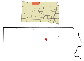
Marty is a census-designated place (CDP) in southern Charles Mix County, South Dakota, United States. The population was 677 at the 2020 census.

<span class="mw-page-title-main">Bullhead, South Dakota</span> CDP in South Dakota, United States

Bullhead is a census-designated place (CDP) in Corson County, South Dakota, United States, within the Standing Rock Indian Reservation. The population was 348 at the 2010 census.

<span class="mw-page-title-main">Little Eagle, South Dakota</span> CDP in South Dakota, United States

Little Eagle is a census-designated place (CDP) in Corson County, South Dakota, United States. The population was 319 at the 2010 census.

<span class="mw-page-title-main">Loomis, South Dakota</span> CDP in South Dakota, United States

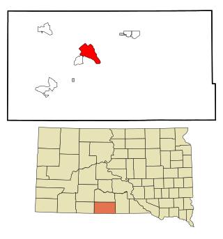
Loomis is a census-designated place (CDP) in Davison County, South Dakota, United States. The population was 33 at the 2020 census. It is part of the Mitchell, South Dakota Micropolitan Statistical Area.

<span class="mw-page-title-main">North Eagle Butte, South Dakota</span> Census-designated place in South Dakota, United States

North Eagle Butte is a census-designated place (CDP) in Dewey County, South Dakota, United States, along the 45th parallel. The population was 1,879 at the 2020 census.

<span class="mw-page-title-main">Kaylor, South Dakota</span> CDP in South Dakota, United States

Kaylor is a census-designated place (CDP) in Hutchinson County, South Dakota, United States. The population was 30 at the 2020 census.

<span class="mw-page-title-main">Wanblee, South Dakota</span> Census-designated place in South Dakota, United States

Wanblee is a census-designated place on the Pine Ridge Indian Reservation, located in Jackson County, South Dakota, United States. The population was 674 at the 2020 census, virtually all of whom are members of the Oglala band of Lakota Sioux. Wanbli is the Lakota word for eagle, and the town was named for its proximity to Wanbli hohpi paha. Wanblee is a few miles directly northeast of the North American continental pole of inaccessibility.

<span class="mw-page-title-main">Lower Brule, South Dakota</span> Census-designated place in South Dakota, United States

Lower Brule is a census-designated place (CDP) in Lyman County, South Dakota, United States. The population was 703 at the 2020 census. The community is located within the Lower Brule Indian Reservation, from which it takes its name.

<span class="mw-page-title-main">Ashland Heights, South Dakota</span> CDP in South Dakota, United States

Ashland Heights is a census-designated place (CDP) and unincorporated community in Pennington County, South Dakota, United States. The population was 678 at the 2020 census.

<span class="mw-page-title-main">Colonial Pine Hills, South Dakota</span> CDP in South Dakota, United States

Colonial Pine Hills is a census-designated place (CDP) and unincorporated community in Pennington County, South Dakota, United States. The population was 1,903 at the 2020 census.

<span class="mw-page-title-main">Green Valley, South Dakota</span> CDP in South Dakota, United States

Green Valley is a census-designated place (CDP) and unincorporated community in Pennington County, South Dakota, United States. The population was 1,051 at the 2020 census.

<span class="mw-page-title-main">Oglala, South Dakota</span> CDP in South Dakota, United States

Oglala is a census-designated place (CDP) in West Oglala Lakota Unorganized Territory equivalent, Oglala Lakota County, South Dakota, United States. The population was 1,282 at the 2020 census. Its location is in the northwest of the Pine Ridge Indian Reservation.

<span class="mw-page-title-main">Pine Ridge, South Dakota</span> CDP in South Dakota, United States

Pine Ridge is a census-designated place (CDP) and the most populous community in Oglala Lakota County, South Dakota, United States. The population was 3,138 at the 2020 census. It is the tribal headquarters of the Oglala Sioux Tribe on the Pine Ridge Indian Reservation.

<span class="mw-page-title-main">Wounded Knee, South Dakota</span> CDP in South Dakota, United States

Wounded Knee is a census-designated place (CDP) on the Pine Ridge Indian Reservation in Oglala Lakota County, South Dakota, United States. The population was 364 at the 2020 census.

<span class="mw-page-title-main">Antelope, South Dakota</span> CDP in South Dakota, United States

Antelope is a census-designated place (CDP) in Todd County, South Dakota, United States. The population was 830 at the 2020 census.

<span class="mw-page-title-main">Rosebud, South Dakota</span> CDP in South Dakota, United States

Rosebud also Sicanġu is a census-designated place (CDP) in Todd County, South Dakota, United States. The population was 1,455 at the 2020 census.

<span class="mw-page-title-main">Two Strike, South Dakota</span> CDP in South Dakota, United States

Two Strike is a census-designated place (CDP) in Todd County, South Dakota, United States, named after Brulé, Lakota chief Two Strike who lived at that location for a period of time. The population was 282 at the 2020 census.

<span class="mw-page-title-main">White Horse, South Dakota</span> CDP in South Dakota, United States

White Horse also Šuŋgská oyáŋke is a census-designated place (CDP) in Todd County, South Dakota, United States. The population was 234 at the 2020 census.

References

  1. "ArcGIS REST Services Directory". United States Census Bureau. Retrieved September 20, 2022.
  2. 1 2 U.S. Geological Survey Geographic Names Information System: Cannon Ball, North Dakota
  3. "2010 Census Redistricting Data (Public Law 94-171) Summary File". American FactFinder. United States Census Bureau . Retrieved May 2, 2011.[ dead link ]
  4. "2010 Demographic Profile Data (DP-1) for Cannon Ball CDP, North Dakota". U.S. Census Bureau. Archived from the original on February 12, 2020. Retrieved December 3, 2016.
  5. "2020 CENSUS - SCHOOL DISTRICT REFERENCE MAP: Sioux County, ND" (PDF). U.S. Census Bureau . Retrieved August 13, 2021.