Osnabrock, North Dakota

Last updated

Osnabrock, North Dakota
First State Bank - Osnabrock, North Dakota 07-19-2009.jpg
First State Bank - Osnabrock
ND Cavalier County Osnabrock.svg
Location of Osnabrock, North Dakota
Coordinates: 48°40′12″N98°08′56″W / 48.67000°N 98.14889°W / 48.67000; -98.14889
CountryUnited States
State North Dakota
County Cavalier
Founded1882
Incorporated1903
Area
[1]
  Total0.30 sq mi (0.78 km2)
  Land0.30 sq mi (0.78 km2)
  Water0.00 sq mi (0.00 km2)
Elevation
[2]
1,621 ft (494 m)
Population
 (2020)
  Total105
  Density350.00/sq mi (135.03/km2)
Time zone UTC-6 (CST)
  Summer (DST) UTC-5 (CDT)
ZIP code
58269
Area code 701
FIPS code 38-60100
GNIS feature ID1036208 [2]

Osnabrock is a city in Cavalier County, North Dakota, United States. The population was 105 at the 2020 census. [3] Osnabrock was founded in 1882 and incorporated as a village in 1903. It was named after Osnabruck, Ontario, the home town of its first postmaster, James T. Anderson. [4] (Osnabruck was itself named after the city of Osnabrück in northwest Germany.)

Contents

Geography

According to the United States Census Bureau, the city has a total area of 0.30 square miles (0.78 km2), all land. [5]

Demographics

Historical population
CensusPop.Note
1910 253
1920 31022.5%
1930 244−21.3%
1940 26910.2%
1950 2845.6%
1960 2891.8%
1970 255−11.8%
1980 222−12.9%
1990 214−3.6%
2000 174−18.7%
2010 134−23.0%
2020 105−21.6%
2021 (est.)105 [6] 0.0%
U.S. Decennial Census [7]
2020 Census [3]

2010 census

As of the census of 2010, there were 134 people, 51 households, and 36 families residing in the city. The population density was 446.7 inhabitants per square mile (172.5/km2). There were 73 housing units at an average density of 243.3 per square mile (93.9/km2). The racial makeup of the city was 96.3% White, 2.2% Native American, and 1.5% from two or more races. Hispanic or Latino of any race were 0.7% of the population.

There were 51 households, of which 11.8% had children under the age of 18 living with them, 62.7% were married couples living together, 5.9% had a female householder with no husband present, 2.0% had a male householder with no wife present, and 29.4% were non-families. 27.5% of all households were made up of individuals, and 11.7% had someone living alone who was 65 years of age or older. The average household size was 2.12 and the average family size was 2.56.

The median age in the city was 61 years. 10.4% of residents were under the age of 18; 5.3% were between the ages of 18 and 24; 15.7% were from 25 to 44; 24% were from 45 to 64; and 44.8% were 65 years of age or older. The gender makeup of the city was 49.3% male and 50.7% female.

2000 census

As of the census of 2000, there were 174 people, 64 households, and 40 families residing in the city. The population density was 592.2 inhabitants per square mile (228.6/km2). There were 85 housing units at an average density of 289.3 per square mile (111.7/km2). The racial makeup of the city was 95.98% White, 2.30% Native American, and 1.72% from two or more races. Hispanic or Latino of any race were 3.45% of the population.

The public school in 1918 Osnabrock school north dakota.jpg
The public school in 1918

There were 64 households, out of which 28.1% had children under the age of 18 living with them, 53.1% were married couples living together, 3.1% had a female householder with no husband present, and 37.5% were non-families. 35.9% of all households were made up of individuals, and 20.3% had someone living alone who was 65 years of age or older. The average household size was 2.23 and the average family size was 2.95.

In the city, the population was spread out, with 21.3% under the age of 18, 8.0% from 18 to 24, 14.9% from 25 to 44, 21.3% from 45 to 64, and 34.5% who were 65 years of age or older. The median age was 50 years. For every 100 females, there were 95.5 males. For every 100 females age 18 and over, there were 98.6 males.

The median income for a household in the city was $43,438, and the median income for a family was $50,938. Males had a median income of $28,750 versus $20,000 for females. The per capita income for the city was $14,254. About 2.7% of families and 6.8% of the population were below the poverty line, including 10.6% of those under the age of eighteen and 12.1% of those 65 or over.

Related Research Articles

<span class="mw-page-title-main">Woodburn, Iowa</span> City in Iowa, United States

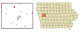
Woodburn is a city in Clarke County, Iowa, United States. The population was 146 at the time of the 2020 census.

<span class="mw-page-title-main">Schleswig, Iowa</span> City in Iowa, United States

Schleswig is a city in Crawford County, Iowa, United States. The population was 830 at the time of the 2020 census.

<span class="mw-page-title-main">Orleans, Iowa</span> City in Iowa, United States

Orleans is a city in Dickinson County, Iowa, United States. The population was 521 at the time of the 2020 census. Orleans is part of the Iowa Great Lakes region, located along Spirit Lake. Numerous state parks are located within a few miles of the town, including Marble Beach and Mini-Wakan.

<span class="mw-page-title-main">Lockridge, Iowa</span> City in Iowa, United States

Lockridge is a city in Jefferson County, Iowa, United States. The population was 244 at the time of the 2020 census. Lockridge was one of the communities considered for the county seat in 1839, but lost out to Fairfield.

<span class="mw-page-title-main">Dixon, Iowa</span> City in Iowa, United States

Dixon is a city in Scott County, Iowa, United States. The population was 202 at the time of the 2020 census.

<span class="mw-page-title-main">North Muskegon, Michigan</span> City in Michigan, United States

North Muskegon is a city in Muskegon County in the U.S. state of Michigan. The population was 3,786 at the 2010 census.

<span class="mw-page-title-main">Vermillion, Minnesota</span> City in Minnesota, United States

Vermillion is a city in Dakota County, Minnesota, United States. The population was 441 at the 2020 census.

<span class="mw-page-title-main">Woodland, Minnesota</span> City in Minnesota, United States

Woodland is a community in Hennepin County, Minnesota, United States, with lake shore property on Lake Minnetonka. The population was 437 at the 2010 census. The first settlers arrived in 1857, when Woodland was part of Minnetonka Township. The land was formally platted in 1882 and developed through the 1890s. Woodland was incorporated as the independent village of Maplewoods in December 1948. It was renamed "Woodland" in 1949.

<span class="mw-page-title-main">Sunburg, Minnesota</span> City in Minnesota, United States

Sunburg is a city in Kandiyohi County, Minnesota, United States. The population was 100 at the 2010 census.

<span class="mw-page-title-main">Pine Springs, Minnesota</span> City in Minnesota, United States

Pine Springs is a city in Washington County, Minnesota, United States. The population was 408 at the 2010 census.

<span class="mw-page-title-main">Goodview, Minnesota</span> City in Minnesota, United States

Goodview is a city in Winona County, Minnesota, United States. The population was 4,158 at the 2020 census.

<span class="mw-page-title-main">Lamar Heights, Missouri</span> City in Missouri, United States

Lamar Heights is a city in Barton County, Missouri, United States. The population was 170 at the 2020 census.

<span class="mw-page-title-main">Freeman, Missouri</span> City in Missouri, United States

Freeman is a city in Cass County, Missouri, United States. The population was 482 at the 2010 census. It is part of the Kansas City metropolitan area.

<span class="mw-page-title-main">Cave, Missouri</span> Populated Place in Missouri, United States

Cave is a populated place in Lincoln County, Missouri, United States. The population was 5 at the 2010 census. With a 2020 population of 5, it is the 939th largest city in Missouri and the 19481st largest city in the United States. Cave is currently declining at a rate of 0.00% annually and its population has decreased by 0.00% since the most recent census, which recorded a population of 5 in 2010.

<span class="mw-page-title-main">Pleasant Hope, Missouri</span> City in Missouri, United States

Pleasant Hope is a city in Polk County, Missouri, United States. The population was 614 at the 2010 census. It is part of the Springfield, Missouri Metropolitan Statistical Area.

<span class="mw-page-title-main">Minnewaukan, North Dakota</span> City in North Dakota, United States

Minnewaukan is a city in Benson County, North Dakota, United States. It serves as the county seat and is fourth largest city in the county, after Fort Totten, Leeds, and Maddock. The population was 199 at the 2020 census. Minnewaukan was founded in 1884.

<span class="mw-page-title-main">Sublimity, Oregon</span> City in Oregon, United States

Sublimity is a city in Marion County, Oregon, United States. The population was 2,967 at the 2020 census. It is part of the Salem Metropolitan Statistical Area.

<span class="mw-page-title-main">Worthington, West Virginia</span> Town in West Virginia, United States

Worthington is a town in Marion County, West Virginia, United States. The population was 158 at the 2010 census. Worthington was incorporated in 1893 and named for Colonel George Worthington, an early settler. U.S. Route 19 passes through the town.

<span class="mw-page-title-main">War, West Virginia</span> City in West Virginia, United States

War is a city in McDowell County, West Virginia, United States. The population was 690 at the 2020 census. War was incorporated in 1920 by the Circuit Court of McDowell County. Its name is derived from War Creek, whose confluence with Dry Fork is located within the city. War is the only place in the United States with this name. War was formerly known as Miner's City. It is also known for being a setting in the movie October Sky; as writer Homer Hickam's Big Creek High School.

<span class="mw-page-title-main">Minneiska, Minnesota</span> City in Minnesota, United States

Minneiska is a city in Wabasha and Winona counties in the U.S. state of Minnesota. The population was 111 at the 2010 census.

References

  1. "ArcGIS REST Services Directory". United States Census Bureau. Retrieved September 20, 2022.
  2. 1 2 U.S. Geological Survey Geographic Names Information System: Osnabrock, North Dakota
  3. 1 2 "Explore Census Data". United States Census Bureau . Retrieved June 16, 2022.
  4. Williams, Mary Ann Barnes (1966). Origins of North Dakota Place Names. Bismarck, ND: Bismarck Tribune. Retrieved June 28, 2017.
  5. "US Gazetteer files 2010". United States Census Bureau. Archived from the original on January 25, 2012. Retrieved June 14, 2012.
  6. "City and Town Population Totals: 2020-2021". United States Census Bureau. July 12, 2022. Retrieved July 12, 2022.
  7. United States Census Bureau. "Census of Population and Housing" . Retrieved August 5, 2013.