
Glenfield is a large village and former civil parish, now in the parish of Glenfields, in the Blaby district of Leicestershire, England. At the 2011 Census, Glenfields had a population of 9,643.
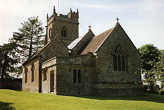
South Cadbury is a village and former civil parish, now in the parish of South Cadbury and Sutton Montis, in the Somerset district of the ceremonial county of Somerset, England. The parish includes the village of Sutton Montis.
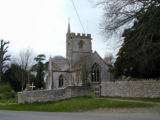
Charlton Mackrell is a village and former civil parish, now in the parish of The Charltons, in the Somerset district, in the ceremonial county of Somerset, England, situated 3 miles (5 km) east of Somerton. The village has a population of 1,020.
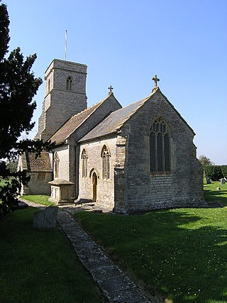
Lovington is a village and civil parish in Somerset, England, situated 3 miles (4.8 km) south west of Castle Cary, between the River Brue and River Cary, in the South Somerset district. The parish, which includes the hamlet of Wheathill, has a population of 141.
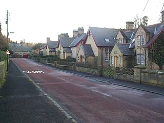
Bothal is a village in Northumberland, in England. It is situated between Morpeth and Ashington. There is a castle, a church, a vicarage opposite the church gates, some stepping stones over the River Wansbeck, and a few houses.

Ingrave is a village and former civil parish, now in the parish of Herongate and Ingrave, in the Brentwood district in Essex, England. It is situated on and around the A128 road, 2 miles (3.2 km) southeast of the town of Brentwood. There is also the adjoining village of Herongate nearby. In 1931 the parish had a population of 692. On 1 January 1937 the parish was abolished and merged with Brentwood.

Carlton is a village and former civil parish, now in the parish of Carlton and Chellington, in the Bedford district, in the ceremonial county of Bedfordshire, England. The River Great Ouse runs just to the north of the village. Nearby places are Chellington, Harrold, Pavenham, Turvey, Lavendon and Odell. In 1931 the parish had a population of 340.

Chesterton is a former mining village on the edge of Newcastle-under-Lyme, in the Newcastle-under-Lyme district, in Staffordshire, England.

Barling is a village and former civil parish, now in the civil parish of Barling Magna in the Rochford district, in the county of Essex, England. It is located approximately 6 km (3.7 mi) northeast of Southend-on-Sea and is 29 km (18 mi) southeast from the county town of Chelmsford. The village is in the parliamentary constituency of Rochford & Southend East. There is a Parish Council of Barling Magna. The village is served by one primary school, Barling Magna Primary Academy.

Orsett is a village, former civil parish and ecclesiastical parish located within Thurrock unitary district in Essex, England, it is north-east of Grays. In 2011 the ward had a population of 6,115.
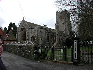
Huntspill is a village and former civil parish on the Huntspill Level in Somerset, England. It lies on the A38 road, 1.5 miles (2.4 km) south of Highbridge. The village is the principal settlement in the civil parish of West Huntspill. In 2019 it had an estimated population of 1102.
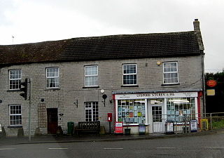
Lydford-on-Fosse is a village and civil parish in the Mendip district of Somerset, England. The parish includes the village of West Lydford and hamlet of East Lydford.

Little Ouseburn is a small village and civil parish in the Harrogate district of North Yorkshire, England. It is situated near the A1(M) motorway and 6 miles (9.7 km) south-east of Boroughbridge. It consists of two roads, Main Street which is the residential area, and Church Lane which contains a Holy Trinity Church that is a grade I listed building. It also has a small brick bridge over a stream which leads to Great Ouseburn. According to the 2011 census data the total population of Little Ouseburn is 264.
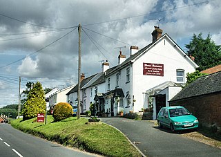
Newton Poppleford is a large village and former civil parish situated on the A3052 road between Exeter and Sidmouth on the west side of the River Otter, now in the parish of Newton Poppleford and Harpford in the East Devon district, in the county of Devon, England, within the East Devon AONB. Newton Poppleford is twinned with Crèvecœur-en-Auge in Normandy, France. In 2019 it had an estimated population of 1784.

Ashurst is a village and former civil parish, now in the parish of Speldhurst, in the Tunbridge Wells district, in the county of Kent, England. It is 5 miles (8 km) west of Royal Tunbridge Wells. The 10th-century parish church is dedicated to St Martin of Tours The parish is located on the border between Kent and East Sussex; the River Medway forms the border between the two counties. There were two watermills located here, both now closed, and there is a weir on the river. In 1931 the parish had a population of 171.

Hardham is a small village and former civil parish, now in the parish of Coldwaltham, in the Horsham district of West Sussex, England. It is on the A29 road 1.2 miles (2 km) southwest of Pulborough. In 1931 the parish had a population of 107.

Wiggonholt is a village and former civil parish, now in the parish of Parham, in the Horsham district of West Sussex, England. It is 1.5 miles (2.4 km) southeast of Pulborough on the A283 road. The village consists of a farm, a few houses and a small Church of England parish church. In 1931 the parish had a population of 54. On 1 April 1933 the parish was abolished and merged with Parham.

Littleborough is a village and former civil parish, now in the parish of Sturton le Steeple, in the Bassetlaw district, in the county of Nottinghamshire, England. It is 8 miles (13 km) east of Retford. Littleborough is the site of the Roman town of Segelocum or Agelocum, on the west bank of the River Trent where the road linking Lincoln and Doncaster bridged or forded the river. In 1931 the parish had a population of 32. On 1 April 1935 the parish was abolished and merged with Sturton le Steeple.
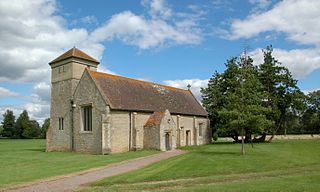
Hardwick is a village and former civil parish, now in the parish of Hardwick-with-Yelford, in the West Oxfordshire district, in the county of Oxfordshire, England. The village is on the A415 road about 2.5 miles (4 km) southeast of Witney. It lies on the river Windrush. Hardwick was historically a hamlet or chapelry in the ancient parish of Ducklington. It became a separate civil parish in 1866. On 1 April 1932 the parish was merged with the parish of Yelford and large parts of the parishes of Ducklington and Standlake to form the civil parish of Hardwick-with-Yelford, part also went to Standlake. In 1931 the parish had a population of 97.

The Church of St Peter in Lydford-on-Fosse, Somerset, England was built in 1846. It is a Grade II* listed building.


