Lydford-on-Fosse

Last updated

Lydford-on-Fosse
Lydford stores.jpg
Lydford stores
Somerset UK location map.svg
Red pog.svg
Lydford-on-Fosse
Location within Somerset
Population511 (2011) [1]
OS grid reference ST565305
District
Shire county
Region
Country England
Sovereign state United Kingdom
Post town SOMERTON
Postcode district TA11
Dialling code 01963
Police Avon and Somerset
Fire Devon and Somerset
Ambulance South Western
UK Parliament
List of places
UK
England
Somerset
51°04′20″N2°37′20″W / 51.07217°N 2.62225°W / 51.07217; -2.62225

Lydford-on-Fosse is a village and civil parish in the Mendip district of Somerset, England. The parish includes the village of West Lydford and hamlet of East Lydford.

Contents

History

Lydford-on-Fosse straddles the Fosse Way, an ancient Roman road which linked the cities of Lincoln and Exeter. The village takes its name from two Saxon words, Lyd torrent or noisy stream and Ford a passage crossing a river, [2] and was established before the Norman Conquest. [3] The villages of East and West Lydford are to the east and west of the ford which was where the Fosse Way crossed the river Brue.

A place where a river could be forded became a meeting place and a centre for trade and the granting of a charter for a fair and weekly market in the reign of Henry III (1216–1272) suggests that Lydford was already a place of some importance by that time. [3] Fair Place, West Lydford, is where the fair was held. The Manor of West Lydford was bequeathed by the 4th Earl of Derby in his will of 1593 to his second son the Hon William Stanley of Lathom, Lancashire. In 1594 William became the 6th Earl on the sudden death of his older brother Ferdinando the 5th Earl. At least 1800 years of recorded history of East and West Lydford, with entries for both in Domesday Book, have led to the Parish now known as Lydford on Fosse.

The parish of West Lydford was part of the hundred of Catsash, while East Lydford was in Somerton Hundred. [4]

The modern A37 trunk road follows the route of the ancient Fosse Way through the parish.

Governance

The parish council has responsibility for local issues, including setting an annual precept (local rate) to cover the council's operating costs and producing annual accounts for public scrutiny. The parish council evaluates local planning applications and works with the local police, district council officers, and neighbourhood watch groups on matters of crime, security, and traffic. The parish council's role also includes initiating projects for the maintenance and repair of parish facilities, as well as consulting with the district council on the maintenance, repair, and improvement of highways, drainage, footpaths, public transport, and street cleaning. Conservation matters (including trees and listed buildings) and environmental issues are also the responsibility of the council.

The village falls within the Non-metropolitan district of Mendip, which was formed on 1 April 1974 under the Local Government Act 1972, having previously been part of Shepton Mallet Rural District, [5] which is responsible for local planning and building control, local roads, council housing, environmental health, markets and fairs, refuse collection and recycling, cemeteries and crematoria, leisure services, parks, and tourism.

Somerset County Council is responsible for running the largest and most expensive local services such as education, social services, libraries, main roads, public transport, policing and fire services, trading standards, waste disposal and strategic planning.

It is also part of the Somerton and Frome county constituency represented in the House of Commons of the Parliament of the United Kingdom. It elects one Member of Parliament (MP) by the first past the post system of election.

Facilities

Lydford on Fosse is served by a pub (the Cross Keys), petrol station (with shop) and a motorhome shop.

Religious sites

The Church of St Mary in East Lydford [6] was built in 1866 by Benjamin Ferrey for the rector, J. J. Moss. It was last used for worship in 1987 and has been privately owned since 1993. The building is Grade II listed, [7] but is disused and derelict, and is described in the Mendip District Council Buildings at Risk Register as being in 'poor' condition and possibly being structurally unsound. [8]

Ferrey also built the Anglican parish Church of St Peter on the site of an earlier church in the village of West Lydford. [9]

Related Research Articles

<span class="mw-page-title-main">Shepton Mallet</span> Town in Somerset, England

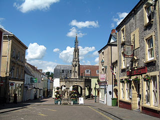
Shepton Mallet is a market town and civil parish in Somerset, England, some 16 miles southwest of Bath, 18 miles south of Bristol and five miles east of Wells. It had an estimated population of 10,810 in 2019. Mendip District Council was based there. The Mendip Hills lie to the north and the River Sheppey runs through the town, as does the route of the Fosse Way, the main Roman road between north-east and south-west England. There is evidence of Roman settlement. Its listed buildings include a medieval parish church. Shepton Mallet Prison was England's oldest, but closed in March 2013. The medieval wool trade gave way to trades such as brewing in the 18th century. It remains noted for cider production. It is the closest town to the Glastonbury Festival and nearby the Royal Bath and West of England Society showground.

<span class="mw-page-title-main">Mendip District</span> Former non-metropolitan district in England

Mendip was a local government district of Somerset in England. The district covered a largely rural area of 285 square miles (738 km2) with a population of approximately 112,500, ranging from the Wiltshire border in the east to part of the Somerset Levels in the west. The district took its name from the Mendip Hills. The administrative centre of the district was Shepton Mallet but the largest town was Frome.

<span class="mw-page-title-main">Somerton, Somerset</span> Town in Somerset, England

Somerton is a town and civil parish in the English county of Somerset. It gave its name to the county and was briefly, around the start of the 14th century, the county town, and around 900 was possibly the capital of Wessex. It has held a weekly market since the Middle Ages, and the main square with its market cross is today popular with visitors. Situated on the River Cary, approximately 8.8 miles (14.2 km) north-west of Yeovil, Somerton has its own town council serving a population of 4,697 as of 2011.

<span class="mw-page-title-main">Pilton, Somerset</span> Human settlement in England

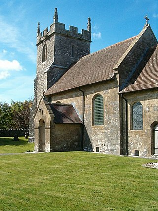
Pilton is a village and civil parish in Somerset, England, situated on the A361 road in the Mendip district, 3 miles (5 km) south-west of Shepton Mallet and 6 miles (10 km) east of Glastonbury. The village has a population of 998. The parish includes the hamlets of West Compton, East Compton, Westholme, Beardly Batch and Cannards Grave.

<span class="mw-page-title-main">Chilcompton</span> Human settlement in England

Chilcompton is a village and civil parish in Somerset, England, situated in the Mendip Hills two miles south of Midsomer Norton and 3.0 miles south-west of Westfield. It is situated on the B3139 road between Radstock and Wells, close to the A37.

<span class="mw-page-title-main">Butleigh</span> Human settlement in England

Butleigh is a small village and civil parish, located in Somerset. The nearest village to it is Barton St David, and it is located a short distance from Glastonbury and Street. Its population is 823. Butleigh has a church, small village shop, a Church of England primary school and Butleigh Nursery School.

<span class="mw-page-title-main">Ashwick</span> Human settlement in England

Ashwick is a village in Somerset, England, about three miles north of Shepton Mallet and seven miles east from Wells. It has also been a civil parish since 1826. The parish had a population of 1,352 according to the 2011 census, and apart from Ashwick village also includes Gurney Slade and Oakhill.

<span class="mw-page-title-main">Witham Friary</span> Human settlement in England

Witham Friary is a small English village and civil parish located between the towns of Frome and Bruton in the county of Somerset. It is in the Cranborne Chase and West Wiltshire Downs Area of Outstanding Natural Beauty and the ancient Forest of Selwood.

<span class="mw-page-title-main">Stratton-on-the-Fosse</span> Village in Somerset, England

Stratton-on-the-Fosse is a village and civil parish located on the edge of the Mendip Hills, 2 miles (3 km) south-west of Westfield, 6 miles (10 km) north-east of Shepton Mallet, and 9 miles (14 km) from Frome, in Somerset, England. It has a population of 1,108, and has a rural agricultural landscape, although it was part of the once-thriving Somerset coalfield. Within the boundaries of the parish are the hamlets of Benter and Nettlebridge.

<span class="mw-page-title-main">Cranmore, Somerset</span> Human settlement in England

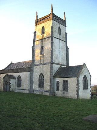
Cranmore is a village and civil parish east of Shepton Mallet, in the Mendip district of Somerset, England. The parish includes the hamlets of Waterlip, East Cranmore and Dean.

<span class="mw-page-title-main">Ditcheat</span> Human settlement in England

Ditcheat is a village and civil parish 4.5 miles (7 km) south of Shepton Mallet, and 2.5 miles (4 km) north-west of Castle Cary, in Somerset, England. Besides the village, the parish has four hamlets: Wraxall, Lower Wraxall, Alhampton and Sutton.

<span class="mw-page-title-main">Downhead</span> Human settlement in England

Downhead is a village and civil parish just south of Leigh-on-Mendip and 5 miles (8 km) north east of Shepton Mallet, in the Mendip district of Somerset, England. The parish includes the hamlet of Tadhill.

<span class="mw-page-title-main">East Pennard</span> Human settlement in England

East Pennard is a village and civil parish 4 miles (6.4 km) north west of Castle Cary, and 5 miles (8.0 km) south of Shepton Mallet, in the Mendip district of Somerset, England. It has a population of 348. The parish includes the hamlets of Stone, Parbrook and Huxham.

<span class="mw-page-title-main">Emborough</span> Human settlement in England

Emborough is a village and civil parish 5 miles (8.0 km) north of Shepton Mallet, and 5 miles (8.0 km) north east of Wells, in the Mendip district of Somerset, England. It adjoins the parish of Ston Easton. It is situated on the B3139 between Radstock and Wells, just off the A37 road.

<span class="mw-page-title-main">Lamyatt</span> Human settlement in England

Lamyatt is a village and civil parish in the Mendip district of Somerset, England. It lies 5 miles (8 km) south east of Shepton Mallet, 2 miles (3 km) north east of Castle Cary, and 3 miles (5 km) south of Evercreech. The parish has a population of 183.

<span class="mw-page-title-main">Milton Clevedon</span> Human settlement in England

Milton Clevedon is a village and civil parish 1 mile (1.6 km) south of Evercreech in the Mendip district of Somerset, England.

<span class="mw-page-title-main">North Wootton, Somerset</span> Human settlement in England

North Wootton is a village and civil parish, on the River Redlake, 2.5 miles (4.0 km) south east of Wells, and 3.5 miles (5.6 km) south west of Shepton Mallet in the Mendip district of Somerset, England.

<span class="mw-page-title-main">Pylle</span> Human settlement in England

Pylle is a village and civil parish 4 miles (6.4 km) south west of Shepton Mallet, and 7 miles (11.3 km) from Wells, in the Mendip district of Somerset, England. It has a population of 160. The parish includes the hamlet of Street on the Fosse.

<span class="mw-page-title-main">Stoke St Michael</span> Village and civil parish in England

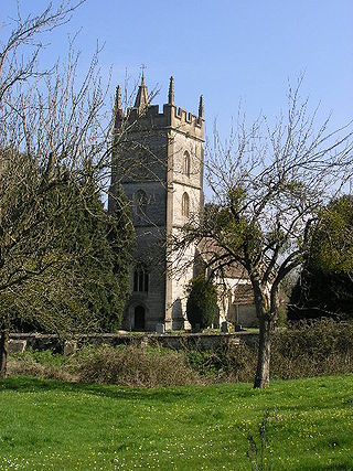
Stoke St Michael is a village and civil parish on the Mendip Hills 4 miles (6.4 km) north east of Shepton Mallet, and 8 miles (12.9 km) west of Frome, in the Mendip district of Somerset, England.

Shepton Mallet was a rural district in Somerset, England, from 1894 to 1974.

References

  1. "Lydford-on-Fosse Parish". Neighbourhood Statistics. Office for National Statistics. Retrieved 1 January 2014.
  2. Ekwall, Eilert (1960). The Concise Oxford Dictionary of English Place-names (4th ed.). Oxford University Press. p. 308. ISBN   0198691033.
  3. 1 2 R. W. Dunning (editor), A. P. Baggs, R. J. E. Bush, Margaret Tomlinson (1974). "Parishes: East Lydford". A History of the County of Somerset: Volume 3. Institute of Historical Research. Retrieved 9 July 2014.{{cite web}}: |author= has generic name (help)CS1 maint: multiple names: authors list (link)
  4. "Somerset Hundreds". GENUKI. Retrieved 19 October 2011.
  5. "Shepton Mallet RD". A vision of Britain Through Time. University of Portsmouth. Retrieved 4 January 2014.
  6. R. W. Dunning (editor), A. P. Baggs, R. J. E. Bush, Margaret Tomlinson (1974). "Parishes: East Lydford". A History of the County of Somerset: Volume 3. Institute of Historical Research. Retrieved 6 January 2014.{{cite web}}: |author= has generic name (help)CS1 maint: multiple names: authors list (link)
  7. Historic England. "Church of St Mary (1058831)". National Heritage List for England . Retrieved 25 November 2006.
  8. "Historic Buildings at Risk Register". Mendip District Council. pp. Entry 24. Archived from the original on 15 August 2016. Retrieved 5 August 2016.
  9. Historic England. "Church of St. Peter (1175052)". National Heritage List for England . Retrieved 25 January 2009.

William Stanley ,6th Earl of Derby

Commons-logo.svg Media related to Lydford-on-Fosse at Wikimedia Commons