Frome is a town and civil parish in Somerset, England, on uneven high ground at the eastern end of the Mendip Hills and on the River Frome, 13 miles (21 km) south of Bath. The population of the parish was 28,559 in 2021.
Southwick is a semi-rural village and civil parish 3 miles (4.8 km) south-west of the county town of Trowbridge, Wiltshire, England. It is separated from the south-west fringe of Trowbridge only by the Southwick Country Park, which consists of 380 acres (150 ha) of open fields. The majority of the village lies south of the A361, which runs through the village, linking Trowbridge with Frome.
Dowlish Wake is a small village and civil parish in Somerset, England, 2 miles (3 km) south of Ilminster and 5 miles (8 km) northeast of Chard in the South Somerset district. With a population of 277, it has several thatched houses and a pub, the New Inn. Its post office closed in 1991.
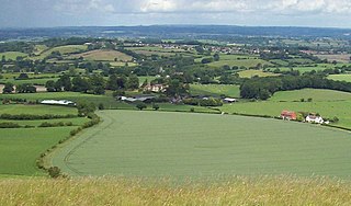
The River Frome is a river in Somerset, England. It rises near Bungalow Farm on Cannwood Lane, south-west of Witham Friary, flows north through Blatchbridge to the town of Frome, and continues in a generally northerly direction passing between the eastern edge of the Mendip Hills and Trowbridge before joining the Bristol Avon at Freshford, below Bradford on Avon.

Compton Dundon is a village and civil parish in Somerset, England, lying beside King's Sedgemoor and the Polden Hills, 5 miles (8 km) south of Glastonbury and 4 miles (6 km) north of Somerton in the South Somerset district. The village has a population of 705. The parish includes the small village of Dundon and the hamlet of Littleton.
Fivehead is a village and civil parish in Somerset, England, situated on the Fivehead River, 8 miles (12.9 km) east of Taunton in the South Somerset district. In 2011 the parish, which includes the hamlet of Swell, had a population of 609.

Whatley is a small rural village and civil parish about 2.5 miles (4 km) west of Frome in the English county of Somerset. The parish lies south of Mells and north of Nunney, and includes the hamlets of Lower Whatley and Chantry.

Queen Camel is a village and civil parish, on the River Cam and the A359 road, in the unitary authority of Somerset, England. It is about 7 miles (11.3 km) north of Yeovil. According to the 2011 census it had a population of 908. The parish includes the hamlet of Wales. Nearby places are West Camel, Sparkford and Marston Magna.

Beckington is a village and civil parish in Somerset, England, across the River Frome from Lullington about three miles north of Frome. According to the 2011 census the parish, which includes the hamlet of Rudge, which has a population of 983, and the hamlet of Standerwick.

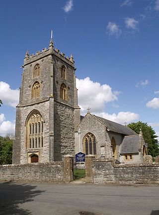
Witham Friary is a small English village and civil parish located between the towns of Frome and Bruton in the county of Somerset. It is in the Cranborne Chase and West Wiltshire Downs Area of Outstanding Natural Beauty and the ancient Forest of Selwood.

Norton Malreward is a small Somerset village and civil parish 4 miles (6.4 km) south of Bristol, England at the northern edge of the Chew Valley. In 1895 Norton Malreward was combined with the neighbouring hamlet of Norton Hawkfield into a single parish, which has a population of 246.

Mells is a village and civil parish in Somerset, England, near the town of Frome.
Corsley is a hamlet and civil parish 3 miles (5 km) west of Warminster in Wiltshire, England. The parish is on the county border with Somerset; the Somerset town of Frome is about 3 miles (5 km) to the northwest. The largest settlement in the parish is Corsley Heath, which is on the A362 Warminster-Frome road.

Cranmore is a village and civil parish east of Shepton Mallet, in Somerset, England. The parish includes the hamlets of Waterlip, East Cranmore and Dean. In 2011 the parish had a population of 667.
Trudoxhill is a village and civil parish near Nunney in Somerset, England.
Wanstrow is a village and civil parish 6 miles (9.7 km) south west of Frome in Somerset, England. The parish includes the village of Cloford.

West Pennard is a village and civil parish east of Glastonbury, situated at the foot of Pennard Hill, in Somerset, England. The parish includes the hamlets of Coxbridge and Woodlands.

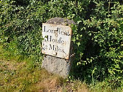
Horningsham is a small village and civil parish in Wiltshire, England, on the county border with Somerset. The village lies about 4 miles (6 km) southwest of the town of Warminster and 4+1⁄2 miles (7 km) southeast of Frome, Somerset.

Kilmington is a village and civil parish in the extreme west of Wiltshire, England, about 8 miles (13 km) southwest of Warminster. The parish includes the hamlets of Kilmington Common and Norton Ferris.

Roddenbury Hillfort is a univallate Iron Age hillfort in the parish of Selwood, Somerset, England. It is a Scheduled Monument and it was on the Heritage at Risk Register in 2011. In 2012 it was announced that it was to undergo major repairs following damage by off road biking. It is close to the later Hales Castle.