West Nipissing

Last updated
West Nipissing
Nipissing-Ouest
Municipality of West Nipissing
Municipalité de Nipissing-Ouest
Sturgeon Falls Ontario.JPG
Power dam on the Sturgeon River in Sturgeon Falls.
West Nipissing, Ontario Location.png
Coordinates: 46°22′N79°55′W / 46.367°N 79.917°W / 46.367; -79.917
Country Canada
Province Ontario
District Nipissing
EstablishedJanuary 1, 1999
Government
  MayorKathleen Thorne Rochon
  Governing BodyWest Nipissing Town Council
  MPs Marc Serré  (Liberal)
  MPPs John Vanthof (NDP)
Area
[1]
  Total1,993.63 km2 (769.74 sq mi)
Population
 (2016) [2]
  Total14,364
  Density7.2/km2 (19/sq mi)
Time zone UTC−5 (EST)
  Summer (DST) UTC−4 (EDT)
Postal Code
P0H, P2B
Area code(s) 705, 249
Website www.westnipissing.ca

West Nipissing is a municipality in Northeastern Ontario, Canada, on Lake Nipissing in the Nipissing District. It was formed on January 1, 1999, with the amalgamation of seventeen and a half former towns, villages, townships and unorganized communities.

Contents

It is the most bilingual community in Ontario, with 73.4% of its population fluent in both English and French.

Communities

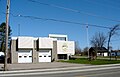
The primary administrative and commercial centre of West Nipissing is the community of Sturgeon Falls, which is situated on the Sturgeon River, 5 kilometres (3.1 mi) north of Lake Nipissing and 35 kilometres (22 mi) west of North Bay on Highway 17, part of the Trans-Canada Highway. Roughly half the population of West Nipissing lives in Sturgeon Falls.

Field is located on Highway 64, approximately 20 kilometres (12 mi) north of Sturgeon Falls. In 1979, the Sturgeon River overflowed its banks, flooding the town's centre. Many houses were demolished and rebuilt on higher ground nearby. The Thistle Fire Tower is to be dismantled and re-erected here as a tourist attraction. Logging, farming and outdoor recreational activities are main village industries.

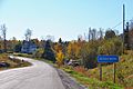
Verner is located on the Veuve River (Rivière Veuve), at the western junction of highways 17 and 64, approximately 16 kilometres (9.9 mi) west of Sturgeon Falls. The largely francophone community serves as an agricultural hub for the surrounding area and offers a consumers' cooperative and farm equipment dealers. The town was named for the wife of Canadian Pacific Railway superintendent Archer Baker, who oversaw the laying of track through the West Nipissing area in the 1880s.

Many of the francophone settlers immigrated to the area from Michigan in the late 19th century in order to preserve their language; they were concerned they would lose their language in the predominantly anglophone United States. Many of the families that settled in Lavigne and Verner came from the Lanaudière region of Quebec from villages such as St-Félix-de-Valois, St-Gabriel-de-Brandon and Ste-Élisabeth.

Smaller communities in the municipality include Cache Bay, Caderette, Crystal Falls, Desaulniers, Evansville, Harfred, Kirk, Lavigne, Notre-Dame-du-Lac, Domrémy and River Valley. It also includes part of the North Monetville area, which straddles the boundary between West Nipissing and French River. The Nipissing First Nation is also located nearby and is closely associated with West Nipissing.

Cache Bay, named after the nearby water feature on a "hidden bay" of Lake Nipissing, had a post office that was established in 1889. [3]

History

The original inhabitants of the area are the N'Biissing, an Anishinabek people, and many N'Biissing still inhabit the area today. A trading post was founded in the last quarter of the 18th century on an island on Lake Nipissing at the mouth of the La Vase River, called Fort La Ronde and was operated by Louis Denis de la Ronde (1675–1741). Fort La Ronde was moved numerous times to different islands on Lake Nipissing. It was later sold to North West Company. It was later bought by the Hudson's Bay Company around 1820 and was later relocated on the right bank of the river several hundred metres below the falls, at the mouth of Sturgeon River, trading with the N'Biissing for furs and other goods. [4] James R. Holditch of Utterson, Ontario is generally credited as being the first permanent non-aboriginal settler in the area. [5] [6] He arrived in 1878 and built a cabin on the left bank, near the waterfalls. Nowadays, the Sturgeon River House Museum sits where the HBC trading post was. It was founded as a centennial project in 1967 by the Historical Restoration Committee of the Sturgeon Falls Secondary High School, the Township of Springer and the Town of Cache Bay, in cooperation and funded by the Government of Canada and the Government of Ontario. It was renovated and re-opened in 1999 and upgraded to include a permanent building capable of being open year-round and vastly improved its exhibits. It is now an agency of the Municipality of West Nipissing and supports the West Nipissing tax base. [7]

The region began to grow in the 1880s, with the arrival of the Canadian Pacific Railway (CPR) and the efforts of Fr. Charles Alfred Marie Paradis, an Oblate missionary, to develop an agricultural settlement for Franco-Ontarians in the Verner area.

The development of Sturgeon Falls began in 1881 with the arrival of Canadian Pacific Railway construction crews. The area's first post office was opened in Sturgeon Falls in 1881. Lumbering and the establishment of pulp and paper industries accelerated the village's growth and attracted many French-Canadian settlers to the area. [8]

The addition of sawmills and the rapid growth of the lumbering and pulp and paper industries stimulated the development of the village and attracted many French-Canadian settlers to the area. The town of Sturgeon Falls was incorporated on April 16, 1895. At the time, J. A. Lévis was elected the first mayor and the population was 850.

The Canadian Pacific Railway was joined by the Canadian Northern Railway in 1915, with its line between Capreol and North Bay. This line later became the Canadian National Railway Alderdale Subdivision, with station stops (from east to west) in Harfred, Crystal Falls, Ashburton, Field, Desaulniers, and River Valley, along with several industrial spurs to serve local industries. [9] CN rail service declined in the mid-20th century and was eliminated altogether in 1996. [10]

The community of Field suffered two significant natural disasters in the 1970s. On August 20, 1970, it was hit by a small tornado associated with the Sudbury tornado event. In the spring of 1979 the Sturgeon River overflowed its banks at Field, causing massive flooding in the town's centre. [11] Half the town that was located in the flood plain was relocated to higher ground two kilometres south of the original town centre on Highway 64. This new location is known as New Field (Val-des-Arbres).

Demographics

In the 2021 Census of Population conducted by Statistics Canada, West Nipissing had a population of 14,583 living in 6,413 of its 7,252 total private dwellings, a change of 1.5% from its 2016 population of 14,364. With a land area of 1,956.27 km2 (755.32 sq mi), it had a population density of 7.5/km2 (19.3/sq mi) in 2021. [12]

Canada census – West Nipissing community profile
2016 2011
Population14,364 (1.5% from 2011)14,149 (5.5% from 2006)
Land area1,993.68 km2 (769.76 sq mi)1,992.08 km2 (769.15 sq mi)
Population density7.2/km2 (19/sq mi)7.1/km2 (18/sq mi)
Median age45.5 (M: 45.0, F: 46.0)47.1 (M: 46.7, F: 47.5)
Private dwellings7,013 (total) 7,156 (total) 
Median household income$55,390
References: 2016 [13] 2011 [14] earlier [15] [16]

Transportation

Ontario Northland motor coach service makes scheduled stops in Sturgeon Falls and Verner. [17]

Media and education

The region is served primarily by broadcast stations from North Bay and Sudbury. Two commercial radio stations, CFSF-FM and CHYQ-FM, [18] broadcast from Sturgeon Falls.

The area has a bilingual weekly newspaper, Tribune: West Nipissing This Week / La Voix du Nipissing Ouest, which was previously called The Sturgeon Falls Tribune. It is also served by the daily North Bay Nugget .

Students attend either Northern Secondary School (École secondaire publique Northern) or École secondaire catholique Franco-Cité.

Notable people

See also

Related Research Articles

<span class="mw-page-title-main">North Bay, Ontario</span> City in Ontario, Canada

North Bay is a city in Northeastern Ontario, Canada. It is the seat of Nipissing District, and takes its name from its position on the shore of Lake Nipissing. North Bay developed as a railroad centre, and its airport was an important military location during the Cold War. The city is located 300 kilometres (190 mi) from both Ottawa and Toronto.

<span class="mw-page-title-main">Kapuskasing</span> Town in Ontario, Canada

Kapuskasing is a town on the Kapuskasing River in the Cochrane District of Northern Ontario, Canada, approximately 92 kilometres (57 mi) east of Hearst and 130 kilometres (81 mi) northwest of Timmins. The town was known as MacPherson until 1917, when the name was changed so as not to conflict with another railway stop in Manitoba.

<span class="mw-page-title-main">Sudbury District</span> District in Ontario, Canada

The Sudbury District is a district in Northeastern Ontario in the Canadian province of Ontario. It was created in 1894 from townships of eastern Algoma District and west Nipissing District.

<span class="mw-page-title-main">Parry Sound District</span> District in Ontario, Canada

Parry Sound District is a census division of the Canadian province of Ontario. Its boundaries are District of Muskoka to the south, the Sudbury District to the north-northwest, the French River and Lake Nipissing in the north, Nipissing District and North Bay in the north and east and parts of Algonquin Park in the northeast.

<span class="mw-page-title-main">Restoule</span> Designated place with Local Services Board in Ontario, Canada

Restoule is a community and designated place in geographic Patterson Township in the Centre Unorganized Part of Parry Sound District in Central Ontario, Canada. It is situated on the Restoule River between Commanda Lake, and Restoule Lake and is part of the Almaguin Highlands region.

<span class="mw-page-title-main">Nipissing District</span> District in Ontario, Canada

Nipissing District is a district in Northeastern Ontario in the Canadian province of Ontario. It was created in 1858. The district seat is North Bay.

<span class="mw-page-title-main">Nickel Centre</span> Community in Ontario, Canada

Nickel Centre was a town in Ontario, Canada, which existed from 1973 to 2000.

<span class="mw-page-title-main">Sturgeon Falls</span> Community in West Nipissing, Ontario, Canada

Sturgeon Falls is a community and former town in Nipissing District, Ontario, located on the Sturgeon River. The community had a population of 6,939 at the 2021 census and a density of 1,129/km2. Following a failed legal challenge in 1997, the community was merged into the municipality of West Nipissing in 1999.

<span class="mw-page-title-main">Burk's Falls</span> Village in Ontario, Canada

Burk's Falls is an incorporated village in the Almaguin Highlands region of Parry Sound District, Ontario, Canada, located 265 kilometres (165 mi) north of Toronto and 90 kilometres (56 mi) south of North Bay, Ontario. The village, and the waterfall on the site, were named by David Francis Burk of Oshawa, after he selected the land surrounding the waterfall in the Free Land Grant Act. Burk's Falls is part of the Magnetawan River waterway.

<span class="mw-page-title-main">French River, Ontario</span> Municipality in Ontario, Canada

French River, also known as Rivière-des-Français, is a municipality in the Canadian province of Ontario, in the Sudbury District. The municipality had a population of 2,662 in the Canada 2016 Census. It was formed in 1999 through the merger of the Township of Cosby, Mason and Martland and surrounding unincorporated portions of the Unorganized North Sudbury District. It was named after the French River, which flows through the municipality.

<span class="mw-page-title-main">Bonfield, Ontario</span> Township in Ontario, Canada

Bonfield is a township in northeastern Ontario, Canada, on the Mattawa River in Nipissing District.

<span class="mw-page-title-main">East Ferris</span> Township in Ontario, Canada

East Ferris is a township in northeastern Ontario, Canada located between Trout Lake and Lake Nosbonsing in the District of Nipissing. West Ferris has long been annexed into the city of North Bay.

<span class="mw-page-title-main">Nipissing, Ontario</span> Township in Ontario, Canada

Nipissing is an incorporated (political) township in Parry Sound District in Central Ontario, Canada. It is on Lake Nipissing and is part of the Almaguin Highlands region. Nipissing was surveyed between 1874 and 1881, and was incorporated in 1888. Among the first settlers in the area were the Chapman and Beatty families. Nipissing Township annexed Gurd Township in 1970. The township also contains a community named Nipissing, which is located on the South River near Chapman's Landing, on the South Bay of Lake Nipissing. The township administrative offices are located in Nipissing.

<span class="mw-page-title-main">Englehart</span> Town in Ontario, Canada

Englehart is a town in the Canadian province of Ontario, located on the Blanche River in the Timiskaming District.

<span class="mw-page-title-main">Chisholm, Ontario</span> Township in Ontario, Canada

Chisholm is a township in Northeastern Ontario, Canada, located in the Nipissing District.

King's Highway 64, commonly referred to as Highway 64, is a provincially maintained highway in the Canadian province of Ontario, connecting Highway 69 north of the French River with Highway 11 at Marten River, via Highway 17 west of Sturgeon Falls. The route serves several communities along the north shore of the French River and west shore of Lake Nipissing as it travels from Highway 69 to Highway 17. North of Sturgeon Falls, the highway provides a shortcut between Highway 17 and Highway 11 northwest of North Bay.

Shellbrook is a rural community in Saskatchewan, Canada located 44.5 km (27.7 mi) west of Prince Albert. The population of the town was 1,433 in 2011. Highways 3, 40, and 55 provide access to the community. Approximately 50 businesses provide a wide range of goods, services, and professional expertise.

<span class="mw-page-title-main">Ear Falls</span> Township in Ontario, Canada

Ear Falls is a township located in Northwestern Ontario, Canada, on the banks of the English River, Lac Seul, Pakwash Lake and Wenesaga Lake. It is located along Highway 105, 100 kilometres (62 mi) north of Highway 17 and Vermilion Bay, about halfway between Highway 17 and Red Lake, or about 480 kilometres (300 mi) northwest of Thunder Bay.

<span class="mw-page-title-main">Sioux Narrows-Nestor Falls</span> Township in Ontario, Canada

Sioux Narrows-Nestor Falls is a township in the Canadian province of Ontario, located in the Kenora District. It is located on the eastern shores of Lake of the Woods along Ontario Highway 71.

<span class="mw-page-title-main">Nipissing First Nation</span> Indian reserve in Ontario, Canada

Nipissing First Nation is a long-standing community of Nishnaabeg peoples located along the shorelines of Lake Nipissing in northern Ontario. They are referred to by many names in European historical records, since the colonists often adopted names given to them by other nations.

References

  1. "West Nipissing / Nipissing Ouest, Ontario (Code 3548055) census profile". 2011 Census of Population . Statistics Canada. 8 February 2012. Retrieved 2013-10-13.
  2. "Census Profile, 2016 Census: West Nipissing". Statistics Canada. Retrieved June 24, 2019.
  3. Hamilton, William (1978). The Macmillan Book of Canadian Place Names. Toronto: Macmillan. p. 139. ISBN   0-7715-9754-1.
  4. "Sturgeon River House". Archived from the original on January 9, 2007. Retrieved December 23, 2018.
  5. "James Holditch (1851- 1913)". HFHS Journal (20). May 2002.
  6. "Sturgeon Falls Settler Dies". Ottawa Journal . July 15, 1913. Retrieved May 21, 2021.
  7. "Sturgeon River House Museum". Municipality of West Nipissing. Retrieved June 24, 2019.
  8. "Founding of Sturgeon Falls". Ontario Heritage Trust. Retrieved June 24, 2019.
  9. "Alderdale Subdivision". CNR in Ontario. 9 July 2019. Retrieved 20 July 2020.
  10. Canadian Transportation Agency (18 April 1996), Order No. 1996-R-152 , retrieved 25 July 2020
  11. "Water level still rising in stricken Ontario town". The Globe and Mail , May 1, 1979.
  12. "Population and dwelling counts: Canada, provinces and territories, census divisions and census subdivisions (municipalities), Ontario". Statistics Canada. February 9, 2022. Retrieved March 31, 2022.
  13. "2016 Community Profiles". 2016 Canadian Census . Statistics Canada. August 12, 2021. Retrieved 2017-03-16.
  14. "2011 Community Profiles". 2011 Canadian Census . Statistics Canada. March 21, 2019. Retrieved 2013-10-13.
  15. "2006 Community Profiles". 2006 Canadian Census . Statistics Canada. August 20, 2019.
  16. "2001 Community Profiles". 2001 Canadian Census . Statistics Canada. July 18, 2021.
  17. https://www.ontarionorthland.ca/communications/schedules/new/2023-09-15-SCHED-501-502-EN.PDF
  18. Broadcasting Decision CRTC 2011-2
  19. McGill Reporter – Volume 28 Number 8
  20. "Roxy dies from injuries (continued from page 1)". Simcoe Reformere. Simcoe, Ontario. February 28, 1975. p. 12.