
Burrard Inlet is a shallow-sided fjord in the northwestern Lower Mainland, British Columbia, Canada. Formed during the last Ice Age, it separates the City of Vancouver and the rest of the lowland Burrard Peninsula to the south from the coastal slopes of the North Shore Mountains, which span West Vancouver and the City and District of North Vancouver to the north.

The Discovery Islands are a group of islands located at the northern end of the Salish Sea and the eastern end of Johnstone Strait, between Vancouver Island and the mainland coast of British Columbia, Canada.
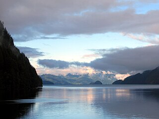
Toba Inlet is one of the lesser, but still principal, inlets of the British Columbia Coast. It is fourth in the series north from the 49th parallel which begins with Burrard Inlet, which is the harbour for the city of Vancouver. Between it and Jervis Inlet to its east, however, there is a freshwater fjord, Powell Lake, which has been augmented by a small hydro project to supply power to the large pulp mill at Powell River, the principal town of the Malaspina Peninsula of the upper Sunshine Coast. Klahoose 1 Reserve, of the Klahoose First Nation is at the mouth of Toba River at the Head of Toba Inlet. Toba Inlet and the Toba Valley is home to many grizzly bears.

Knight Inlet is one of the principal inlets of the British Columbia Coast, and the largest of the major inlets in the southern part of the Coast. It is fifth in sequence of the great saltwater inlets north from the 49th parallel near Vancouver, but it is the first whose outflow points away from the Strait of Georgia, opening into Queen Charlotte Strait at the Kwakwakaʼwakw community of Memkumlis on Village Island.

Desolation Sound is a deep water sound at the northern end of the Salish Sea and of the Sunshine Coast in British Columbia, Canada.
Háthayim Marine Provincial Park, formerly Von Donop Marine Provincial Park, is a provincial park in British Columbia, Canada, located on the north end of Cortes Island in the Discovery Islands.

Dionisio Alcalá Galiano was a Spanish naval officer, cartographer, and explorer. He mapped various coastlines in Europe and the Americas with unprecedented accuracy using new technology such as chronometers. He commanded an expedition that explored and mapped the Strait of Juan de Fuca and the Strait of Georgia, and made the first European circumnavigation of Vancouver Island. He reached the rank of brigadier and died during the Battle of Trafalgar.
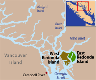
East Redonda Island is a coastal island in British Columbia, Canada, part of the Discovery Islands archipelago. It lies just to the north of Desolation Sound Marine Park, which is located off the north end of the Malaspina Peninsula at the mouth of Toba Inlet within Electoral Area C of the Strathcona Regional District.

Cortes Island is an island in the Discovery Islands archipelago on the coast of British Columbia, Canada. The island is 25 km (16 mi) long, 13 km (8 mi) wide, and 130 km2 (50 sq mi) in area. It has a population of 1,035 permanent residents. Cortes Island lies within Electoral Area B of the Strathcona Regional District, which provides water and sewage systems, fire protection, land use planning, parks, recreation, and emergency response.

Cayetano Valdés y Flores Bazán (1767–1835) was a commander of the Spanish Navy, explorer, and captain general who served in the French Revolutionary and Napoleonic Wars, fighting for both sides at different times due to the changing fortunes of Spain in the conflict. He took part in a number of naval battles, including the Great Siege of Gibraltar, the Battle of Cape St Vincent, and the Battle of Trafalgar. He was an explorer, most notable in the Pacific Northwest, where he and Dionisio Alcalá Galiano conducted the first circumnavigation of Vancouver Island, in partial cooperation with George Vancouver. Over his long career he achieved the highest ranks in the Spanish Navy, eventually being named Captain General of Cadiz and Captain General of the Spanish Navy.
The ƛoʔos Klahoose are one of the three groups comprising the ʔayʔaǰuθəm Tla'Amin or Mainland Comox. The other two divisions of this once-populous group are the χʷɛmaɬku Homalco and Sliammon. The Klahoose, Homalco and Sliammon are, according to oral tradition, the descendants of the survivors of the Great Flood. The three groups were split by colonialism into different band councils but united historically as the Tla A'min, known as the Mainland Comox, and K’ómoks, the larger grouping of the Comox people, also known as the Island Comox and before the merger with the Laich-kwil-tach culture. Historically both groups are a subgroup of the Coast Salish though the K’ómoks name is from, and their language today, is the Lik'wala dialect of Kwak'wala. The ancestral tongue is the Comox language, though the Sahtloot/Island dialect is extinct.

West Thurlow Island is an island in British Columbia, Canada. It is part of the Discovery Islands, an archipelago between Vancouver Island and the mainland, whose waters connect the Strait of Georgia with Johnstone Strait and Queen Charlotte Strait.
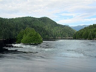
Cordero Channel is a strait in British Columbia, Canada, located between the mainland and Vancouver Island, among the Discovery Islands north of the Strait of Georgia. Cordero Channel runs north of Sonora Island, East Thurlow Island, and part of West Thurlow Island. Its eastern end connects to the mouth of Bute Inlet and to Calm Channel, at Stuart Island. Its west end is marked by the mouth of Loughborough Inlet, beyond which the channel is called Chancellor Channel, which continues west to Johnstone Strait.

José Cardero was a Spanish draughtsman and artist. He is most remembered for his work on the expedition of Alejandro Malaspina and the related expedition of Dionisio Alcalá Galiano. During the Galiano voyage Cordero Channel was named in his honor. Other places in British Columbia were later named in his honor as well, including Dibuxante Point, "dibuxante" being Spanish for "draughtsman".

Sutil Channel is a broad strait located in the Discovery Islands of British Columbia, Canada.
The Malaspina Peninsula is a peninsula in the northern Gulf of Georgia-Sunshine Coast region of British Columbia, Canada. It extends northwest from the town of Powell River, which lies near its isthmus, past the settlement of Lund, to Desolation Sound. This sound spans the opening of Toba Inlet, a fjord lying between Lund and the Discovery Islands to the west and northwest.
Malaspina Strait is a strait in the northern Gulf of Georgia-Sunshine Coast region of British Columbia, Canada. It separates Texada Island from the upper Sunshine Coast-Malaspina Peninsula area on the adjacent mainland.
Frederick Arm is an inlet on the South Coast of British Columbia, extending north from Cordero Channel between Lougborough and Bute Inlets.
The New Westminster Land District is one of 59 land districts of British Columbia, Canada, which are the underlying cadastral divisions of that province, created with rest of those on Mainland British Columbia via the Lands Act of the Colony of British Columbia in 1860. The British Columbia government's BC Names system, a subdivision of GeoBC, defines a land district as "a territorial division with legally defined boundaries for administrative purposes". All land titles and surveys use the Land District system as the primary point of reference, and entries in BC Names for placenames and geographical objects are so listed.
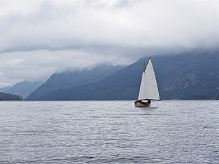
Lewis Channel is a strait located between Cortes Island and West Redonda Island in the Discovery Islands of British Columbia, Canada. It is part of the northern Salish Sea.


