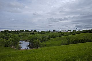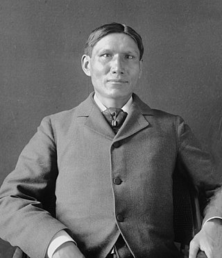
South Dakota is a landlocked state in the North Central region of the United States. It is also part of the Great Plains. South Dakota is named after the Dakota Sioux tribe, which comprises a large portion of the population with nine reservations currently in the state and has historically dominated the territory. South Dakota is the 17th largest by area, but the 5th least populous, and the 5th least densely populated of the 50 United States. Pierre is the state capital, and Sioux Falls, with a population of about 213,900, is South Dakota's most populous city. The state is bisected by the Missouri River, dividing South Dakota into two geographically and socially distinct halves, known to residents as "East River" and "West River". South Dakota is bordered by North Dakota to the north, Minnesota to the east, Iowa to the southeast, Nebraska to the south, Wyoming to the west, and Montana to the northwest.

The Lakota are a Native American people. Also known as the Teton Sioux, they are one of the three prominent subcultures of the Sioux people, with the Eastern Dakota (Santee) and Western Dakota (Wičhíyena). Their current lands are in North and South Dakota. They speak Lakȟótiyapi—the Lakota language, the westernmost of three closely related languages that belong to the Siouan language family.

The Sioux or Oceti Sakowin are groups of Native American tribes and First Nations people from the Great Plains of North America. The Sioux have two major linguistic divisions: the Dakota and Lakota peoples. Collectively, they are the Očhéthi Šakówiŋ, or "Seven Council Fires". The term "Sioux", an exonym from a French transcription ("Nadouessioux") of the Ojibwe term "Nadowessi", can refer to any ethnic group within the Great Sioux Nation or to any of the nation's many language dialects.

Mellette County is a county in the U.S. state of South Dakota. As of the 2020 census, the population was 1,918. Its county seat is White River. The county was created in 1909, and was organized in 1911. It was named for Arthur C. Mellette, the last Governor of the Dakota Territory and the first Governor of the state of South Dakota.

Bennett County is a county in the U.S. state of South Dakota. As of the 2020 census, the population was 3,381. Its county seat is Martin. The county lies completely within the exterior boundary of the Pine Ridge Indian Reservation. To the east is the Rosebud Indian Reservation, occupied by Sicangu Oyate, also known the Upper Brulé Sioux Nation and the Rosebud Sioux Tribe (RST), a branch of the Lakota people.

Sioux County is a county located along the southern border of the U.S. state of North Dakota. As of the 2020 census, the population was 3,898. Its eastern border is the Missouri River and its county seat is Fort Yates.

The Pine Ridge Indian Reservation, also called Pine Ridge Agency, is an Oglala Lakota Indian reservation located in the U.S. state of South Dakota, with a small portion of it extending into Nebraska. Originally included within the territory of the Great Sioux Reservation, Pine Ridge was created by the Act of March 2, 1889, 25 Stat. 888. in the southwest corner of South Dakota on the Nebraska border. It consists of 3,468.85 sq mi (8,984 km2) of land area and is one of the largest reservations in the United States.

The Lower Sioux Indian Community, also known as the Mdewakanton Tribal Reservation, is an Indian reservation located along the southern bank of the Minnesota River in Paxton and Sherman townships in Redwood County, Minnesota. Its administrative headquarters is two miles south of Morton. The reservation is located southeast of Redwood Falls, the county seat.

The Standing Rock Reservation lies across the border between North and South Dakota in the United States, and is inhabited by ethnic "Hunkpapa and Sihasapa bands of Lakota Oyate and the Ihunktuwona and Pabaksa bands of the Dakota Oyate," as well as the Hunkpatina Dakota. The Ihanktonwana Dakota are the Upper Yanktonai, part of the collective of Wiciyena. The sixth-largest Native American reservation in land area in the US, Standing Rock includes all of Sioux County, North Dakota, and all of Corson County, South Dakota, plus slivers of northern Dewey and Ziebach counties in South Dakota, along their northern county lines at Highway 20.

The Hunkpapa are a Native American group, one of the seven council fires of the Lakota tribe. The name Húŋkpapȟa is a Lakota word, meaning "Head of the Circle". By tradition, the Húŋkpapȟa set up their lodges at the entryway to the circle of the Great Council when the Sioux met in convocation. They speak Lakȟóta, one of the three dialects of the Sioux language.

The Great Sioux Reservation initially set aside land west of the Missouri River in South Dakota and Nebraska for the use of the Sioux, who had dominated this territory. The reservation was established in the Fort Laramie Treaty of 1868. It included all of present-day western South Dakota and modern Boyd County, Nebraska. This area was established by the United States as a reservation for the Teton Sioux, also known as the Lakota: the seven western bands of the "Seven Council Fires".

The Crow Creek Indian Reservation, home to Crow Creek Sioux Tribe is located in parts of Buffalo, Hughes, and Hyde counties on the east bank of the Missouri River in central South Dakota in the United States. It has a land area of 421.658 square miles (1,092.09 km2) and a 2000 census population of 2,225 persons. The major town and capital of the federally recognized Crow Creek Sioux Tribe is Fort Thompson.

The Rosebud Indian Reservation is an Indian reservation in South Dakota, United States. It is the home of the federally recognized Rosebud Sioux Tribe, who are Sicangu, a band of Lakota people. The Lakota name Sicangu Oyate translates as the "Burnt Thigh Nation", also known by the French term, the Brulé Sioux.

The Cheyenne River Indian Reservation was created by the United States in 1889 by breaking up the Great Sioux Reservation, following the attrition of the Lakota in a series of wars in the 1870s. The reservation covers almost all of Dewey and Ziebach counties in South Dakota. In addition, many small parcels of off-reservation trust land are located in Stanley, Haakon, and Meade counties.

The Dakota are a Native American tribe and First Nations band government in North America. They compose two of the three main subcultures of the Sioux people, and are typically divided into the Eastern Dakota and the Western Dakota.

The Lower Brulé Indian Reservation is an Indian reservation that belongs to the Lower Brulé Lakota Tribe. It is located on the west bank of the Missouri River in Lyman and Stanley counties in central South Dakota in the United States. It is adjacent to the Crow Creek Indian Reservation on the east bank of the river. The Kul Wicasa Oyate, the Lower Brulé Sioux, are members of the Sicangu, one of the bands of the Lakota Tribe. Tribal headquarters is in Lower Brule.
The history of South Dakota describes the history of the U.S. state of South Dakota over the course of several millennia, from its first inhabitants to the recent issues facing the state.

Native American tribes in the U.S. state of Nebraska have been Plains Indians, descendants of succeeding cultures of indigenous peoples who have occupied the area for thousands of years. More than 15 historic tribes have been identified as having lived in, hunted in, or otherwise occupied territory within the current state boundaries.

The Black Hills is an isolated mountain range rising from the Great Plains of North America in western South Dakota and extending into Wyoming, United States. Black Elk Peak, which rises to 7,244 feet (2,208 m), is the range's highest summit. The Black Hills encompass the Black Hills National Forest. The name of the hills in Lakota is Pahá Sápa. The Black Hills are considered a holy site. The hills are so called because of their dark appearance from a distance, as they are covered in evergreen trees.

The 2016 South Dakota Democratic presidential primary was held on June 7 in the U.S. state of South Dakota as one of the Democratic Party's primaries ahead of the 2016 presidential election.


