McCook County, South Dakota

Last updated

McCook County
SalemSD McCookCountyCourthouse.jpg
McCook County Courthouse
Map of South Dakota highlighting McCook County.svg
Location within the U.S. state of South Dakota
South Dakota in United States.svg
South Dakota's location within the U.S.
Coordinates: 43°40′N97°22′W / 43.67°N 97.36°W / 43.67; -97.36
CountryFlag of the United States.svg United States
StateFlag of South Dakota.svg  South Dakota
FoundedJanuary 8, 1873 (created)
June 15, 1878 (organized)
Named for Edwin Stanton McCook
Seat Salem
Largest citySalem
Area
  Total577 sq mi (1,490 km2)
  Land574 sq mi (1,490 km2)
  Water2.7 sq mi (7 km2)  0.5%
Population
 (2020)
  Total5,682
  Estimate 
(2023)
5,809 Increase2.svg
  Density9.8/sq mi (3.8/km2)
Time zone UTC−6 (Central)
  Summer (DST) UTC−5 (CDT)
Congressional district At-large
Website www.mccookcountysd.com

McCook County is a county in the U.S. state of South Dakota. At the 2020 census, the population was 5,682. [1] Its county seat is Salem. [2] The county was established in 1873, and was organized in 1878. [3] It was named for the former governor of the Dakota Territory and Civil War general Edwin Stanton McCook. [4] [5]

Contents

McCook County is part of the Sioux Falls, SD Metropolitan Statistical Area.

Geography

The terrain of McCook County consists of rolling hills, mostly devoted to agriculture. [6] The terrain slopes to the south and southwest; its highest point is near its northeast corner, at 1,798 ft (548 m) ASL. [7] The county has a total area of 577 square miles (1,490 km2), of which 574 square miles (1,490 km2) is land and 2.7 square miles (7.0 km2) (0.5%) is water. [8]

Major highways

Adjacent counties

Protected areas [6]

  • Ediger State Game Production Area
  • Forsch Lake State State Game Production Area
  • Lake Vermillion State Recreation Area
  • Lehrman Slough State Game production Area
  • Tschetter Slough State Game Production Area

Lakes [6]

Demographics

Historical population
CensusPop.Note
1880 1,283
1890 6,448402.6%
1900 8,68934.8%
1910 9,58910.4%
1920 9,9904.2%
1930 10,3163.3%
1940 9,793−5.1%
1950 8,828−9.9%
1960 8,268−6.3%
1970 7,246−12.4%
1980 6,444−11.1%
1990 5,688−11.7%
2000 5,8322.5%
2010 5,618−3.7%
2020 5,6821.1%
2023 (est.)5,809 [9] 2.2%
U.S. Decennial Census [10]
1790-1960 [11] 1900-1990 [12]
1990-2000 [13] 2010-2020 [1]

2020 census

As of the 2020 census, there were 5,682 people, 2,159 households, and 1,505 families residing in the county. [14] The population density was 9.9 inhabitants per square mile (3.8/km2). There were 2,448 housing units.

2010 census

As of the 2010 census, there were 5,618 people, 2,168 households, and 1,535 families in the county. The population density was 9.8 inhabitants per square mile (3.8/km2). There were 2,491 housing units at an average density of 4.3 units per square mile (1.7 units/km2). The racial makeup of the county was 98.0% white, 0.4% American Indian, 0.1% Pacific islander, 0.1% Asian, 0.1% black or African American, 0.6% from other races, and 0.7% from two or more races. Those of Hispanic or Latino origin made up 1.8% of the population. In terms of ancestry, 61.5% were German, 12.8% were Irish, 11.1% were Norwegian, 7.4% were Swedish, 6.2% were Dutch, 5.2% were English, and 3.5% were American.

Of the 2,168 households, 30.4% had children under the age of 18 living with them, 61.0% were married couples living together, 6.0% had a female householder with no husband present, 29.2% were non-families, and 26.2% of all households were made up of individuals. The average household size was 2.45 and the average family size was 2.94. The median age was 42.7 years.

The median income for a household in the county was $42,022 and the median income for a family was $57,287. Males had a median income of $35,951 versus $29,750 for females. The per capita income for the county was $25,502. About 5.2% of families and 7.9% of the population were below the poverty line, including 6.7% of those under age 18 and 14.4% of those age 65 or over.

Politics

McCook County voters usually vote Republican. Although the county was one only 130 nationwide to support favorite son George McGovern in 1972, it has selected the Democratic nominee in only six other elections since South Dakota's statehood, and none since 1980.

United States presidential election results for McCook County, South Dakota [15]
Year Republican Democratic Third party
No.%No.%No.%
2020 2,06871.31%76926.52%632.17%
2016 1,79469.35%62324.08%1706.57%
2012 1,65563.34%90534.63%532.03%
2008 1,64655.89%1,21941.39%802.72%
2004 2,01761.66%1,20136.72%531.62%
2000 1,61061.19%96536.68%562.13%
1996 1,29247.45%1,16642.82%2659.73%
1992 1,17739.44%1,16739.11%64021.45%
1988 1,50150.00%1,49249.70%90.30%
1984 1,90256.57%1,44843.07%120.36%
1980 2,01456.83%1,22334.51%3078.66%
1976 1,74448.74%1,82250.92%120.34%
1972 1,96349.53%1,99350.29%70.18%
1968 1,95951.55%1,65343.50%1884.95%
1964 1,75644.60%2,18155.40%00.00%
1960 2,37556.93%1,79743.07%00.00%
1956 2,38257.54%1,75842.46%00.00%
1952 2,99172.63%1,12727.37%00.00%
1948 2,06459.46%1,38739.96%200.58%
1944 2,51668.39%1,16331.61%00.00%
1940 3,31066.12%1,69633.88%00.00%
1936 2,11743.64%2,53652.28%1984.08%
1932 1,43632.47%2,88465.22%1022.31%
1928 2,23455.78%1,75843.90%130.32%
1924 1,36844.27%45714.79%1,26540.94%
1920 1,86460.52%56518.34%65121.14%
1916 1,19452.19%1,02144.62%733.19%
1912 00.00%96244.64%1,19355.36%
1908 1,20957.00%82638.94%864.05%
1904 1,28463.00%69334.00%612.99%
1900 97849.07%98949.62%261.30%
1896 67839.03%1,04760.28%120.69%
1892 57337.35%26217.08%69945.57%

Communities

Cities

Census-designated places

Unincorporated communities [6]

Townships

The county is divided into sixteen townships:

  • Benton
  • Bridgewater
  • Brookfield
  • Canistota
  • Emery
  • Grant
  • Greenland
  • Jefferson
  • Pearl
  • Montrose
  • Union
  • Ramsey
  • Richland
  • Salem
  • Spring Valley
  • Sun Prairie

Other places

See also

Related Research Articles

<span class="mw-page-title-main">Clay County, South Dakota</span> County in South Dakota, United States

Clay County is a county in the U.S. state of South Dakota. As of the 2020 census, the population was 14,967. The county seat is Vermillion, which is also home to the University of South Dakota. The county is named for Henry Clay, American statesman, US Senator from Kentucky, and United States Secretary of State in the 19th century.

<span class="mw-page-title-main">Walworth County, South Dakota</span> County in South Dakota, United States

Walworth County is a county in the U.S. state of South Dakota. As of the 2020 census, the population was 5,315. Its county seat is Selby. The county was created in 1873 and organized in 1883. It is named for Walworth County, Wisconsin.

<span class="mw-page-title-main">Turner County, South Dakota</span> County in South Dakota, United States

Turner County is a county in the U.S. state of South Dakota. As of the 2020 census, the population was 8,673. Its county seat is Parker. The county was established in 1871, and was named for Dakota Territory official John W. Turner.

<span class="mw-page-title-main">Sanborn County, South Dakota</span> County in South Dakota, United States

Sanborn County is a county in the U.S. state of South Dakota. As of the 2020 census, the population was 2,330. Its county seat and largest city is Woonsocket. The county was created by the Dakota Territorial legislature on May 1, 1883, with land partitioned from Miner County. It was fully organized by July 18, 1883.

<span class="mw-page-title-main">Perkins County, South Dakota</span> County in South Dakota, United States

Perkins County is a county in the U.S. state of South Dakota. As of the 2020 census, the population was 2,835. Its county seat is Bison. The county was established in 1908 and organized in 1909. It was named for Sturgis, South Dakota, official Henry E. Perkins.

<span class="mw-page-title-main">Minnehaha County, South Dakota</span> County in South Dakota, United States

Minnehaha County is a county on the eastern border of the state of South Dakota. As of the 2020 census, the population was 197,214, making it the state's most populous county. It contains over 20% of the state's population. Its county seat is Sioux Falls, South Dakota's most populous city. The county was created in 1862 and organized in 1868. Its name was derived from the Sioux word Mnihaha, meaning "rapid water," or "waterfall".

<span class="mw-page-title-main">Miner County, South Dakota</span> County in South Dakota, United States

Miner County is a county in the U.S. state of South Dakota. As of the 2020 census, the population was 2,298. Its county seat is Howard. The county was created in 1873 and organized in 1880.

<span class="mw-page-title-main">Marshall County, South Dakota</span> County in South Dakota, United States

Marshall County is a county in the U.S. state of South Dakota. As of the 2020 census, the population was 4,306. Its county seat is Britton. The county was created on May 2, 1885, and was named for Marshall Vincent, who homesteaded near Andover, South Dakota.

<span class="mw-page-title-main">Lincoln County, South Dakota</span> County in South Dakota, United States

Lincoln County is a county in the U.S. state of South Dakota. As of the 2020 census, the population was 65,161, making it the third most populous county in South Dakota. Its county seat is Canton. The county was named for Abraham Lincoln, 16th President of the United States.

<span class="mw-page-title-main">Lake County, South Dakota</span> County in South Dakota, United States

Lake County is a county in the U.S. state of South Dakota. As of the 2020 census, the population was 11,059. Its county seat is Madison. The county was formed in 1873.

<span class="mw-page-title-main">Jerauld County, South Dakota</span> County in South Dakota, United States

Jerauld County is a county in the U.S. state of South Dakota. As of the 2020 census, the population was 1,663. Its county seat is Wessington Springs.

<span class="mw-page-title-main">Hand County, South Dakota</span> County in South Dakota, United States

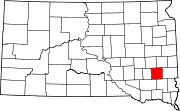
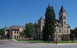
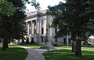
Hand County is a county in the U.S. state of South Dakota. As of the 2020 census, the population was 3,145. Its county seat is Miller.

<span class="mw-page-title-main">Codington County, South Dakota</span> County in South Dakota, United States

Codington County is a county in the U.S. state of South Dakota. As of the 2020 census, the population was 28,325, making it the 7th most populous county in South Dakota. Its county seat is Watertown. The county was created in 1877 and organized in 1878. It is named for Rev. George S. S. Codington, Dakota Territory legislator.

<span class="mw-page-title-main">Clark County, South Dakota</span> County in South Dakota, United States

Clark County is a county in the U.S. state of South Dakota. As of the 2020 census, the population was 3,837. Its county seat is Clark. The county was created in 1873 and organized in 1881. It was named for Newton Clark, a Dakota Territory legislator in 1873.

<span class="mw-page-title-main">Aurora County, South Dakota</span> County in South Dakota, United States

Aurora County is a county in the U.S. state of South Dakota. As of the 2020 census, the population was 2,747. The county was created in 1879, and was organized in 1881.

<span class="mw-page-title-main">McIntosh County, North Dakota</span> County in North Dakota, United States

McIntosh County is a county in the U.S. state of North Dakota. As of the 2020 census, the population was 2,530. Its county seat is Ashley. The county is notable for being the county with the highest percentage of German-Americans in the United States, with over 76% of the county's residents being of German descent as of 2010.

<span class="mw-page-title-main">McHenry County, North Dakota</span> County in North Dakota, United States

McHenry County is a county in the U.S. state of North Dakota. As of the 2020 census, the population was 5,345. Its county seat is Towner.

<span class="mw-page-title-main">Traverse County, Minnesota</span> County in Minnesota, United States

Traverse County is a county in the U.S. state of Minnesota. As of the 2020 census, the population was 3,360, making it the least-populous county in Minnesota. Its county seat is Wheaton. The county was founded in 1862 and organized in 1881.

<span class="mw-page-title-main">Canistota, South Dakota</span> City in South Dakota, United States

Canistota is a city in McCook County, South Dakota, United States. The population was 631 at the 2020 census. Canistota is known for chiropractic services, especially the longstanding Ortman Clinic, which attracts many Amish people from around the Midwest.

<span class="mw-page-title-main">Irene, South Dakota</span> City in South Dakota, United States

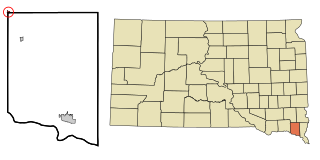
Irene is a city in Clay, Turner, and Yankton counties in South Dakota, United States. The population was 422 at the 2020 census. The portion of Irene that is located in Turner County is a part of the Sioux Falls, South Dakota metropolitan area, the portion located in Yankton County is part of the Yankton Micropolitan Statistical Area, and the portion located in Clay County is part of both the Vermillion Micropolitan Statistical Area and the Sioux City-Vermillion Combined Statistical Area. Irene is also host to the Irene Rodeo, held every summer.

References

  1. 1 2 "State & County QuickFacts". United States Census Bureau. Retrieved March 21, 2024.
  2. "Find a County". National Association of Counties. Archived from the original on May 31, 2011. Retrieved June 7, 2011.
  3. "Dakota Territory, South Dakota, and North Dakota: Individual County Chronologies". The Newberry Library. 2006. Archived from the original on April 2, 2018. Retrieved March 30, 2015.
  4. Hellmann, Paul T. (May 13, 2013). Historical Gazetteer of the United States. Routledge. p. 997. ISBN   978-1135948597 . Retrieved November 30, 2013.
  5. Chicago and North Western Railway Company (1908). A History of the Origin of the Place Names Connected with the Chicago & North Western and Chicago, St. Paul, Minneapolis & Omaha Railways. p. 162.
  6. 1 2 3 4 "McCook County · South Dakota". Google Maps. Retrieved April 27, 2024.
  7. ""Find an Altitude" Google Maps (accessed February 5, 2019)". Archived from the original on May 21, 2019. Retrieved February 6, 2019.
  8. "2010 Census Gazetteer Files". United States Census Bureau. August 24, 2012. Retrieved March 28, 2015.
  9. "County Population Totals and Components of Change: 2020-2023" . Retrieved March 17, 2024.
  10. "U.S. Decennial Census". United States Census Bureau. Retrieved March 28, 2015.
  11. "Historical Census Browser". University of Virginia Library. Retrieved March 28, 2015.
  12. Forstall, Richard L., ed. (March 27, 1995). "Population of Counties by Decennial Census: 1900 to 1990". United States Census Bureau. Retrieved March 28, 2015.
  13. "Census 2000 PHC-T-4. Ranking Tables for Counties: 1990 and 2000" (PDF). United States Census Bureau. April 2, 2001. Archived (PDF) from the original on October 9, 2022. Retrieved March 28, 2015.
  14. "US Census Bureau, Table P16: Household Type". United States Census Bureau. Retrieved March 21, 2024.
  15. Leip, David. "Atlas of US Presidential Elections". uselectionatlas.org. Retrieved April 15, 2018.
  16. Andrews, John (March 17, 2017). "Inspired by McCook County". South Dakota Magazine .

43°40′N97°22′W / 43.67°N 97.36°W / 43.67; -97.36