Balga is a suburb of Perth, the capital city of Western Australia, 13 kilometres (8 mi) north of Perth city's central business district (CBD). Its local government area is the City of Stirling. Mark Irwin is the current mayor.

Gwelup is a suburb of Perth, the capital city of Western Australia 12 km north of Perth's central business district (CBD) along the Mitchell Freeway. Its local government area is the City of Stirling.

Innaloo is a suburb of Perth, the capital city of Western Australia, 9 km (5.6 mi) from Perth's central business district in the local government area of the City of Stirling.

Karrinyup is a suburb of Perth, the capital city of Western Australia, and is located 12 km north of Perth's central business district. Its local government area is the City of Stirling.

Mirrabooka is a suburb of Perth, Western Australia. Its local government area is the City of Stirling.

Mount Lawley is an inner northern suburb of Perth, Western Australia. The suburb is bounded by the Swan River to the east, Vincent, Harold and Pakenham Streets to the south, Central Avenue and Alexander Drive to the north, and Norfolk Street to the west.

Nollamara is a suburb of Perth, Western Australia. Its local government area is the City of Stirling.

North Beach is a northern coastal suburb of Perth, the capital city of Western Australia 16 kilometres (10 mi) from Perth's central business district via Mitchell Freeway and Reid Highway. Its local government area is the City of Stirling.

Yokine is a suburb of Perth, Western Australia. Its local government area is the City of Stirling.

Claremont is a western suburb of Perth, Western Australia, on the north bank of the Swan River.

Stirling railway station is a railway station on the Transperth network. It is located on the Joondalup line, nine kilometres from Perth station serving the suburb of Stirling.

Watermans Bay is a northern coastal suburb of Perth, the capital city of Western Australia. Its local government area is the City of Stirling.
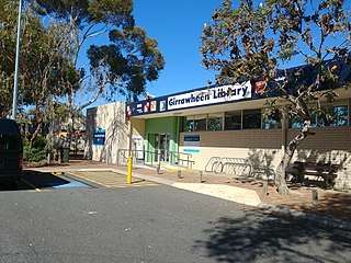
Girrawheen is a northern suburb of Perth, the capital city of Western Australia. Its local government area is the City of Wanneroo.

Marmion is a northern coastal suburb of Perth, the capital city of Western Australia. Its local government area is the City of Joondalup.
Warwick is a suburb of Perth, Western Australia, within the City of Joondalup. Its postcode is 6024. The eastern third of the suburb is a native bushland area known as the Warwick Open Space.

Enfield is a suburb in the Inner West of Sydney, in the state of New South Wales, Australia. It is 11 kilometres south-west of the Sydney central business district in the local government area of Municipality of Burwood.
High Wycombe is a suburb of Perth, Western Australia, within the City of Kalamunda. High Wycombe lies east of the Perth CBD at the base of the Darling Scarp. Formerly part of Maida Vale, the suburb was officially declared on 2 June 1978; its name, which was first used in 1958 by a subdivider, Western Agencies, and refers to the town in Buckinghamshire where one of the partners in the firm was born.

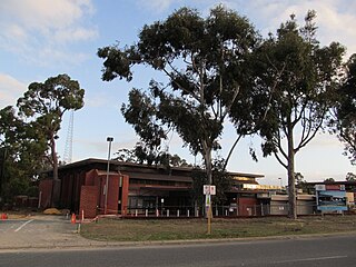
Stirling is a suburb of Perth, the capital city of Western Australia, about 10 km north of Perth's central business district (CBD) along the Mitchell Freeway. Its local government area is the City of Stirling, whose council offices and administration centre are located in the southwest of the mostly residential suburb.

Nedlands is an affluent western suburb of Perth, the capital city of Western Australia. It is a part of the local government areas of the City of Nedlands and the City of Perth. It is about 7 kilometres (4 mi) from the Perth CBD via either Thomas Street or Mounts Bay Road.
Transport in Perth, Western Australia, is served by various means, among them an extensive highway / freeway network and a substantial system of commuter rail lines and bus routes. Public transport is managed by the Transperth agency.


