The Bronx River Parkway is a 19.12-mile (30.77 km) limited-access parkway in downstate New York in the United States. It is named for the nearby Bronx River, which it parallels. The southern terminus of the parkway is at Story Avenue near the Bruckner Expressway in the Bronx neighborhood of Soundview. The northern terminus is at Kensico Circle in North Castle, Westchester County, where the parkway connects to the Taconic State Parkway and via a short connector, New York State Route 22 (NY 22). Within the Bronx, the parkway is maintained by the New York State Department of Transportation and is designated New York State Route 907H (NY 907H), an unsigned reference route. In Westchester County, the parkway is maintained by the Westchester County Department of Public Works and is designated unsigned County Route 9987 (CR 9987).

The 5 Lexington Avenue Express is a rapid transit service in the A Division of the New York City Subway. Its route emblem, or "bullet", is colored forest green since it uses the IRT Lexington Avenue Line in Manhattan.

The Hutchinson River Parkway is a controlled-access parkway in southern New York in the United States. It extends for 18.71 miles (30.11 km) from the Bruckner Interchange in the Throggs Neck section of the Bronx to the New York–Connecticut state line at Rye Brook. The parkway continues south from the Bruckner Interchange as the Whitestone Expressway (Interstate 678) and north into Greenwich, Connecticut, as the Merritt Parkway. The roadway is named for the Hutchinson River, a 10-mile-long (16 km) stream in southern Westchester County that the road follows alongside. The river, in turn, was named for English colonial religious leader Anne Hutchinson.

Wakefield is a working-class and middle-class section of the northern borough of the Bronx in New York City. It is bounded by the city's border with Westchester County to the north, East 222nd Street to the south, and the Bronx River Parkway to the west.

Bronx River Road is a major street and neighborhood in Yonkers, New York. It runs alongside the Bronx River, Bronx River Parkway, and Metro-North railroad tracks in south-eastern Yonkers. On the other side of the Bronx River is the City of Mount Vernon, New York as well as the Bronx. Bronx River Road runs down to McLean Avenue at the city line with New York City where it becomes Webster Avenue in the Woodlawn section of the Bronx. To the north, when it reaches the Cross County Parkway, Bronx River Road merges into Midland Avenue which leads to the Village of Bronxville, New York.

The White Plains Road Line is a rapid transit line of the A Division of the New York City Subway serving the central Bronx. It is mostly elevated and served both subway and elevated trains until 1952. The original part of the line, the part opened as part of the first subway was called the West Farms Division, and the extension north to 241st Street as part of the Dual Contracts was called the White Plains Road Line. Eventually, however, the two parts came to be known as the White Plains Road Line.

New York State Route 22 (NY 22) is a north–south state highway that parallels the eastern border of the U.S. state of New York, from the outskirts of New York City to the hamlet of Mooers in Clinton County near the Canadian border. At 337 miles (542 km), it is the state's longest north–south route and the third longest state route overall, after NY 5 and NY 17. Many of the state's major east–west roads intersect with, and often join, NY 22 just before crossing into the neighboring New England states, where U.S. Route 7 (US 7), which originally partially followed NY 22's alignment, similarly parallels the New York state line.

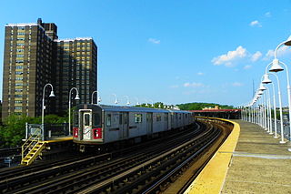
The Wakefield–241st Street station is a terminal station on the IRT White Plains Road Line of the New York City Subway, located at the intersection of 241st Street and White Plains Road in the Wakefield neighborhood of the Bronx. It is served by the 2 train at all times. This station is geographically the northernmost station in the entire New York City Subway system.

The Nereid Avenue station is a local station on the IRT White Plains Road Line of the New York City Subway, located at the intersection of Nereid Avenue and White Plains Road in the Wakefield neighborhood of the Bronx. It is served by the 2 train at all times and by the 5 train during rush hours in the peak direction. Nereid Avenue is the northern terminal for all peak-direction rush-hour 5 trains that use this branch. However, all 2 trains terminate at the next stop, Wakefield–241st Street.

New York State Route 100 (NY 100) is a major north–south state highway in Westchester County, New York, in the United States. It begins parallel to Interstate 87 (I-87) at a junction with the Cross County Parkway in the city of Yonkers and runs through most of the length of the county up to U.S. Route 202 (US 202) in the town of Somers. NY 100 was designated as part of the 1930 renumbering of state highways in New York. Prior to becoming a state road, various sections of NY 100 were part of several important early roads in the county.

New York State Route 125 (NY 125) is a 7.50-mile (12.07 km) north–south state highway located within Westchester County, New York, in the United States. The route begins at an intersection with U.S. Route 1 (US 1) in the Town of Mamaroneck and ends at a junction with NY 22 in the city of White Plains. A section of the route in the city of White Plains is maintained by Westchester County and co-designated as County Route 26 (CR 26). A second county-owned segment exists along the New Rochelle–Scarsdale line as County Route 129. Both numbers are unsigned. NY 125 was assigned as part of the 1930 renumbering of state highways in New York, initially extending from US 1 to Mamaroneck Avenue in White Plains. It was extended north to NY 22 in the mid-1930s.

Pelham Parkway is a working- and middle-class residential neighborhood geographically located in the center of the Bronx, a borough of New York City in the United States. Its boundaries, starting from the north and moving clockwise are: Waring Avenue to the north, the IRT Dyre Avenue Line tracks to the east, Neill Avenue to the South, and Bronx River Parkway to the west. White Plains Road is the primary commercial thoroughfare through Pelham Parkway. The neighborhood is named after Pelham Parkway, a major west–east parkway that travels through the East Bronx.
The Central Westchester Parkway is a 1.01-mile (1.63 km) controlled-access parkway in Westchester County, New York, in the United States. It runs from exit 7 of the Cross-Westchester Expressway (I-287) to New York State Route 22 (NY 22). The road has two intermediate exits and is maintained by Westchester County as County Route 150.

U.S. Route 1 (US 1) is a part of the U.S. Highway System that extends from Key West, Florida, to the Canada–United States border at Fort Kent, Maine. In the U.S. state of New York, US 1 extends 21.54 miles (34.67 km) from the George Washington Bridge in Manhattan to the Connecticut state line at Port Chester. It closely parallels Interstate 95 (I-95) for much of its course and does not serve as a major trunk road within the state. It is not concurrent with any other highways besides I-95 and (briefly) US 9, and few other state highways intersect it.

The New York, Westchester and Boston Railway Company, was an electric commuter railroad in the Bronx and Westchester County, New York from 1912 to 1937. It ran from the southernmost part of the South Bronx, near the Harlem River, to Mount Vernon with branches north to White Plains and east to Port Chester. From 1906, construction and operation was under the control of the New York, New Haven & Hartford Railroad (NH) until its bankruptcy in 1935.

Gun Hill Road is a major thoroughfare in the New York City borough of the Bronx. The road stretches for 3.5 miles (5.6 km) from Mosholu Parkway in Norwood to Stillwell Avenue in Baychester, near an exit for the Hutchinson River Parkway. Van Cortlandt Park and the Mosholu Golf Course are both located at the western terminus of Gun Hill Road.

Jerome Avenue is one of the longest thoroughfares in the New York City borough of the Bronx, New York, United States. The road is 5.6 miles (9.0 km) long and stretches from Concourse to Woodlawn. Both of these termini are with the Major Deegan Expressway which runs parallel to the west. Most of the elevated IRT Jerome Avenue Line runs along Jerome Avenue. The Cross Bronx Expressway interchanges with Jerome and the Deegan. Though it runs through what is now the West Bronx neighborhood, Jerome Avenue is the dividing avenue between nominal and some named "West" and "East" streets in the Bronx; Fifth Avenue, and to a lesser extent, Broadway, also splits Manhattan into nominal "West" and "East" streets.
East 233rd Street is a major thoroughfare in the New York City borough of The Bronx. The road is 3 miles (4.8 km) long and stretches from U.S. Route 1 in the Eastchester section of the Bronx to the Major Deegan Expressway (I-87) in Woodlawn. The road changes names from East 233rd Street to Pinkley Avenue after the eastern terminus, at Boston Road. There is one interchange with a highway along the way, which is for the Bronx River Parkway. There are two subway stations along the road, one at Dyre Avenue, serving the 5 train, and one at White Plains Road, serving the 2 and 5 trains.
Webster Avenue is a major north–south thoroughfare in the Bronx, New York City, United States. It stretches for 5.8 miles (9.3 km) from Melrose to Woodlawn. The road starts at the intersection of Melrose Avenue, East 165th Street, Brook Avenue, and Park Avenue in the neighborhood of Melrose, ending at Nereid Avenue in the neighborhood of Woodlawn. There are no subway lines along this thoroughfare, unlike the streets it parallels—Jerome Avenue, The Grand Concourse, and White Plains Road, which all have subway lines —but until 1973, Webster Avenue north of Fordham Road was served by the Third Avenue Elevated, served by the 8 train.

New York State Route 164 (NY 164) was a state highway in the New York City Metropolitan Area. It extended for 5 miles (8 km) from U.S. Route 9 (US 9) and NY 9A in Yonkers to US 1 in the New York City borough of the Bronx. The route ran mostly along the New York City line and indirectly met both the Saw Mill River Parkway and the New York State Thruway in Yonkers. NY 164 followed McLean Avenue in Yonkers and Nereid and Baychester Avenues in the Bronx.


