Willcox is a city in Cochise County, Arizona, United States. The city is located in the Sulphur Springs Valley, a flat and sparsely populated drainage basin dotted with seasonal lakes. The city is surrounded by Arizona's most prominent mountain ranges, including the Pinaleño Mountains and the Chiricahua Mountains.

The Great Basin Desert is part of the Great Basin between the Sierra Nevada and the Wasatch Range. The desert is a geographical region that largely overlaps the Great Basin shrub steppe defined by the World Wildlife Fund, and the Central Basin and Range ecoregion defined by the U.S. Environmental Protection Agency and United States Geological Survey. It is a temperate desert with hot, dry summers and snowy winters. The desert spans large portions of Nevada and Utah, and extends into eastern California. The desert is one of the four biologically defined deserts in North America, in addition to the Mojave, Sonoran, and Chihuahuan Deserts.

The Salton Sea is a shallow, landlocked, highly saline body of water in Riverside and Imperial counties at the southern end of the U.S. state of California. It lies on the San Andreas Fault within the Salton Trough, which stretches to the Gulf of California in Mexico.

The Chiricahua Mountains massif is a large mountain range in southeastern Arizona which is part of the Basin and Range province of the west and southwestern United States and northwest Mexico; the range is part of the Coronado National Forest. The highest point, Chiricahua Peak, rises 9,759 feet (2,975 m) above sea level, approximately 6,000 feet (1,800 m) above the surrounding valleys. The range takes its name from the Chiricahua Apaches native to the region.

The Dragoon Mountains are a range of mountains located in Cochise County, Arizona. The range is about 25 mi (40 km) long, running on an axis extending south-south east through Willcox. The name originates from the 3rd U.S. Cavalry Dragoons who battled the Chiricahua, including Cochise, during the Apache Wars. The Dragoons established posts around 1856 after the Gadsden Purchase made it a U.S. territory.
Luna Lake is a natural body of water that covers approximately 75 acres (0.30 km2) of land. It is located about three miles (5 km) southeast of Alpine, Arizona, at the elevation of 7,890 ft (2,400 m), and is the centerpiece of the Luna Lake Wildlife Area.
Malpai Borderlands is a region, or areal feature, along the U.S.-Mexico border at the Arizona and New Mexico state line. It encompasses the extreme southeast corner of Arizona and the southwest corner of New Mexico describe the general vicinity. It includes areas inside the U.S. states of Arizona and New Mexico as well as the Mexican states of Chihuahua and Sonora.

Chiricahua Peak is the name of a 9,763 feet (2,976 m) peak located in the Chiricahua Mountains of southeastern Arizona, located about 35 miles (56 km) north of the United States–Mexico border. It is the highest summit in the Chiricahua Mountains and the highest point in Cochise County.

The beautiful shiner is a species of ray-finned fish in the family Cyprinidae. It is found in Mexico and Arizona and New Mexico in the United States. It is one of 22 species of Cyprinella found in North America.

The Geography of Oklahoma encompasses terrain and ecosystems ranging from arid plains to subtropical forests and mountains. Oklahoma contains 10 distinct ecological regions, more per square mile than in any other state by a wide margin. It is situated in the Great Plains and U.S. Interior Highlands region near the geographical center of the 48 contiguous states. Usually considered part of the South Central United States, Oklahoma is bounded on the east by Arkansas and Missouri, on the north by Kansas, on the northwest by Colorado, on the far west by New Mexico, and on the south and near-west by Texas.

The Northern Basin and Range ecoregion is a Level III ecoregion designated by the United States Environmental Protection Agency (EPA) in the U.S. states of Oregon, Idaho, Nevada, Utah, and California. It contains dissected lava plains, rolling hills, alluvial fans, valleys, and scattered mountain ranges in the northern part of the Great Basin. Although arid, the ecoregion is higher and cooler than the Snake River Plain to the north and has more available moisture and a cooler climate than the Central Basin and Range to the south. Its southern boundary is determined by the highest shoreline of Pleistocene Lake Bonneville, which once inundated the Central Basin and Range. The western part of the region is internally drained; its eastern stream network drains to the Snake River system.

The San Bernardino National Wildlife Refuge is located on the U.S.-Mexico border in Cochise County, Arizona. Situated at 3,720 to 3,920 feet (1,130–1,190 m) elevation in the bottom of a wide valley, the refuge encompasses a portion of the headwaters of the Yaqui River, which drains primarily western Chihuahua and eastern Sonora, Mexico. The 2,309-acre (9.34 km2) ranch was acquired by the U.S. Fish and Wildlife Service in 1982 to protect the water resources and provide habitat for endangered native fishes.
The Yaqui longfin dace is a small fish of the American Southwest and northern Mexico, and considered a form of the longfin dace. It is often referred to as Agosia chrysogaster sp 1.

The Dos Cabezas Mountains are a mountain range in southeasternmost Arizona, United States. The 11,700 acres (4,700 ha) Dos Cabezas Mountains Wilderness lies 20 miles (32 km) east of Willcox and 7 miles (11 km) south of Bowie in Cochise County. The mountain range's name means Two Heads in Spanish, for the twin granite peaks, Dos Cabezas Peaks, that sit atop the range.

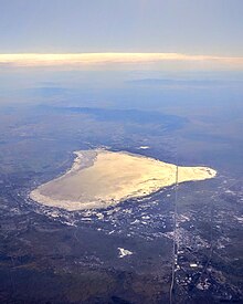
The Sulphur Springs Valley is a valley in the eastern half of Cochise County, Arizona. The valley covers an approximated vertical rectangle west of the Chiricahua Mountains–Dos Cabezas Mountains complex. The Sulphur Springs Valley is the large flatland to the west.
The Whitlock Valley is a small valley in southeast Graham County, Arizona, southwestern United States, lying between three mountain ranges. The valley lies on the south perimeter region of the White Mountains in eastern Arizona, and lies south of the west-flowing Gila River, and the region transitions south into Cochise County and three large valleys, with some scattered dry lakes. The valley is endorheic, with a small dry lake called Parks Lake, and merges southwest into the north of the San Simon Valley, where the San Simon River has its origins in the flatlands, and surrounding perimeter mountains. The valley was named after Captain James H. Whitlock who commanded during the Battle of Mount Gray in 1864 which was fought near the valley.

The South Fork Eel River Wilderness is a 12,868-acre (5,207 ha) wilderness area located in Mendocino County, California. The wilderness was added to the National Wilderness Preservation System when the United States Congress passed the Northern California Coastal Wild Heritage Wilderness Act in 2006. The Department of the Interior's Bureau of Land Management (BLM) is the agency in charge.
The Intermountain West Joint Venture (IWJV) is a partnership of government agencies, nongovernmental organizations, and other public and private landowners for the conservation of bird habitats in the inter-mountain areas of the western United States. It was established in 1994 and focuses on the "implementation of the conservation goals and objectives of five major bird initiatives": North American Waterfowl Management Plan, Partners in Flight, United States Shorebird Conservation Plan, North American Waterbird Conservation Plan and the National Sage Grouse Conservation Planning Framework. Its primary objective is to address conservation issues for about 40 waterbird species which use the marshes, playas, riparian zones, lakes and other wetlands throughout its extent.
Portneuf Wildlife Management Area at 3,104 acres (12.56 km2) is an Idaho Wildlife Management Area (WMA) in Bannock County near the town of McCammon. The first land acquisition for the WMA occurred in 1970 from M.S. Bastian, a local farmer and rancher. Three additional parcels were acquired in 1974.

The Little Dragoon Mountains, are included in the Douglas Ranger District of Coronado National Forest, in Cochise County, Arizona.