Wilmington, New York

Last updated

Wilmington, New York
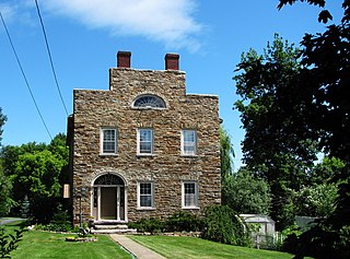
Whiteface (1).JPG
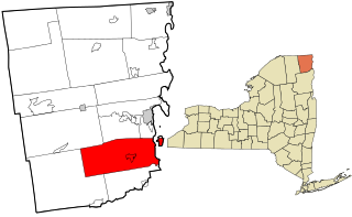
Essex County New York incorporated and unincorporated areas Wilmington highlighted.svg
Location in Essex County and the state of New York
Coordinates: 44°23′30″N73°48′13″W / 44.39167°N 73.80361°W / 44.39167; -73.80361
Country United States
State New York
County Essex
Government
  Type Town Council
   Town Supervisor Favor Smith
   Town Council
Members' List
Area
[1]
  Total65.47 sq mi (169.57 km2)
  Land65.22 sq mi (168.93 km2)
  Water0.25 sq mi (0.64 km2)
Elevation
1,093 ft (333 m)
Population
 (2020)
  Total843
  Density12.87/sq mi (4.99/km2)
Time zone UTC-5 (Eastern (EST))
  Summer (DST) UTC-4 (EDT)
ZIP code
12997
Area code 518
FIPS code 36-031-82315
GNIS feature ID0979644 [2]
Website www.townofwilmington.org

Wilmington is a town in Essex County, New York, United States. The population was 1,253 at the 2010 census. [3] The town is named after the nearby town of Wilmington, Vermont.

Contents

Wilmington is on the county's northern border and is southwest of Plattsburgh. It is in the Whiteface region of the Adirondack Park.

History

The town was first settled circa 1812.

The town was formed in 1821 from the town of Jay. At that time, the town was called "Dansville". In 1822, the name was changed, as suggested by a settler from Vermont, to "Wilmington" due to confusion with another "Dansville" in New York. In 1848, part of the town was partitioned off to form the town of St. Armand.

In the beginning of the 20th century, the tourist industry began to develop in the town. "Santa's Workshop", one of the first American theme parks for children, is located part way up the Whiteface Mountain Memorial Highway and was awarded its own Post Office—North Pole, New York. Whiteface Mountain (4,865 feet) Ski Center was the site of alpine events for the 1980 Winter Olympics.

Geography

According to the United States Census Bureau, the town has a total area of 65.3 square miles (169.0 km2), of which 65.3 square miles (169.0 km2) is land and 0.2 square miles (0.6 km2), or 0.36%, is water. [3]

The northern town line is the border of Clinton County. At the northwestern corner is the corresponding corner of Franklin County.

The West Branch of the Ausable River flows northeastward through the center of the town.

New York State Route 431, an east–west highway known as Whiteface Mountain Memorial Highway, intersects New York State Route 86, a north–south highway, in Wilmington village.

Demographics

Historical population
CensusPop.Note
1830 695
1840 92833.5%
1850 1,21831.3%
1860 861−29.3%
1870 794−7.8%
1880 89913.2%
1890 678−24.6%
1900 634−6.5%
1910 573−9.6%
1920 545−4.9%
1930 5674.0%
1940 73730.0%
1950 574−22.1%
1960 68319.0%
1970 77713.8%
1980 1,05135.3%
1990 1,020−2.9%
2000 1,13110.9%
2010 1,25310.8%
2020 843−32.7%
2016 (est.)1,264 [4] 0.9%
U.S. Decennial Census [5]

At the 2020 census, [6] there were 843 people and 417 households residing in the town. The population density was 17.4 people per square mile (6.7/km2). There were 616 housing units at an average density of 11.3 per square mile (4.3/km2). The racial makeup of the town was 98.59% White, 0.09% African American, 0.35% Native American, 0.09% Asian, 0.18% from other races, and 0.71% from two or more races. Hispanic or Latino of any race were 0.62% of the population.

There were 460 households, of which 35.0% had children under the age of 18 living with them, 53.0% were married couples living together, 8.7% had a female householder with no husband present, and 33.7% were non-families. 27.4% of all households were made up of individuals, and 10.9% had someone living alone who was 65 years of age or older. The average household size was 2.46 and the average family size was 3.01.

27.7% of the population were under the age of 18, 5.9% from 18 to 24, 29.2% from 25 to 44, 23.7% from 45 to 64, and 13.5% who were 65 years of age or older. The median age was 36 years. For every 100 females, there were 97.0 males. For every 100 females age 18 and over, there were 96.6 males.

The median household income was $34,432 and the median family income was $43,077. Males had a median income of $27,604 and females $21,328. The per capita income was $18,052. About 6.6% of families and 10.0% of the population were below the poverty line, including 11.3% of those under age 18 and 4.7% of those age 65 or over.

Communities and locations in Wilmington

See also

Related Research Articles

<span class="mw-page-title-main">AuSable, New York</span> Town in New York, United States

Au Sable, or Ausable, is a town in Clinton County, New York, United States. The population was 3,146 at the 2010 census. The name is from the Ausable River that flows through the town and means "of sand".

<span class="mw-page-title-main">Chesterfield, New York</span> Town in New York, United States

Chesterfield is a town in Essex County, New York, United States. The population was 2,445 at the 2010 census. The name possibly is from a location in New England.

<span class="mw-page-title-main">Jay, New York</span> Town in New York, United States

Jay is a town in Essex County, New York, United States. The population was 2,506 at the 2010 census. The town is named after John Jay, governor of New York when the town was formed.

<span class="mw-page-title-main">Keene, New York</span> Town in New York, United States

Keene is a town in central Essex County, New York, United States. It includes the hamlets of Keene, Keene Valley, and St. Huberts, with a total population of 1,144 as of the 2020 census

Conesus is a town in Livingston County, New York, United States. The population was 2,473 at the 2010 census. The name is derived from a native word meaning "berry place".

Dansville is a village in the town of North Dansville, with a small northern part in the town of Sparta in Livingston County, in western New York, United States. As of the 2020 census, the village population was 4,433. The village is named after Daniel Faulkner, an early European-American settler. Interstate 390 passes the west side of the village.

Groveland is a town in Livingston County, New York, United States. The population was 3,249 at the 2010 census. The town is centrally located in the county, south of Geneseo.

North Dansville is a town in Livingston County, New York, United States. The population was 5,538 at the 2010 census. The town is in the southeast part of the county. The village of Dansville occupies the center of the town.

Ossian is a town in Livingston County, New York, United States. The population was 789 at the 2010 census. The town was named after Ossian, the blind narrator and purported 3rd Century author of a cycle of extremely popular epic poems published by the Scottish poet James Macpherson in 1761.

Sparta is a town in Livingston County, New York, United States. The population was 1,624 at the 2010 census. Sparta is in the southeast part of the county and is north of Dansville.

West Sparta is a town in Livingston County, New York, United States. The population was 1,255 at the 2010 census. The name is derived from the neighboring town of Sparta.

<span class="mw-page-title-main">Exeter, New York</span> Town in New York, United States

Exeter is a town in Otsego County, New York, United States. The town is located in the northern part of the county. The population was 987 at the 2010 census. It is named after the county town and cathedral city of Exeter in England.

<span class="mw-page-title-main">Conesville, New York</span> Town in New York, United States

Conesville is a town in Schoharie County, New York, United States. The population was 687 at the 2020 census. The town is named after Jonathan Cone, an early resident.

Dansville is a town in Steuben County, New York, United States, not to be confused with the nearby village of Dansville in Livingston County. The population was 1,842 at the 2010 census. The town was named after Daniel Faulkner.

Fremont is a town in Steuben County, New York, United States. The population was 898 at the 2020 census. The town is named after General John Fremont.
<span class="mw-page-title-main">Keeseville, New York</span> Hamlet and CDP in New York, United States

Keeseville is a hamlet in Clinton and Essex counties, New York, United States. The population was 1,815 at the 2010 census. The hamlet was named after the Keese family, early settlers from Vermont. It developed along the Ausable River, which provided water power for mills and industrial development.
<span class="mw-page-title-main">Peru, New York</span> Town in New York, United States

Peru is a town in Clinton County in the U.S. state of New York. The population was 6,772 at the 2020 census. The town was so named for its views of the Adirondack Mountains to the west and the farmlands throughout the town, resembling scenery found in the country of Peru in South America. Peru, New York, is in the southeastern part of Clinton County, south of Plattsburgh.

<span class="mw-page-title-main">Esperance, New York</span> Town in New York, United States

Esperance is a town in Schoharie County, New York, United States. The population was 1,806 at the 2020 census. The town was given the name of the principal village, which was named for "hope" in French.

Wayland is a town in Steuben County, New York, United States. The population was 3,733 at the 2020 census.

Wilmington is a hamlet and census-designated place (CDP) in the town of Wilmington in Essex County, New York, United States. The population of the CDP was 843 at the 2020 census, out of a total town population of 880.

References

  1. "2016 U.S. Gazetteer Files". United States Census Bureau. Retrieved July 4, 2017.
  2. "US Board on Geographic Names". United States Geological Survey. October 25, 2007. Retrieved January 31, 2008.
  3. 1 2 "Geographic Identifiers: 2010 Demographic Profile Data (G001): Wilmington town, Essex County, New York". U.S. Census Bureau, American Factfinder. Retrieved March 8, 2016.[ dead link ]
  4. "Population and Housing Unit Estimates" . Retrieved June 9, 2017.
  5. "Census of Population and Housing". Census.gov. Retrieved June 4, 2015.
  6. "U.S. Census website". United States Census Bureau . Retrieved January 31, 2008.

44°23′18″N73°48′56″W / 44.38833°N 73.81556°W / 44.38833; -73.81556