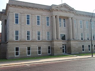
Ford County is a county located in the U.S. state of Kansas. Its county seat and most populous city is Dodge City. As of the 2020 census, its population was 34,287. The county was named in honor of James Ford, a brevet brigadier general during the American Civil War.

Finney County is a county located in the U.S. state of Kansas. Its county seat and most populous city is Garden City. As of the 2020 census, the county population was 38,470. The county was named for David Finney, the Lieutenant Governor of Kansas from 1881 and 1885. In 2020, 51.4 percent of the population in the county was Hispanic, one of a few counties in Kansas with a Hispanic majority population.
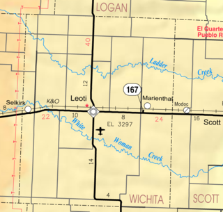
Marienthal is an unincorporated community in Wichita County, Kansas, United States. As of the 2020 census, the population of the community and nearby areas was 64.

Shallow Water is an unincorporated community in Scott County, Kansas, United States. As of the 2020 census, the population of the community and nearby areas was 89.

Navarre is an unincorporated community in Dickinson County, Kansas, United States. As of the 2020 census, the population of the city was 52.

Healy is an unincorporated community in Lane County, Kansas, United States. As of the 2020 census, the population of the community and nearby areas was 195.

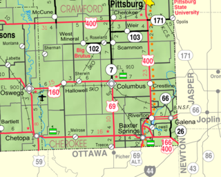
Opolis is an unincorporated community in Crawford County, Kansas, United States. As of the 2020 census, the population of the community and nearby areas was 104.
Farlington is an unincorporated community in Crawford County, Kansas, United States. As of the 2020 census, the population of the community and nearby areas was 68. Farlington is located near K-7, 8 miles (13 km) north of Girard.
Franklin is an unincorporated community in Crawford County, Kansas, United States. As of the 2020 census, the population of the community and nearby areas was 473. Franklin is located along U.S. Route 69, 1 mile (1.6 km) south of Arma, or 5.9 miles (9.5 km) north of Frontenac.

Greenwich is an unincorporated community in Sedgwick County, Kansas, United States. As of the 2020 census, the population of the community and nearby areas was 64. It is located northeast of 53rd St North and Greenwich Rd.

Edson is an unincorporated community in Sherman County, Kansas, United States. As of the 2020 census, the population of the community and nearby areas was 17. Edson is located near Interstate 70, 9 miles (14 km) east of Goodland.

Fort Dodge is an unincorporated community in Grandview Township, Ford County, Kansas, United States. As of the 2020 census, the population of the community and nearby areas was 97. It is located on U.S. Route 400 5 miles (8 km) southeast of Dodge City. Fort Dodge has a post office with ZIP code 67843.

Pierceville is an unincorporated community in Finney County, Kansas, United States. As of the 2020 census, the population of the community and nearby areas was 98. It is located along U.S. Routes 50 and 400, 12 miles (19 km) southeast of Garden City.
Wright is an unincorporated community in Ford County, Kansas, United States. As of the 2020 census, the population of the community and nearby areas was 145. It is located along Highway 50.

Eastshore is an unincorporated community in Marion County, Kansas, United States. As of the 2020 census, the population of the community and nearby areas was 92. The community name comes from it being near the east shore of the Marion Reservoir. It is located north of the intersection of Pawnee Road and 210th Street.

Furley is an unincorporated community in Sedgwick County, Kansas, United States. As of the 2020 census, the population of the community and nearby areas was 39. It is located northwest of the intersection of Greenwich Road and 101st Street N, along the Union Pacific Railroad.

Kickapoo Site 2 is an unincorporated community on the Kickapoo Reservation in Brown County, Kansas, United States. As of the 2020 census, the population of the community and nearby areas was 27.
Kickapoo Site 5 is an unincorporated community on the Kickapoo Reservation in Brown County, Kansas, United States. As of the 2020 census, the population of the community and nearby areas was 59.
Lowell is an unincorporated community in Cherokee County, Kansas, United States. As of the 2020 census, the population of the community and nearby areas was 244.
Radley is an unincorporated community in Crawford County, Kansas, United States. As of the 2020 census, the population of the community and nearby areas was 105.


