Winklern

Last updated
Winklern
Cold Valley.jpg
Winklern seen from the southwest
Winklern CoA.svg
Coat of arms
Austria adm location map.svg
Red pog.svg
Winklern
Location within Austria
Coordinates: 46°52′N12°53′E / 46.867°N 12.883°E / 46.867; 12.883 Coordinates: 46°52′N12°53′E / 46.867°N 12.883°E / 46.867; 12.883
Country Austria
State Carinthia
District Spittal an der Drau
Government
   Mayor Hermann Seebacher
Area
[1]
  Total37.38 km2 (14.43 sq mi)
Elevation
966 m (3,169 ft)
Population
 (2018-01-01) [2]
  Total1,200
  Density32/km2 (83/sq mi)
Time zone UTC+1 (CET)
  Summer (DST) UTC+2 (CEST)
Postal code
9841
Area code 04822
Website www.winklern.at

Winklern is a town in the district of Spittal an der Drau in the Austrian state of Carinthia.

Geography

The municipality lies at the foot of the Großglockner massif between the Schober, Goldberg, and Kreuzeck groups in the upper Möll valley.

Related Research Articles

Schwarzach, Vorarlberg Place in Vorarlberg, Austria

Schwarzach is a municipality in the Austrian state of Vorarlberg.

Nenzing Place in Vorarlberg, Austria

Nenzing is a market town in the district of Bludenz in the Austrian state of Vorarlberg.

Bildstein Place in Vorarlberg, Austria

Bildstein is a municipality in the district of Bregenz in the Austrian state of Vorarlberg.

Götzendorf an der Leitha Place in Lower Austria, Austria

Götzendorf an der Leitha is a village in the district of Bruck an der Leitha in Lower Austria in Austria.

Höflein an der Hohen Wand Place in Lower Austria, Austria

Höflein an der Hohen Wand is a town in the district of Neunkirchen in the Austrian state of Lower Austria.

Nußdorf ob der Traisen Place in Lower Austria, Austria

Nußdorf ob der Traisen is a municipality in the district of Sankt Pölten-Land in Lower Austria, Austria.

Göstling an der Ybbs Place in Lower Austria, Austria

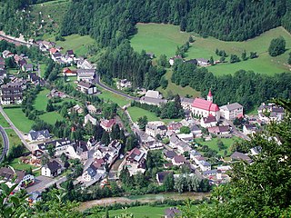
Göstling an der Ybbs is a municipality in the district of Scheibbs in the Austrian state of Lower Austria.

Zwölfaxing Place in Lower Austria, Austria

Zwölfaxing is a municipality in the district of Bruck an der Leitha in the Austrian state of Lower Austria.

Blons Place in Vorarlberg, Austria

Blons is a municipality in the district of Bludenz in Austrian state of Vorarlberg.

Bludesch Place in Vorarlberg, Austria

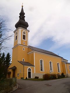
Bludesch is a municipality in the district of Bludenz in the Austrian state of Vorarlberg.

Lorüns Place in Vorarlberg, Austria

Lorüns is a municipality in the district of Bludenz in the Austrian state of Vorarlberg.

Stallehr Place in Vorarlberg, Austria

Stallehr is a municipality in the district of Bludenz in the Austrian state of Vorarlberg.

Thüringerberg Place in Vorarlberg, Austria

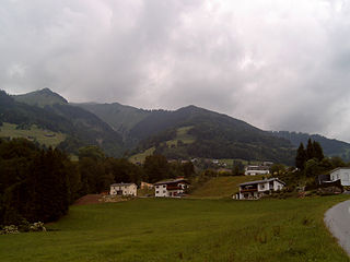
Thüringerberg is a municipality in the district of Bludenz in the Austrian state of Vorarlberg.

Fußach Place in Vorarlberg, Austria

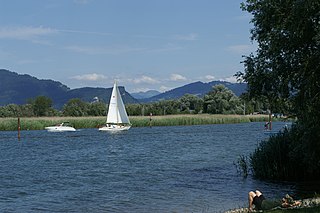
Fußach is a municipality in the district of Bregenz in the Austrian state of Vorarlberg.

Höchst, Austria Place in Vorarlberg, Austria

Höchst is a municipality in the district of Bregenz in the Austrian state of Vorarlberg.

Mäder Place in Vorarlberg, Austria

Mäder is a municipality in the district of Feldkirch in the Austrian state of Vorarlberg.

Schlins Place in Vorarlberg, Austria

Schlins is a municipality in the district of Feldkirch in the Austrian state of Vorarlberg.

Altschwendt Place in Upper Austria, Austria

Altschwendt is a municipality in the district of Schärding in the Austrian state of Upper Austria.

Neukirchen an der Vöckla Place in Upper Austria, Austria

Neukirchen an der Vöckla is a municipality in the district of Vöcklabruck in the Austrian state of Upper Austria.

Bad Waltersdorf Place in Styria, Austria

Bad Waltersdorf is a municipality in the district of Hartberg-Fürstenfeld in Styria, Austria.

References

  1. "Dauersiedlungsraum der Gemeinden Politischen Bezirke und Bundesländer - Gebietsstand 1.1.2018". Statistics Austria. Retrieved 10 March 2019.
  2. "Einwohnerzahl 1.1.2018 nach Gemeinden mit Status, Gebietsstand 1.1.2018". Statistics Austria. Retrieved 9 March 2019.