Baldramsdorf

Last updated
Baldramsdorf
Baldramsdorf Ortenburg mit Gmeineck 01.jpg
View from Mt Goldeck
Baldramsdorf CoA.svg
Coat of arms
Austria adm location map.svg
Red pog.svg
Baldramsdorf
Location within Austria
Coordinates: 46°48′N13°27′E / 46.800°N 13.450°E / 46.800; 13.450 Coordinates: 46°48′N13°27′E / 46.800°N 13.450°E / 46.800; 13.450
Country Austria
State Carinthia
District Spittal an der Drau
Government
   Mayor Heinrich Gerber (SPÖ)
Area
[1]
  Total37.94 km2 (14.65 sq mi)
Elevation
584 m (1,916 ft)
Population
 (2018-01-01) [2]
  Total1,866
  Density49/km2 (130/sq mi)
Time zone UTC+1 (CET)
  Summer (DST) UTC+2 (CEST)
Postal code
9805
Area code 04762
Website www.baldramsdorf.at

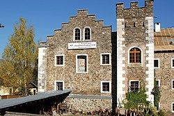
Baldramsdorf is a municipality in the district of Spittal an der Drau in the Austrian state of Carinthia.

Contents

Geography

Ortenburg Castle Badramsdorf Ortenburg 02.jpg
Ortenburg Castle

The municipal area stretches west of Spittal an der Drau in the southern part of the Lurnfeld valley between the Drava river and the slopes of the Goldeck mountain, part of the Gailtal Alps. The municipality comprises the cadastral communities of Baldramsdorf and Gschieß.

History

Both Baldramsdorf and Gschieß were first mentioned in an 1166 deed. Ortenburg Castle, located on a rock above the Unterhaus settlement, was already documented in the 11th century; it was probably erected from about 1090 onwards and finished in 1140. The former seat of the Counts of Ortenburg, who also founded the neighbouring town of Spittal in 1191, decayed after the extinction of the line in 1418. Today only ruins remain.

Unterhaus Castle Baldramsdorf Unterhaus Schloss 01.jpg
Unterhaus Castle

The Habsburg emperor Frederick III, having seized the former Ortenburg estates, had Unterhaus Castle (Paternschloss) erected below the medieval fortress, it was rebuilt from 1710 onwards as a Hieronymite monastery at the behest of the local Porcia princes, in order to encounter crypto-protestant practises in the area. The convent was dissolved in the course of the Josephinist reforms; the building today houses the First Carinthian Handicraft Museum.

Politics

Seats in the municipal assembly (Gemeinderat) as of 2015 local elections:

Related Research Articles

Malta, Austria Place in Carinthia, Austria

Malta is a municipality in the district of Spittal an der Drau, in the Austrian state of Carinthia.

Spittal an der Drau Place in Carinthia, Austria

Spittal an der Drau is a town in the western part of the Austrian federal state of Carinthia. It is the administrative centre of Spittal an der Drau District, Austria's second largest district (Bezirk) by area.

Gmünd, Carinthia Place in Carinthia, Austria

Gmünd in Kärnten is a historic town in the district of Spittal an der Drau, in the Austrian state of Carinthia.

Seeboden Place in Carinthia, Austria

Seeboden am Millstätter See is a market town in Spittal an der Drau District in Carinthia, Austria.

Feldkirchen in Kärnten Place in Carinthia, Austria

Feldkirchen in Kärnten is a town in the Austrian state of Carinthia and the capital of the district of the same name. It consists of the Katastralgemeinden Fasching, Feldkirchen, Glanhofen, Gradisch, Hoefling, Klein Sankt Veit, Pernegg, Rabensdorf, Sankt Ulrich, Sittich, Tschwarzen and Waiern. The name Feldkirchen is meaning the church in the fields.

Kötschach-Mauthen Place in Carinthia, Austria

Kötschach-Mauthen is a market town in the district of Hermagor in Carinthia in Austria.

Flattach Place in Carinthia, Austria

Flattach is a municipality in Spittal an der Drau District in the Austrian state of Carinthia.

Greifenburg Place in Carinthia, Austria

Greifenburg is a market town in the district of Spittal an der Drau in the Austrian state of Carinthia.

Krems, Carinthia Place in Carinthia, Austria

Krems in Kärnten is a municipality in the district of Spittal an der Drau in Carinthia in Austria.

Lurnfeld Place in Carinthia, Austria

Lurnfeld is a market town in the district of Spittal an der Drau in the Austrian state of Carinthia. The municipality consists of the two Katastralgemeinden: Möllbrücke and Pusarnitz, comprising several small villages.

Mallnitz Place in Carinthia, Austria

Mallnitz is a municipality in the Spittal an der Drau District in Carinthia, Austria.

Mühldorf, Carinthia Place in Carinthia, Austria

Mühldorf is a municipality in the district of Spittal an der Drau in the Austrian state of Carinthia.

Oberdrauburg Place in Carinthia, Austria

Oberdrauburg is a market town in the district of Spittal an der Drau at the western rim of the Austrian state of Carinthia.

Obervellach Place in Carinthia, Austria

Obervellach is a market town in the district of Spittal an der Drau, in the Austrian state of Carinthia.

Radenthein Place in Carinthia, Austria

Radenthein is a town in Spittal an der Drau District, in the Austrian state of Carinthia.

Reißeck Place in Carinthia, Austria

Reißeck is a municipality in the district of Spittal an der Drau in Carinthia, Austria.

Rennweg am Katschberg Place in Carinthia, Austria

Rennweg am Katschberg is a market town in the district of Spittal an der Drau in Carinthia, Austria.

Weissensee, Austria Place in Carinthia, Austria

Weissensee is a municipality in the district of Spittal an der Drau in Carinthia, Austria.

Ferndorf Place in Carinthia, Austria

Ferndorf is a municipality in the district of Villach-Land in the Austrian state of Carinthia.

Fresach Place in Carinthia, Austria

Fresach is a municipality in Villach-Land District, in the Austrian state of Carinthia.

References

  1. "Dauersiedlungsraum der Gemeinden Politischen Bezirke und Bundesländer - Gebietsstand 1.1.2018". Statistics Austria. Retrieved 10 March 2019.
  2. "Einwohnerzahl 1.1.2018 nach Gemeinden mit Status, Gebietsstand 1.1.2018". Statistics Austria. Retrieved 9 March 2019.