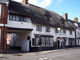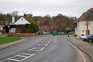
Dorset is a ceremonial county in South West England. It is bordered by Somerset to the north-west, Wiltshire to the north and the north-east, Hampshire to the east, the Isle of Wight across the Solent to the south-east, the English Channel to the south, and Devon to the west. The largest settlement is Bournemouth, and the county town is Dorchester.

Woodbridge is a town in New Haven County, Connecticut, United States. The town is part of the South Central Connecticut Planning Region. The population was 9,087 at the 2020 census. The town center is listed on the National Register of Historic Places as Woodbridge Green Historic District. Woodbridge is part of the Amity Regional School District #5, rated the #1 school district in New Haven County and the 10th best school district in CT by Niche in 2021. As of 2019 Woodbridge has the 7th highest median household income in CT.

Shaftesbury is a town and civil parish in Dorset, England. It is on the A30 road, 20 miles west of Salisbury and 23 miles north-northeast of Dorchester, near the border with Wiltshire. It is the only significant hilltop settlement in Dorset, being built about 215 metres above sea level on a greensand hill on the edge of Cranborne Chase.

Vaughan is a city in Ontario, Canada. It is located in the Regional Municipality of York, just north of Toronto. Vaughan was the fastest-growing municipality in Canada between 1996 and 2006 with its population increasing by 80.2% during this time period and having nearly doubled in population since 1991. It is the fifth-largest city in the Greater Toronto Area, and the 17th-largest city in Canada.

Dorchester is the county town of Dorset, England. It is situated between Poole and Bridport on the A35 trunk route. A historic market town, Dorchester is on the banks of the River Frome to the south of the Dorset Downs and north of the South Dorset Ridgeway that separates the area from Weymouth, 7 miles (11 km) to the south. The civil parish includes the experimental community of Poundbury and the suburb of Fordington.

Abbotsbury is a village and civil parish in the English county of Dorset. The village is located around 7+1⁄2 miles (12.1 km) west southwest of Dorchester and 1 mile (1.6 km) inland from the English Channel coast. In the 2021 census the civil parish had a population of 451.

Sturminster Newton is a town and civil parish situated on the River Stour in the north of Dorset, England. The town is at the centre of the Blackmore Vale, a large dairy agriculture region around which the town's economy is built, and is known as 'the heart of the Blackmore vale'.

Beaminster is a town and civil parish in Dorset, England, situated in the Dorset Council administrative area approximately 15 miles (24 km) northwest of the county town Dorchester. It is sited in a bowl-shaped valley near the source of the small River Brit. The 2013 mid-year estimate of the population of Beaminster parish is 3,100.

Marnhull is a village and civil parish in the county of Dorset in southern England. It lies in the Blackmore Vale, three miles north of Sturminster Newton. The resort towns of Bournemouth and Weymouth are approximately 30 miles south. Marnhull is sited on a low ridge of Corallian limestone above the valley of the River Stour, which forms the northern and western boundaries of the parish. In the 2011 census the parish had 962 dwellings, 905 households and a population of 1,998.

Charlton Marshall is a village and civil parish in the English county of Dorset. It lies within the North Dorset administrative district, on the A350 road 2 miles south of the market town of Blandford Forum. It is sited on a river terrace above the floodplain of the River Stour, with most of the land in the parish stretching south-west over chalk hills. In the 2011 census the number of dwellings recorded within the parish was 513 and the population was 1,156.

Chickerell is a town and parish in Dorset, England. In the 2011 census the parish and the electoral ward had a population of 5,515.

Compton Abbas is a village and civil parish in north Dorset, England. It lies 3 miles south of the town of Shaftesbury. It is sited on greensand strata on the edge of the Blackmore Vale, below the chalk downs of Cranborne Chase. On top of these hills is Compton Abbas Airfield. The A350 road between Wiltshire and the south coast passes through the village. In the 2011 census the civil parish had a population of 216. The name Compton Abbas derives from the Saxon "cumb-ton", meaning 'village in a narrow valley', plus "abbas" which refers to Shaftesbury Abbey. The church, St. Mary's, was built in 1866 to replace the older structure which was more remote from the village.

Dewlish is a village and civil parish in the county of Dorset in southern England, and is situated approximately 7 miles (11 km) north-east of the county town Dorchester. The village is sited in the valley of the small Devil's Brook among the chalk hills of the Dorset Downs; the parish covers about 2,100 acres (850 ha) and extends west to include part of the valley of the small Cheselbourne stream, and east to include a dry valley at Dennet's Bottom. The surrounding area is part of the Dorset Area of Outstanding Natural Beauty (AONB). In the 2011 census the parish had a population of 284.

Holwell is a village and civil parish in the county of Dorset in southern England, situated approximately 5 miles (8.0 km) south-east of Sherborne. It is sited on Oxford clay in the Blackmore Vale. Its name derives from the Old English hol and walu, meaning a bank or ridge in a hollow. The parish includes the hamlets of Sandhills, Westrow, Barnes Cross, The Borough, and Woodbridge. In the 2011 census the parish had a population of 369 and is part of the Cam Vale electoral ward. Until 1844 Holwell was an exclave of Somerset, being part of the parish of Milborne Port.

Okeford Fitzpaine is a village and civil parish in the English county of Dorset, situated in the Blackmore Vale three miles south of the town of Sturminster Newton. It is sited on a thin strip of greensand under the scarp face of the Dorset Downs. In the 2011 census the civil parish—which includes the village of Belchalwell to the west and most of the hamlet of Fiddleford to the north—had 404 dwellings, 380 households and a population of 913.

Whitchurch Canonicorum is a village and civil parish in southwest Dorset, England, situated in the Marshwood Vale 5 miles (8.0 km) west-northwest of Bridport. In the 2011 Census the parish – which includes the settlements of Morcombelake, Ryall and Fishpond Bottom – had a population of 684.

Woodbridge is a very large suburban community in Vaughan, Ontario, Canada, along the city's border with Toronto. It occupies the city's entire southwest quadrant, west of Highway 400, east of Highway 50, north of Steeles Avenue, and generally south of Major Mackenzie Drive. It was once an independent village before being amalgamated with nearby communities to form the city in 1971. Its traditional downtown core is the Woodbridge Avenue stretch between Islington Avenue and Kipling Avenue north of Highway 7.

Woodbridge is a semi-rural locality in the local government area (LGA) of Kingborough in the Hobart LGA region of Tasmania. The locality is about 26 kilometres (16 mi) south of the town of Kingston. The 2021 Census recorded a population of 547 for the state suburb of Woodbridge, with the median age being 54. There are 180 families living in Woodbridge, with a mean of 1.8 children per household. It is located 38 kilometres (24 mi) south of the state capital, Hobart.

Nunavut is the largest and northernmost territory of Canada. It was separated officially from the Northwest Territories on April 1, 1999, via the Nunavut Act and the Nunavut Land Claims Agreement Act, which provided this territory to the Inuit for self-government. The boundaries had been drawn in 1993. The creation of Nunavut resulted in the first major change to Canada's political map in half a century since the province of Newfoundland was admitted in 1949.

Dorset Island, or Cape Dorset Island, is one of the Canadian Arctic islands located in Hudson Strait, Nunavut, Canada. It lies off the Foxe Peninsula area of southwestern Baffin Island in the Qikiqtaaluk Region. It is serviced by an airport and a harbour.


