
Inverclyde is one of 32 council areas used for local government in Scotland. Together with the East Renfrewshire and Renfrewshire council areas, Inverclyde forms part of the historic county of Renfrewshire, which currently exists as a registration county and lieutenancy area. Inverclyde is located in the west central Lowlands. It borders the North Ayrshire and Renfrewshire council areas, and is otherwise surrounded by the Firth of Clyde.

Greenock is a town and administrative centre in the Inverclyde council area in Scotland, United Kingdom and a former burgh within the historic county of Renfrewshire, located in the west central Lowlands of Scotland. It forms part of a contiguous urban area with Gourock to the west and Port Glasgow to the east.

Gourock is a town in the Inverclyde council area and formerly a burgh of the County of Renfrew in the west of Scotland. It was a seaside resort on the East shore of the upper Firth of Clyde. Its main function today is as a residential area, extending contiguously from Greenock, with a railway terminus and ferry services across the Clyde.

Port Glasgow is the second-largest town in the Inverclyde council area of Scotland. The population according to the 1991 census for Port Glasgow was 19,426 persons and in the 2001 census was 16,617 persons. The most recent census in 2011 states that the population has declined to 15,414. It is located immediately to the east of Greenock and was previously a burgh in the county of Renfrewshire.
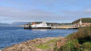
Wemyss Bay is a town on the coast of the Firth of Clyde in Inverclyde in the west central Lowlands of Scotland. It is in the traditional county of Renfrewshire. It is adjacent to Skelmorlie, North Ayrshire. The town and villages have always been in separate counties, divided by the Kelly Burn.

Inverclyde is a parliamentary constituency of the House of Commons of the Parliament of the United Kingdom. It replaced Greenock and Inverclyde and the Port Glasgow and Kilmacolm areas from West Renfrewshire for the 2005 general election.

The Inverclyde Line is a railway line running from Glasgow Central station through Paisley and a series of stations to the south of the River Clyde and the Firth of Clyde, terminating at Gourock and Wemyss Bay, where it connects to Caledonian MacBrayne ferry services. The line has been in operation since the 1840s between Glasgow and Greenock and was the first passenger service to follow the River Clyde to the coast. The line was electrified in 1967.

Park Farm is a housing scheme in the upper east area of Port Glasgow, Inverclyde, Scotland, built on the site of Park farm which stood near Parkhill Square. It consists of two distinct phases; the original phase stretches uphill from Parkhill Square to Mull Avenue and the second phase was built south of Mull Avenue in the late 1960s and consists of the streets around Oronsay Avenue. All of the streets take their names from Scottish islands. These include Stroma Avenue, Islay Avenue, Rona Avenue, Pladda Avenue, Westray Avenue, Sandray Avenue, Tiree Avenue, Staffa Avenue, Iona Road, Skye Road and Arran Avenue.

Inverkip is a village and parish in the Inverclyde council area and historic county of Renfrewshire in the west central Lowlands of Scotland, 5 miles (8 km) southwest of Greenock and 8.1 miles (13 km) north of Largs on the A78 trunk road. The village takes its name from the River Kip and is served by Inverkip railway station.
Larkfield is the largest council housing estate in Greenock, Inverclyde, Scotland.

Greenock West railway station is a station in Greenock, Scotland, located on the Inverclyde Line which runs from Gourock to Glasgow Central. The route is currently operated by ScotRail under the auspices of Strathclyde Partnership for Transport. Each service to and from Glasgow on the Inverclyde Line stops at this station.
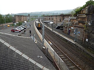
Greenock Central station is one of eight railway stations serving the town of Greenock in western Scotland, and is the nearest to the town centre. This station, which is staffed, is on the Inverclyde Line, 37 km (23 mi) west of Glasgow Central towards Gourock. It has three platforms, two of which are in use, with one disused bay platform. This disused platform is still connected to the main line.

Renfrewshire or the County of Renfrew is a historic county, registration county and lieutenancy area in the west central Lowlands of Scotland. The lieutenancy area covers the three modern council areas of Inverclyde, Renfrewshire and East Renfrewshire, and this area is occasionally termed Greater Renfrewshire to distinguish it from the modern council area called Renfrewshire. The historic county additionally included territory on the south-western edge of Glasgow which was gradually transferred to the administrative area of the city as it grew.

Lyle Hill stands at the West End of Greenock in Inverclyde, Scotland. It has scenic viewpoints accessible from Lyle Road, which was constructed in 1879–1880 and named after Provost Abram Lyle, well known as a sugar refiner. The hill's highest point is Craigs Top at 426 feet above sea level, and before the road was constructed the hill was known as the Craigs, or as the Bingens.
Inverclyde Council is one of the 32 local authorities of Scotland, covering the Inverclyde council area. In its current form the council was created in 1996, replacing the previous Inverclyde District Council which existed from 1975 to 1996.

Bouverie is an area of the town of Port Glasgow, Inverclyde, Scotland.
The Glasgow, Paisley and Greenock Railway (GP&GR) was an early Scottish railway, opened in 1841, providing train services between Greenock and Glasgow. At the time the River Clyde was not accessible to sea-going ships, and the intention was to compete with river boats that brought goods to and from the city. In fact passenger traffic proved surprisingly buoyant, and connecting steamer services to island resorts in the Firth of Clyde provided a very great source of business.
The Greenock and Wemyss Bay Railway was a railway owned by the Caledonian Railway, providing services between Greenock and Wemyss Bay.
The Wallace Oak was a tree at Port Glasgow, Scotland. It is linked in legend to the Scottish independence leader William Wallace who is said to have been chained to the tree in 1304/05 after his capture by English forces. The tree was starting to decay by the 18th century and was treated with pitch. It also had chains added to strengthen its branches, which may be the origin of the Wallace myth. The tree fell during a storm in 1995 but some of its timber has been preserved. A proposal was made in 2019 to erect a monument to the tree.
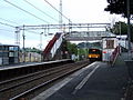 Class 318 at Woodhall railway station in 2007
 Woodhall railway station in 2007

 St Martin's Parish Church
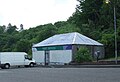 Former Dino's Cafe
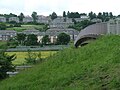 Woodhall from Kelburn Park
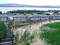 Pleasantside from Sunnyside
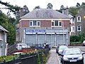 Former Brightside Co-op
 The last remaining tenement on Woodhall Terrace
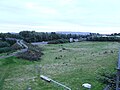 Former home of Port Glasgow Juniors FC
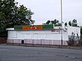 Former cafe, newsagents and chippy near Woodhall railway station


