Woodland, Aroostook County, Maine

Last updated

Woodland, Maine
Aroostook County Maine incorporated and unincorporated areas Woodland highlighted.svg
Location of Woodland, Maine
Coordinates: 46°51′35″N68°01′0″W / 46.85972°N 68.01667°W / 46.85972; -68.01667
Country United States
State Maine
County Aroostook
VillagesWoodland Center
Carson
Colby
Area
[1]
  Total35.25 sq mi (91.30 km2)
  Land35.25 sq mi (91.30 km2)
  Water0 sq mi (0 km2)
Population
 (2020)
  Total1,217
  Density34/sq mi (13.3/km2)
Time zone UTC-5 (Eastern (EST))
  Summer (DST) UTC-4 (EDT)
Website www.townofwoodland.org

Woodland is a town in Aroostook County, Maine, United States. The population was 1,217 at the 2020 census. [2] Because the state of Maine has a law stating that no two towns may share the same name, Woodland of Aroostook County and Woodland of Washington County found themselves before the Maine Supreme Judicial Court in the late 1990s. Because it was founded as a township first, Woodland of Aroostook County was allowed to keep its name and Woodland of Washington County was ordered by the court to choose a new name: Baileyville.

Contents

Among the first white settlements in Woodland was the Moir Farm, which was still active as of 2020.

Geography

According to the United States Census Bureau, the town has a total area of 35.25 square miles (91.30 km2), all land. [1]

Demographics

Historical population
CensusPop.Note
1870 174
1880 679290.2%
1890 88530.3%
1900 1,09623.8%
1910 1,1615.9%
1920 1,120−3.5%
1930 1,30816.8%
1940 1,298−0.8%
1950 1,292−0.5%
1960 1,3726.2%
1970 1,218−11.2%
1980 1,36912.4%
1990 1,4022.4%
2000 1,4030.1%
2010 1,213−13.5%
2020 1,2170.3%
U.S. Decennial Census [3]

2010 census

As of the census [4] of 2010, there were 1,213 people, 508 households, and 360 families living in the town. The population density was 34.4 inhabitants per square mile (13.3/km2). There were 586 housing units at an average density of 16.6 per square mile (6.4/km2). The racial makeup of the town was 97.6% White, 0.3% African American, 0.6% Native American, and 1.5% from two or more races. Hispanic or Latino of any race were 0.7% of the population.

There were 508 households, of which 27.6% had children under the age of 18 living with them, 56.9% were married couples living together, 7.1% had a female householder with no husband present, 6.9% had a male householder with no wife present, and 29.1% were non-families. 22.2% of all households were made up of individuals, and 9% had someone living alone who was 65 years of age or older. The average household size was 2.39 and the average family size was 2.77.

The median age in the town was 46.1 years. 19.7% of residents were under the age of 18; 6.3% were between the ages of 18 and 24; 22.6% were from 25 to 44; 35.9% were from 45 to 64; and 15.5% were 65 years of age or older. The gender makeup of the town was 50.5% male and 49.5% female.

2000 census

As of the census [5] of 2000, there were 1,403 people, 528 households, and 397 families living in the town. The population density was 39.8 inhabitants per square mile (15.4/km2). There were 577 housing units at an average density of 16.4/sq mi (6.3/km2). The racial makeup of the town was 96.01% White, 0.93% African American, 1.35% Native American, 1.00% Asian, and 0.71% from two or more races. Hispanic or Latino of any race were 0.78% of the population.

There were 528 households, out of which 34.1% had children under the age of 18 living with them, 61.6% were married couples living together, 7.4% had a female householder with no husband present, and 24.8% were non-families. 18.9% of all households were made up of individuals, and 8.9% had someone living alone who was 65 years of age or older. The average household size was 2.65 and the average family size was 3.03.

In the town, the population was spread out, with 25.9% under the age of 18, 6.4% from 18 to 24, 28.7% from 25 to 44, 27.9% from 45 to 64, and 11.1% who were 65 years of age or older. The median age was 39 years. For every 100 females, there were 110.7 males. For every 100 females age 18 and over, there were 103.9 males.

The median income for a household in the town was $28,929, and the median income for a family was $35,250. Males had a median income of $27,750 versus $21,500 for females. The per capita income for the town was $14,034. About 11.6% of families and 13.3% of the population were below the poverty line, including 17.5% of those under age 18 and 19.6% of those age 65 or over.

Related Research Articles

<span class="mw-page-title-main">Bancroft, Maine</span> Unorganized territory in Maine, United States

Bancroft is a township in Aroostook County, Maine, United States. The population was 57 at the 2020 census. On July 1, 2015 the town voted to deorganize and become part of the unorganized territory of South Aroostook.

<span class="mw-page-title-main">Castle Hill, Maine</span> Town in the state of Maine, United States

Castle Hill is a town in Aroostook County, Maine, United States. The population was 373 people at the 2020 census.

<span class="mw-page-title-main">Dyer Brook, Maine</span> Town in the state of Maine, United States

Dyer Brook is a town in Aroostook County, Maine, United States. The population was 215 at the 2020 census. Dyer Brook is also host to the local school, Southern Aroostook Community School.

<span class="mw-page-title-main">Eagle Lake, Maine</span> Town in the state of Maine, United States

Eagle Lake is a town in Aroostook County, Maine, United States. The population was 772 at the 2020 census. The town was named by a body of troops heading from Bangor to the Aroostook War for the many eagles that they saw around the lake. A total of 49.0% of the population speaks French, reflecting a trend in Northeastern Maine.

<span class="mw-page-title-main">Frenchville, Maine</span> Town in the state of Maine, United States

Frenchville is a town in Aroostook County, Maine, United States. The population was 1,052 at the 2020 census.

<span class="mw-page-title-main">Grand Isle, Maine</span> Town in the state of Maine, United States

Grand Isle is a town in Aroostook County, Maine, United States. The population was 366 at the 2020 census. The village of Grand Isle is in the northwestern part of the town.

<span class="mw-page-title-main">Hammond, Maine</span> Town in the state of Maine, United States

Hammond is a town in Aroostook County, Maine, United States. The population was 91 at the 2020 census.

<span class="mw-page-title-main">Hersey, Maine</span> Town in the state of Maine, United States

Hersey is a town in Aroostook County, Maine, United States. The population was 73 at the 2020 census.

<span class="mw-page-title-main">Island Falls, Maine</span> Town in the state of Maine, United States

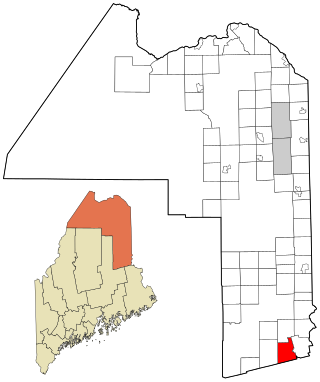
Island Falls is a town in Aroostook County, Maine, United States. The population was 758 at the 2020 census. The primary village of Island Falls in the town is situated at a falls in the West Branch Mattawamkeag River.

<span class="mw-page-title-main">Mapleton, Maine</span> Town in the state of Maine, United States

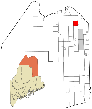
Mapleton is a town in Aroostook County, Maine, United States. The population was 1,886 at the 2020 census.

<span class="mw-page-title-main">Masardis, Maine</span> Town in Maine, United States

Masardis is a town in Aroostook County, Maine, United States. The population was 204 at the 2020 census.

<span class="mw-page-title-main">Merrill, Maine</span> Town in the state of Maine, United States

Merrill is a town in Aroostook County, Maine, United States. The population was 208 at the 2020 census.

<span class="mw-page-title-main">New Canada, Maine</span> Town in the state of Maine, United States

New Canada is a town in Aroostook County, Maine, United States. The population was 310 at the 2020 census.

<span class="mw-page-title-main">Portage Lake, Maine</span> Town in the state of Maine, United States

Portage Lake is a town in Aroostook County, Maine, United States. The population was 359 at the 2020 census.

<span class="mw-page-title-main">Sherman, Maine</span> Town in the state of Maine, United States

Sherman is a town in Aroostook County, Maine, United States. The population was 815 at the 2020 census.

<span class="mw-page-title-main">Smyrna, Maine</span> Town in the state of Maine, United States

Smyrna is a town in Aroostook County, Maine, United States. The population was 439 at the 2020 census.

<span class="mw-page-title-main">St. Francis, Maine</span> Town in the state of Maine, United States

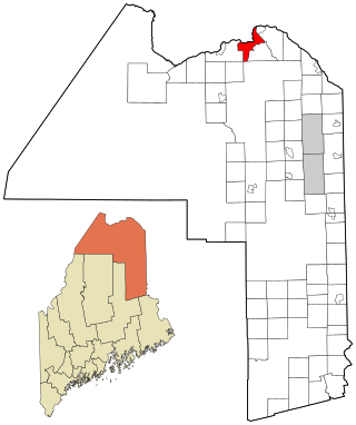
St. Francis is a town in Aroostook County, Maine, United States on the Canada–United States border at the junction of the St. Francis River and the Saint John River. The population was 438 at the 2020 census. First settled by English speakers from southern Maine, the original population has been supplanted by French-speaking Acadians.

<span class="mw-page-title-main">Stockholm, Maine</span> Town in the state of Maine, United States

Stockholm is a town in Aroostook County, Maine, United States. The population was 250 at the 2020 census.

<span class="mw-page-title-main">Wallagrass, Maine</span> Town in the state of Maine, United States

Wallagrass is a town in Aroostook County, Maine, United States. The population was 519 at the 2020 census.

<span class="mw-page-title-main">Westfield, Maine</span> Town in the state of Maine, United States

Westfield is a town in Aroostook County, Maine, United States. The population was 455 at the 2020 census.

References

  1. 1 2 "US Gazetteer files 2010". United States Census Bureau . Retrieved December 16, 2012.
  2. "Census - Geography Profile: Woodland town, Aroostook County, Maine" . Retrieved January 21, 2022.
  3. "Census of Population and Housing". Census.gov. Retrieved June 4, 2015.
  4. "U.S. Census website". United States Census Bureau . Retrieved December 16, 2012.
  5. "U.S. Census website". United States Census Bureau . Retrieved January 31, 2008.