Related Research Articles
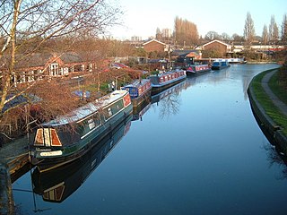
The Wyrley and Essington Canal, known locally as "the Curly Wyrley", is a canal in the English Midlands. As built it ran from Wolverhampton to Huddlesford Junction near Lichfield, with a number of branches: some parts are currently derelict. Pending planned restoration to Huddlesford, the navigable mainline now terminates at Ogley Junction near Brownhills. In 2008 it was designated a Local Nature Reserve.
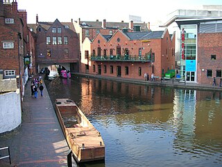
Birmingham Canal Navigations (BCN) is a network of canals connecting Birmingham, Wolverhampton, and the eastern part of the Black Country. The BCN is connected to the rest of the English canal system at several junctions. It was owned and operated by the Birmingham Canal Navigations Company from 1767 to 1948.

South Staffordshire is a local government district in Staffordshire, England. The district lies to the north and west of the West Midlands county, bordering Shropshire to the west and Worcestershire to the south. It contains notable settlements such as Codsall, Cheslyn Hay, Great Wyrley, Penkridge, Brewood, Coven, Essington, Huntington, Weston-under-Lizard, Bilbrook, Wombourne, Himley, Perton and Featherstone. Codsall is the main administrative centre of South Staffordshire District. Many of the villages form both commuter and residential areas for the nearby towns of Cannock, Stafford and Telford, as well as the wider West Midlands County.

The Hatherton Canal is a derelict branch of the Staffordshire and Worcestershire Canal in south Staffordshire, England. It was constructed in two phases, the first section opening in 1841 and connecting the main line to Churchbridge, from where a tramway connected to the Great Wyrley coal mines. The second section was a joint venture with the Birmingham Canal Navigations, and linked Churchbridge to the Cannock Extension Canal by a flight of 13 locks, which were opened with the Extension Canal in 1863. The coal traffic was very profitable, and the canal remained in use until 1949. It was formally abandoned in 1955, after which the Churchbridge flight and much of the Extension Canal were destroyed by open cast mining.

The Chase Line is a suburban railway line in the West Midlands region of England. It runs from its southern terminus, Birmingham New Street, to Walsall, and then Rugeley in Staffordshire, where it joins the Trent Valley Line. The name of the line refers to Cannock Chase which it runs through at its northern end.

South Staffordshire is a constituency represented in the House of Commons of the UK Parliament since 2010 by Sir Gavin Williamson, a Conservative.

Great Wyrley is a large village and civil parish in Staffordshire, England. It is coterminous with the villages of Landywood and Cheslyn Hay in the South Staffordshire district. It lies 5.5 miles north of Walsall, West Midlands. It had a population of 11,060 at the 2011 census.

Lichfield Trent Valley is a railway station on the outskirts of the city of Lichfield in Staffordshire, England. It is one of two stations in Lichfield, the other being Lichfield City in the city-centre. It is a split-level station, with low level platforms served by the Trent Valley section of the West Coast Main Line, and a single high level platform, which is the northern terminus of the Cross-City Line.

Essington is a village and civil parish in South Staffordshire, England, located near the city of Wolverhampton and towns of Walsall, Bloxwich, Cannock and Brewood. The villages of Cheslyn Hay, Great Wyrley, Coven, Penkridge and Featherstone are also nearby. The village forms part of the Staffordshire/West Midlands border.

The River Penk is a small river flowing through Staffordshire, England. Its course is mainly within South Staffordshire, and it drains most of the northern part of that district, together with some adjoining areas of Cannock Chase, Stafford, Wolverhampton, and Shropshire. It flows into the River Sow, which is a tributary of the River Trent, so its waters flow ultimately into the North Sea via the Humber Estuary.

Landywood is a small village in Staffordshire, England. Landywood forms part of the parish and village of Great Wyrley, and together with Great Wyrley and Cheslyn Hay, forms a community with a combined population in 2001 of almost 20,000. For the population as taken at the 2011 census see Great Wyrley.
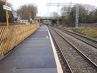
Landywood railway station is situated in the village of Landywood in Staffordshire, England. As well as Landywood, the station also serves the adjacent villages of Cheslyn Hay and Great Wyrley. The LNWR also operated an earlier halt at Landywood which closed on 1 January 1916.

Cannock railway station serves the town of Cannock in the Cannock Chase, Staffordshire, England. It is situated on the Chase Line. The station and all trains serving it are operated by West Midlands Trains. The station is located over half a mile from the centre of the town, close to the suburbs of Stoney Lea and Hawks Green.

Cheslyn Hay is a former mining village and civil parish which is contiguous with Great Wyrley and Landywood in Staffordshire, England. It is situated within the South Staffordshire district some 3 miles south of Cannock, 7 miles north of Walsall, 8.5 miles northeast of Wolverhampton and 12.5 miles south of the county town of Stafford. The West Midlands county border lies 2 miles to the south.
The South Staffordshire Railway (SSR) was authorised in 1847 to build a line from Dudley in the West Midlands of England through Walsall and Lichfield to a junction with the Midland Railway on the way to Burton upon Trent, with authorised share capital of £945,000. It was supported by the newly-formed London and North Western Railway (LNWR) and the Midland Railway, giving each company access to important areas. It completed its main line in 1849. As collieries in the Cannock region rose in importance, it built a second main line from Walsall to Rugeley, as well as numerous short spurs and connections to lines it intersected. Colliery working in the Cannock area expanded enormously, and mineral traffic carryings increased in step.

The current Cannock Extension Canal is a 1.8-mile (2.9 km) canal in England. It runs from Pelsall Junction on the Wyrley and Essington Canal, north to Norton Canes Docks and forms part of the Birmingham Canal Navigations. Historically, it ran to Hednesford, and served a number of collieries, which provided the main traffic. It opened in 1863, and the northern section closed in 1963, as a result of mining subsidence.

Rumer Hill Junction was a canal junction on the Cannock Extension Canal where the Churchbridge Branch left to join the Hatherton Canal. The junction, along with the northern section of the canal was abandoned in 1963. The Churchbridge Branch and Rumer Hill Junction were subsequently obliterated by opencast mining.
Awsworth railway station was a former railway station in Awsworth, Nottinghamshire. It was opened by the Great Northern Railway on its Derbyshire and Staffordshire Extension in 1875–6.

Bridgtown is an industrial town and civil parish in the Cannock Chase District of Staffordshire, England. It is situated on the A5 between Cannock and Great Wyrley. There are multiple industrial and retail estates around the town as well as residential areas. There is now only one church in Bridgtown, the Bethel Church. There was one on Church Street but it is now used for commercial purposes.
Cheslyn may refer to:
References
- 1 2 Butt, R.V.J. (1995). The Directory of Railway Stations. Yeovil: Patrick Stephens Ltd. p. 256. ISBN 1-85260-508-1. R508.
- ↑ Awdry, Christopher (1990). Encyclopaedia of British Railway Companies. London: Guild Publishing. p. 103. CN 8983.