Gangwon State is a Special Self-Governing Province of South Korea and the least densely populated subdivision of the country. Gangwon is one of the three provinces with special self-governing status, the others being Jeju Province and Jeonbuk State. On the east bound by the East Sea, it borders Gyeonggi Province to its west, North Gyeongsang Province and North Chungcheong Province to its south, and the Military Demarcation Line to the north, separating it from North Korea's Kangwŏn Province. Before the division of Korea in 1945 Gangwon and Kangwŏn Provinces formed a single province.

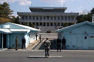
The Korean Demilitarized Zone is a heavily militarized strip of land running across the Korean Peninsula near the 38th parallel north. The demilitarized zone (DMZ) is a border barrier that divides the peninsula roughly in half. It was established to serve as a buffer zone between the countries of North Korea and South Korea under the provisions of the Korean Armistice Agreement in 1953, an agreement between North Korea, China, and the United Nations Command.

Cheorwon County, also spelled Chorwon, is a county in Gangwon Province, South Korea. It is located right next to the border with North Korea.

Goseong is a county in Gangwon Province, South Korea.

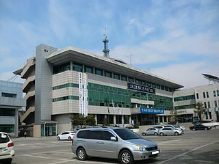
Hongcheon (Hongcheon-gun) is a county and city in Gangwon Province, South Korea. The city lies on the northern bank of the Hongcheon River, southeast of Chuncheon. The terrain of the county is mainly mountainous and contains hot springs in the Hongcheong River valley. The county produces ginseng, maize, and vegetables. As of 2012 the county had a population of 70,401 people in 29,894 households.

Hwacheon County is a county in Gangwon Province, South Korea. The northern border is, in some places, within nine kilometres of the Korean Demilitarized Zone. Neighboring counties are Cheorwon to the northwest and north, Yanggu to the east, Chuncheon to the south, and the Gyeonggi-do province to the southwest. The county consists largely of mountains and rivers, between which are small farming communities, military bases and military training grounds. The area is renowned for its rivers, lake trout, indigenous otters, and natural scenery.

Inje County is a county in Gangwon Province, South Korea. It has the lowest population density of any South Korean county. The county seat is Inje-eup, which located near the center of the county.

Gapyeong County (Korean: 가평군) is a county in Gyeonggi Province, South Korea. It was the scene of the Battle of Kapyong, a major battle of the Korean War.

Sokcho is a city and major tourist hub located in the northeast of Gangwon Province, South Korea.

Yangyang County is in Gangwon Province, South Korea. The county is located in the northeast of the country in Gangwon-do. Its population is about 31,000 (2004).

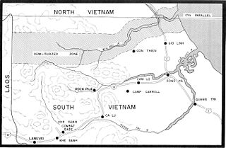
The Vietnamese Demilitarized Zone was a demilitarized zone at the 17th parallel in Quang Tri province that was established as the dividing line between the two countries i.e. North Vietnam and South Vietnam from 22 July 1954 to 2 July 1976 when Vietnam was officially divided into the two military gathering areas, which was intended to be sustained in the short term after the First Indochina War.

The United States Forces Korea (USFK) is a sub-unified command of U.S. Indo-Pacific Command (USINDOPACOM). USFK is the joint headquarters for U.S. combat-ready fighting forces and components under the ROK/US Combined Forces Command (CFC) – a supreme command for all of the South Korean and U.S. ground, air, sea and special operations component commands. Major USFK elements include U.S. Eighth Army (EUSA), U.S. Air Forces Korea, U.S. Naval Forces Korea (CNFK), U.S. Marine Forces Korea (MARFORK) and U.S. Special Operations Command Korea (SOCKOR). It was established on July 1, 1957.

Kosŏng County is a kun, or county, in Kangwŏn province, North Korea. It lies in the southeasternmost corner of North Korea, immediately north of the Korean Demilitarized Zone. Prior to the end of the Korean War in 1953, it made up a single county, together with what is now the South Korean county of the same name. In a subsequent reorganization, the county absorbed the southern portion of Tongch'ŏn county.

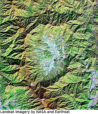
Haean is a township (myeon) in Yanggu County, Gangwon-do, South Korea. Haean sits in the distinctive Haean Basin (해안분지), which was nicknamed The Punchbowl by UN forces during the Korean War. The northern part of the basin lies within the Demilitarized Zone, and the area saw heavy fighting during the war.
Daeamsan is a mountain in the province of Gangwon-do, South Korea. It sits on the boundary between the counties of Inje and Yanggu. Daeamsan has an elevation of 1,304 m (4,278 ft).
Samyeongsan is a mountain between the counties of Yanggu, Hwacheon and the city of Chuncheon, Gangwon-do in South Korea. It has an elevation of 1,197.6 m (3,929 ft).
Yoo Young-ho is a South Korean sculptor.

The Punchbowl was the name given to the bowl-shaped Haean Basin (해안분지) in Yanggu County, Gangwon Province by UN Forces during the Korean War. The Punchbowl lies several km south of the Korean Demilitarized Zone.

DMZ Train is a South Korean excursion train operated by Korail. The train began operations in 2014 and transports tourists from Seoul to train terminals closest to the Korean Demilitarized Zone. The service was suspended in 2019 and has not yet resumed operation. Due to the aging issue of the trains, the DMZ Train ended its operation on 28 December 2023.


