Yatala Pie Shop

Last updated

Yatala Big Pie, 2008 Yatala BigPie.jpg
Yatala Big Pie, 2008
Interior of the pie shop, 2012 Yatala Pie Shop, interior.jpg
Interior of the pie shop, 2012

The Yatala Pie Shop is an iconic pie shop in Yatala, City of Gold Coast, Queensland, Australia. In 2009 as part of the Q150 celebrations, the Yatala Pie Shop was announced as one of the Q150 Icons of Queensland for its role as a "location". [1]

Contents

History

Whole pie cut into slices, 2015 Yatala Pie Shop, full pie, 2015.jpg
Whole pie cut into slices, 2015

The pie shop opened in 1914. [2] Originally it was located on the Pacific Highway, but when the highway was replaced by the Pacific Motorway which did not permit roadside businesses, it relocated to larger modern premises just off exit 38 of the north-bound side of the motorway. [3]

The pie shop was flooded in April 2017 following heavy rain produced by Cyclone Debbie. [4] [5]

Slice of Yatala pie, 2015 Yatala Pie Shop, slice of pie, 2015.jpg
Slice of Yatala pie, 2015

Recognition

Yatala Pie Shop appears on numerous "best of pie shop" lists, [6] [7] [8] [9] won a 2007 Family Business Australia award, [10] and is one of Queenslands top 15 icons. [11]

Landmark

The Big Pie on top of a post outside the shop is listed as one of Australia's Big Things. [12]

See also

Related Research Articles

<span class="mw-page-title-main">Gold Coast, Queensland</span> Australian coastal city

The Gold Coast is a coastal city and region in the state of Queensland, Australia, approximately 66 kilometres (41 mi) south-southeast of the centre of the state capital Brisbane. With a population over 600,000, the Gold Coast is the sixth-largest city in Australia, the nation's largest non-capital city, and Queensland's second-largest city after Brisbane. The city's central business district is located roughly in the centre of the Gold Coast in the suburb of Southport, with the suburb holding more corporate office space than anywhere else in the city. The urban area of the Gold Coast is concentrated along the coast sprawling almost 60 kilometers, joining up with the Greater Brisbane Metropolitan Area to the north and to the state border with New South Wales to the south.

<span class="mw-page-title-main">Surfers Paradise, Queensland</span> Town in Queensland, Australia

Surfers Paradise is a suburb in the City of Gold Coast, Queensland, Australia. In the 2021 census, Surfers Paradise had a population of 26,412 people.

<span class="mw-page-title-main">Q1 (building)</span> Tallest building in Australia

Q1 Tower is a 322.5-metre (1,058 ft) supertall skyscraper in Queensland, Australia. The residential tower on the Gold Coast was the world's tallest residential building from 2005 to 2011. As of 2023, it is the tallest building in Australia, the second tallest building in the Southern Hemisphere, and the third-tallest free-standing structure in the Southern Hemisphere, behind the Autograph Tower in Jakarta, Indonesia, and the Sky Tower in Auckland, New Zealand. The Q1 officially opened in November 2005.

<span class="mw-page-title-main">Stradbroke Island</span> Island near Brisbane, Australia

Stradbroke Island, also known as Minjerribah, was a large sand island that formed much of the eastern side of Moreton Bay near Brisbane, Queensland until the late 19th century. Today the island is split into two islands: North Stradbroke Island and South Stradbroke Island, separated by the Jumpinpin Channel.

<span class="mw-page-title-main">Nerang, Queensland</span> Suburb of Gold Coast, Queensland, Australia

Nerang is a town and suburb in the City of Gold Coast, Queensland, Australia. In the 2016 census, Nerang had a population of 16,864 people.

<span class="mw-page-title-main">Southport, Queensland</span> Suburb of Gold Coast, Queensland, Australia

Southport is a coastal town and suburb in the City of Gold Coast in Queensland, Australia. It contains the Gold Coast central business district. In the 2021 census, Southport had a population of 36,786 people.

<span class="mw-page-title-main">Pacific Motorway (Brisbane–Brunswick Heads)</span> Motorway in New South Wales and Queensland

The Pacific Motorway is a motorway in Australia between Brisbane, Queensland, and Brunswick Heads, New South Wales, through the New South Wales–Queensland border at Tweed Heads.

<span class="mw-page-title-main">Tilt Train</span>

Tilt Train is the name for two similar high-speed tilting train services, one electric and the other diesel, operated by Queensland Rail. They run on the North Coast line from Brisbane to Rockhampton (electric) and Cairns (diesel). Services commenced in 1998.

<span class="mw-page-title-main">1974 Brisbane flood</span> Deadly flood in 1974 in Brisbane, Queensland, Australia

In January 1974 a flood occurred in Brisbane, Queensland, Australia after three weeks of continual rain. The Brisbane River, which runs through the heart of the city, broke its banks and flooded the surrounding areas. The cyclone that produced the flood also flooded surrounding cities: Ipswich, Beenleigh, and the Gold Coast.

<span class="mw-page-title-main">Albert River (South East Queensland)</span> River in Queensland, Australia

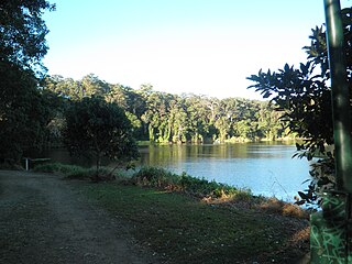
The Albert River is a perennial river in the South East region of Queensland, Australia. Its catchment lies within the Gold Coast and Scenic Rim Region local government areas and covers an area of 782 square kilometres (302 sq mi). The river provides potable water for the town of Beaudesert.

<span class="mw-page-title-main">Helensvale, Queensland</span> Suburb of Gold Coast, Queensland, Australia

Helensvale is a suburb of the City of Gold Coast in Queensland, Australia. In the 2016 census, Helensvale had a population of 16,862 people.

<span class="mw-page-title-main">South Coast railway line, Queensland</span> Former railway line in Queensland, Australia

The South Coast railway line was a railway from Brisbane, the capital city of Queensland, Australia. The route via the South Coast to Tweed Heads on the border of Queensland and New South Wales. The line operated from 1889 to 1964. The Gold Coast railway line re-opened in 1996 along a modified alignment in the north and a new route south but does not extend as far south yet as the South Coast line.

<span class="mw-page-title-main">Oxenford, Queensland</span> Suburb of Gold Coast, Queensland, Australia

Oxenford is a suburb in the City of Gold Coast, Queensland, Australia. In the 2016 census, Oxenford had a population of 11,842 people.

<span class="mw-page-title-main">Logan Road</span> Road in Brisbane, Australia

Logan Road, allocated state routes 95 and 30, is a major road in Brisbane, Queensland. It runs 18 kilometres (11 mi) from Springwood in Logan City to Woolloongabba in Brisbane, with most of the route signed as state route 95. The route was formerly the main route to the Gold Coast from Brisbane, until the South East Freeway was built.

Pimpama is a northern suburb in the City of Gold Coast, Queensland, Australia. At the 2021 census, Pimpama had a population of 24,601. The name is of Aboriginal origin. The suburb contains numerous schools with the first opening in the 1870s.

<span class="mw-page-title-main">Yatala, Queensland</span> Suburb of Gold Coast City, Queensland, Australia

Yatala (is a suburb in the City of Gold Coast, Queensland, Australia. In the 2016 census, Yatala had a population of 1,312 people.

<span class="mw-page-title-main">Cavill Avenue</span> Street in Surfers Paradise, Queensland

Cavill Avenue is a street and a pedestrian mall in Surfers Paradise, Gold Coast, Queensland, Australia. It is in the heart of the Surfers Paradise shopping and entertainment district. It was named in honour of the man credited as the founder of Surfers Paradise, James Cavill, known as Jim Cavill.

<span class="mw-page-title-main">Stapylton, Queensland</span> Suburb of Gold Coast, Queensland, Australia

Stapylton is a mixed-use locality in the City of Gold Coast, Queensland, Australia. In the 2016 census, Stapylton had a population of 444 people.

The following is a timeline of history of the city of Gold Coast, Queensland, Australia.

Westfield Coomera is a shopping centre in the Gold Coast suburb of Coomera in Queensland, Australia. It is located adjacent to the Coomera railway station and 500 metres from the Pacific Motorway that connects Coomera with the southern suburbs of the Gold Coast as well as Brisbane. Westfield Coomera was developed by the Scentre Group and is planned to be the heart of the booming northern region of the Gold Coast. The shopping centre opened on 11 October 2018.

References

  1. Bligh, Anna (10 June 2009). "PREMIER UNVEILS QUEENSLAND'S 150 ICONS". Queensland Government. Archived from the original on 24 May 2017. Retrieved 24 May 2017.
  2. "Queensland's history—1900s". Queensland Government . Retrieved 25 May 2017.
  3. "About Yatala Pies" . Retrieved 26 May 2017.
  4. "Yatala pie shop flooded as parts of southeast go under". The Courier-Mail . 31 March 2017. Retrieved 26 May 2016.
  5. Emery, Lea (6 April 2017). "Flooded Yatala Pies to reopen in days". Gold Coast Bulletin . Retrieved 26 May 2017.
  6. "NSW: The Pacific Pieway". Australian Traveller. Australian Traveller Media. 19 June 2008. Retrieved 26 May 2017. The granddaddy of them all and still the best
  7. "15 spots for pie perfection". insidegoldcoast.com.au. Infomaps Australia Pty Ltd. 20 July 2016. Retrieved 26 May 2017. they are famous beyond our shores and people would kill for a pie from Yatala[ permanent dead link ]
  8. James Frostick (23 June 2016). "The round-up: Brisbane's best pies". The Weekend Edition: Brisbane. Retrieved 26 May 2017. This one's a classic.
  9. "Top 10 pies on the Gold Coast". Gold Coast Bulletin. News Corp. 15 August 2015. Retrieved 26 May 2017.
  10. "Queensland State Awards: 2007 State Award Winners - 2nd Generation". fambiz.org.au. Family Business Australia. Archived from the original on 23 April 2017. Retrieved 26 May 2017.
  11. "Tourist road signs to highlight Qld". The Daily Examiner. 6 October 2010. Retrieved 26 May 2017.
  12. Clark, David (2004). Big Things: Australia's Amazing Roadside Attractions. Penguin Books. p. 55. ISBN   0-14-300200-7.

Commons-logo.svg Media related to Yatala Pie Shop at Wikimedia Commons

27°44′06″S153°13′34″E / 27.7349°S 153.2261°E / -27.7349; 153.2261