Yatala, Queensland

Last updated

Yatala
Gold Coast City,  Queensland
Yatala BigPie.jpg
The Big Pie sign, 2008
Brisbane OpenStreetMap.png
Red pog.svg
Yatala
Coordinates 27°45′04″S153°13′03″E / 27.7511°S 153.2174°E / -27.7511; 153.2174 (Yatala (centre of suburb))
Population1,312 (2016 census) [1]
 • Density93.7/km2 (242.7/sq mi)
Postcode(s) 4207
Area14.0 km2 (5.4 sq mi)
Time zone AEST (UTC+10:00)
Location
LGA(s) City of Gold Coast
State electorate(s) Coomera
Federal division(s) Forde
Suburbs around Yatala:
Mount Warren Park Beenleigh Eagleby
Windaroo Yatala Stapylton
Bannockburn
Wolffdene
Luscombe Ormeau

Yatala ( /ˈjætlə/ YAT-lə) is a suburb in the City of Gold Coast, Queensland, Australia. [2] In the 2016 census, Yatala had a population of 1,312 people. [1]

Contents

Geography

Surrounding suburbs of Yatala include Beenleigh, Windaroo, and Stapylton. Yatala and adjoining suburbs are located near the confluence of the Albert River, which is at the northern end of the suburb.

Etymology

The suburb takes its name from a property on the Albert River which was named by a South Australian after Yatala Harbor near Port Augusta, South Australia. [3] The word is presumed to be from the Kaurna Aboriginal word 'yertalla', meaning water running by the side of a river. [4] [5] As a place name it specifically referred to the inundation of the usually-dry plain either side of Dry Creek in South Australia after heavy rain.

History

St Mary's Catholic Church was officially opened by Bishop James Quinn on Sunday 12 December 1875. The church was originally built as a masonic hall. [6] The church building is no longer extant. [7]

St Joseph's School opened on November 1875 and closed on December 1877. [8]

In 1988, Bernie Powers operating as Power's Brewery opened a new brewery in Yatala. [9] Powers entered a joint venture with Carlton & United Breweries (CUB) in 1992 and then sold completely to them in 1993. For CUB, it provided a modern efficient plant on a large site, ideal for their northern brewing operations. By 2010, CUB had expanded by the plant to over 20 times its original size, enabling it to produce one quarter of Australia's beer. [10]

Yatala was home to an African safari park, operated by Bullen Circuses, from 1969 to 1988. It was sold due to financial unviability and developed into industrial estates. It was located on what is now Lions Park Drive, Yatala. [11] [12]

Rivermount College opened on 1992. [8]

Since 2006, development has been rapidly occurring within the suburb, with over 300 businesses now established within its boundaries. [13] This type of urban development is predicted to eventually encompass all the semi-rural land currently separating the Brisbane Metropolitan Area and Gold Coast City. Currently, there is approximately 6 kilometres (3.7 mi) of this land remaining between the two cities.

In the 2011 census, Yatala had a population of 1,346 people. [14]

In the 2016 census, Yatala had a population of 1,312 people. [1]

Economy

The Yatala Brewery is on a site bounded by Cuthbert Drive (and the Pacific Motorway) to the east, Darlington Drive to the north and Pearson Road to the west ( 27°45′18″S153°14′05″E / 27.75493°S 153.23486°E / -27.75493; 153.23486 (Yatala Brewery) ). [9]

Yatala is the base for Supercar team Matt Stone Racing, and was previously the base for Stone Brothers Racing and later Erebus Motorsport. [15] [16]

Kanga Loaders, a heavy machinery manufacturer, are headquartered in Yatala.

Education

Rivermount College is a private primary and secondary (Preparatory to Year 12) school for boys and girls at Rivermount Drive ( 27°45′14″S153°12′01″E / 27.7539°S 153.2004°E / -27.7539; 153.2004 (Rivermount College) ). [17] [18] In 2018, the school had an enrolment of 917 students with 66 teachers (64 full-time equivalent) and 50 non-teaching staff (39 full-time equivalent). [19]

There are no government schools in Yatala. The nearest government primary schools are Norfolk Village State School in neighbouring Ormeau to the south-east and Mount Warren Park State School in neighbouring Mount Warren Park. to the north-west. The nearest government secondary schools are Ormeau Woods State High School in neighbouring Ormeau to the south-east, Beenleigh State High School in Beenleigh to the north-west, and Windaroo Valley State High School in neighbouring Windaroo to the west. [20]

Amenities

There are no permanent public libraries in the vicinity of Yatala (Yatala residents are ineligible to use the nearby Beenleigh public library as it is operated by the Logan City Council), however the Gold Coast City Council operates a mobile library which regularly visits the nearby suburb of Ormeau.

There are a number of parks in the area:

Transport

Yatala is linked to both Beenleigh and Ormeau railway stations by bus routes 728 and 729, operated by Kinetic Group.

Attractions

Yatala is home to the Yatala Pie Shop which claims to have been "a landmark in the Yatala area" for "more than 130 years" as of 2011. [22] The restaurant is considered a common stop-over for travellers between Brisbane and the Gold Coast. [23]

Related Research Articles

<span class="mw-page-title-main">Beenleigh, Queensland</span> Suburb of City of Logan, Queensland, Australia

Beenleigh is a town and suburb in the City of Logan, Queensland, Australia. In the 2016 census, the suburb of Beenleigh had a population of 8,252 people.

<span class="mw-page-title-main">Dutton Park, Queensland</span> Suburb of Brisbane, Queensland, Australia

Dutton Park is an inner southern suburb in the City of Brisbane, Queensland, Australia. In the 2016 census, Dutton Park had a population of 2,024 people.

<span class="mw-page-title-main">Beenleigh railway station</span> Railway station in Beenleigh, Queensland, Australia

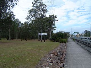
Beenleigh railway station is located on the Beenleigh line in Queensland, Australia. It is one of two stations serving the suburb of Beenleigh in City of Logan, the other being Holmview.

Benowa is a suburb in the City of Gold Coast, Queensland, Australia. In the 2016 census, Benowa had a population of 8,741 people.

<span class="mw-page-title-main">Biggera Waters, Queensland</span> Suburb of Gold Coast, Queensland, Australia

Biggera Waters is a coastal suburb in the City of Gold Coast, Queensland, Australia. In the 2016 census, Biggera Waters had a population of 8,534 people.

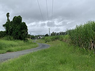
Pimpama is a northern suburb in the City of Gold Coast, Queensland, Australia. At the 2021 census, Pimpama had a population of 24,601. The name is of Aboriginal origin. The suburb contains numerous schools with the first opening in the 1870s.

Runaway Bay is a coastal suburb in the City of Gold Coast, Queensland, Australia. In the 2016 census, Runaway Bay had a population of 9,068 people.

<span class="mw-page-title-main">Bahrs Scrub, Queensland</span> Suburb of Logan City, Queensland, Australia

Bahrs Scrub is an urban locality in the City of Logan, Queensland, Australia. In the 2016 census, Bahrs Scrub had a population of 1,919 people.

<span class="mw-page-title-main">Windaroo, Queensland</span> Suburb of Logan City, Queensland, Australia

Windaroo is a residential suburb in the outer southern areas of the City of Logan, Queensland, Australia. In the 2016 census, Windaroo had a population of 2,827 people.

<span class="mw-page-title-main">Mount Warren Park, Queensland</span> Suburb of Logan City, Queensland, Australia

Mount Warren Park is a residential suburb in the outer eastern area of the City of Logan, Queensland, Australia. The mountain of Mount Warren is within the suburb. In the 2016 census, Mount Warren Park had a population of 5,791 people.

<span class="mw-page-title-main">Alberton, Queensland</span> Suburb of Gold Coast, Queensland, Australia

Alberton is a rural locality in the City of Gold Coast, Queensland, Australia. In the 2021 census, Alberton had a population of 547 people.

<span class="mw-page-title-main">Cedar Creek, Queensland (Logan & Gold Coast)</span> Suburb of City of Gold Coast, Queensland, Australia

Cedar Creek is a locality split between City of Gold Coast and Logan City in Queensland, Australia. In the 2016 census, Cedar Creek had a population of 838 people.

<span class="mw-page-title-main">Holmview</span> Suburb of Logan City, Queensland, Australia

Holmview is a residential suburb in the City of Logan, Queensland, Australia. In the 2016 census, Holmview had a population of 2,358 people.

<span class="mw-page-title-main">Stapylton, Queensland</span> Suburb of Gold Coast, Queensland, Australia

Stapylton is a mixed-use locality in the City of Gold Coast, Queensland, Australia. In the 2016 census, Stapylton had a population of 444 people.

<span class="mw-page-title-main">Woongoolba, Queensland</span> Suburb of Gold Coast, Queensland, Australia

Woongoolba is a coastal rural locality in the northern part of City of Gold Coast, Queensland, Australia. In the 2016 census, Woongoolba had a population of 280 people.

<span class="mw-page-title-main">Steiglitz, Queensland</span> Suburb of Gold Coast, Queensland, Australia

Steiglitz is a rural coastal town and locality in the City of Gold Coast, Queensland, Australia. In the 2016 census the locality of Steiglitz had a population of 705 people.

<span class="mw-page-title-main">Gilberton, Queensland (Gold Coast)</span> Suburb of City of Gold Coast, Queensland, Australia

Gilberton is a rural locality in the City of Gold Coast, Queensland, Australia. In the 2021 census, Gilberton had a population of 31 people.

<span class="mw-page-title-main">Kingsholme, Queensland</span> Suburb of Gold Coast City, Queensland, Australia

Kingsholme is an affluent rural locality in the City of Gold Coast, Queensland, Australia. In the 2016 census Kingsholme had a population of 286 people.

<span class="mw-page-title-main">Luscombe, Queensland</span> Suburb of Gold Coast City, Queensland, Australia

Luscombe is a rural locality in the City of Gold Coast, Queensland, Australia. In the 2016 census, Luscombe had a population of 307 people.

<span class="mw-page-title-main">Springfield Central, Queensland</span> Suburb of City of Ipswich, Queensland, Australia

Springfield Central is a suburb in the City of Ipswich, Queensland, Australia. In the 2016 census, Springfield Central had a population of 114 people. It is the designated business district of Greater Springfield.

References

  1. 1 2 3 Australian Bureau of Statistics (27 June 2017). "Yatala (SSC)". 2016 Census QuickStats. Retrieved 20 October 2018. OOjs UI icon edit-ltr-progressive.svg
  2. "Yatala – suburb in City of Gold Coast (entry 46098)". Queensland Place Names. Queensland Government . Retrieved 27 December 2020.
  3. "Yatala". QueenslandPlaces.com.au. Centre for the Government of Queensland. Archived from the original on 1 March 2011. Retrieved 13 July 2011.
  4. "Place Names of South Australia - XYZ (Yatala)". State Library of South Australia. Archived from the original on 12 March 2007. Retrieved 28 February 2007.
  5. Chapter 12 'Weeding Out Spurious Etymologies: Toponyms On The Adelaide Plains Archived 10 August 2019 at the Wayback Machine ' (Rob Amery) in: Luise Hercus; Flavia Hodges; Jane Simpson, eds. (March 2009). The Land is a Map: Placenames of Indigenous Origin in Australia. ANU Press. pp. 165–180. ISBN   9781921536571. Archived from the original on 25 March 2021. Retrieved 25 March 2021. Yatala most likely derives from yertalla 'water running by the side of a river; inundation; cascade'. As Manning (1986:238) observes 'in winter when water flowed from the hills, over the plains, the Dry Creek area became a morass'.
  6. "Current News". The Queenslander . Vol. X, no. 18. Queensland, Australia. 18 December 1875. p. 26. Archived from the original on 8 September 2022. Retrieved 9 September 2022 via National Library of Australia.
  7. Blake, Thom. "St Mary's Catholic Church". www.thomblake.com.au. Archived from the original on 8 September 2022. Retrieved 8 September 2022.
  8. 1 2 Queensland Family History Society (2010), Queensland schools past and present (Version 1.01 ed.), Queensland Family History Society, ISBN   978-1-921171-26-0
  9. 1 2 "1980s". History. Carlton & United Breweries. Archived from the original on 24 March 2012. Retrieved 28 March 2014.
  10. "Yatala Brewery". Brew & Brewer Magazine. Archived from the original on 28 March 2014. Retrieved 28 March 2014.
  11. "The eventful history of Bullen's African Lion Safari Park in Yatala". Triple M. Retrieved 19 March 2024.
  12. "Lions on the car bonnet, escaping elephants and more wild stories from Yatala's safari park". ABC News. 3 April 2022. Retrieved 19 March 2024.
  13. "Yatala enterprise area leads industrial growth". Brisbane Business News. March 2009. Archived from the original on 6 July 2011. Retrieved 13 July 2011.
  14. Australian Bureau of Statistics (31 October 2012). "Yatala (State Suburb)". 2011 Census QuickStats. Retrieved 16 February 2014. OOjs UI icon edit-ltr-progressive.svg
  15. Jim Stone's son starts V8 Supercars team Archived 20 December 2016 at the Wayback Machine Speedcafe 3 February 2011
  16. Erebus to close Queensland workshop Archived 20 January 2016 at the Wayback Machine Speedcafe 11 December 2015
  17. "State and non-state school details". Queensland Government. 9 July 2018. Archived from the original on 21 November 2018. Retrieved 21 November 2018.
  18. "Rivermount College". Archived from the original on 7 December 2018. Retrieved 21 November 2018.
  19. "ACARA School Profile 2018". Australian Curriculum, Assessment and Reporting Authority. Archived from the original on 27 August 2020. Retrieved 28 January 2020.
  20. "Queensland Globe". State of Queensland . Retrieved 25 March 2021.
  21. 1 2 3 4 5 6 7 8 9 10 11 12 13 14 15 16 17 "Land for public recreation - Queensland". Queensland Open Data. Queensland Government. 20 November 2020. Archived from the original on 22 November 2020. Retrieved 22 November 2020.
  22. "About Yatala Pies". Yatala Pies. Archived from the original on 28 September 2011. Retrieved 13 July 2011.
  23. "Yatala Pie Shoppe - just south of Brisbane". Around Oz. Archived from the original on 4 September 2011. Retrieved 4 September 2011.