Arundel, Queensland

Last updated

Map all coordinates using: OpenStreetMap
Arundel
Gold Coast,  Queensland
Greenacre Drive, Arundel, Queensland.jpg
Greenacre Drive, 2015
Gold Coast locator map.svg
Red pog.svg
Arundel
Arundel, Queensland
Coordinates 27°56′19″S153°21′50″E / 27.9386°S 153.3638°E / -27.9386; 153.3638 (Arundel (centre of suburb))
Population11,171 (2021 census) [1]
 • Density1,085/km2 (2,809/sq mi)
Postcode(s) 4214
Area10.3 km2 (4.0 sq mi)
Time zone AEST (UTC+10:00)
Location
LGA(s) City of Gold Coast
State electorate(s) Bonney
Federal division(s) Fadden
Suburbs around Arundel:
Helensvale Coombabah Biggera Waters
Gaven Arundel Labrador
Molendinar Parkwood Southport

Arundel is a suburb in the City of Gold Coast, Queensland, Australia. [2] In the 2021 census, Arundel had a population of 11,171 people. [1]

Contents

Geography

Located in the suburb is the Coombabah Lake Conservation Park, bordered by Coombabah Creek and adjacent to the Ivan Gibbs Wetlands Reserve in Coombabah. The Biggera Creek Dam is located in Arundel, for the purpose of flood mitigation.

History

In September 1989, Arundel was officially named a suburb and has since grown into a series of housing estates.

A.B. Paterson College opened on 1 January 1991. [3] In 2021, A.B. Paterson College celebrated its 30th anniversary. [4]

Arundel State School opened on 1 January 1994. [3]

In the 2011 census, Arundel recorded a population of 9,575 people, 51.7% female and 48.3% male. [5] The median age of the Arundel population was 36 years, 1 year below the national median of 37. 60.9% of people living in Arundel were born in Australia. The other top responses for country of birth were New Zealand 9.7%, England 5.5%, China 1.3%, South Africa 1.2%, Korea, Republic of 1.2%. 80% of people spoke only English at home; the next most common languages were 1.6% Korean, 1.5% Mandarin, 1.2% Japanese, 0.8% Cantonese, 0.5% Greek. [5]

In the 2016 census, Arundel had a population of 10,246 people. [6]

In the 2021 census, Arundel recorded a population of 11,171 people, 51.2% female and 48.8% male. [1] The median age of the Arundel population was 41 years, 3 years above the national median of 38. 59.5% of people living in Arundel were born in Australia. The other top responses for country of birth were New Zealand 8%, England 5.3%, China 3.1%, India 1.9%, Philippines 1.5%. 74.9% of people spoke only English at home; the next most common languages were 3.9% Mandarin, 1.4% Japanese, 0.9% Korean, 0.8% Cantonese, 0.7% Arabic. [1]

Heritage listings

There are a number of heritage-listed sites in Arundel, including:

Education

Arundel State School is a government primary (Prep-6) school for boys and girls at Cnr Napper Road & Arundel Drive ( 27°56′42″S153°21′57″E / 27.9450°S 153.3658°E / -27.9450; 153.3658 (Arundel State School) ). [8] [9] In 2022, the school had an enrolment of 1066 students with 78 teachers (71 full-time equivalent) and 41 non-teaching staff (28.2 full-time equivalent). It includes a special education program. [8] [10]

A B Paterson College is a private primary and secondary (Prep-12) school for boys and girls at 10 A B Paterson Drive ( 27°55′39″S153°21′37″E / 27.9276°S 153.3603°E / -27.9276; 153.3603 (A B Paterson College) ). [8] [11] In 2022, the school had an enrolment of 1598 students with 104 teachers (102.3 full-time equivalent) and 92 non-teaching staff (77.6 full-time equivalent). [8]

There is no government secondary school in Arundel. The nearest government secondary schools are Coombabah State High School in neighbouring Coombabah to the north, Southport State High School in neighbouring Southport to the south-east, and Pacific Pines State High School in Pacific Pines to the west. [12]

Amenities

Situated within the suburb was the Arundel Hills Country Club, which has its own golf course. As of the 24th of May 2022, the country club has closed. [13]

Other major facilities are located in adjacent suburbs, including Helensvale railway station and Westfield Helensvale (Helensvale), Harbour Town Shopping Centre (Biggera Waters) and Griffith University, Gold Coast University Hospital and the G:link light rail service.

Sport

The Mike Hatcher Raceway (formerly the Gold Coast Speedway) is a motorcycle speedway and motocross venue on Kendor Street, off Captain Cook Drive (lot 10). [14] The track has held significant events in the past, including the final of the Australian Solo Championship in 2004 [15] [16] and the Queensland Solo Championship six times, from 2000 to 2008. [17]

See also

Related Research Articles

<span class="mw-page-title-main">Broadbeach, Queensland</span> Suburb of Gold Coast, Queensland, Australia

Broadbeach is a suburb in the City of Gold Coast, Queensland, Australia. In the 2021 census, Broadbeach had a population of 6,786 people.

<span class="mw-page-title-main">Southport, Queensland</span> Suburb of Gold Coast, Queensland, Australia

Southport is a coastal town and suburb in the City of Gold Coast in Queensland, Australia. It contains the Gold Coast central business district. In the 2021 census, Southport had a population of 36,786 people.

<span class="mw-page-title-main">Helensvale, Queensland</span> Suburb of Gold Coast, Queensland, Australia

Helensvale is a suburb of the City of Gold Coast in Queensland, Australia. In the 2016 census, Helensvale had a population of 16,862 people.

<span class="mw-page-title-main">Ashmore, Queensland</span> Suburb of Gold Coast, Queensland, Australia

Ashmore is a suburb of the City of Gold Coast, Queensland, Australia. In the 2016 census, Ashmore had a population of 11,910 people.

<span class="mw-page-title-main">Biggera Waters, Queensland</span> Suburb of Gold Coast, Queensland, Australia

Biggera Waters is a coastal suburb in the City of Gold Coast, Queensland, Australia. In the 2016 census, Biggera Waters had a population of 8,534 people.

<span class="mw-page-title-main">Coombabah</span> Suburb of Gold Coast, Queensland, Australia

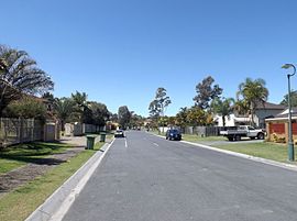
Coombabah is a suburb in the City of Gold Coast, Queensland, Australia. In the 2016 census, Coombabah had a population of 10,388 people.

<span class="mw-page-title-main">Hope Island, Queensland</span> Suburb of Gold Coast, Queensland, Australia

Hope Island is a suburb in the City of Gold Coast, Queensland, Australia. In the 2016 census, Hope Island had a population of 11,186 people.

<span class="mw-page-title-main">Labrador, Queensland</span> Suburb of Gold Coast, Queensland, Australia

Labrador is a coastal suburb in the City of Gold Coast, Queensland, Australia. In the 2016 census, Labrador had a population of 18,261 people.

<span class="mw-page-title-main">Varsity Lakes</span> Suburb of Gold Coast, Queensland, Australia

Varsity Lakes is a suburb in the City of Gold Coast, Queensland, Australia. In the 2021 census, Varsity Lakes had a population of 16,493 people.

<span class="mw-page-title-main">Oxenford, Queensland</span> Suburb of Gold Coast, Queensland, Australia

Oxenford is a suburb in the City of Gold Coast, Queensland, Australia. In the 2016 census, Oxenford had a population of 11,842 people.

<span class="mw-page-title-main">Parkwood, Queensland</span> Suburb of Gold Coast, Queensland, Australia

Parkwood is a suburb in the City of Gold Coast, Queensland, Australia. In the 2016 census, Parkwood had a population of 8,702 people.

<span class="mw-page-title-main">Clear Island Waters, Queensland</span> Suburb of Gold Coast, Queensland, Australia

Clear Island Waters is a suburb of the City of Gold Coast in Queensland, Australia. In the 2016 census, Clear Island Waters had a population of 4,120 people.

Runaway Bay is a coastal suburb in the City of Gold Coast, Queensland, Australia. In the 2016 census, Runaway Bay had a population of 9,068 people.

Coombabah State High School is a public secondary school located in the northern suburb of Coombabah on the Gold Coast, Queensland, in Australia. Backing onto the Coombabah Lakelands Conversation Area, The campus is situated on Pine Ridge Road.

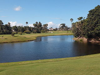
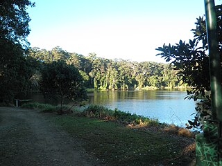
The Coombabah Lake Conservation Park is a conservation park that is an Important Wetland in Australia, located in the Gold Coast region of South East Queensland, Australia. Part of the Coomera River catchment, Lake Coombabah is a tidal lake at the mouth of Coombabah Creek. The Coombabah wetlands are significant because they are the most southerly lake and coastal swampland representatives in the bioregion, and because the area provides significant wildlife value and refuge habitat. The conservation area includes tidal marshlands and mangroves along part of the lakes edge. The Melaleuca boardwalk allows viewing of the wildlife. The mangroves are home to frogs, crabs and fish that attract native and migratory birds. There are guided bushwalking and canoeing activities as part of community conservation and environmental workshops to promote local conservation.

<span class="mw-page-title-main">Paradise Point, Queensland</span> Suburb of Gold Coast, Queensland, Australia

Paradise Point is a coastal suburb in the City of Gold Coast, Queensland, Australia. In the 2016 census, Paradise Point had a population of 6,536 people.

<span class="mw-page-title-main">Currumbin Waters, Queensland</span> Suburb of Gold Coast City, Queensland, Australia

Currumbin Waters is a suburb in the City of Gold Coast, Queensland, Australia. It borders New South Wales. In the 2021 census, Currumbin Waters had a population of 9,797 people.

<span class="mw-page-title-main">Gaven, Queensland</span> Suburb of City of Gold Coast, Queensland, Australia

Gaven is a rural residential locality in the City of Gold Coast, Queensland, Australia. In the 2021 census, Gaven had a population of 1,638 people.

Hollywell is a coastal suburb in the City of Gold Coast, Queensland, Australia. In the 2016 census, Hollywell had a population of 2,865 people.

References

  1. 1 2 3 4 Australian Bureau of Statistics (28 June 2022). "Arundel (SSC)". 2021 Census QuickStats. Retrieved 26 December 2023. OOjs UI icon edit-ltr-progressive.svg
  2. "Arundel – suburb in City of Gold Coast (entry 49865)". Queensland Place Names. Queensland Government . Retrieved 18 September 2020.
  3. 1 2 "Opening and closing dates of Queensland Schools". Queensland Government . Retrieved 18 April 2019.
  4. "Queensland school anniversaries". Education Queensland. 1 July 2016. Archived from the original on 16 February 2018. Retrieved 12 March 2018.
  5. 1 2 Australian Bureau of Statistics (31 October 2012). "Arundel (State Suburb)". 2011 Census QuickStats. Retrieved 6 July 2014. OOjs UI icon edit-ltr-progressive.svg
  6. Australian Bureau of Statistics (27 June 2017). "Arundel (SSC)". 2016 Census QuickStats. Retrieved 20 October 2018. OOjs UI icon edit-ltr-progressive.svg
  7. Gold Coast Local Heritage Register - A to M, pp. 17-18
  8. 1 2 3 4 "State and non-state school details". Queensland Government. 2022. Archived from the original on 8 April 2023. Retrieved 26 December 2023.
  9. "Arundel State School". Archived from the original on 15 April 2021. Retrieved 26 March 2021.
  10. "Arundel SS - Special Education Program". Archived from the original on 15 April 2021. Retrieved 26 March 2021.
  11. "A B Paterson College". Archived from the original on 9 November 2018. Retrieved 21 November 2018.
  12. "Queensland Globe". State of Queensland . Retrieved 17 October 2020.
  13. "Gold Coast's Arundel Hills to close immediately". Golf Australia. 25 May 2022. Archived from the original on 26 December 2023. Retrieved 26 December 2023.
  14. "Where Champions are born". Mike Hatcher Raceway. Retrieved 19 February 2024.
  15. "Individual Australian Championship". Historia Sportu Zuzlowego. Retrieved 19 February 2024.
  16. "The Australian Solo Championhip". Vintage Speedway. Retrieved 19 February 2024.
  17. "Speedway". Motorcycling Queensland. Retrieved 2 August 2023.

Sources