Bundall, Queensland

Last updated

Bundall
Gold Coast,  Queensland
Bundall1.JPG
Aerial view of Bundall from the north looking south (racecourse centre, sewerage works right), 2005
Gold Coast locator map.svg
Red pog.svg
Bundall
Bundall, Queensland
Coordinates 28°00′42″S153°24′19″E / 28.0116°S 153.4052°E / -28.0116; 153.4052 (Bundall (centre of suburb))
Population4,895 (2021 census) [1]
 • Density1,255/km2 (3,250/sq mi)
Established1862
Postcode(s) 4217
Elevation2 m (7 ft)
Area3.9 km2 (1.5 sq mi)
Time zone AEST (UTC+10:00)
Location
LGA(s) City of Gold Coast
State electorate(s)
Federal division(s) Moncrieff
Suburbs around Bundall:
Ashmore Southport Surfers Paradise
Benowa Bundall Surfers Paradise
Benowa Broadbeach Waters Broadbeach Waters

Bundall is a suburb in the City of Gold Coast, Queensland, Australia. [2] In the 2021 census, Bundall had a population of 4,895 people. [1]

Contents

Geography

Bundall is bounded by the Slayter Road to the north ( 27°59′52″S153°24′27″E / 27.9978°S 153.4075°E / -27.9978; 153.4075 (Slayter Avenue (to the north)) ), Bundall Road to the east ( 28°00′23″S153°24′46″E / 28.0064°S 153.4129°E / -28.0064; 153.4129 (Bundall Road (to the east)) ), Nerang River to the south-east and south ( 28°01′45″S153°24′17″E / 28.0291°S 153.4046°E / -28.0291; 153.4046 (Nerang River (to the south)) ), and an unnamed canal from the Nerang River to the south-west and west ( 28°00′22″S153°23′54″E / 28.0060°S 153.3982°E / -28.0060; 153.3982 (Unnamed canal (to the west)) ).

Sorrento is a neighbourhood within the south of Bundall ( 28°01′04″S153°24′03″E / 28.01778°S 153.40083°E / -28.01778; 153.40083 (Sorrento, Queensland) ). [3] [4] It takes its name from a canal real estate development on the Nerang River that created 800 waterfront blocks and 400 "dry" blocks. [5] The northernmost part of the suburb near the canals is also used for housing. There are commercial buildings to the north of Ashmore Road and the west of Bundall Road. The centre of the suburb provides a range of civic infrastructure including Southport Racecourse (with naming rights as Aquis Park 28°00′18″S153°24′29″E / 28.005°S 153.408°E / -28.005; 153.408 (Southport Racecourse) ) and associated businesses and the Benowa Effluent re-pump station, part of the city's sewage and recycled water infrastructure ( 28°00′22″S153°24′04″E / 28.006°S 153.401°E / -28.006; 153.401 (Benowa Effluent re-pump station) ). [4] [6] [7]

History

The name Bundall is from the Aboriginal word for a species of prickly vine. The area was originally settled by British landowner Edmund Henry Price in 1862. He established the Bundall sugarcane plantation. The sugarcane was crushed at the Benowa sugar mill. Subsequently, the land was used for dairy farming, until it was developed for urban use. [8]

Bundall Provisional School opened on 21 September 1885. It was renamed Benowa Provisional School in November 1900. On 1 January 1909 it became Benowa State School. [9]

In 1965, a group of Greek residents of the Gold Coast formed the Greek Orthodox Community of St Anna (Gold Coast and Districts) with the ambition of establishing a Greek Orthodox Church. In 1978, the first St Anna Greek Orthodox Church was built on land donated by Greek entrepreneur Peter Vaggelas to fulfill a pledge that his wife Betty had made to St Anna during the difficult birth of their daughter. The present St Anna's Church at 31A Crombie Avenue was built on land donated by Jim Raptis, President of the Greek Community. [10] [11] [12]

Demographics

In the 2016 census, Bundall had a population of 4,523 people. [13] The median age of the Bundall population was 42 years, 4 years above the national median of 38. 65.5% of people were born in Australia. The most common countries of birth were New Zealand 7.4% and England 4.4%. 80.0% of people only spoke English at home. Other languages spoken at home included Mandarin at 3.1%. The most common responses for religion were No Religion 28.7%, Catholic 24.1% and Anglican 21.1%. [13]

In the 2021 census, Bundall had a population of 4,895 people. [1]

Heritage listings

There are a number of heritage sites in Bundall, including:

Slatyer Avenue

Family members at the dedication of the Southport Park Streets Heritage sign on 11 November 2012 Southport Park Streets.JPG
Family members at the dedication of the Southport Park Streets Heritage sign on 11 November 2012
The Slatyer entries on the Southport Park Streets Heritage Sign Sign4.JPG
The Slatyer entries on the Southport Park Streets Heritage Sign

Slatyer Avenue is one of eleven local streets named after young men who died on active service in World War II. [15] When the Bradbrook family farm at Bundall was subdivided for housing in the 1950s, Slatyer Avenue was named after two brothers – Allan and Gordon Slatyer, the only children of Francis Leichhardt and Hilda (Peggy) Slatyer of Surfers Paradise. [15] [16] [17] Allan, an RAAF leading aircraftman, died in a training accident at Wagga Wagga on 29 August 1941. He was 18 years old. [16] [18] [19] Gordon, an AIF infantryman, was killed in action on 3 August 1942 at El Alamein, Egypt. He was 22 years old. [17] [20]

Education

There are no schools in Bundall. The nearest primary schools are Surfers Paradise State School in neighbouring Surfers Paradise to the east, Benowa State School in neighbouring Benowa to the west and Bellevue Park State School in neighbouring Ashmore to the north-west. The nearest secondary schools are Benowa State High School in neighbouring Benowa to the west and Keebra Park State High School in neighbouring Southport to the north. [21]

Sport

Bundall is also the home of the Bundall Iceland Ice Rink, home of the Bartercard Gold Coast Blue Tongues ice hockey club, Queensland's only team in the Australian Ice Hockey League.

Amenities

St Anna's Greek Orthodox Church is at 31A Crombie Avenue ( 28°00′08″S153°24′44″E / 28.0023°S 153.4121°E / -28.0023; 153.4121 (St Anna's Greek Orthodox Church) ). Its feast days are 25 July, 9 September and 9 December. [10] [12]

Notable people

Notable people from or who have lived in Bundall include:

See also

Related Research Articles

<span class="mw-page-title-main">Surfers Paradise, Queensland</span> Town in Queensland, Australia

Surfers Paradise is a town and suburb in the City of Gold Coast, Queensland, Australia. In the 2021 census, Surfers Paradise had a population of 26,412 people.

<span class="mw-page-title-main">Broadbeach, Queensland</span> Suburb of Gold Coast, Queensland, Australia

Broadbeach is a suburb in the City of Gold Coast, Queensland, Australia. In the 2021 census, Broadbeach had a population of 6,786 people.

<span class="mw-page-title-main">Burleigh Heads, Queensland</span> Suburb of Gold Coast, Queensland, Australia

Burleigh Heads is a suburb in the City of Gold Coast, Queensland, Australia. In the 2021 census, Burleigh Heads had a population of 10,572 people.

<span class="mw-page-title-main">Mudgeeraba, Queensland</span> Town in Queensland, Australia

Mudgeeraba is a town and suburb in the City of Gold Coast, Queensland, Australia. In the 2021 census, the suburb of Mudgeeraba had a population of 14,578 people. Mudgeeraba's essential character remains one of a nineteenth-century village.

<span class="mw-page-title-main">Nerang, Queensland</span> Town in Queensland, Australia

Nerang is a town and suburb in the City of Gold Coast, Queensland, Australia. In the 2016 census, Nerang had a population of 16,864 people.

<span class="mw-page-title-main">Southport, Queensland</span> Suburb of Gold Coast, Queensland, Australia

Southport is a coastal town and suburb in the City of Gold Coast in Queensland, Australia. It contains the Gold Coast central business district. In the 2021 census, Southport had a population of 36,786 people.

<span class="mw-page-title-main">Carrara, Queensland</span> Suburb of Gold Coast, Queensland, Australia

Carrara is a suburb in the City of Gold Coast, Queensland, Australia. In the 2021 census, Carrara had a population of 13,138 people.

<span class="mw-page-title-main">Ashmore, Queensland</span> Suburb of Gold Coast, Queensland, Australia

Ashmore is a suburb of the City of Gold Coast, Queensland, Australia. In the 2021 census, Ashmore had a population of 12,415 people.

Benowa is a suburb in the City of Gold Coast, Queensland, Australia. In the 2021 census, Benowa had a population of 9,889 people.

<span class="mw-page-title-main">Molendinar, Queensland</span> Suburb of Gold Coast, Queensland, Australia

Molendinar is a mixed-use suburb in the City of Gold Coast, Queensland, Australia. In the 2016 census, Molendinar had a population of 6,375 people.

<span class="mw-page-title-main">Numinbah Valley</span> Suburb of Gold Coast, Queensland, Australia

Numinbah Valley is a rural locality in the City of Gold Coast, Queensland, Australia. In the 2021 census, Numinbah Valley had a population of 212 people.

<span class="mw-page-title-main">Ferry Road, Gold Coast</span> Road in Southport, Queensland, Australia

Ferry Road is a road in Southport, on the Gold Coast, Queensland, Australia. Originally a suburban street, it is now part of Southport–Burleigh Road, a state controlled road

<span class="mw-page-title-main">Clagiraba, Queensland</span> Suburb of Gold Coast, Queensland, Australia

Clagiraba is a rural locality in the City of Gold Coast, Queensland, Australia. In the 2021 census, Clagiraba had a population of 651 people.

<span class="mw-page-title-main">Advancetown, Queensland</span> Suburb of City of Gold Coast, Queensland, Australia

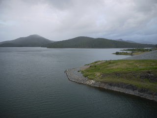
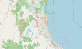
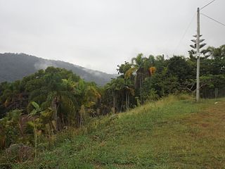
Advancetown is a rural outer locality in the City of Gold Coast, Queensland, Australia. In the 2021 census, Advancetown had a population of 528 people.

<span class="mw-page-title-main">Gilston, Queensland</span> Suburb of City of Gold Coast, Queensland, Australia

Gilston is a rural residential locality in the City of Gold Coast, Queensland, Australia. In the 2021 census, Gilston had a population of 2,669 people.

<span class="mw-page-title-main">Maudsland, Queensland</span> Suburb of City of Gold Coast, Queensland, Australia

Maudsland is a rural-residential locality in the north of the City of Gold Coast, Queensland, Australia. In the 2021 census, Maudsland had a population of 8,073 people.

<span class="mw-page-title-main">Mount Nathan, Queensland</span> Suburb of City of Gold Coast, Queensland, Australia

Mount Nathan is a rural locality in the City of Gold Coast, Queensland, Australia. In the 2021 census, Mount Nathan had a population of 1,375 people.

<span class="mw-page-title-main">Neranwood, Queensland</span> Suburb of City of Gold Coast, Queensland, Australia

Neranwood is a suburb in the City of Gold Coast, Queensland, Australia. In the 2016 census Neranwood had a population of 67 people.

<span class="mw-page-title-main">Worongary</span> Suburb of Gold Coast City, Queensland, Australia

Worongary is a suburb in the City of Gold Coast, Queensland, Australia. In the 2016 census, Worongary had a population of 5,613 people.

<span class="mw-page-title-main">Chevron Island</span> Island in Queensland, Australia

The Chevron Island is an urban island that lies in the Nerang River and is a neighbourhood within the suburb of Surfers Paradise in the City of Gold Coast, Queensland, Australia.

References

  1. 1 2 3 Australian Bureau of Statistics (28 June 2022). "Bundall (SAL)". 2021 Census QuickStats. Retrieved 28 February 2023. OOjs UI icon edit-ltr-progressive.svg
  2. "Bundall – suburb in City of Gold Coast (entry 46033)". Queensland Place Names. Queensland Government . Retrieved 18 September 2020.
  3. "Sorrento (entry 31408)". Queensland Place Names. Queensland Government . Retrieved 30 September 2015.
  4. 1 2 "Queensland Globe". State of Queensland . Retrieved 6 October 2020.
  5. "Sorrento". Ray White Broadbeach. 8 September 2012. Archived from the original on 6 October 2020. Retrieved 6 October 2020.
  6. "Aquis Park (Gold Coast Turf Club)". Austadiums. Archived from the original on 6 October 2020. Retrieved 6 October 2020.
  7. "Long term recycled water release plan" (PDF). Gold Coast City Council . Archived (PDF) from the original on 6 October 2020. Retrieved 6 October 2020.
  8. "Bundall history". Gold Coast City Council . Archived from the original on 21 March 2020. Retrieved 6 October 2020.
  9. Queensland Family History Society (2010), Queensland schools past and present (Version 1.01 ed.), Queensland Family History Society, ISBN   978-1-921171-26-0
  10. 1 2 "St Anna, Bundall-Gold Coast, QLD". Greek Orthodox Archdiocese of Australia . Archived from the original on 25 December 2020. Retrieved 25 December 2020.
  11. "The Perfect Fit: Multicultural entrepreneurs of the Gold Coast" (PDF). Gold Coast City Council. pp. 34–35. Archived (PDF) from the original on 6 October 2020.
  12. 1 2 "Contact Us". Greek Orthodox Church of St Anna. Archived from the original on 6 October 2020. Retrieved 6 October 2020.
  13. 1 2 Australian Bureau of Statistics (27 June 2017). "Bundall (SSC)". 2016 Census QuickStats. Retrieved 20 October 2018. OOjs UI icon edit-ltr-progressive.svg
  14. Gold Coast Local Heritage Register - A to M, pp. 41-42
  15. 1 2 Young, Bernadette. "What's in a Name: Slatyer Avenue". ABC Online . Australian Broadcasting Corporation. Archived from the original on 4 March 2016. Retrieved 27 June 2013.
  16. 1 2 "Slatyer, Allan". Casualty details. Commonwealth War Graves Commission. Archived from the original on 21 July 2015. Retrieved 21 July 2013.
  17. 1 2 "Slayter, Gordon". Casualty details. Commonwealth War Graves Commission. Archived from the original on 21 July 2015. Retrieved 21 July 2013.
  18. "2 Air Trainees Killed". The Daily News (FIRST ed.). Perth. 30 August 1941. p. 26. Archived from the original on 6 October 2020. Retrieved 22 July 2013 via National Library of Australia.
  19. "Accident to Wirraway A20-251 of 2 SFTS at Wagga on 29/8/41 – Pilot LAC Wilkinson G C H and LAC Slatyer A – Both killed". Department of Defence, Australia. National Archives of Australia. Archived from the original on 6 October 2020. Retrieved 21 July 2013.
  20. "RESTRICTED HOSPITAL USE OF LIQUID PARAFFIN". The Courier-Mail . Brisbane. 21 August 1942. p. 5. Archived from the original on 6 October 2020. Retrieved 22 July 2013 via National Library of Australia.
  21. "Queensland Globe". State of Queensland . Retrieved 6 October 2020.

Sources