Yellowstone expedition

Last updated
Secretary of War John C. Calhoun authorized the Yellowstone Expedition. John C Calhoun-.jpg
Secretary of War John C. Calhoun authorized the Yellowstone Expedition.

The Yellowstone expedition was an expedition to the American frontier in 1819 and 1820 authorized by United States Secretary of War John C. Calhoun, with the goal of establishing a military fort or outpost at the mouth of the Yellowstone River in present-day North Dakota. Sometimes called the Atkinson–Long Expedition after its two principal leaders, Colonel Henry Atkinson and Major Stephen Harriman Long, it led to the creation of Fort Atkinson in present-day Nebraska, the first United States Army post established west of the Missouri River, but was otherwise a costly failure, stalling near Council Bluffs, Iowa.

Contents

Background

Map of North America, from an 1818 U.S. edition of Pinkerton's Atlas, showing the approximate area of the 1803 Louisiana Purchase west of the Mississippi River 1818 Pinkerton Map of North America - Geographicus.jpg
Map of North America, from an 1818 U.S. edition of Pinkerton's Atlas, showing the approximate area of the 1803 Louisiana Purchase west of the Mississippi River

Secretary Calhoun stated the expedition was a "part of a system of measures" to maintain northwestern trade, describing its objects as "the protection of our northwestern frontier and the greater extension of our fur trade." [1] The economic condition had halted in the states due to growing dissent over state issues that were to lead up to the American Civil War, [2] and this gave the expedition military as well as economic purpose. [2]

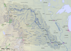
Starting from St. Louis, Missouri, the expedition aimed to establish a series of forts along the Missouri River on the way upstream to the Yellowstone River, the principal tributary of the upper Missouri, which meets the Missouri in what is now western North Dakota. These forts were intended to increase the American presence in the fur trade and to counteract British influence on the northern plains. [3] The first fort was to be at the Council Bluff (not to be confused with Council Bluffs, Iowa, 20 miles to the south), the site previously used for an 1804 council between the Lewis and Clark Expedition and members of the Oto and Missouria Native American tribes. William Clark had recommended the high bluff overlooking the Missouri River to the U.S. government as a suitable location to build a fort.

Preparations

Map of the Missouri River watershed with tributaries and states labelled. Missouri River basin map.png
Map of the Missouri River watershed with tributaries and states labelled.

In 1818, Calhoun awarded the expedition's transportation and supply contract to James Johnson, partner and younger brother of Kentucky Congressman Richard Mentor Johnson, who would later become Vice President of the United States. Richard Johnson enjoyed considerable leverage over the expedition's funding as chairman from 1817 to 1819 of the House Committee on Expenditures in the Department of War, [2] and there was warm public interest in the enterprise. An editorial of the Missouri Gazette of St. Louis said on April 21, 1819 that "there is no measure which has been adopted by the present administration that has received such universal commendation." [4] The public's later "deep disappointment at their non-fulfilment" [5] was to coincide with an eventual "scandal growing out of the transportation contract", [6] with revelations that James Johnson had been practically guaranteed against loss and had thus taken little care to see that his equipment was of sufficient character to ensure a prompt fulfillment of the contract. [7]

The Yellowstone expedition was led by Colonel (later General) Henry Atkinson, commander of the 6th Infantry, then stationed at Plattsburgh, New York on the U.S.–Canada border. In the fall of 1818, he received orders to rendezvous his troops to the south and encamp with the Rifle Regiment by the Missouri River near St. Louis. The 6th Infantry hastily traveled the 2,700 miles by land and water to the area. [8]

The expedition was also chartered to perform science and engineering functions, in conjunction with which a U.S. Army topographical engineer, Major Stephen Harriman Long, was ordered to select and lead a crew of notable specialists in zoology, geology, cartography, journalism, art and botany to accompany the expedition. It was the first scientific expedition of U.S. government-funded "Army Engineers" charged with mapping, studying, documenting and exploring the vast area of uncharted land between the Mississippi River and the Rocky Mountains. [8]

Steamboat Western Engineer

Steamboat Western Engineer. Western Engineer 1819.jpg
Steamboat Western Engineer.

Major Long immediately planned the construction of an experimental steamboat to transport the task force of scientists as far as possible on the venture. Named the Western Engineer, it was uniquely designed to navigate the expected narrow, shallow, snag-littered channels of the Missouri River and its tributaries, with a particularly strong engine for increased power against swift currents. Another novel feature was a paddlewheel built into the stern to reduce the danger of damage from snags. [8] The vessel was launched in Pittsburgh, Pennsylvania in the winter of 1818–19, and was probably the first stern-wheel paddle steamer ever built. [9]

The boat had a 75-by-13-foot (22.9 by 4.0 m) hull with the weight of the machinery carefully distributed to permit increased maneuverability in shallow channels. To protect the vessel from Indian attack, Long installed a bulletproof pilothouse, mounted a cannon on the bow, placed howitzers along the side, and armed the crew with rifles and sabres. Nicknamed "Long's Dragon" because it was decorated as a serpent in order to deter and frighten any hostile frontier natives, it was anything but a typical steamboat of its day. Its hull drew only 19 inches (48 cm) of water compared to the 5 or 6 feet (1.5 or 1.8 m) of most steamboats of the era. Its basic design (shallow draft, rear paddlewheel, narrow beam, amidships engine) later became the prototype for western river steam vessels. [8]

A description in the Missouri Gazette of May 26, 1819 stated that "The Western Engineer is well armed and carries an elegant flag representing a white man and an Indian shaking hands, the calumet of peace and the sword. The boat is 75 feet long, 13 feet beam and draws 19 inches of water. The steam passes off through the mouth of a larger figure-head (a serpent)...". [9] This was the first steamboat to travel up the Missouri River into the Louisiana Purchase territory all the way to Nebraska.

Expedition departure

The 6th U.S. Infantry and 1st Rifle Regiments made up the expedition's military component. They departed from St. Louis, Missouri in May 1819, when Colonel Atkinson led his force of 1,126 riflemen upriver on three well-equipped, state-of-the-art steamboats. Major Long later followed with the scientific party of "Army Engineers" aboard the Western Engineer, leaving in June. Notable expedition members included Captain Stephen Kearny (later military governor of California), landscape painter Samuel Seymour, naturalist and painter Titian Peale, and zoologist Thomas Say.

Atkinson's party suffered a variety of problems from the outset, including an inefficient and corrupt steamboat captain. [8] Five steamboats had been contracted for Atkinson, but two had not reached the Mississippi at all and, of the remainder, a third (the Thomas Jefferson) was soon found incapable of navigating the numerous snags, sandbars and currents. She and her crew were left behind, some forty miles below Franklin. [10] The last two (the R.M. Johnson and the Expedition) also could not advance through the treacherous obstacles and were stopped just above the mouth of the Kansas River, to winter at Cow Island and return to St. Louis in the spring. [7] After several days and many miles, Atkinson's troops had to resort back to using keelboats similar to those used by Lewis and Clark a few years earlier, which were powered mainly by men rowing, poling or towing upriver with ropes. [8]

Autumn 1819

Major Long meets with the Pawnees at Council Bluff, Nebraska, 1819. The American Soldier, 1819.jpg
Major Long meets with the Pawnees at Council Bluff, Nebraska, 1819.

The expedition left the mouth of the Kansas River on August 13, 1819 and arrived at the mouth of the Grand Nemaha River two weeks later. On September 17, the steamboat Western Engineer arrived at Fort Lisa, a trading post belonging to William Clark's Missouri Fur Company. This was on the west side of the river, about 20 miles north of today's Council Bluffs, Iowa. "The Council Bluffs" was at that time the generic name for the land on both sides of the Missouri River upstream of the mouth of the Platte River, and Fort Lisa was located "at a point between five and six miles below the original Council Bluff - where Lewis and Clark had a council with the Missouri and Otoe Indians, August 3, 1804, and now the site of the town of Fort Calhoun...". [11]

Atkinson's troops arrived several days later, on September 26. [9] The parties then decided to build two camps for winter quarters, establishing Atkinson's troops in "Cantonment Missouri" near Council Bluff and Major Long's men at "Engineer Cantonment", five miles down the river near the western riverbank, [8] and half a mile upstream from Fort Lisa. Within a month, the quarters were substantially completed and Major Long returned to the east coast for further orders. [12]

Winter 1819–20

"Cantonment Missouri", set along the river bottom below the bluffs, was short-lived. The winter of 1819–20 was very harsh, and a shortfall of government contractors left the garrison without sufficient supplies. The soldiers suffered widespread scurvy (due to poor nutrition and lack of vitamin C), which claimed the lives of over 200 of the 1,126 men that first winter. Estimates of the civilian deaths is possibly as high as double the military dead; no records were kept of their losses. [3] Finally, in the spring of 1820, the Missouri River flooded Cantonment Missouri, so the soldiers built a permanent camp atop Council Bluff, and renamed it Fort Atkinson. [3] Just east of present-day Fort Calhoun, Nebraska, it was abandoned in 1827.

Failure of the expedition

Due to its financial costs and general lack of first season results, the expedition became a resounding failure [1] upon stalling at Fort Lisa. Congressional economy measures and difficulties in supplying such distant outposts prevented the completion of the expedition and the force was halted there, well downstream of its intended destination at the mouth of the Yellowstone River. [8]

In May 1820, Long returned to "Engineer Cantonment" with his own orders from the Secretary of War to cease work along the Missouri and turn instead to exploring the Platte River and its sources. The expedition left their winter quarters on June 6, 1820. [12] Colonel Atkinson led a further expedition to reach the Yellowstone River in 1825.

Financial issues and over-extravagant planning

At about the time that the Yellowstone expedition departed from St. Louis, the Panic of 1819 brought an end to the economic expansion that followed the War of 1812. In December 1819, Secretary of the Treasury William H. Crawford issued a report projecting a budget deficit of five million dollars. Added to this, the costs of the expedition grossly exceeded those anticipated, mostly due to James Johnson's "malfeasance" [2] and his brother Richard's influential pleas for further funding. The political reputation of James and Richard Johnson was mostly maintained, however, due to their respective popularity in their home district. [2]

In 1905, writer H.M. Chittendem summarized the expedition as:

an unqualified failure if not a huge fiasco... Although the troops could with ease have marched three times as far as the boats carried them, it was considered necessary to transport them in a manner becoming the dignity of so vast an enterprise. As a result it took an entire season to reach a point that could have been reached in two months at most. [13]

He wrote further that:

The same spirit of absurd extravagance pervaded the scientific branch of the enterprise. If Major Long had been content with a sentible field equipment transported on pack mules, or on a keelboat while on the Missouri, he could have kept his party in the field for five years,, and have explored the entire region east of the mountains, for less money than his actual operations took in 1819 alone. The insignificant results of the first season's work, and the scandal growing out of the transportation contract, disgusted Congress with the whole enterprise and that body declined to appropriate any further funds for it. [14]

See also

Related Research Articles

<span class="mw-page-title-main">Missouri River</span> Major river in central United States

The Missouri River is the longest river in the United States. Rising in the Eastern Centennial Mountains of the Bitteroot Range of the Rocky Mountains of Southwestern Montana, the Missouri flows east and south for 2,341 miles (3,767 km) before entering the Mississippi River north of St. Louis, Missouri. The river drains a sparsely populated, semi-arid watershed of more than 500,000 square miles (1,300,000 km2), which includes parts of ten U.S. states and two Canadian provinces. Although a tributary of the Mississippi, the Missouri River is slightly longer and carries a comparable volume of water. When combined with the lower Mississippi River, it forms the world's fourth longest river system.

<span class="mw-page-title-main">Manuel Lisa</span>

Manuel Lisa, also known as Manuel de Lisa, was a Spanish citizen and later, became an American citizen who, while living on the western frontier, became a land owner, merchant, fur trader, United States Indian agent, and explorer. Lisa was among the founders, in St. Louis, of the Missouri Fur Company, an early fur trading company. Manuel Lisa gained respect through his trading among Native American tribes of the upper Missouri River region, such as the Teton Sioux, Omaha and Ponca.

<span class="mw-page-title-main">Stephen Harriman Long</span> American inventor, civil engineer, and explorer (1784–1864)

Stephen Harriman Long was an American army civil engineer, explorer, and inventor. As an inventor, he is noted for his developments in the design of steam locomotives. He was also one of the most prolific explorers of the early 1800s, although his career as an explorer was relatively short-lived. He covered over 26,000 miles in five expeditions, including a scientific expedition in the Great Plains area, which he famously confirmed as a "Great Desert".

<span class="mw-page-title-main">Henry Atkinson (soldier)</span> US Army officer

Henry Atkinson was a United States army officer serving on the western frontier, during the War of 1812, and the Yellowstone expedition. With Indian agent Benjamin O'Fallon, he negotiated a treaty with Native Americans of the upper Missouri River in 1825. Over his career in the army, he served in the western frontier, the Gulf Coast, and in New York at the border with Canada.

<span class="mw-page-title-main">Fort Atkinson (Nebraska)</span> Fort in Nebraska

Fort Atkinson was the first United States Army post to be established west of the Missouri River in the unorganized region of the Louisiana Purchase of the United States. Located just east of present-day Fort Calhoun, Nebraska, the fort was erected in 1819 and abandoned in 1827. The site is now known as Fort Atkinson State Historical Park and is a National Historic Landmark. A replica fort was constructed by the state at the site during the 1980s–1990s.

The Missouri National Recreational River is a National Recreational River located on the border between Nebraska and South Dakota. The designation was first applied in 1978 to a 59-mile section of the Missouri River between Gavins Point Dam and Ponca State Park. In 1991, an additional 39-mile section between Fort Randall Dam and Niobrara, Nebraska, was added to the designation. These two stretches of the Missouri River are the only parts of the river between Montana and the mouth of the Missouri that remain undammed or unchannelized. The last 20 miles of the Niobrara River and 6 miles of Verdigre Creek were also added in 1991.

Fort Lisa (1812–1823) was established in 1812 in what is now North Omaha in Omaha, Nebraska by famed fur trader Manuel Lisa and the Missouri Fur Company, which was based in Saint Louis. The fort was associated with several firsts in Nebraska history: Lisa was the first European farmer in Nebraska; it was the first settlement by American citizens set up in the then-recent Louisiana Purchase; Lisa's wife was the first woman resident of European descent in Nebraska; and the first steamboat to navigate Nebraska waters, the Western Engineer, arrived at Fort Lisa in September 1819.

<span class="mw-page-title-main">Thomas Fitzpatrick (trapper)</span> Irish-American fur trader (1799–1854)

Thomas Fitzpatrick was an Irish-American fur trader, Indian agent, and mountain man. He trapped for the Rocky Mountain Fur Company and the American Fur Company. He was among the first white men to discover South Pass, Wyoming. In 1831, he found and took in a lost Arapaho boy, Friday, who he had schooled in St. Louis, Missouri; Friday became a noted interpreter and peacemaker and leader of a band of Northern Arapaho.

<span class="mw-page-title-main">Transportation in Omaha</span>

Transportation in Omaha, Nebraska, includes most major modes, such as pedestrian, bicycle, automobile, bus, train and airplane. While early transportation consisted of ferries, stagecoaches, steamboats, street railroads, and railroads, the city's transportation systems have evolved to include the Interstate Highway System, parklike boulevards and a variety of bicycle and pedestrian trails. The historic head of several important emigrant trails and the First transcontinental railroad, its center as a national transportation hub earned Omaha the nickname "Gate City of the West" as early as the 1860s.

<span class="mw-page-title-main">Great Platte River Road</span>

The Great Platte River Road was a major overland travel corridor approximately following the course of the Platte River in present-day Nebraska and Wyoming that was shared by several popular emigrant trails during the 19th century, including the Trapper's Trail, the Oregon Trail, the Mormon Trail, the California Trail, the Pony Express route, and the military road connecting Fort Leavenworth and Fort Laramie. The road, which extended nearly 370 miles (600 km) from the Second Fort Kearny to Fort Laramie, was utilized primarily from 1841 to 1866. In modern times it is often regarded as a sort of superhighway of its era, and has been referred to as "the grand corridor of America's westward expansion".

The Missouri Fur Company was one of the earliest fur trading companies in St. Louis, Missouri. Dissolved and reorganized several times, it operated under various names from 1809 until its final dissolution in 1830. It was created by a group of fur traders and merchants from St. Louis and Kaskaskia, Illinois, including Manuel Lisa and members of the Chouteau family. Its expeditions explored the upper Missouri River and traded with a variety of Native American tribes, and it acted as the prototype for fur trading companies along the Missouri River until the 1820s.

<i>Yellowstone</i> (steamboat)

The steamboat Yellowstone was a side wheeler steamboat built in Louisville, Kentucky, for the American Fur Company for service on the Missouri River. By design, the Yellowstone was the first powered boat to reach above Council Bluffs, Iowa, on the Missouri River achieving, on her maiden voyage, Fort Tecumseh, South Dakota, on June 19, 1831. The Yellowstone also played an important role in the Texas Revolution of 1836, crossing the Texas Army under Sam Houston over the swollen Brazos River ahead of Santa Anna's pursuing Mexican Army.

<span class="mw-page-title-main">French people in Nebraska</span>

French people have been present in the U.S. state of Nebraska since before it achieved statehood in 1867. The area was originally claimed by France in 1682 as part of La Louisiane, the extent of which was largely defined by the watershed of the Mississippi River and its tributaries. Over the following centuries, explorers of French ethnicity, many of them French-Canadian, trapped, hunted, and established settlements and trading posts across much of the northern Great Plains, including the territory that would eventually become Nebraska, even in the period after France formally ceded its North American claims to Spain. During the 19th century, fur trading gave way to settlements and farming across the state, and French colonists and French-American migrants continued to operate businesses and build towns in Nebraska. Many of their descendants continue to live in the state.

<span class="mw-page-title-main">Fur trade in Montana</span>

The fur trade in Montana was a major period in the area's economic history from about 1800 to the 1850s. It also represents the initial meeting of cultures between indigenous peoples and those of European ancestry. British and Canadian traders approached the area from the north and northeast focusing on trading with the indigenous people, who often did the trapping of beavers and other animals themselves. American traders moved gradually up the Missouri River seeking to beat British and Canadian traders to the profitable Upper Missouri River region.

<span class="mw-page-title-main">Engineer Cantonment</span> United States historic place

Engineer Cantonment is an archaeological site in Washington County, in the state of Nebraska in the Midwestern United States. Located in the floodplain of the Missouri River near present-day Omaha, Nebraska, it was the temporary winter camp of the scientific party of the Yellowstone Expedition. From October 1819 to June 1820, the party studied the geology and biology of the vicinity, and met with the local indigenous peoples. Their eight-month study of the biota has been described as "the first biodiversity inventory undertaken in the United States".

<span class="mw-page-title-main">Joseph LaBarge</span> US steamboat captain

Joseph Marie LaBarge was an American steamboat captain, most notably of the steamboats Yellowstone, and Emilie, that saw service on the Mississippi and Missouri rivers, bringing fur traders, miners, goods and supplies up and down these rivers to their destinations. During much of his career LaBarge was in the employ of the American Fur Company, a giant in the fur trading business, before building his own steamboat, the Emilie, to become an independent riverman. During his career he exceeded several existing speed and distance records for steamboats on the Missouri River. Passengers aboard his vessels sometimes included notable people, including Abraham Lincoln. LaBarge routinely offered his steamboat services gratis to Jesuit missionaries throughout his career.

<span class="mw-page-title-main">Joseph Bijeau</span> American fur trapper

Joseph Bijeau, also known as Joseph Bijeau dit Bissonet and Joseph Bissonet, was among the earliest fur trappers of the Rocky Mountains. He was a guide for Stephen Harriman Long's expedition of the Great Plains in 1820. A fur trapper and hunter, he lived among the Pawnee people. He was able to communicate to a number of Native American tribes through his use of sign language as well as the Crow language, which was used among a number of western tribes. After Spain lost the Mexican territory, trappers like Bijeau moved to Taos where they could trap, trade, and travel east without the hostilities that they experienced in the western United States.

<span class="mw-page-title-main">Long's Expedition of 1820</span>

The Stephen H. Long Expedition of 1820 traversed America's Great Plains and up to the foothills of the Rocky Mountains. It was the first scientific party hired by the United States government to explore the West. Lewis and Clark (1803–1806) and Zebulon Pike (1805–1807) explored the western frontier but they were primarily military expeditions. A group of scientists traveled to St. Louis and on to Council Bluff (Nebraska) for the Yellowstone expedition of the upper Missouri River that would have established a number of military posts. The expensive effort was cancelled following a financial crash, steamboat failures, operational scandals, and negotiation of the Adams–Onís Treaty of 1819, which changed the border between New Spain and the United States. The scientists were reassigned to an expedition led by Stephen Harriman Long. From June 6 to September 13, 1820, Long and fellow scientists traveled across the Great Plains beginning at the Missouri River near present Omaha, Nebraska, along the Platte River to the Front Range, and east along the Arkansas and Canadian Rivers of Colorado and Oklahoma. The expedition terminated at Fort Smith in Arkansas. They recorded many new species of plants, insects, and animals. Long termed the land the Great American Desert.

<span class="mw-page-title-main">Benjamin O'Fallon</span>

Benjamin O'Fallon (1793–1842) was an Indian agent along the upper areas of the Mississippi and Missouri Rivers. He interacted with Native Americans as a trader and Indian agent. He was against British trappers and traders operating in the United States and territories. He believed that the military should have taken a strong stance against the British and firm in negotiations with Native Americans. Despite his brash manner and contention with the military, he was able to negotiate treaties between native and white Americans. In his early and later careers, he built gristmills, was a retailer, and a planter. He collected Native American artifacts and paintings of tribe members by George Catlin. His uncle William Clark was his guardian and financial backer.

<i>Western Engineer</i>

The paddle steamer Western Engineer was the first steamboat on the Missouri River. It was purpose built after a design by Major Stephen Harriman Long by the Allegheny Arsenal in Pittsburgh, for the scientific party of the Yellowstone expedition which Major Long commanded. The paddle wheel was placed in the stern, the steam engine hidden below the waterline, the vessel was heavily armed and had acquired a peculiar appearance intended to inspire fear and awe among the Plains Indians. Her first voyage took her from Pittsburgh to Saint Louis in 1819. The second voyage took her to Fort Lisa, Nebraska the same year. The third voyage took her back to Saint Louis in the spring of 1820, while the fourth voyage was a charting expedition up the Mississippi to the Des Moines Rapids and down to Cape Girardeau, Missouri. A fifth voyage supposed to take her back to Pittsburgh had to be aborted at Smithland, Kentucky due to low water, and she was left there.

References

  1. 1 2 Goodwin, Cardinal (1917). "A Larger View of the Yellowstone Expedition (1819-1820)". The Mississippi Valley Historical Review. 4 (3): 299–313. doi:10.2307/1888594. JSTOR   1888594.
  2. 1 2 3 4 5 "Richard Mentor Johnson, 9th Vice President - US Senate" . Retrieved 2011-01-11.
  3. 1 2 3 "Fort Calhoun -- Washington County". Nebraska...Our Towns. University of Nebraska-Lincoln. Retrieved 2009-10-19.
  4. Chittendem, p.561
  5. Chittendem, p.564
  6. Chittendem, p.571
  7. 1 2 Chittendem, p.566
  8. 1 2 3 4 5 6 7 8 "184 Years of Lost American History is Emerging from Local Missouri River Soil". OmahaRiverFront.com website. Retrieved 2011-08-09.
  9. 1 2 3 Chittendem, p.567
  10. H.R. Doc. 110 16th Cong. 2d Sess. 164 (1821)
  11. Morton & Watkins. (1918) "Fur Trade" History of Nebraska. p. 53, on Rootsweb.com, Retrieved 5/28/08
  12. 1 2 "Stephen Harriman Long biography". U.S. Corps of Topographical Engineers website. Retrieved 2011-08-09.
  13. Chittendem, p.570
  14. Chittendem, pp.570-571

Further reading