Engineer Cantonment

Last updated

Engineer Cantonment
Engineer Cantonment excavations 2.JPG
Excavations at Engineer Cantonment, 2015
Map of Nebraska highlighting Washington County.svg
Washington County, Nebraska
Nearest city Fort Calhoun, Nebraska
NRHP reference No. 15000795 [1]
Added to NRHPNovember 17, 2015

Engineer Cantonment is an archaeological site in Washington County, in the state of Nebraska in the Midwestern United States. Located in the floodplain of the Missouri River near present-day Omaha, Nebraska, it was the temporary winter camp of the scientific party of the Yellowstone Expedition. From October 1819 to June 1820, the party studied the geology and biology of the vicinity, and met with the local indigenous peoples. Their eight-month study of the biota has been described as "the first biodiversity inventory undertaken in the United States". [2]

Contents

The site was not used again after the departure of the expedition, and its location was forgotten. In 2003, it was rediscovered, and investigated during the 2003–05 archaeological seasons. In 2015, it was listed in the National Register of Historic Places.

History

Louisiana Territory Louisiana Purchase.png
Louisiana Territory

The 1803 purchase of the Louisiana Territory from France gave the United States a claim to the watershed of the Missouri River. The Lewis and Clark expedition of 1804–06 discovered abundant fur-trapping resources in the region. President Thomas Jefferson was eager to see these resources exploited, believing that fur trappers and traders with the local indigenous peoples would serve as the vanguard of American expansion into the new territory. [3]

The 1812–15 War of 1812 between the U.S. and the British Empire impeded the former's exploitation of the upper Missouri basin's fur-trapping potential. After the war ended, the U.S. remained concerned about British incursions onto American-claimed territory and British influence over the native peoples of the region. [4] [5] [6] In 1818, to counteract this British influence, and to protect American territory and fur-trapping activity in the upper Missouri watershed, President James Monroe and Secretary of War John C. Calhoun proposed, and Congress authorized, the Yellowstone Expedition. Over 1000 soldiers, led by Colonel Henry Atkinson, were ordered to travel up the Missouri and establish a chain of forts in its upper reaches. [7] [8] [9]

Long expedition

Stephen H. Long Stephen Harriman Long portrait montage.jpg
Stephen H. Long

Atkinson's military expedition was joined by a scientific one, under the direction of Major Stephen H. Long. A member of the U.S. Army's topographical engineers, Long had explored and mapped portions of the Mississippi River basin in 1817, ranging from Fort Smith on the Arkansas River to Fort St. Anthony at the confluence of the Minnesota and the Mississippi Rivers. In early 1817, he had suggested to President-elect Monroe that an expedition be mounted to explore and map the Great Lakes and the upper Mississippi watershed by steamboat. He had repeated this proposal to Calhoun in 1818, with the addition of a party of scientists, and won approval. In the spring of 1819, Calhoun modified the plan, directing Long's party to accompany the Atkinson expedition up the Missouri. [9] [10]

Long assembled a company of distinguished scientists for his expedition. The party included William Baldwin, doctor and botanist; Augustus Edward Jessup, geologist; Thomas Say, zoologist; Titian Peale, assistant naturalist; and Samuel Seymour, artist. The quintet has been described as "the largest and best-trained group of civilian scientists and investigators to accompany any government-sponsored expedition up to that time". [11]

Calhoun authorized Long to design and build a special steamboat for the expedition. [12] The vessel, the Western Engineer , was constructed in Pittsburgh in 1818–19. One of the first stern-wheelers ever built, it was 75 feet (23 m) long, with a beam of 13 feet (4.0 m), and a draft of only 19 inches (48 cm). To impress the indigenous peoples who beheld it, it bore "an elegant flag representing a white man and an Indian shaking hands, the calumet of peace and the sword", [13] and the bow was formed in the shape of "a huge serpent, black and scaly ... his mouth open, vomiting smoke". [14]

Up the Missouri

The Western Engineer, bearing the Long party, left Pittsburgh in the spring of 1819. [15] It descended the Ohio River and steamed up the Mississippi to St. Louis, near the confluence of the Missouri and the Mississippi. [16] In June 1819, the Long party started up the Missouri. [17]

William Baldwin William Baldwin (botanist).png
William Baldwin

Progress upstream was slow. The river's strong current limited the vessel's average speed to less than three miles per hour (five kilometers per hour), and silt from the muddy waters clogged the steamboat's boiler. The party also made a number of stops, including one of a week at Franklin in the present-day state of Missouri. [9] [12] [18] [19]

The expedition lost one of its members in Franklin. Baldwin, the surgeon and botanist, had long suffered from tuberculosis. Failing health forced him to leave the expedition, and he died several weeks later in Franklin. [18] [20]

The military expedition under Atkinson made no better progress. Of the five steamboats hired to carry the force upstream, two apparently never reached the Missouri; another gave out and had to be left behind 30 miles (50 km) below Franklin; and the remaining two had to be abandoned a short distance above the mouth of the Kansas River. The expedition was forced to carry out the last leg of the journey on keelboats, which the soldiers towed from the banks using long ropes. [21] [22]

Engineer Cantonment

On September 17, 1819, the Long party reached Fort Lisa, a fur-trading post located a few miles north of present-day Omaha, Nebraska. On September 19, the group established its winter quarters about half a mile (about three-quarters of a kilometer) above Ft. Lisa. This temporary post was dubbed Engineer Cantonment, after the Western Engineer. [2] [16] [23]

The military contingent under Atkinson was slower arriving. They reached the vicinity of present-day Fort Calhoun, Nebraska, a few miles upstream from Engineer Cantonment, in late September or early October; [24] there, they established Cantonment Missouri. Intended to be a permanent post, Cantonment Missouri was destroyed by floods the following spring, and abandoned in favor of a new site, Fort Atkinson, atop the bluffs and out of the floodplain. [22] [25]

Engineer Cantonment with the Western Engineer in the foreground. Western Engineer by Titian Ramsay Peale.png
Engineer Cantonment with the Western Engineer in the foreground.

Long remained at Engineer Cantonment until October, when he returned eastward. He was accompanied by geologist Jessup, who had resigned from the expedition. Major Thomas Biddle, the keeper of the scientific expedition's official journal, had quarrelled with Long and was transferred to the military expedition late in 1819. Say, Peale, and Seymour spent the winter at Engineer Cantonment, as did Long's assistant James Duncan Graham, mapmaker and engineer William Henry Swift, six civilian members of the Western Engineer's crew, and a nine-man military guard. [12] [26] [27] [28]

The party at Engineer Cantonment spent the next half-year exploring the vicinity of the camp. They held councils with the Pawnees and with the Otoes, visited Pawnee and Omaha villages, and were visited by members of other indigenous groups. They determined the camp's latitude and longitude, and investigated the geology and the biota of the area. [23] [29] [30]

1820 and thereafter

Long returned to Engineer Cantonment on May 27, 1820, accompanied by two new members of the party. Dr. Edwin James was to act as the expedition's surgeon, geologist, and botanist, thus replacing both Baldwin and Jessup. Captain John R. Bell was to keep the official journal, replacing Biddle. [27] [29]

Thomas Say Thomas Say.jpg
Thomas Say

Long also brought a new set of orders from Washington. While there, he had attempted to secure additional funding from Calhoun, with limited success. Budgetary constraints arising from the Panic of 1819 led to a reduction in the size and scope of the expedition. Rather than continuing to ascend the Missouri, the Long party was to follow the Platte River upstream to its source, then work southward along the front of the Rocky Mountains to the headwaters of the Arkansas and the Red Rivers, then follow those rivers downstream to the Mississippi. [30] [31] [32]

The Long expedition left Engineer Cantonment on June 6, 1820. It did not return to the camp, and history does not record use of the site by anyone else after their departure. [33]

Biology

Boxelder bug, discovered by Say at Engineer Cantonment Box elder bug.jpg
Boxelder bug, discovered by Say at Engineer Cantonment

The scientific party's eight-month stay at Engineer Cantonment produced what has been called "the first biodiversity inventory undertaken in the United States". [35] Expeditions such as Lewis and Clark's, while investigating the biota of the regions through which they passed, had only spent a short time in any one location. This was the case with Long's expedition in the second half of 1820: the need to cover distance quickly precluded the thorough investigation of any one locale. By contrast, the long stay at Engineer Cantonment allowed the party to study the local biota in detail, and to try to produce a complete inventory of the plants and animals of the area. [36]

The party's study of the local flora was limited. The loss of Baldwin en route to Engineer Cantonment had left them without a botanist; James, his replacement, did not arrive until a short time before the departure of the summer 1820 expedition. A total of 51 plants in 34 families were described, four of which were thought to be new to science. [37] [38]

Say, who has been called "the father of American entomology", [39] described the new animals found at the site. These included 46 insects in 30 families, 38 of them thought to be new to science. Other animals described include 143 birds, 4 of them thought to be new; 33 mammals, 6 of them new; 14 reptiles and 2 amphibians, all previously known; and 14 snails, 1 of them thought to be new. [37] [38]

Since 1820

Passenger pigeons Ectopistes migratorius(s.XVIII).jpg
Passenger pigeons

The habitat and the biota of the area have changed significantly since 1820. At the time of the Long expedition, the Missouri was a meandering stream subject to spring flooding, moving through a wide floodplain with oxbow lakes and palustrine wetlands. Frequent prairie fires prevented the growth of extensive woodlands: the river valley was characterized by scattered groves, the bluffs that bounded it were not densely wooded, and the prairie west of the bluffs was entirely treeless. Since then, the river has been straightened and confined to a single channel. Dams built upstream control flooding. The wetlands of the floodplain have been drained and converted to farmland. Fire suppression has allowed the growth of riparian forests dominated by cottonwood, and the bluffs are now heavily wooded. [40] [41]

Several species recorded at Engineer Cantonment are no longer present in the area. Two birds, the passenger pigeon and the Carolina parakeet, are entirely extinct. The local subspecies of gray wolf, Canis lupus nubilus , is likewise extinct. Several more of the larger carnivores, including black bear, eastern spotted skunk, and river otter, are no longer found in the vicinity; the mountain lion vanished from the area for many years, but in the early 21st century was once again found in eastern Nebraska. Hunting and destruction of habitat have led to the disappearance of three major herbivores: American bison, pronghorn, and elk. [42]

Two bat species, the eastern pipistrelle and the evening bat, have established themselves in the vicinity. The preferred habitat of both species is forest and forest edge, and in Nebraska their range has expanded from the extreme southeast corner of the state to cover the entire eastern third. This phenomenon has been observed with other birds, mammals, and insects of the eastern woodlands: their ranges have expanded with the spread of riparian forest upstream along prairie rivers. [35]

Eastern chipmunk Tamias striatus2.jpg
Eastern chipmunk

Two forest-dwelling rodent species documented at Engineer Cantonment, the eastern chipmunk and the eastern gray squirrel, have not expanded their range in the area, but have vanished since 1820. It has been suggested that although the increase in forest cover would seem to provide them with more habitat, the change in forest composition has been unfavorable to them: they prefer mature oak-hickory woods to the cottonwood forest that has grown up along the Missouri. [43]

Archaeology

History records no further use of the Engineer Cantonment site after 1820. With the passage of years, the location was forgotten. During the 20th century, there were some desultory attempts to find it; the failure of these led to the general belief that the remains of the site had been obliterated by flooding and cutting of the river, by quarrying operations, or by other modern development. [44]

In 2002, the Nebraska State Historical Society (NSHS) undertook an archaeological sampling survey in the greater Omaha area; it was thought that Engineer Cantonment and Fort Lisa might be found in the northern part of the study area. Planned improvements to a county road also called for an assessment of the impact on local cultural sites. [45]

While at Engineer Cantonment, Peale had produced several sketches of the camp and its surroundings. In early 2003, when the trees on the bluffs were bare, NSHS archaeologists saw that a stretch of the bluffs appeared to match Peale's drawing, including a wide ravine that Peale had depicted behind the camp. A trench was dug at the putative site, which produced limestone fragments, some discolored by burning, possibly remnants of a fireplace. Screening of dirt taken from the trench in the area of the burned limestone yielded, among other things, a brass button and a trigger guard fragment similar to items found at Fort Atkinson. [46]

Ravine behind Engineer Cantoment site Ravine behind Engineer Cantonment site 1.JPG
Ravine behind Engineer Cantoment site

Ground-penetrating radar followed by further excavation revealed a building measuring about 30 feet (9.1 m) east-west by 48 feet (15 m) north-south. The building was divided into two rooms by an interior wall, with a double fireplace in the middle. Fragments of ceramic tobacco pipes and tableware of a sort used around 1820 tended to support the conjecture that the site was actually Engineer Cantonment. [47] The quality of the items also lent support to the conjecture: while tin cups and utensils would have been used by common soldiers, the wine bottles and painted porcelain found at the site were consistent with the upper stratum of society to which the expedition's scientists belonged. [48]

Peale's drawing appeared to show two buildings, one behind the other, near the mouth of a wide ravine. In the foreground, not far from the front building, the Western Engineer and several keelboats were moored in what appeared to be an oxbow cutoff of the Missouri. Although the oxbow was no longer extant in the early 21st century, trenching east of the two-room building discovered the edge of the harbor. [49]

The search for the second building depicted by Peale was unsuccessful. Initially, it was assumed that the building already discovered was the eastern of the two, so trenches were dug to the west and southwest. These yielded no evidence of a building. The archaeologists then investigated the hypothesis that the undiscovered building was east of the known one. Excavations in that direction yielded limestone fragments and a few artifacts, but nothing that could define a building. These eastern items were buried more shallowly than the remains of the known building, and it was conjectured that the remains of the western building had been covered and protected by the alluvial fan from the ravine, while the eastern building was buried only shallowly or not at all, and its remains were effaced by exposure and erosion. [50]

Excavation continued through the 2005 season, after which the site was left open, but enclosed in a large portable building to protect it and allow further excavations. In 2011, the Missouri flooded, inundating and damaging the site; in the spring of 2015, NSHS archaeologists and students participating in the University of Nebraska–Lincoln's Archeological Field School removed silt deposited by the flood to re-expose the 2003–2005 excavations. [51]

In 2015, Engineer Cantonment was listed in the National Register of Historic Places. [1]

See also

Notes

  1. 1 2 "National Register of Historic Places Program: Weekly List: November 27, 2015". National Park Service. Retrieved 2016-01-08.
  2. 1 2 Genoways and Ratcliffe (2008), p. 3.
  3. Campbell (2007), pp. 20–21.
  4. Nichols (1971), p. 52.
  5. Campbell (2007), p. 21.
  6. Chittenden (1902), pp. 555–61.
  7. O'Brien (1986), pp. 2–3 of PDF.
  8. Carson et al. (2004), pp. 3–4 of PDF.
  9. 1 2 3 Schubert (1980).
  10. Nichols (1971), pp. 52–54.
  11. Nichols (1971), p. 53.
  12. 1 2 3 Nichols (1971), p. 54.
  13. Chittenden (1902), p. 570. The quote is from the Missouri Gazette of May 26, 1819, reproduced in Chittenden.
  14. Chittenden (1902), p. 571. The quote is from a contemporary letter, reproduced in Chittenden.
  15. Sources differ on the date of the Long party's departure from Pittsburgh. Manders and Renfro (2011), p. 11, states that the party left Pittsburgh in April 1819. Nichols (1971), p. 4 of the PDF, gives a date of May 3, 1819.
  16. 1 2 Carlson et al. (2004), p. 5 of PDF.
  17. Sources differ on the date on which the Long party left St. Louis. Chittenden (1902), pp. 571–72, gives a departure date of June 9, 1819. Manders and Renfro (2011), p. 11, states that the party arrived in St. Louis on June 9 and left on June 19. Schubert (1980) gives a date of June 21 for the departure from St. Louis.
  18. 1 2 Chittenden (1902), p. 572.
  19. Manders and Renfro (2011), p. 11.
  20. "Biography of William Baldwin". New York Botanical Garden. Retrieved 2016-01-05.
  21. Chittenden (1902), p. 569.
  22. 1 2 Carlson et al. (2004), p. 6 of PDF.
  23. 1 2 Chittenden (1902), p. 573.
  24. Sources differ on the time of the Atkinson party's arrival at the site of Camp Missouri. Chittenden (1902), p. 570, gives a date of September 26. Carlson et al. (2004), p. 6 of PDF, states that "The soldiers began arriving... in early October".
  25. O'Brien (1986), p. 2 of PDF.
  26. Carlson et al. (2004), pp. 6–7 of PDF.
  27. 1 2 Genoways and Ratcliffe (2008), pp. 3–4.
  28. History of Boone County (1882), pp. 141–42.
  29. 1 2 Carlson et al. (2004), p. 7 of PDF.
  30. 1 2 Genoways and Ratcliffe (2008), p. 4.
  31. Chittenden (1902), p. 575.
  32. Nichols (1971), pp. 54–55.
  33. Carlson et al. (2004), pp. 7–8 of PDF.
  34. Genoways and Ratcliffe (2008), p. 22.
  35. 1 2 Genoways and Ratcliffe (2008), p. 14.
  36. Genoways and Ratcliffe (2008), pp. 4–6.
  37. 1 2 Genoways and Ratcliffe (2008), pp. 10–12.
  38. 1 2 Genoways and Ratcliffe (2008), pp. 10–11, note that it is not always possible to tell whether a plant or animal described by the Long expedition was found at Engineer Cantonment or elsewhere. They also note that species considered new at the time of their description might no longer be regarded thus: for instance, taxonomic revision might lead to the combining of two species that were once thought distinct. New species numbers in this article are those that Genoways and Ratcliffe confirm as being from Engineer Cantonment, and that were thought to be new to science at the time of their discovery.
  39. "American Naturalist". American Treasures of the Library of Congress. Retrieved 2016-01-07.
  40. Genoways and Ratcliffe (2008), pp. 10, 14.
  41. Carlson et al. (2004), p. 12 of PDF.
  42. Genoways and Ratcliffe (2008), pp. 12–13.
  43. Genoways and Ratcliffe (2008), pp. 13–14, 40.
  44. Carlson et al. (2004), pp. 8–10 of PDF.
  45. Carlson et al. (2004), p. 11 of PDF.
  46. Carlson et al. (2004), pp. 13–16 of PDF.
  47. Carlson et al. (2004), pp. 16–18 of PDF.
  48. Rice, Melissa. "The lost is found: Engineer's Cantonment located". Washington County Pilot-Tribune & Enterprise. 2003-07-29. Retrieved 2016-01-08.
  49. Carlson et al. (2004), pp. 13–14, 18–19 of PDF.
  50. Carlson et al. (2004), pp. 20–22 of PDF.
  51. "UNL Archeological Field School Helps Restore Engineer Cantonment Site" (2015). Nebraska History News, vol. 68, no. 3. [Usurped!] Retrieved 2016-01-08.

Related Research Articles

<span class="mw-page-title-main">Manuel Lisa</span>

Manuel Lisa, also known as Manuel de Lisa, was a Spanish citizen and later, became an American citizen who, while living on the western frontier, became a land owner, merchant, fur trader, United States Indian agent, and explorer. Lisa was among the founders, in St. Louis, of the Missouri Fur Company, an early fur trading company. Manuel Lisa gained respect through his trading among Native American tribes of the upper Missouri River region, such as the Teton Sioux, Omaha and Ponca.

<span class="mw-page-title-main">Arikara War</span>

The Arikara War was an armed conflict between the United States, their allies from the Sioux tribe and Arikara Native Americans that took place in the summer of 1823, along the Missouri River in present-day South Dakota. It was the first Indian war west of the Missouri fought by the U.S. Army and its only conflict ever with the Arikara. The war came as a response to an Arikara attack on trappers, called "the worst disaster in the history of the Western fur trade".

<span class="mw-page-title-main">Titian Peale</span> American naturalist, artist and explorer (1799–1885)

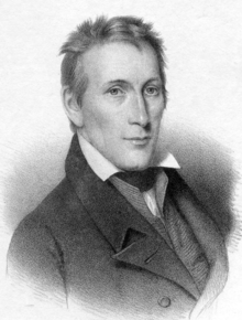
Titian Ramsay Peale was an American artist, naturalist, and explorer from Philadelphia, Pennsylvania. He was a scientific illustrator whose paintings and drawings of wildlife are known for their beauty and accuracy.

<span class="mw-page-title-main">Stephen Harriman Long</span> American inventor, civil engineer, and explorer (1784–1864)

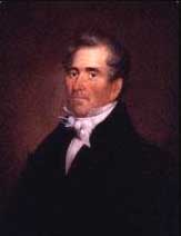
Stephen Harriman Long was an American army civil engineer, explorer, and inventor. As an inventor, he is noted for his developments in the design of steam locomotives. He was also one of the most prolific explorers of the early 1800s, although his career as an explorer was relatively short-lived. He covered over 26,000 miles in five expeditions, including a scientific expedition in the Great Plains area, which he famously confirmed as a "Great Desert".

<span class="mw-page-title-main">Henry Atkinson (soldier)</span> US Army officer

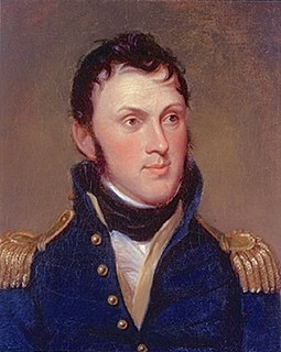
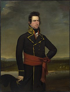
Henry Atkinson was a United States army officer serving on the western frontier, during the War of 1812, and the Yellowstone expedition. With Indian agent Benjamin O'Fallon, he negotiated a treaty with Native Americans of the upper Missouri River in 1825. Over his career in the army, he served in the western frontier, the Gulf Coast, and in New York at the border with Canada.

<span class="mw-page-title-main">Fort Atkinson (Nebraska)</span> Fort in Nebraska

Fort Atkinson was the first United States Army post to be established west of the Missouri River in the unorganized region of the Louisiana Purchase of the United States. Located just east of present-day Fort Calhoun, Nebraska, the fort was erected in 1819 and abandoned in 1827. The site is now known as Fort Atkinson State Historical Park and is a National Historic Landmark. A replica fort was constructed by the state at the site during the 1980s–1990s.

Cabanne's Trading Post was established in 1822 by the American Fur Company as Fort Robidoux near present-day Dodge Park in North Omaha, Nebraska, United States. It was named for the influential fur trapper Joseph Robidoux. Soon after it was opened, the post was called the French Company or Cabanné's Post, for the ancestry and name of its operator, Jean Pierre Cabanné, who was born and raised among the French community of St. Louis, Missouri.

Fort Lisa (1812–1823) was established in 1812 in what is now North Omaha in Omaha, Nebraska by famed fur trader Manuel Lisa and the Missouri Fur Company, which was based in Saint Louis. The fort was associated with several firsts in Nebraska history: Lisa was the first European farmer in Nebraska; it was the first settlement by American citizens set up in the then-recent Louisiana Purchase; Lisa's wife was the first woman resident of European descent in Nebraska; and the first steamboat to navigate Nebraska waters, the Western Engineer, arrived at Fort Lisa in September 1819.

<span class="mw-page-title-main">Thomas Biddle</span>

Thomas Biddle was an American military hero during the War of 1812. Biddle is better known though for having been killed in a duel with Missouri Congressman Spencer Pettis.

<span class="mw-page-title-main">Hayden Geological Survey of 1871</span>

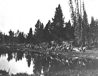
The Hayden Geological Survey of 1871 explored the region of northwestern Wyoming that later became Yellowstone National Park in 1872. It was led by geologist Ferdinand Vandeveer Hayden. The 1871 survey was not Hayden's first, but it was the first federally funded geological survey to explore and further document features in the region soon to become Yellowstone National Park, and played a prominent role in convincing the U.S. Congress to pass the legislation creating the park. In 1894, Nathaniel P. Langford, the first park superintendent and a member of the Washburn-Langford-Doane Expedition which explored the park in 1870, wrote this about the Hayden expedition:

We trace the creation of the park from the Folsom-Cook expedition of 1869 to the Washburn expedition of 1870, and thence to the Hayden expedition of 1871, Not to one of these expeditions more than to another do we owe the legislation which set apart this "pleasuring-ground for the benefit and enjoyment of the people"

<span class="mw-page-title-main">Edwin James (scientist)</span>

Edwin P. James, a 19th-century American botanist, geologist, linguist, and medical practitioner, was an important figure in the early exploration of the American West. James was also known for his time spent creating relationships with Native Americans in the United States, and also aiding African Americans to escape slavery.

The Missouri Fur Company was one of the earliest fur trading companies in St. Louis, Missouri. Dissolved and reorganized several times, it operated under various names from 1809 until its final dissolution in 1830. It was created by a group of fur traders and merchants from St. Louis and Kaskaskia, Illinois, including Manuel Lisa and members of the Chouteau family. Its expeditions explored the upper Missouri River and traded with a variety of Native American tribes, and it acted as the prototype for fur trading companies along the Missouri River until the 1820s.

<span class="mw-page-title-main">Yellowstone expedition</span>

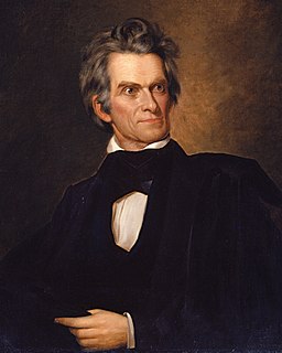
The Yellowstone expedition was an expedition to the American frontier in 1819 and 1820 authorized by United States Secretary of War John C. Calhoun, with the goal of establishing a military fort or outpost at the mouth of the Yellowstone River in present-day North Dakota. Sometimes called the Atkinson–Long Expedition after its two principal leaders, Colonel Henry Atkinson and Major Stephen Harriman Long, it led to the creation of Fort Atkinson in present-day Nebraska, the first United States Army post established west of the Missouri River, but was otherwise a costly failure, stalling near Council Bluffs, Iowa.

<span class="mw-page-title-main">Old Baldy (Lynch, Nebraska)</span> United States historic place

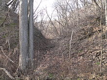
Old Baldy, also known as the Tower, is a hill located near the village of Lynch, in Boyd County, in the northern part of the state of Nebraska in the Midwestern United States. It was visited by the Lewis and Clark Expedition on their way up the Missouri River in 1804; nearby, they discovered a colony of prairie dogs, an animal previously unknown to scientists.

Columbia Fur Company was a fur trading and Indian trading business active from 1821 to 1827, in Michigan Territory and in the unorganized territory of the United States. It then became the Upper Missouri Outfit of the American Fur Company.

<span class="mw-page-title-main">Joseph Bijeau</span> American fur trapper

Joseph Bijeau, also known as Joseph Bijeau dit Bissonet and Joseph Bissonet, was among the earliest fur trappers of the Rocky Mountains. He was a guide for Stephen Harriman Long's expedition of the Great Plains in 1820. A fur trapper and hunter, he lived among the Pawnee people. He was able to communicate to a number of Native American tribes through his use of sign language as well as the Crow language, which was used among a number of western tribes. After Spain lost the Mexican territory, trappers like Bijeau moved to Taos where they could trap, trade, and travel east without the hostilities that they experienced in the western United States.

<span class="mw-page-title-main">Long's Expedition of 1820</span>

The Stephen H. Long Expedition of 1820 traversed America's Great Plains and up to the foothills of the Rocky Mountains. It was the first scientific party hired by the United States government to explore the West. Lewis and Clark (1803–1806) and Zebulon Pike (1805–1807) explored the western frontier but they were primarily military expeditions. A group of scientists traveled to St. Louis and on to Council Bluff (Nebraska) for the Yellowstone expedition of the upper Missouri River that would have established a number of military posts. The expensive effort was cancelled following a financial crash, steamboat failures, operational scandals, and negotiation of the Adams–Onís Treaty of 1819, which changed the border between New Spain and the United States. The scientists were reassigned to an expedition led by Stephen Harriman Long. From June 6 to September 13, 1820, Long and fellow scientists traveled across the Great Plains beginning at the Missouri River near present Omaha, Nebraska, along the Platte River to the Front Range, and east along the Arkansas and Canadian Rivers of Colorado and Oklahoma. The expedition terminated at Fort Smith in Arkansas. They recorded many new species of plants, insects, and animals. Long termed the land the Great American Desert.

<span class="mw-page-title-main">Benjamin O'Fallon</span>

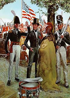
Benjamin O'Fallon (1793–1842) was an Indian agent along the upper areas of the Mississippi and Missouri Rivers. He interacted with Native Americans as a trader and Indian agent. He was against British trappers and traders operating in the United States and territories. He believed that the military should have taken a strong stance against the British and firm in negotiations with Native Americans. Despite his brash manner and contention with the military, he was able to negotiate treaties between native and white Americans. In his early and later careers, he built gristmills, was a retailer, and a planter. He collected Native American artifacts and paintings of tribe members by George Catlin. His uncle William Clark was his guardian and financial backer.

Samuel Seymour was a painter, engraver, and illustrator who documented Native American people and the scenery from expeditions of Stephen Harriman Long in 1819, 1820, and 1823. Some of the drawings captured new species of flora and fauna.

<i>Western Engineer</i>

The paddle steamer Western Engineer was the first steamboat on the Missouri River. It was purpose built after a design by Major Stephen Harriman Long by the Allegheny Arsenal in Pittsburgh, for the scientific party of the Yellowstone expedition which Major Long commanded. The paddle wheel was placed in the stern, the steam engine hidden below the waterline, the vessel was heavily armed and had acquired a peculiar appearance intended to inspire fear and awe among the Plains Indians. Her first voyage took her from Pittsburgh to Saint Louis in 1819. The second voyage took her to Fort Lisa, Nebraska the same year. The third voyage took her back to Saint Louis in the spring of 1820, while the fourth voyage was a charting expedition up the Mississippi to the Des Moines Rapids and down to Cape Girardeau, Missouri. A fifth voyage supposed to take her back to Pittsburgh had to be aborted at Smithland, Kentucky due to low water, and she was left there.

References