Ystradowen

Last updated

Sign in the village Ystradowen1.jpg
Sign in the village
Ystradowen Church Ystradowen2.jpg
Ystradowen Church

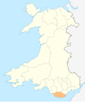
Ystradowen is a small village twelve miles west of Cardiff, located in Penllyn community in the Vale of Glamorgan in south Wales; its nearest town is Cowbridge which is about three miles to the south.

The village was served by Ystradowen railway station between 1865 and 1951. The name Ystradowen means "Owen's Valley" in English. Local amenities include St Owain's parish church, The White Lion public house, Tudor Garage and Seven Oaks fisheries. Notable residents: Tom Jones had a home in the village until 1998. [1] [2]

Related Research Articles

<span class="mw-page-title-main">Vale of Glamorgan</span> County borough in Wales

The Vale of Glamorgan, locally referred to as The Vale, is a county borough in the south-east of Wales. It borders Bridgend County Borough to the west, Cardiff to the east, Rhondda Cynon Taf to the north, and the Bristol Channel to the south. With an economy based largely on agriculture and chemicals, it is the southernmost unitary authority in Wales. Attractions include Barry Island Pleasure Park, the Barry Tourist Railway, Medieval wall paintings in St Cadoc's Church, Llancarfan, Porthkerry Park, St Donat's Castle, Cosmeston Lakes Country Park and Cosmeston Medieval Village. The largest town is Barry. Other towns include Penarth, Llantwit Major, and Cowbridge. There are many villages in the county borough.

<span class="mw-page-title-main">Pontypridd (UK Parliament constituency)</span> Parliamentary constituency in the United Kingdom, 1918 onwards

Pontypridd is a constituency represented in the House of Commons of the UK Parliament since 2019 by Alex Davies-Jones of the Labour Party.

<span class="mw-page-title-main">Vale of Glamorgan (UK Parliament constituency)</span> Parliamentary constituency in the United Kingdom, 1983 onwards

Vale of Glamorgan is a constituency represented in the House of Commons of the UK Parliament since 2010 by Alun Cairns, a Conservative.

Bedlinog is a small village located in The Taff Bargoed valley, 10 km (6 mi) north of Pontypridd, 10 km (6 mi) north west of Caerphilly and 10 km (6 mi) south east of Merthyr Tydfil in south-east Wales. It is currently in the south of Merthyr Tydfil County Borough, but until 1974 was part of Gelligaer Urban District Council in the county of Glamorgan.

<span class="mw-page-title-main">Southerndown</span> Village in Vale of Glamorgan, Wales

Southerndown is a village in the Vale of Glamorgan, in south Wales. It is southwest of Bridgend, and within the St Brides Major community, close to Llantwit Major and Ogmore-by-Sea. It is mostly known for its beach which backs Dunraven Bay, which is a popular tourist destination during the summer months and since 1972 has been part of a Heritage Coast and is part of the Southerndown Coast SSSI. When the tide is out there is an expanse of sand and pools. The cliffs are an obvious example of sedimentary rock.

<span class="mw-page-title-main">Llansannor</span> Human settlement in Wales

Llansannor is a small hamlet in the Vale of Glamorgan, Wales, United Kingdom.

Cadoxton, is a village situated in Neath Port Talbot county borough, Wales. Cadoxton is located just outside the town of Neath and borders the villages of Cilfrew and Bryncoch. The village has 1,684 residents and is located in the Cadoxton ward. Cadoxton elected a Liberal Democrat representative in the 2008 council elections.

<span class="mw-page-title-main">Font-y-Gary</span> Human settlement in Wales

Font-y-Gary, also Fontygary, Fontegary or Fontygari, is a village adjacent to Rhoose, 3 miles south-west of Barry in the Vale of Glamorgan, on the coast of south Wales. To the north is Fonmon and Fonmon Castle. The origin of the name is uncertain but in 1587 it was documented as "Fundygary".

<span class="mw-page-title-main">A4232 road</span> Road in Cardiff, Wales

The A4232, which is also known either as the Peripheral Distributor Road (PDR) (Welsh: Ffordd Ddosbarthu Ymylol) or the Cardiff Link Road (Welsh: Ffordd Gyswllt Caerdydd), is a distributor road in Cardiff, the capital of Wales.

<span class="mw-page-title-main">Ewenny River</span> River in United Kingdom, Wales

The Ewenny River is a river in South Wales. For most of its 10 miles (16 km) length, it forms the border between the Vale of Glamorgan and Bridgend. It is a major tributary of the River Ogmore, which it joins near its estuary.

<span class="mw-page-title-main">Llandow</span> Human settlement in Wales

Llandow is a village and community in the Vale of Glamorgan, Wales. The community population taken at the 2011 census was 726. The village is located 15 miles (24 km) south west of Cardiff. The community includes the villages of Sigingstone and Llysworney.

Quarter Bach is a community located in the east of Carmarthenshire, Wales.

City is a small village in the Vale of Glamorgan, Wales, United Kingdom.

<span class="mw-page-title-main">Valeways Millennium Heritage Trail</span>

The Valeways Millennium Heritage Trail is a waymarked long distance footpath in the Vale of Glamorgan, Wales.

<span class="mw-page-title-main">Llanwenarth</span>

Llanwenarth is a small village and parish in the Usk Valley of Monmouthshire, south-east Wales, United Kingdom. It is in the community of Llanfoist Fawr and covered by the electoral ward of Llanwenarth Ultra.

<span class="mw-page-title-main">St Nicholas, Vale of Glamorgan</span> Village in Wales

St Nicholas is a small village in the Vale of Glamorgan, South Wales. It lies 2 miles west of the capital city, Cardiff and 6 miles from its city centre. The population was 417 in 2011. It is in the community of St Nicholas and Bonvilston.

<span class="mw-page-title-main">B4265 road</span>

The B4265 road is a main road in the Vale of Glamorgan, southeastern Wales, running in a northwesterly direction along near the coast. It links Cardiff Airport to Bridgend, lasting for 15.9 miles (25.6 km). The road begins at the roundabout near the airport and the village of Penmark at 51°24′21″N3°20′39″W as a continuation of the A4226 road leading from Barry. Passing the junction turnoff to Gileston and St Athan, at Llantwit Major, the B4270 road branches off to the northwest to Llandow Industrial Estate. The road then moves progressively in northwesterly direction until St Brides Major, where the B4524 road to the south connects it to Southerndown and Ogmore-by-Sea. At St Brides Major, the road shifts to a northerly direction, where it passes Ewenny and Ogmore village leading to Bridgend, where it joins the A48 road and finally A473 road at 51°30′7″N3°34′34″W.

<span class="mw-page-title-main">Penllyn, Vale of Glamorgan</span> Human settlement in Wales

Penllyn is a village and community in the Vale of Glamorgan, Wales. It is located north west of the market town of Cowbridge. As a community it contains the settlements of Llansannor, Pentre Meyrick, Trerhyngyll, Ystradowen and Penllyn itself.

<span class="mw-page-title-main">Welsh St Donats</span> Human settlement in Wales

Welsh St Donats is a village and a community in the Vale of Glamorgan, Wales. Consisting of 1207 hectares of mainly rural land, it is located north east of Cowbridge. The population of the community was 534 in the 2011 census. Welsh St Donats includes the villages of Maendy, Prisk and Tair Onen. A mile to the east from the village lies the Hensol Forest, while the remains of Talyfan Castle are to the north.

<span class="mw-page-title-main">Llanfair, Vale of Glamorgan</span>

Llanfair is a community in the Vale of Glamorgan, Wales. It is located immediately south of the town of Cowbridge and includes the settlements of St Hilary, Llandough, St Mary Church and The Herberts. The population in 2011 was 611.

References

  1. "Geograph:: 5,075 Photos within 10km of Ystradowen, The Vale of Glamorgan". Geograph.org.uk. Retrieved 26 August 2017.
  2. Cooper, Stephen. "Ystradowen Village - Welcome". Ystradowen.org.uk. Retrieved 26 August 2017.

51°29′22″N3°25′23″W / 51.48944°N 3.42306°W / 51.48944; -3.42306