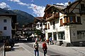
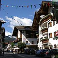
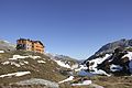
Zillertal

Last updated
Uderns in the Ziller Valley Blick auf Uderns.jpg
Uderns in the Ziller Valley

The Ziller Valley [1] [2] [3] (German : Zillertal) is a valley in Tyrol, Austria that is drained by the Ziller River. It is the widest valley south of the Inn Valley (German : Inntal) and lends its name to the Zillertal Alps, the strongly glaciated section of the Alps in which it lies. [4] The Tux Alps lie to its west, while the lower grass peaks of the Kitzbühel Alps are found to the east.

Contents

The Ziller Valley is one of the valley areas in Tyrol most visited by tourists. [4] Its largest settlement is Mayrhofen.

Geography

Zillertal Alps: south face of Olperer Zillertaler Alpen 2009.jpg
Zillertal Alps: south face of Olperer

The Ziller Valley branches from the Inn trench near Jenbach, about 40 km northeast of Innsbruck, running mostly in a north–south direction. The Ziller Valley proper stretches from the village of Strass to Mayrhofen, where it separates into four smaller valleys, the Tux valley and the sparsely settled, so-called Gründe – Zamsergrund, Zillergrund and Stilluppgrund. Along the way, two more Gründe and the Gerlos valley, which leads to the Gerlos Pass and into Salzburg, branch off.

Unlike other side valleys of the Inntal, the Ziller Valley rises constantly, but only marginally, from one end to the other – only about 100 m over 30 km. Permanent settlements cover about 9% of the entire area of the Ziller Valley municipalities.

History

Near the Tuxer Joch, a pass between the Wipptal and the Tux valley, there have been archeological finds from middle Stone Age. The oldest remains of settlements in the Ziller Valley date back to the Illyrians during the late Bronze and early Iron Ages – a tribe from the Balkan Peninsula who were absorbed in that area by the Bavarians (Baiuvarii).

The earliest written record of the Ziller Valley dates from 889, when Arnulf of Carinthia granted land to the Archbishop of Salzburg in the "Cilarestal". Ownership of the valley was divided along the Ziller River. Even today this division is visible, as churches on the right bank of the river generally have green towers and belong to Salzburg Diocese, while churches on the left bank have red towers and belong to Innsbruck Diocese.

In 1248, the land west of the Ziller was acquired by the Counts of Tyrol, while the lands east of the Ziller pledged as security to the Counts of Tyrol by the Lords of Rattenberg from 1290 to 1380. In 1504, with both the County of Tyrol and the Archbishopric of Salzburg dominated by the Habsburgs, the Ziller Valley was united under Emperor Maximilian and put under joint Tyrolean/Salzburgian rule.

In 1805, the Treaty of Pressburg ended the War of the Third Coalition and forced Austria to cede Tyrol to Bavaria. For the purposes of this treaty, the Ziller Valley was considered part of Salzburg and thus remained with Austria. The people of the Ziller Valley nevertheless joined Andreas Hofer's Tyrolean Rebellion of 1809 in the Battle of the Ziller Bridge (14 May). Later that year, the insurrection was defeated and the Ziller Valley briefly became Bavarian until the Congress of Vienna in 1814/1815.

The Ziller Valley c. 1898 Zillertal um 1898.jpg
The Ziller Valley c.1898

While the relatively lenient stance of the archbishops of Salzburg had allowed the creation of small pockets of Protestantism in their lands since the Protestant Reformation, the remaining Protestants were oppressed more harshly during the Habsburg rule of the 19th century. In 1837, 437 Protestant inhabitants of the Ziller Valley left the valley after they were given the choice of renouncing the Augsburg Confession or emigrating to Silesia, where Frederick William III of Prussia offered them lands and housing near Erdmannsdorf (now Mysłakowice in western Poland).

In 1902, the Ziller Valley Railway was constructed, which still runs between Jenbach and Mayrhofen to this day, opening up the valley, the economy of which had previously relied mostly on agriculture and mining, to commerce and tourism. From 1921 to 1976, magnesium carbonate (and later tungsten) were mined around the Alpine pastures of the Schrofen and Wangl Almen above the Tuxertal A ropeway conveyor of more than 9 km length was used to transport the ore to the Ziller Valley Railway goods station in the valley below.

The Ziller Valley was known for its itinerant tradesmen, "farm doctors" and singing families. In the second half of the 19th century refuge huts were erected and trails established as climbing became a mass sport. The development of the area for tourism began in 1953/1954 with the construction of the Gerlosstein ski region, today the Zillertal Arena, which was soon followed by other lifts and the opening of the Mayrhofner Penkenbahn in 1954. The use of water power took off in the 1970s.

Economy

Sawmill at Fugen and goods train on the Ziller Valley Railway in 2007 Binder2.JPG
Sawmill at Fügen and goods train on the Ziller Valley Railway in 2007

In the second half of the 20th century, after the end of mining in the valley, tourism became the area's dominant economic activity. In 2003, tourists stayed a total of 6 million nights in the valley, mostly during winter sports holidays. Following a phase of mergers by building connecting lifts during the 1990s and early 2000s, there are now four big ski areas, the largest of which is the Zillertal Arena, and three smaller satellite areas in the valley. Combined, they offer a total of more than 170 lifts and more than 630 km of downhill slopes.

Traditional agriculture – mostly cattle, dairy and some sheep farming on the Alm pastures – is still widespread and the large sawmill outside the village of Fügen is a sign of the lumber industry that also plays a significant role. The periphery of the area is home to a number of factories. Four large reservoirs in the Gründe supply water to a total of eight hydroelectric power stations, generating slightly more than 1,200  GWh per year.

Culture

The Ziller Valley is particularly renowned for its musical tradition. For instance, several families of travelling singers and organ builders from the valley have been credited with spreading the Christmas carol Silent Night across the world during the 19th and early 20th centuries. More recently, the Schürzenjäger band have had tremendous success in German-speaking countries with their crossover mix of Volksmusik and pop.

Religion

Catholic Church

The majority of the population belongs to the Catholic Church, which plays an important role in socio-cultural life. [5]

Protestantism

After the Reformation a lively Protestant movement developed in the Ziller Valley. There was animosity from the side of the Catholic Church, culminating in the forced exodus of Ziller Valley Protestants in 1837. [6] Today, some smaller Protestant congregations exist in Mayrhofen, [7] Jenbach [8] and Schwaz.

See also

Related Research Articles

<span class="mw-page-title-main">Kitzbühel Alps</span> Mountain range in Austria

The Kitzbühel Alps are a mountain range of the Central Eastern Alps surrounding the town of Kitzbühel in Tyrol, Austria. Geologically they are part of the western slate zone.

<span class="mw-page-title-main">Mayrhofen</span> Place in Tyrol, Austria

Mayrhofen is a town in the Zillertal in the Austrian state of Tyrol. It is located approximately an hour from the Tyrolean capital city of Innsbruck.

<span class="mw-page-title-main">Tux Alps</span> Subgroup of Austrian Central subgroup of Eastern Alps, Central Europe

The Tux Alps or Tux Prealps are a sub-group of the Austrian Central Alps, which in turn form part of the Eastern Alps within Central Europe. They are located entirely within the Austrian federal state of Tyrol. The Tux Alps are one of three mountain ranges that form an Alpine backdrop to the city of Innsbruck. Their highest peak is the Lizumer Reckner, 2,886 m (AA), which rises between the glen of Wattentaler Lizum and the valley of the Navisbach. Their name is derived from the village of Tux which is tucked away in a side valley of the Zillertal.

The Bezirk Schwaz is an administrative district (Bezirk) in Tyrol, Austria. It borders Bavaria (Germany) in the north, the districts of Kufstein, Kitzbühel and Pinzgau (Salzburg) in the east, South Tyrol (Italy) in the south, and the Innsbruck-Land district in the west.

<span class="mw-page-title-main">Innsbruck-Land District</span> District in Tyrol, Austria

The Bezirk Innsbruck-Land is an administrative district (Bezirk) in Tyrol, Austria. It encloses the Statutarstadt Innsbruck, and borders Bavaria (Germany) in the north, the district Schwaz in the east, South Tyrol in Italy to the south, and the district of Imst in the west.

<span class="mw-page-title-main">Krimml</span> Place in Salzburg, Austria

Krimml is a municipality in Zell am See District, in the federal state of Salzburg, Austria, in the Pinzgau region.

<span class="mw-page-title-main">Gerlos Pass</span>

Gerlos Pass is a mountain pass in the Austrian Alps between the Oberpinzgau region in the state of Salzburg and the Zillertal valley in Tyrol. The old road leads from Wald im Pinzgau to Gerlos in the Zillertal valley. It is closed to trucking and not always open in winter. A new toll road that is open all year was built in the 1960s from Krimml to Gerlos.

<span class="mw-page-title-main">Tux, Tyrol</span> Place in Tyrol, Austria

Tux is a municipality in the Schwaz district in the Austrian state of Tyrol.

<span class="mw-page-title-main">Gerlos</span> Place in Tyrol, Austria

Gerlos is a municipality with 793 inhabitants in Schwaz district of the Austrian state of Tyrol. The village is popular with skiing tourists, mainly families, as there is easy access to Zillertal Arena Centre on Isskogel. The village lies in the Zell am Ziller judicial district.

<span class="mw-page-title-main">Schmirn</span> Place in Tyrol, Austria

Schmirn is a municipality in the District Innsbruck-Land in the Austrian state of Tyrol.

<span class="mw-page-title-main">Zillertal Railway</span>

The Zillertal Railway or Zillertalbahn is a 760 mm gauge independent railway running along the valley of the river Ziller (Zillertal) in Tyrol, Austria. The 32 kilometres (20 mi) line starts in Jenbach and terminates in Mayrhofen.

<span class="mw-page-title-main">Ziller</span> River in Tyrol, Austria

The Ziller is a right tributary to the Inn, in the Zillertal in Tyrol, Austria. It is 55.7 km (34.6 mi) long, and its basin area is 1,135 km2 (438 sq mi). It springs from the ridge of the Zillertal Alps, and feeds the Zillergründl Dam. In Mayrhofen it receives the Zemmbach (that in turn receives the Tuxbach. By Zell am Ziller it receives the Gerlosbach, before it flows into the Inn by Strass im Zillertal.

<span class="mw-page-title-main">Achen Lake</span> A lake in Tyrol, Austria

Lake Achen is a lake in Austria, north of Jenbach in Tyrol. Lake Achen is also called "Fjord of the Alps" and "Tyrolean Sea". The largest lake within the federal state, its maximum depth is 133 metres (436 ft). Together with the Achen Valley, it parts the Karwendel mountain range in the west from the Brandenberg Alps in the east.

<span class="mw-page-title-main">Innsbruck Hauptbahnhof</span> Railway station in Tyrol, Austria

Innsbruck Hauptbahnhof is the main railway station in Innsbruck, the capital city of the Austrian federal state of Tyrol. Opened in 1853, the station is a major hub for western and central Austria. In 2019, it was the 8th-busiest station in the country, and the 2nd-busiest outside of Vienna after only Linz Hauptbahnhof, with 315 train movements and 38,500 passengers daily.

Hinterwaldberg is a dispersed settlement in the Oberpinzgau, the upper Salzach valley and the district of Zell am See/Pinzgau, and is a village and Katastralgemeinde in the municipality of Wald im Pinzgau, on the southern edge of the Kitzbühel Alps in Austria.

<span class="mw-page-title-main">Deutsches Eck (transport link)</span>

The Deutsches Eck is the name given to the shortest and most convenient road and railway link between the Austrian metropolitan region of Salzburg and the Tyrolean Unterland with the state capital Innsbruck.

<span class="mw-page-title-main">Tyrol</span> Region across the Alps

Tyrol is a historical region in the Alps of Northern Italy and western Austria. The area was historically the core of the County of Tyrol, part of the Holy Roman Empire, Austrian Empire and Austria-Hungary, from its formation in the 12th century until 1919. In 1919, following World War I and the dissolution of Austria-Hungary, it was divided into two modern administrative parts through the Treaty of Saint-Germain-en-Laye:

<span class="mw-page-title-main">Tuxertal</span> Valley in Tyrol, Austria

The Tuxertal is a valley located in Tyrol, Austria. A side valley of the Zillertal, from which it branches at Mayrhofen, the Tuxertal is about 13 km long and accessible on the Tuxer Straße. From Mayrhofen to Hintertux (1500 m) in the municipality of Tux, the village that gives the valley its name, there is a height difference of about 850 m. The valley ends at Hintertux and the Hintertux Glacier. The Tuxbach, which rises near Hintertux, flows as far as Mayrhofen where it empties into the River Ziller.

<span class="mw-page-title-main">Lizumer Reckner</span>

The Lizumer Reckner is, at 2,886 m above sea level (AA), the highest mountain in the Tux Alps in the Austrian state of Tyrol.

<span class="mw-page-title-main">Rastkogel</span> Tux Alps main crest mountain, Tyrol, Austria

The Rastkogel is a 2,762 metre high, pyramidal, mountain on the main crest of the Tux Alps in the Austrian federal state of Tyrol.

References

  1. "Glacier Express and the Ziller Valley Steam Railway: Scenic Alpine Journeys". The Observer. February 15, 1998. p. 144. Retrieved December 26, 2019 via Newspapers.com. Open Access logo PLoS transparent.svg
  2. "A Song and Its Power". Santa Ynez Valley News. December 13, 2018. p. B1. Retrieved December 26, 2019 via Newspapers.com. Open Access logo PLoS transparent.svg
  3. "Tirol Has Lots of Charm". The Province. January 12, 2003. p. 72. Retrieved December 26, 2019 via Newspapers.com. Open Access logo PLoS transparent.svg
  4. 1 2 "Zillertal". Encyclopedia of Austria. Retrieved 2 November 2013.
  5. Salzburg 2016 - Warum die Kirchtürme im Zillertal grün und rot sind. Tiroler Tageszeitung, 2015.
  6. Der geschichtliche Ablauf der Auswanderung aus dem Zillertal. In: 1837-auswanderer.de. Zillertaler Auswanderer 1837. Retrieved 11 October 2016.
  7. Free Evangelical Church in Mayrhofen
  8. Evangelical Church Jenbach

Coordinates: 47°20′N11°52′E / 47.333°N 11.867°E / 47.333; 11.867