Makerere is a neighborhood in the city of Kampala, Uganda's capital city. The name also applies to the hill on which this neighborhood is perched; one of the original seven hills that constituted Kampala at the time of its founding, in the early 1900s.
Kawempe is an area in the city of Kampala, Uganda's capital. It is also the location of the headquarters of Kawempe Division, one of the five administrative divisions of Kampala.
Kawempe Division (sub-county) is one of the five divisions that comprise the city of Kampala along with Makindye division, Lubaga division, Nakawa division and Central division, It has 19 parishes and 771 villages. The parishes include Bwaise I, Kanyanya, Kazo ward, Kyebando, Makerere iii, Mulago I, Bwaise ii, Kawempe I, Kikaya, Makerere I, Mpererwe, Mulago iii, Bwaise III, Kawempe ii, Komambogo, Makerere ii, Mulago i, Makerere University. The division's current mayor is His worship Dr. Emmanuel Serunjogi.
Bweyogerere is one of the six townships or wards that constitute Kira Municipality in Wakiso District in southern central Uganda. The other five wards are Kimwaanyi, Kira, Kireka, Kirinnya and Kyaliwajjala.
The Kampala Northern Bypass Highway, often referred to as the Northern Bypass, is a road in Uganda. It forms a semicircle across the northern suburbs of Kampala, Uganda's capital and largest city. The road was constructed to relieve traffic congestion within the city center, allowing cross-country traffic to bypass the city's downtown area.
Kisaasi is a location, within the city of Kampala, Uganda.
Wandegeya is a neighborhood within the city of Kampala, Uganda's capital and largest metropolitan area. The name is derived from the weaver birds,, which used to inhabit the area prior to the 1990s.
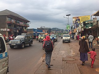
Naakulabye, also Nakulabye, is a neighborhood within the city of Kampala, the capital and largest city in Uganda.
Bwaise is a neighborhood within Kampala, Uganda's capital, and largest city. Due to lack of proper urban planning, it has grown into a commercial, industrial and residential township with poor infrastructure. The lack of developed infrastructure and poor service provision has exposed the town dwellings and residents to several challenges including flooding and water borne diseases.
Kamwookya, sometimes spelled as Kamwokya, is a location within the city of Kampala, Uganda's capital and largest metropolitan area.
Namungoona is a neighborhood within Kampala, Uganda's capital and largest city.
Busega is a neighborhood within Kampala, Uganda's capital and largest city.
Opportunity Bank Uganda Limited (OBUL), is a commercial bank in Uganda. It received a commercial banking licence from the Bank of Uganda on 25 September 2019.
Kyebando is a neighborhood within Kampala, the capital and largest city in Uganda.
Kanyanya is a neighborhood within the city of Kampala, Uganda's capital.
Mpererwe is a neighborhood in the city of Kampala, Uganda's capital city. Sometimes it is spelled as Mpereerwe.
The Kampala–Bombo Expressway is a proposed four-lane, dual carriage highway in the Central Region of Uganda, connecting, Kampala, the capital city, and Bombo, in Luweero District.
The Kampala–Gayaza Road is a road in the Central Region of Uganda, connecting the capital city of Kampala to the town of Gayaza in the Wakiso District. The road is part of the 44 kilometres (27 mi) Kampala–Gayaza–Ziroobwe Road Project.
Lugogo is an area in the city of Kampala, Uganda's capital.
Kijabijo is a neighborhood in Kira Town, in Wakiso District in the Buganda Region of Uganda.

