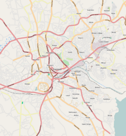
The Kampala–Jinja Highway is a road in Uganda, connecting the cities of Kampala and Jinja. Sometimes referred to as Kampala–Jinja Road, it is a busy road, with several towns, trading centers and other points of interest along the way. As of October 2016, a new, wider, four-lane dual carriageway expressway, the Kampala–Jinja Expressway, is proposed to be constructed south of the present highway to relieve traffic and complement existing transport infrastructure between Kampala and Jinja.
Kawempe Division (sub-county) is one of the five divisions that comprise the city of Kampala along with Makindye division, Lubaga division, Nakawa division and Central division, It has 19 parishes and 771 villages. The parishes include Bwaise I, Kanyanya, Kazo ward, Kyebando, Makerere iii, Mulago I, Bwaise ii, Kawempe I, Kikaya, Makerere I, Mpererwe, Mulago iii, Bwaise III, Kawempe ii, Komambogo, Makerere ii, Mulago i, Makerere University. The division's current mayor is His worship Dr. Emmanuel Serunjogi.
Nakawa is an area in the city of Kampala, Uganda's capital. It is also the location of the headquarters of Nakawa Division, one of the five administrative divisions of Kampala.
Nakawa Division is one of the five administrative divisions of the city of Kampala, the capital and largest city of Uganda. The town of Nakawa is the site of the division headquarters.
Namuwongo is a location in Kampala, the capital of Uganda and the largest city in that country.
Mbuya is a hill in southeastern Kampala, the capital city of Uganda. The hill rises 1,300 metres (4,300 ft) above sea level. The name also applies to the upscale residential neighborhood that sits on that hill, as well as the government military installations located there.
Ntinda is a location in northeastern Kampala, the capital city of Uganda.
Nateete is a location in the city of Kampala, Uganda's capital.
Naguru, also Naggulu, is a hill in Kampala, the capital and largest city in Uganda. The name also applies to the commercial and residential neighborhoods that sit on that hill.
Banda is a hill that lies in Nakawa Division, within Kampala, the capital of Uganda. Banda also refers to the neighborhoods on the slopes of the hill and between Banda Hill and Kireka, extending all the way to the Kampala-Jinja Highway. The southwestern slopes of the hill are occupied by the neighbourhood known as Kyambogo, and is the location of the campus of Kyambogo University, one of the nine public universities in the country.
Najjera, sometimes spelled as Najjeera is a neighborhood in Kira Municipality, Wakiso District, in the Buganda Region of Uganda.
Kisaasi is a location, within the city of Kampala, Uganda.
Bukoto is a township within the city of Kampala, Uganda's capital and largest metropolitan area.
Naalya is a township in Kira Municipality, in Kyaddondo County, Wakiso District, in Uganda.
Kiwaatule is a township within the city of Kampala, Uganda's capital.
Kawaala is a neighborhood within Kampala, Uganda's capital and largest city.
Busega is a neighborhood within Kampala, Uganda's capital and largest city.
Kigoowa is a location within the city of Kampala, Uganda's capital.
Kaleerwe is a neighborhood within Kampala, Uganda's capital and largest city. Kaleerwe is a busy road-side marketplace, beyond which is a residential slum. Due to its relative low altitude, compared to the surrounding hills, and its proximity to a wetland, the area is prone to flooding. Kaleerwe merges with its immediate slum-neighborhood to the southwest, Bwaise. One may argue that Kaleerwe is part of Bwaise.
Lugogo is an area in the city of Kampala, Uganda's capital.

