Administrative divisions of Albania

Last updated

Administrative divisions of Albania
Ndarja Administrative e Republikës së Shqipërisë (Albanian)
Harta Administrative e Shqiperise.svg
  •   Tiranë
  •   Elbasan
  •   Vlorë
  •   Korçë
  •   Dibër
  •   Kukës
  •   Durrës
  •   Shkodër
  •   Fier
  •   Lezhë
  •   Berat
  •   Gjirokastër
Category Unitary state
LocationFlag of Albania.svg  Albania
Number12 counties; 61 municipalities
PopulationsTotal: 2,845,955
AreasTotal: 28,748 km2 (11,100 sq mi)

The administrative divisions of Albania comprise 12 counties, 61 municipalities, and 373 administrative units. Since its 1912 Declaration of Independence, Albania has reorganized its administrative divisions 21 times. Its internal boundaries have been enlarged or subdivided into prefectures, counties, districts, subprefectures, municipalities, communes, neighborhoods or wards, villages, and localities. [1] [2] [3] The most recent changes were made in 2014 and enacted in 2015.

Contents

Main administrative divisions

Counties

The first level of government is constituted by the 12 counties (Albanian : qarqe / qarqet ), organized into their present form in the year 2000. [3] They are run by a prefect ( prefekt / prefekti ) and a county council ( këshill / këshilli i qarkut ). Prefects are appointed as representatives of the national Council of Ministers. [4]

Municipalities

The second level of government is constituted by the 61 municipalities ( bashki / bashkitë ). They are run by a mayor ( kryebashkiak / kryebashkiaku ) and a municipal council ( këshill / këshilli bashkiak ), elected every 4 years. Before 2015, a bashki was an urban municipality and only covered the jurisdiction of such cities. After 2015, the jurisdiction of the bashki was expanded to cover the nearby rural municipalities. [5] [6]

Administrative units

The third level of government is constituted by the 373 administrative units ( njësia / njësitë administrative ) or units of local administration ( njësia / njësite qeverisjes vendore ). Most of these were former rural municipalities or communes ( komuna / komunat ), which functioned as second-level divisions of the country until 2015. Parts of the administrative units are still further divided into Albania's 2,972 villages ( fshatra / fshatrat ).

History

Ottoman Albania

Albania within the borders of Ottoman Empire (1905) Balkans at 1905.jpg
Albania within the borders of Ottoman Empire (1905)

At the beginning of the 20th century, the territory which now forms Albania was divided among the four separate vilayets (Albanian : vilajete / vilajetet ) of Scutari, Janina, Manastir, and Kosovo. This helped mix Albanians with the surrounding Greeks, Serbs, and other groups. The four vilayets were divided into the sanjaks ( sanxhaqe / sanxhaqet ) of Scutari, Durrës, Ioannina, Ergiri, Preveze, Berat, Manastir, Serfiğe, Dibra, Elbasan, Görice, Üsküp, Priştine, İpek, Prizren, and Novi Pazar. The sanjaks were in turn further divided into kazas ( kazaja / kazajat ) at the town level and nahiyes ( nahije / nahijet ) at the village level.

Revolutionary Albania

Following the successful War of Independence against the Ottoman Empire in 1912, the first Albanian government led by Ismail Qemali initially retained the former Turkish divisions and offices. This was revised by the "Canon of Albanian Civil Administration" on 22 November 1913, which created a new three tier system. The primary division was into the 8 prefectures ( prefektura / prefekturat ) of Durrës, Berat, Dibër, Elbasan, Gjirokastër, Korcë, Shkodër, and Vlorë. Each of these was to be overseen by a prefect. The prefectures were divided into subprefectures ( nënprefektura / nënprefekturat ), which were divided into regions or provinces ( krahina / krahinat ) for local administration. [7] The authority of this provisional government was never recognized by the Great Powers or the Republic of Central Albania; never administered territory outside Vlorë, Berat, and Lushnjë; and was forced to dissolve after the discovery of its plot to restore some Turkish control to gain more territory and better resist Serbia.

Principality of Albania

The Principality of Albania (1916) 1916 map - Carta corografica dell'Albania e regioni contermini del Montenegro, Serbia e Grecia.jpg
The Principality of Albania (1916)

Separately, the International Control Commission drafted and enacted the Organic Statute (Statuti Organik)Albania's first constitution on 10 April 1914. [8] Primarily functioning as a compromise among the Great Powers of the era, it established the Principality of Albania as a constitutional monarchy to be headed by the German prince Wilhelm Wied and his heirs in primogeniture. [9]

An entire chapter of the Organic Statute was devoted to the administrative division of Albania, explicitly preserving Ottoman names and terms. The primary division was into the 7 sanjaks of Durrës, Berat, Dibër, Elbasan, Gjirokastër, Korçë, and Shkodër. [10] Each would be administered from its namesake city except Dibër. [11] The former Ottoman sanjak of Dibra had been divided among other countries and the city of Debar remained outside the principality's borders. [8] The Albanian sanjak of Dibër, however, expanded a bit with the inclusion of districts of the former sanjak of Prizren. [12] Areas of Chameria that had been in the former sanjak of Ioannina were added to Gjirokastër and the kaza of Leskovik was added to Korçë. [12] [13] Each sanjak was overseen by a mutasarrif ( mytesarif / mytesarifi ) appointed by the central government [14] and a sanjak council ( këshill / këshilli i sanxhakut ) consisting of five members appointed by lawa secretary, a comptroller, a director of agriculture and trade, a director of public education, and a director of public worksand one member from each of the sanjak's kazas, [15] elected by the local councils and approved by the mutasarrif. [16] The mutasarrif was personally responsible for maintaining public order, [17] controlling the local gendarmerie and police directly. [18] He also controlled local budgets in consultation with the council, [19] providing for public education [20] and inspecting each of the local kazas at least once a year. [21]

The sanjaks were again divided into kaza, each administered by a kaymakam ( kajmekam / kajmekami ) and his council ( këshill / këshilli i kazasë ), [22] consisting of three members appointed by lawa secretary, a comptroller, and a director of land taxesand four members appointed by the local councils and approved by the kaymakam. [23] The kaymakam was responsible for the kaza's finances and public services, including issuing passports, [24] and was required to answer to the sanjak's mutasarrif for a number of issues. The kaza was named and administered from the chief town in its district, headquartered at a city hall ( bashki / bashkia ). [lower-alpha 1] Each municipal council was obliged to hold meetings at the city hall at least once a week. [8]

The kaza were again divided into nahiye, which consisted of a group of villages together representing a population of 40007000 people. [25] They were administered by a mudir ( mudir / mudiri ) and the local council ( këshill / këshilli komunal ), [26] consisting of the local secretary and 4 members chosen by public election by the mukhtars ( muhtarë / muhtarët ) of the local villages assembled before the mudir. [27] The mudir was responsible for announcing and enacting the central government's laws, carrying out the census, and collecting taxes; [28] the council was charged with ensuring public hygiene, maintaining local water supplies and roads, and overseeing agricultural development and the use of public lands. [29]

Kingdom of Albania

Administrative divisions of Occupied Albania in 1943 KingdomOfAlbania1943.png
Administrative divisions of Occupied Albania in 1943

Under King Zog, Albania reformed its internal administration under the "Municipal Organic Law" of 1921 and the "Civil Code" of February 1928.

The primary division was into 10 prefectures, each led by a prefect. The secondary division was into subprefectures, of which there were 39 in 1927 and 30 by 1934. The subprefects were nominated by the prefects. [30]

The subprefectures were initially divided into 69 provinces, which oversaw local administration through the chiefs of the 2351 villages. [7] In 1928, urban centers were reorganized as municipalities governed by a mayor and municipal council popularly elected every three years and rural areas were organized as 160 communes. [7]

Occupied Albania

Following the Italian occupation of Albania, the country was organized into 10 prefectures, 30 subprefectures, 23 municipalities, 136 communes, and 2551 villages. [7]

Communist Albania

Following the liberation of Albania in World War II, Albania maintained its 10 prefectures and 61 subprefectures but abolished its municipalities and communes. A census was conducted in September 1945, and Law No. 284 (dated 22 August 1946) reformed the internal administration of the country once again. It maintained the 10 prefectures, reduced the number of subprefectures to 39, and organized local government as localities ( lokalitete / lokalitetet ). In 1947, the subprefectures were replaced by 2 districts ( rrathë / rrathët ), with local government divided between towns, villages, and localities. [31] In 1953, Law No. 1707 replaced the prefectures with 10 counties divided into 49 districts and 30 localities. In July 1958, the counties were replaced with 26 districts, including a capital district for Tirana. These districts were divided into 203 localities, which oversaw 39 cities and 2655 villages. Larger cities were further divided into neighborhoods or wards ( lagje / lagjet ). In 1967, the localities were replaced by "unified villages" ( fshatra / fshatrat i bashkuar ). By 1968, the 26 districts were divided into 65 cities or urban municipalities (divided into 178 neighborhoods) and 437 unified villages or rural municipalities (divided into 2641 villages). This was largely maintained until the late 1980s. In 1990, the 26 districts were divided into 67 cities (divided into 306 neighborhoods) and 539 unified villages (divided into 2848 villages). The capital Tirana was divided into three regions, each of which was further divided into constituent neighborhoods. [7]

See also

Notes

  1. This is the same word as the current municipalities of Albania but at the time referred only to the central office of local government, which provided municipal services and saw the meetings of the municipal council.

Related Research Articles

Albania is a unitary parliamentary constitutional republic, in which the president of Albania is the head of state and the prime minister of Albania is the head of government in a multi-party system. The executive power is exercised by the Government and the prime minister with its Cabinet. Legislative power is vested in the Parliament of Albania. The judiciary is independent of the executive and the legislature. The political system of Albania is laid out in the 1998 constitution. The Parliament adopted the current constitution on 28 November 1998. Historically Albania has had many constitutions. Initially constituted as a monarchy in 1913, Albania became briefly a republic in 1925, and then a authoritarian monarchy in 1928. In 1939 Albania was invaded by Fascist Italian forces, imposing a puppet state, and later occupied by Nazi German forces. Following the partisan liberation from the Nazis in 1944 a provisional government was formed, which by 1946 had transformed into a communist one-party state. In March 1991 democracy was restored with multi-party elections.

<span class="mw-page-title-main">Prefect</span> Magisterial title

Prefect is a magisterial title of varying definition, but essentially refers to the leader of an administrative area.

<span class="mw-page-title-main">Berat</span> Ninth largest city of Albania

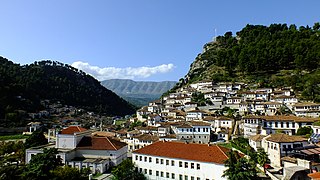
Berat is the ninth most populous city of Albania and the seat of Berat County and Berat Municipality. By air, it is 71 kilometres north of Gjirokastër, 70 kilometres west of Korçë, 70 kilometres south of Tirana, and 33 kilometres east of Fier.

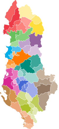
Counties, also sometimes known as prefectures, are the first-level administrative subdivisions of Albania, replacing the earlier districts. Since 2000, there have been 12 counties. Since 2015, they have been divided into 61 municipalities and 373 communes.

<span class="mw-page-title-main">Districts of Albania</span>

Districts were first and second-level administrative divisions of Albania from 1913–2000. Their number, size, and status changed over time. From 1991 to 2000, the 36 districts were organized into 12 counties. Pursuant to the 1998 Constitution and Law No. 8653, the districts were abolished and replaced with the larger counties and smaller municipalities.

<span class="mw-page-title-main">Sandžak</span> Geographical region

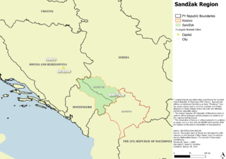
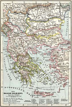
Sandžak is a historical geo-political region located in the southwestern part of Serbia and the eastern part of Montenegro. The name Sandžak derives from the Sanjak of Novi Pazar, a former Ottoman administrative district founded in 1865.

<span class="mw-page-title-main">Durrës County</span> County in central Albania

Durrës County, officially the County of Durrës, is a county in the Northern Region of the Republic of Albania. It is the smallest by area and the second most populous of the twelve counties, with 292,029 people within an area of 766 km2 (296 sq mi). The county borders on the Adriatic Sea to the west, the counties of Lezhë to the north, Dibër to the east and Tirana to the south. It is divided into three municipalities, Durrës, Krujë and Shijak, with all of whom incorporate sixteen administrative units.

<span class="mw-page-title-main">Sanjak of Novi Pazar</span> Sanjak of the Ottoman Empire from 1865 to 1902

The Sanjak of Novi Pazar was an Ottoman sanjak that was created in 1865. It was reorganized in 1880 and 1902. The Ottoman rule in the region lasted until the First Balkan War (1912). The Sanjak of Novi Pazar included territories of present-day northeastern Montenegro and southwestern Serbia, also including some northern parts of Kosovo. In modern day terms the region is known as Sandžak.

The present Constitution of the Republic of Albania was adopted by the Parliament of Albania on 21 October 1998 and certified by presidential decree on 28 November 1998, following a failed referendum which was boycotted by the opposition. It is split up over many different acts. The document succeeded the 1976 Constitution, originally adopted at the creation of the People's Socialist Republic of Albania on 28 December 1976 and heavily amended on 29 April 1991.

<span class="mw-page-title-main">Council of Ministers (Albania)</span>

The Council of Ministers is the executive branch that constitutes the Government of Albania. The Council is led by the Prime Minister of Albania. The prime minister is nominated by the President from among those candidates, who enjoy majority support in the Parliament; the candidate is then chosen by the Parliament. In the absence of the prime minister, the Deputy Prime Minister takes over his functions. There are 19 other government members, serving as deputy prime ministers, government ministers or both; they are chosen by the prime minister and confirmed by the Parliament.

The Albanian revolt of 1847 was a 19th-century uprising in southern Albania directed against Ottoman Tanzimat reforms which started in 1839 and were gradually being put in action in the regions of Albania.

The Uprising of Dervish Cara was a 19th-century uprising in northern Ottoman Albania directed against the Ottoman Tanzimat reforms which started in 1839 and were gradually being put in action in the regions of Albania. Some historians include the actions in Dibër of the same time under the same historical name, though the events in Dibër were independent and headed by other leaders.

<span class="mw-page-title-main">International Control Commission (Albania)</span>

The International Commission of Control was the commission established on October 15, 1913, on the basis of the decision by the six Great Powers made on July 29, 1913, according to the London Treaty signed on May 30, 1913. Its goal was to take care of the administration of newly established Albania until its own political institutions were in order.

<span class="mw-page-title-main">Vilayet</span> First-order administrative division of the later Ottoman Empire

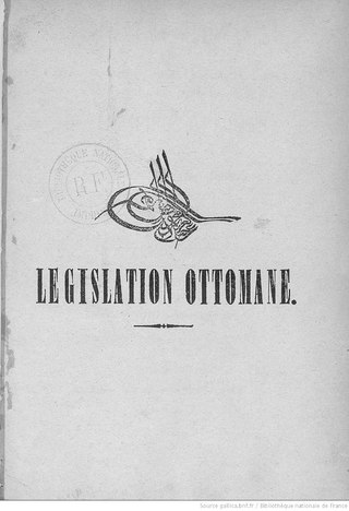
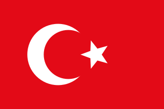
A vilayet, also known by various other names, was a first-order administrative division of the later Ottoman Empire. It was introduced in the Vilayet Law of 21 January 1867, part of the Tanzimat reform movement initiated by the Ottoman Reform Edict of 1856. The Danube Vilayet had been specially formed in 1864 as an experiment under the leading reformer Midhat Pasha. The Vilayet Law expanded its use, but it was not until 1884 that it was applied to all of the empire's provinces. Writing for the Encyclopaedia Britannica in 1911, Vincent Henry Penalver Caillard claimed that the reform had intended to provide the provinces with greater amounts of local self-government but in fact had the effect of centralizing more power with the sultan and local Muslims at the expense of other communities.

<span class="mw-page-title-main">Sanjak of Albania</span> Ottoman administrative unit in the 15th century

The Sanjak of Albania was a second-level administrative unit of the Ottoman Empire between 1415 and 1444. Its mandate included territories of modern central and southern Albania between Krujë to the Kalamas River in northwestern Greece.

<span class="mw-page-title-main">Villages of Albania</span> Administrative divisions of Albania

Albania has 2,972 villages as of 2016. Albania has reformed its internal administrative divisions 21 times since its Declaration of Independence from the Ottoman Empire in 1912. Following the most recent reorganization, enacted in 2014 and carried out in June 2015, Albania's 12 counties were entirely divided into 61 municipalities for regional government and 373 administrative units for local government. These administrative units, communes, towns now oversee most government at the village level.

<span class="mw-page-title-main">Sanjak of Elbasan</span>

The Sanjak of Elbasan was one of the sanjaks of the Ottoman Empire. Its county town was Elbasan in Albania.

<span class="mw-page-title-main">Aziz Vrioni</span> Albanian politician

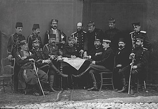
Aziz Pasha Vrioni (1859–1920) was an Ottoman-Albanian politician of the early 20th century. He was a member of the Ottoman Parliament representing Berat, and Albanian Minister of Finance and Minister of Agriculture and of Mines.

<span class="mw-page-title-main">Hasan Moglica</span> Albanian educator and nationalist figure

Hoxhë Hasan Moglica commonly referred as Hoxhë Moglica, was an Albanian alim, müderris, engineer, philosopher, patriot, nationalist figure and proclaimed as martyr of Albanian language and nation by the Albanian government.

<span class="mw-page-title-main">Sanjak of Durrës</span>

The Sanjak of Durrës, also known in the west by the Italian form as the Sanjak of Durazzo, was one of the sanjaks of the Ottoman Empire. It was named after its county town Durrës. The sanjak was composed of the kazas of Durrës, Tirana, Shijak, Kavajë, and Krujë. The Sanjak of Durrës was located in the southern part of the Vilayet of Scutari and was one of its two constituent sanjaks. It bordered to the north the Sanjak of Scutari, Manastir and Dibra to the north-east, Elbasan to the east and south, and the Adriatic Sea to the west. Its terrain is generally flat and plain, and only the eastern parts of the kazas of Tirana and Kavajë are mountainous.

References

Citations

  1. 61 bashkitë do të drejtohen dhe shërbejnë sipas “modelit 1958”
  2. "HARTA AD MINIST RATIVE TERRITORIALE E BASHKIVE TË SHQIPËRISË" (PDF). Reformaterritoriale.al. Archived from the original (PDF) on 2015-09-24. Retrieved 2017-09-09.
  3. 1 2 "HARTA AD MINIST RATIVE TERRITORIALE E QARQEVE TË SHQIPËRISË" (PDF). Reformaterritoriale.al. Archived from the original (PDF) on 2018-09-05. Retrieved 2017-09-09.
  4. "LIGJ Nr. 8927, date 25.7.2002 : Per Prefektin (Ndryshuar me Ligjin Nr. 49/2012 "Për Organizimin dhe Funksionimin e Gjykatave : Administrative dhe Gjykimin r Mosmarrëveshjeve Administrative"" (PDF). Planifikimi.gov.al. Archived from the original (PDF) on 2016-03-05. Retrieved 2017-09-09.
  5. "HARTA ADMINISTRATIVE TERRITORIALE E BASHKIVE TË SHQIPËRISË" (PDF). Ceshtjetvendore.gov.al. Archived from the original (PDF) on 2016-03-06. Retrieved 2017-09-09.
  6. "STAR 2 - Consolidation of the Territorial and Administrative Reform".
  7. 1 2 3 4 5 "Reforma Territoriale - Historik". Reformaterritoriale.al. Retrieved 9 September 2017.
  8. 1 2 3 Statuti Organik i Shqipërisë (PDF) (in Albanian).
  9. "Lo statuto dell'Albania - Prassi Italiana di Diritto Internazionale". www.prassi.cnr.it. Retrieved 2021-12-10.
  10. Statuti Organik, Ch. VI, §95.
  11. Statuti Organik, Ch. VI, §96.
  12. 1 2 Statuti Organik, Ch. VI, §98.
  13. Clayer 2005 , pp. 319, 324, 331.
  14. Statuti Organik, Ch. VI, §100.
  15. Statuti Organik, Ch. VI, §110.
  16. Statuti Organik, Ch. VI, §111.
  17. Statuti Organik, Ch. VI, §106.
  18. Statuti Organik, Ch. VI, §101.
  19. Statuti Organik, Ch. VI, §103.
  20. Statuti Organik, Ch. VI, §108.
  21. Statuti Organik, Ch. VI, §104.
  22. Statuti Organik, Ch. VI, §119.
  23. Statuti Organik, Ch. VI, §125.
  24. Statuti Organik, Ch. VI, §123.
  25. Statuti Organik, Ch. VI, §132.
  26. Statuti Organik, Ch. VI, §133.
  27. Statuti Organik, Ch. VI, §134.
  28. Statuti Organik, Ch. VI, §135.
  29. Statuti Organik, Ch. VI, §136.
  30. ""Historia e ndarjes administrative nga Ismail Qemali në '92"". Panorama.com.al. Retrieved 9 September 2017.
  31. "Historia e ndarjes administrative nga Ismail Qemali në '92". Shtetiweb.org. Retrieved 9 September 2017.

Bibliography