BMT Nassau Street Line

Last updated

BMT Nassau Street Line
NYCS-bull-trans-J-Std.svg NYCS-bull-trans-Z-Std.svg
The J and Z, which use the Nassau Street Line through downtown, are colored brown.
One station is also served by the M, which is now part of the IND Sixth Avenue Line.
Overview
Owner City of New York
Termini
Stations6
Service
Type Rapid transit
System New York City Subway
Operator(s) New York City Transit Authority
Daily ridership112,631 [1]
History
Opened1908–1931
Technical
Number of tracks2–4
CharacterUnderground
Track gauge 4 ft 8+12 in (1,435 mm)
Electrification 600V DC third rail
Route map

Contents

BSicon uhCONTg.svg
BSicon utSTR+l.svg
BSicon uhtSTRe@fq.svg
BSicon uWKRZh.svg
BSicon uhSTRr.svg
BSicon utSTR+l.svg
BSicon utSTRq.svg
BSicon utTBHFt.svg
BSicon utCONTfq.svg
Essex Street
BSicon utHST.svg
BSicon utABZg3.svg
BSicon utABZg+l.svg
BSicon utABZq1.svg
BSicon utKRZto.svg
BSicon utSTRc4.svg
BSicon utCONTfq.svg
BSicon utCONT3+g.svg
BSicon utSTR.svg
BSicon utHST.svg
Bowery
BSicon utCONTg.svg
BSicon utCONTg.svg
BSicon utSTR.svg
BSicon utABZgl.svg
BSicon utBHF-L.svg
BSicon lACC.svg
BSicon utKRZt.svg
BSicon utKRZt.svg
BSicon utBHF-R.svg
BSicon utSTRc2.svg
BSicon lENDE3.svg
BSicon uetABZq+3.svg
BSicon utCONTfq.svg
Canal Street
BSicon utLSTR.svg
BSicon utSTR.svg
BSicon utABZg+1.svg
BSicon utdSTRc4.svg
former connection
BSicon utACC.svg
BSicon BLaq.svg
BSicon utHST.svg
BSicon BLeq.svg
Chambers Street
BSicon utCONTgq.svg
BSicon utKRZto.svg
BSicon utKRZto.svg
BSicon utSTR+r.svg
BSicon utCONTgq.svg
BSicon utKRZto.svg
BSicon BLc2.svg
BSicon KBL3.svg
BSicon utTBHFt.svg
BSicon lACC.svg
BSicon KBL2.svg
BSicon utKRZto.svg
BSicon BLc3.svg
BSicon utCONTfq.svg
BSicon utACC.svg
BSicon KBL1.svg
BSicon BLc4.svg
BSicon utSTR.svg
BSicon BLc1.svg
BSicon utACC.svg
BSicon KBL4.svg
Fulton Street
BSicon POINTERf@gq.svg
BSicon utCONTf.svg
BSicon utSTR.svg
BSicon utCONTf.svg
BSicon utHST.svg
Broad Street
BSicon utLSTRl.svg
BSicon utLSTRq.svg
BSicon utABZql.svg
BSicon uWKRZt.svg
BSicon utSTR+r.svg
BSicon utCONTf.svg

The BMT Nassau Street Line is a rapid transit line of the B Division of the New York City Subway system in Manhattan. At its northern end, the line is a westward continuation of the BMT Jamaica Line in Brooklyn after the Jamaica Line crosses the Williamsburg Bridge into Manhattan. The Nassau Street Line continues south to a junction with the BMT Broadway Line just before the Montague Street Tunnel, after which the line reenters Brooklyn. Although the tracks merge into the Broadway Line south of Broad Street, there has been no regular service south of the Broad Street station since June 25, 2010. While the line is officially recognized as the Nassau Street Line, [2] it only serves one station on Nassau Street: Fulton Street.

The line is served at all times by the J train. The Z provides supplemental rush hour service, operating in the peak direction. The M service has historically served the Nassau Street Line, but since 2010, the M has been rerouted via the Chrystie Street Connection to run on the IND Sixth Avenue Line, as a replacement for the V, which was discontinued due to financial shortfalls. The M continues to serve one Nassau Street Line station: the Essex Street station.

Service

The following services use part or all of the BMT Nassau Street Line. [3] The trunk line's bullets are colored brown:

 Time periodSection of line
Rush hoursMiddays,
evenings,
weekends
Late nights
NYCS-bull-trans-J-Std.svg local
NYCS-bull-trans-Z-Std.svg local in
peak direction
no service
NYCS-bull-trans-M-Std.svg Essex Street onlyno service

History

Planning, construction, and first section

After the original lines of the Interborough Rapid Transit Company (IRT) opened, the city began planning new lines. Two of these were extensions of that system, to Downtown Brooklyn and Van Cortlandt Park, but the other two – the Centre Street Loop subway (or Brooklyn Loop subway) and Fourth Avenue subway (in Brooklyn) – were separate lines for which construction had not progressed as far. The Centre Street Loop, approved on January 25, 1907 as a four-track line (earlier proposed as two tracks), [4] [5] was to connect the Brooklyn Bridge, Manhattan Bridge, and Williamsburg Bridge via Centre Street, Canal Street, and Delancey Street. An extension south from the Brooklyn Bridge under William Street to Wall Street was also part of the plan, as were several loops towards the Hudson River and a loop connecting the bridges through Brooklyn. Trains coming from Brooklyn via the Manhattan and Williamsburg Bridges would be able to head back to that borough via the Brooklyn Bridge as well as the Montague Street Tunnel at the south end of the Centre Street Loop, and vice versa. All trains would pass through a large central station with four tracks and five platforms at Chambers Street, just north of the Brooklyn Bridge. [4] [6]

Construction contracts for the main line in Manhattan were awarded in early 1907, though the city had not yet selected an operator for the line. The work was divided into five sections: two under Centre Street and three under other streets or buildings. [7] The city began receiving bids for the sections under Centre Street in March 1907. [8] [9] The city received bids for the sections between Centre Street and Bowery (under Kenmare Street), between Bowery and Norfolk Street (under Delancey Street), and between Pearl Street and Park Row (under the Manhattan Municipal Building) that June. [9] [10] The line was assigned to a proposed Tri-borough system in early 1908 and to the Brooklyn Rapid Transit Company (BRT) in the Dual Contracts, adopted on March 4, 1913. [11] [12] Unlike previous subway contracts that the city government had issued, the BRT was responsible only for constructing the Centre Street Loop and installing equipment, not for operating the loop. As a result, although the loop was almost completed by late 1908, there was no operator for the route at the time. [13] Furthermore, the BRT did not originally want to operate the loop. [14]

1908 plan for Chambers Street and the Brooklyn Bridge connection Chambers Street station plan 1908.jpg
1908 plan for Chambers Street and the Brooklyn Bridge connection

The BRT began operating through a short piece of subway, coming off the Williamsburg Bridge under Delancey Street to Essex Street, on September 16, 1908. [15] The BRT tunnel under Centre Street was completed by 1910, except for the section under the Municipal Building, which contained the incomplete Chambers Street station. [16] [17] The tunnel remained unused for several years. [18] In March 1913, the Public Service Commission authorized the BRT to lay tracks, install signals, and operate the loop. [18] [19] The Centre Street Loop was opened to Chambers Street on August 4, 1913, [20] [21] with temporary operation at first on the two west tracks. [22] The south tracks on the Manhattan Bridge, also running into Chambers Street, were placed in service on June 22, 1915. [23]

Second section

Construction

Group photo of the Marcus Contracting Co. taken during construction of the Nassau Street subway, circa 1928 Marcus Contracting Co. Group Photo.jpg
Group photo of the Marcus Contracting Co. taken during construction of the Nassau Street subway, circa 1928

Under Contract 4 of the Dual Contracts, the BRT (later reorganized as the Brooklyn–Manhattan Transit Corporation or BMT) was to operate the Nassau Street Line. [24] The southern portion of the line remained incomplete for several years, and the BRT brought a $30 million suit against the city for not building the line before January 1, 1917. [25] Most of the BMT's Dual Contracts lines were completed by 1924, except for the Nassau Street Line. [24] BMT chairman Gerhard Dahl was persistent at requesting that the city build the line, saying in 1923 that the BMT was willing to operate the line as soon as the city completed it. [26] At the time, the BMT was planning to construct two stations on the Nassau Street Line: one at Fulton Street, where the BMT planned to place the northbound platform above the southbound platform due to the street's narrowness, and the other at the intersection at Broad and Wall Streets, where both platforms would be on the same level. [27] However, mayor John Hylan refused to act during his final two years in office. [24] BOT chairman John H. Delaney believed that the line was unnecessary because both of its planned stations would be extremely close to existing subway stations. [28] Meanwhile, the BMT claimed that the city's failure to complete the line was overburdening other BMT lines. [29] By January 1925, the BMT was asking its passengers to pressure Hylan into approving the remainder of the Nassau Street Line. [30] Work did not commence until after James Walker succeeded Hylan as mayor at the end of 1925. [24]

The city government agreed to build the Nassau Street Line in May 1927, [31] after the BMT sued the city for $30 million. [31] [32] At the time, the city wanted to take over the BMT's lines but could not do so until all Dual Contracts lines were completed. [32] The BOT received bids for the construction of the line that July, [33] but it rejected every bid the next month because of concerns over the lowest bidder's ability to complete the work. [32] [34] That September, contractors again submitted bids to the BOT; some bidders offered to build the entire line, while others only offered to construct the segments of the line to the north or south of Liberty Street. [33] The BOT awarded construction contracts for the line's construction two months later. The Marcus Contracting Company was hired to build the portion north of Liberty Street, including the Fulton Street station, for $4.7 million, while Moranti and Raymond were hired to build the portion to the south for $5.7 million. [35] [36] The New York City Board of Estimate approved the contracts in January 1928, allowing the builders to construct the line using the cut-and-cover method, despite merchants' requests that the line be constructed using tunnelling shields. [37]

The line was constructed 20 feet (6.1 m) below the active IRT Lexington Avenue Line, next to buildings along the narrow Nassau Street, and the project encountered difficulties such as quicksand. [24] [38] When the construction contracts were awarded, work had been projected to be completed in 39 months. [24] By early 1929, sixty percent of the work had been finished. [24] [39] Nassau Street is only 34 feet (10 m) wide, and the subway floor was only 20 feet (6.1 m) below building foundations. As a result, 89 buildings had to be underpinned to ensure that they would stay on their foundations. Construction had to be done 20 feet below the active IRT Lexington Avenue Line. An area filled with quicksand with water, which used to belong to a spring, was found between John Street and Broad Street. Construction was done at night so as to not disturb workers in the Financial District. [24] The project was 80 percent complete by April 1930, [40] and Charles Meads & Co. was awarded a $252,000 contract to install the Fulton Street station's finishes the next month. [41] [42] The plans for that station had been changed so that the southbound platform was above the northbound platform. [41] [42] The total construction cost was $10.072 million [38] [43] for 0.9 miles (1.4 km) of new tunnels, or $2,068 per foot ($6,780/m), which was three times the normal cost of construction at the time. [24]

Opening of loop

The Nassau Street Loop opened at 3 p.m. on May 29, 1931, when Mayor Jimmy Walker took the controls of a train of D-type Triplex cars from Chambers Street to Broad Street. [25] [44] [45] This completed what was known as the Nassau Street Loop. [25] The loop ran from the line's previous terminus at Chambers Street, running through the Fulton Street and Broad Street stations before merging with the Montague Street Tunnel to Brooklyn. [46] The completion of the line relieved congestion on several BMT lines to southern Brooklyn, which previously had to operate to Midtown Manhattan using the Broadway Line. [47] When the line was completed, Culver Line trains began operating on the loop; previously, elevated Culver Line trains from Coney Island ran only as far as Ninth Avenue, where transfers were made to West End subway trains. The new line provided an additional ten percent capacity compared with existing service through DeKalb Avenue. Service on the Jamaica Line was extended to operate to this station. [48] The station at Wall Street was named "Broad Street" to distinguish it from the already-open Wall Street stations on the Lexington Avenue Line and Seventh Avenue Line. [38]

Plans for the Chambers Street area changed several times during construction, always including a never-completed connection to the Brooklyn Bridge tracks. By 1910, only the west two tracks were to rise onto the bridge, and the east two were to continue south to the Montague Street Tunnel. As actually built for the 1931 opening south of Chambers Street, the two outer tracks ran south to the tunnel, while the two inner tracks continued several blocks in a lower level stub tunnel to allow trains to reverse direction. [49]

Service changes and modifications

A major change to the Nassau Street Line occurred on November 27, 1967, when the extensive Chrystie Street reroutes resulted in the discontinuation of service over the south tracks of the Manhattan Bridge into Chambers Street, as those tracks were now directly connected to the upper level (Broadway) Canal Street station. This ended all "loop" service, which had most recently seen rush hour "specials" on both the Brighton and 4th Avenue lines operating via both the Manhattan Bridge and Montague Street tunnel in single directions.

As part of the Metropolitan Transportation Authority's 2000–2004 Capital Program, the reconfiguration of the Nassau Street Line between Canal Street and Essex Street took place. As part of the plan, northbound trains were rerouted via the second track from the west, and the former northbound platforms at Canal Street and Bowery were closed. The second track from the east was removed. Work on the project started in 2001. This change took effect on September 20, 2004. The reconfiguration provided additional operational flexibility by providing a third through track (previously the center two tracks stub-ended at Canal Street), which was equipped with reverse signaling. The consolidation of the Bowery and Canal Street stations was intended to enhance customer security while consolidating passengers onto what used to be the southbound platforms. [50] [51] [52] :29 The project was completed in May 2005, seven months behind its scheduled completion. [53] The project cost $36 million. [54]

On June 14, 2015, weekend J service was extended back to Broad Street; this was proposed in July 2014 to improve weekend service between Lower Manhattan and Brooklyn. [55] [56] [57] Between 1990 and 2015, when weekend service terminated at Canal, between September 30, 1990 [58] and January 1994, [59] or Chambers Streets, from January 1994 to June 2015, Broad Street and the J/Z platforms at Fulton Street were two of the four New York City Subway stations that lacked full-time service (the remaining two being the platforms for the IRT 42nd Street Shuttle).

Station listing

Station service legend
NYCS-SSI-alltimes.svg Stops all times
NYCS-SSI-allexceptnights.svg Stops all times except late nights
NYCS-SSI-nightsonly.svg Stops late nights only
NYCS-SSI-weekdaysonly.svg Stops weekdays during the day
NYCS-SSI-rushonly.svg Stops rush hours only
NYCS-SSI-rushpeak.svg Stops rush hours in the peak direction only
Time period details
Wheelchair symbol.svg Station is compliant with the Americans with Disabilities Act
Wheelchair symbol.svg  Station is compliant with the Americans with Disabilities Act
in the indicated direction only
Wheelchair symbol.svg  
Aiga elevator.svg Elevator access to mezzanine only
Neighborhood
(approximate)
Wheelchair symbol.svg StationServicesOpenedTransfers and notes
Begins as the BMT Jamaica Line from the Williamsburg Bridge ( J   NYCS-SSI-alltimes.svg M   NYCS-SSI-allexceptnights.svg Z   NYCS-SSI-rushpeak.svg )
Lower East Side Essex Street J   NYCS-SSI-alltimes.svg M   NYCS-SSI-allexceptnights.svg Z   NYCS-SSI-rushpeak.svg September 16, 1908 [60] IND Sixth Avenue Line ( F   NYCS-SSI-alltimes.svg <F> NYCS-SSI-rushpeak.svg ) at Delancey Street
Split to Chrystie Street Connection ( M   NYCS-SSI-weekdaysonly.svg )
Bowery J   NYCS-SSI-alltimes.svg Z   NYCS-SSI-rushpeak.svg August 4, 1913 [20]
Chinatown Aiga elevator.svg Canal Street J   NYCS-SSI-alltimes.svg Z   NYCS-SSI-rushpeak.svg August 4, 1913 [20] BMT Broadway Line ( N   NYCS-SSI-alltimes.svg Q   NYCS-SSI-alltimes.svg R   NYCS-SSI-allexceptnights.svg W   NYCS-SSI-weekdaysonly.svg )
IRT Lexington Avenue Line ( 4   NYCS-SSI-nightsonly.svg 6   NYCS-SSI-alltimes.svg <6> NYCS-SSI-rushpeak.svg )
Former Connection to Manhattan Bridge south tracks
Civic Center Wheelchair symbol.svg Chambers Street J   NYCS-SSI-alltimes.svg Z   NYCS-SSI-rushpeak.svg August 4, 1913 [20] IRT Lexington Avenue Line ( 4   NYCS-SSI-alltimes.svg 5   NYCS-SSI-allexceptnights.svg 6   NYCS-SSI-alltimes.svg <6> NYCS-SSI-rushpeak.svg ) at Brooklyn Bridge–City Hall
Financial District Wheelchair symbol.svg Fulton Street J   NYCS-SSI-alltimes.svg Z   NYCS-SSI-rushpeak.svg May 29, 1931 [44] IRT Broadway–Seventh Avenue Line ( 2   NYCS-SSI-alltimes.svg 3   NYCS-SSI-allexceptnights.svg )
IRT Lexington Avenue Line ( 4   NYCS-SSI-alltimes.svg 5   NYCS-SSI-allexceptnights.svg )
IND Eighth Avenue Line ( A   NYCS-SSI-alltimes.svg C   NYCS-SSI-allexceptnights.svg )
Connection to BMT Broadway Line ( N   NYCS-SSI-nightsonly.svg R   NYCS-SSI-allexceptnights.svg W   NYCS-SSI-weekdaysonly.svg ) at Cortlandt Street via Dey Street Passageway
Connection to PATH at World Trade Center
Broad Street J   NYCS-SSI-alltimes.svg Z   NYCS-SSI-rushpeak.svg May 29, 1931 [44]
Terminus of all service
Line merges with the BMT Broadway Line ( N   NYCS-SSI-nightsonly.svg R   NYCS-SSI-allexceptnights.svg ) and becomes the BMT Fourth Avenue Line via the Montague Street Tunnel

Related Research Articles

<span class="mw-page-title-main">Brooklyn Rapid Transit Company</span> Former transit holding company in New York City

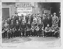
The Brooklyn Rapid Transit Company (BRT) was a public transit holding company formed in 1896 to acquire and consolidate railway lines in Brooklyn and Queens, New York City, United States. It was a prominent corporation and industry leader using the single-letter symbol B on the New York Stock Exchange.

<span class="mw-page-title-main">Queensboro Plaza station</span> New York City Subway station in Queens

The Queensboro Plaza station is an elevated New York City Subway station at Queens Plaza in the Long Island City neighborhood of Queens. It is near the east end of the Queensboro Bridge, with Queens Boulevard running east from the plaza. The station is served by the 7 and N trains at all times, the W train on weekdays, and the <7> train rush hours in the peak direction.

<span class="mw-page-title-main">Chrystie Street Connection</span> New York City Subway track connections

The Chrystie Street Connection is a set of New York City Subway tunnels running the length of Chrystie Street on the Lower East Side of Manhattan. It is one of the few track connections between lines of the former Brooklyn–Manhattan Transit Corporation (BMT) and Independent Subway System (IND) divisions, which together constitute the system's B Division. A major branch of the IND Sixth Avenue Line, it connects the Sixth Avenue Line to the BMT Brighton Line and BMT Fourth Avenue Line via the north side of the Manhattan Bridge and to the BMT Jamaica Line over the Williamsburg Bridge. The project, opened in 1967 and 1968, also includes the Sixth Avenue Line's Grand Street and 57th Street stations, the latter of which is not part of the connection itself.

The BMT Canarsie Line is a rapid transit line of the B Division of the New York City Subway system, named after its terminus in the Canarsie neighborhood of Brooklyn. It is served by the L train at all times, which is shown in medium gray on the New York City Subway map and on station signs.

<span class="mw-page-title-main">Borough Hall/Court Street station</span> New York City Subway station in Brooklyn

The Borough Hall/Court Street station is an underground New York City Subway station complex in Brooklyn shared by the BMT Fourth Avenue Line, the IRT Broadway–Seventh Avenue Line and the IRT Eastern Parkway Line. The complex comprises three stations: Borough Hall on the IRT lines and Court Street on the BMT line. The stations are located under Court, Joralemon, and Montague Streets, next to Brooklyn Borough Hall, in the Downtown Brooklyn and Brooklyn Heights neighborhoods of Brooklyn. It is served by the 2, 4, and R trains at all times; the 3 train all times except late nights; the 5 train on weekdays; the N train during late nights; and limited rush-hour W trains.

The BMT Broadway Line is a rapid transit line of the B Division of the New York City Subway in Manhattan. As of November 2016, it is served by four services, all colored yellow: the N and ​Q trains on the express tracks and the R and ​W trains on the local tracks during weekdays. The line is often referred to as the "N and R", since those were the only services on the line from 1988 to 2001, when the Manhattan Bridge's southern tracks were closed for rebuilding. The Broadway Line was built to give the Brooklyn Rapid Transit Company access to Midtown Manhattan.

<span class="mw-page-title-main">M (New York City Subway service)</span> New York City Subway service

The M Queens Boulevard/Sixth Avenue Local is a rapid transit service in the B Division of the New York City Subway. Its route emblem, or "bullet", is colored orange since it is a part of the IND Sixth Avenue Line in Manhattan.

<span class="mw-page-title-main">DeKalb Avenue station (BMT lines)</span> New York City Subway station in Brooklyn

The DeKalb Avenue station is an interchange station on the BMT Brighton Line and BMT Fourth Avenue Line of the New York City Subway, located at the intersection of DeKalb and Flatbush Avenues in Downtown Brooklyn. It is served by the Q and R trains at all times, the B train on weekdays, and the D and N trains during late nights. During rush hours only, a few W train trips also serve this station.

<span class="mw-page-title-main">Broad Street station (BMT Nassau Street Line)</span> New York City Subway station in Manhattan

The Broad Street station is a station on the BMT Nassau Street Line of the New York City Subway at the intersection of Broad and Wall Streets in the Financial District of Manhattan. It serves as the southern terminal for J trains at all times and for Z trains during rush hours in the peak direction.

<span class="mw-page-title-main">57th Street–Seventh Avenue station</span> New York City Subway station in Manhattan

The 57th Street–Seventh Avenue station is an express station on the BMT Broadway Line of the New York City Subway. Located in Midtown Manhattan at the intersection of 57th Street and Seventh Avenue, it is served by the N and Q trains at all times, the R train at all times except late nights, and the W train on weekdays. It is directly adjacent to Carnegie Hall.

<span class="mw-page-title-main">Seventh Avenue station (BMT Brighton Line)</span> New York City Subway station in Brooklyn

The Seventh Avenue station is a station on the BMT Brighton Line of the New York City Subway, located at the intersection of Seventh Avenue, Park Place and Flatbush Avenue in Park Slope and Prospect Heights, Brooklyn. The station is served by the Q train at all times and by the B train on weekdays only.

<span class="mw-page-title-main">Grand Street station (IND Sixth Avenue Line)</span> New York City Subway station in Manhattan

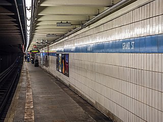
The Grand Street station is an express station on the IND Sixth Avenue Line of the New York City Subway. Located at the intersection of Grand Street and Chrystie Street at the border of Chinatown and the Lower East Side, it is served by the D train at all times and the B train on weekdays.

<span class="mw-page-title-main">Fifth Avenue–59th Street station</span> New York City Subway station in Manhattan

The Fifth Avenue–59th Street station is a station on the BMT Broadway Line of the New York City Subway. Located under Grand Army Plaza near the intersection of 5th Avenue and 60th Street in Manhattan, it is served by the N train at all times, the W train on weekdays during the day, and the R train at all times except late nights.

<span class="mw-page-title-main">South Ferry/Whitehall Street station</span> New York City Subway station in Manhattan

The South Ferry/Whitehall Street station is a New York City Subway station complex in the Financial District neighborhood of Manhattan, under Battery Park. The complex is shared by the IRT Broadway–Seventh Avenue Line and the BMT Broadway Line. It is served by the 1 and R trains at all times, the W train only on weekdays during the day, and the N train at night.

<span class="mw-page-title-main">Lexington Avenue/59th Street station</span> New York City Subway station in Manhattan

The Lexington Avenue/59th Street station is a New York City Subway station complex shared by the IRT Lexington Avenue Line and the BMT Broadway Line. It is located at Lexington Avenue between 59th and 60th Streets, on the border of Midtown and the Upper East Side of Manhattan. The station complex is the fourteenth-busiest in the system, with over 21 million passengers in 2016.

<span class="mw-page-title-main">Canal Street station (New York City Subway)</span> New York City Subway station in Manhattan

The Canal Street station is a New York City Subway station complex. It is located in the neighborhoods of Chinatown and SoHo in Manhattan and is shared by the BMT Broadway Line, the IRT Lexington Avenue Line, and the BMT Nassau Street Line. It is served by the 6, J, N, and Q trains at all times; the R train at all times except late nights; the W train during weekdays; the <6> train during weekdays in the peak direction; the Z train during rush hours in the peak direction; and the 4 train during late nights.

<span class="mw-page-title-main">Atlantic Avenue–Barclays Center station</span> New York City Subway station in Brooklyn

The Atlantic Avenue–Barclays Center station is a New York City Subway station complex shared by the BMT Fourth Avenue Line, the BMT Brighton Line and the IRT Eastern Parkway Line. Named after Atlantic Avenue and the Barclays Center arena, it is located at Fourth and Flatbush Avenues' intersections with Atlantic Avenue and Pacific Street in Downtown Brooklyn. The complex is served by the 2, 4, D, N, Q and R trains at all times; the 3 train at all times except late nights; the 5 and B trains on weekdays during the day; and a few rush-hour W trains.

<span class="mw-page-title-main">Fulton Street station (New York City Subway)</span> New York City Subway station in Manhattan

The Fulton Street station is a major New York City Subway station complex in Lower Manhattan. It consists of four linked stations on the IND Eighth Avenue Line, the IRT Lexington Avenue Line, the BMT Nassau Street Line and the IRT Broadway–Seventh Avenue Line. The complex is served by the 2, 4, A, and J trains at all times. The 3, 5, and C trains stop here at all times except late nights, and the Z stops during rush hours in the peak direction.

<span class="mw-page-title-main">Brooklyn Bridge–City Hall/Chambers Street station</span> New York City Subway station in Manhattan

The Brooklyn Bridge–City Hall/Chambers Street station is a New York City Subway station complex in Lower Manhattan. The complex is served by trains of the IRT Lexington Avenue Line and the BMT Nassau Street Line. The station is served by the 4, 6, and J trains at all times; the 5 train at all times except late nights; the <6> train during weekdays in the peak direction; and the Z train during rush hours in the peak direction.

<span class="mw-page-title-main">Jay Street–MetroTech station</span> New York City Subway station in Brooklyn

The Jay Street–MetroTech station is a New York City Subway station complex on the IND Fulton Street, IND Culver, and BMT Fourth Avenue lines. The complex is located in the vicinity of MetroTech Center in Downtown Brooklyn. It is served by the A, F, and R trains at all times; the C train at all times except late nights; the N train during late nights only; and a few rush-hour W and <F> trains in the peak direction.

References

  1. "Annual Subway Ridership (2018–2023)". Metropolitan Transportation Authority. 2023. Retrieved April 20, 2024.
  2. Dougherty, Peter (2006) [2002]. Tracks of the New York City Subway 2006 (3rd ed.). Dougherty. OCLC   49777633 via Google Books.
  3. "Subway Service Guide" (PDF). Metropolitan Transportation Authority. September 2019. Retrieved September 22, 2019.
  4. 1 2 "Subway Loop Approved; Will Have Four Tracks". The New York Times. January 26, 1907. p. 16. ISSN   0362-4331 . Retrieved August 1, 2019.
  5. "Subway Loop Assured: Four-track Bridge Link Estimate Board Approves--cost, $5,000,000--ready in 2 1-2 Years". New-York Tribune. January 26, 1907. p. 1. ISSN   1941-0646. ProQuest   571760875.
  6. Stevenson, Frederick Boyd (July 13, 1913). "Colonel Williams' View of Centre Street Loop". Brooklyn Daily Eagle. p. 23. Retrieved October 2, 2018.
  7. Comptroller's Monthly Report. 1916. p. 2-PA147-IA1.
  8. "Expect Many Bidders". The Brooklyn Citizen. March 23, 1907. p. 12. Retrieved May 16, 2023 via Newspapers.com.
  9. 1 2 "Bids for Subway Loop". New-York Tribune. March 13, 1907. p. 5. Retrieved May 16, 2023 via Newspapers.com.
  10. "Bids for Manhattan Subway Loop Opened". The Brooklyn Daily Eagle. June 13, 1907. Retrieved May 16, 2023 via Newspapers.com.
  11. James Blaine Walker, Fifty Years of Rapid Transit, 1864–1917, published 1918, pp. 203–239
  12. Engineering News, A New Subway Line for New York City, Volume 63, No. 10, March 10, 1910
  13. "Centre Street Subway Loop and Manhattan Bridge Nearing Completion With No Traffic Arrangements in Sight". The Brooklyn Daily Eagle. October 15, 1908. p. 21. Retrieved May 16, 2023 via Newspapers.com.
  14. "Bridge Subway Loop a Trying Problem; Part of the Tube Still Far from Completion, and Its Operation Unsettled". The New York Times. April 7, 1909. ISSN   0362-4331 . Retrieved May 13, 2023.
  15. "Mayor Runs a Train Over New Bridge". The New York Times. September 17, 1908. ISSN   0362-4331 . Retrieved January 26, 2020.
  16. "Asks for Subway Loop: B. R. T. Would Bring "L" Trains Close to Brooklyn Bridge P. S. C. Considering Offer Company Says Bridge Crush Would Be Relieved and Transit Improved". New-York Tribune. April 13, 1910. p. 8. ISSN   1941-0646. ProQuest   572372770.
  17. "Subway Bridge Loop Nearing Completion; Only That Part Under the New Municipal Building Yet to be Built". The New York Times. April 13, 1910. ISSN   0362-4331. Archived from the original on May 12, 2023. Retrieved May 12, 2023.
  18. 1 2 "To Open Centre St. Loop; B.R.T. Authorized to Begin Operations -- May Be Ready by July 1". The New York Times. March 29, 1913. ISSN   0362-4331. Archived from the original on May 12, 2023. Retrieved May 12, 2023.
  19. "Subway Construction". The Wall Street Journal. March 29, 1913. p. 2. ISSN   0099-9660. ProQuest   129417638.
  20. 1 2 3 4 "Passenger Killed On Loop's First Day ; Printer, Impatient at Delay in New Bridge Subway, Tries to Walk the Track". The New York Times. August 5, 1913. p. 2. ISSN   0362-4331 . Retrieved August 1, 2019.
  21. "Brooklyn Crowds Jam New $13,000,000 Loop: One-fourth of Old Bridge Traffic Diverted at Night, but Crush is Terrific". New-York Tribune. August 5, 1913. p. 14. ISSN   1941-0646. ProQuest   575116848.
  22. Public Service Commission For the First District, New Subways For New York: The Dual System of Rapid Transit, Chapter 1
  23. The City Record: Official Journal of the City of New York. New York City Board of City Record. October 15, 1915. p. 7827. Retrieved August 7, 2018.
  24. 1 2 3 4 5 6 7 8 9 Linder, Bernard (February 2016). "Contract 4 Subway Controversy". The Bulletin. Vol. 59, no. 2. Electric Railroaders' Association. pp. 1, 6. Archived from the original on August 16, 2016. Retrieved July 28, 2016.
  25. 1 2 3 Cunningham, Joseph; DeHart, Leonard O. (January 1, 1993). A History of the New York City Subway System. J. Schmidt, R. Giglio, and K. Lang.
  26. "Agree to Extension of 14th St. Subway; B.M.T. Relinquishes Demand for Elevated Structure Specified in Contract". The New York Times. December 19, 1923. ISSN   0362-4331 . Retrieved May 7, 2023.
  27. "Nassau St. Subway Plan Nearly Ready; Southern End Completed, but Northern Section Involves a More Difficult Problem". The New York Times. March 3, 1923. ISSN   0362-4331 . Retrieved May 7, 2023.
  28. Young, James C. (June 12, 1927). "Nassau Loop Builders Face a Difficult Task; The Half-Mile of Subway in the Heart of New York's Financial District Raises Construction Problems Never Before Encountered". The New York Times. ISSN   0362-4331 . Retrieved May 7, 2023.
  29. "B.M.T. Plans Work to Cost $2,000,000; Directors Approve Program of Improvements to Be Made This Year". The New York Times. May 20, 1925. ISSN   0362-4331 . Retrieved May 7, 2023.
  30. "B.M.T. Asks Public to Make Hylan Act; Offers $15,000,000; Starts Campaign to Force Construction of the Nassau Street Subway". The New York Times. April 6, 1925. ISSN   0362-4331 . Retrieved May 7, 2023.
  31. 1 2 "City Will Build Nassau St. Tube; Forced to Yield; Link for the B.M.T., Less Than a Mile in Length, Will Cost $13,000,000". The New York Times. May 28, 1927. ISSN   0362-4331 . Retrieved May 7, 2023.
  32. 1 2 3 Moscow, Warren (August 21, 1927). "Nassau Street Subway Again Proves Nuisance As Board Rejects Bids". The Brooklyn Citizen. pp. 1, 4 . Retrieved May 7, 2023.
  33. 1 2 "$9,986,997 Low Bid for Nassau Subway; Board Tabulates Figures of 17 Contractors in Second Competition for the Work". The New York Times. September 25, 1927. ISSN   0362-4331 . Retrieved May 7, 2023.
  34. "All Bids Rejected on Nassau Subway; Transportation Board Orders New Figures -- Delays Start of Work Three Months". The New York Times. August 21, 1927. ISSN   0362-4331 . Retrieved May 7, 2023.
  35. "Awards Contracts for Nassau St. Links; Board Lets Out Work on Two Subway Sections for $10,458,034". The New York Times. November 24, 1927. ISSN   0362-4331 . Retrieved May 7, 2023.
  36. "Board Awards Nassau Street Tube Contracts". The Standard Union. November 23, 1927. p. 3. Retrieved May 7, 2023.
  37. "Approves Open Cut for Nassau St. Link; Estimate Board Overrules the Pleas for Tunnel Method of Subway Construction". The New York Times. January 27, 1928. ISSN   0362-4331 . Retrieved May 7, 2023.
  38. 1 2 3 "Nassau St. Subway To Open On May 30; Its Construction an Engineering Feat Because Many Buildings Had to Be Underpinned. Cost $10,072,000 To Build It Will Link B.M.T.'s Centre Street Loop With Tunnel Under East River. 14th St. Extension Ready Connection With Eighth Avenue Line Will Go Into Operation on the Same Day". The New York Times. May 10, 1931. ISSN   0362-4331. Archived from the original on July 26, 2018. Retrieved July 28, 2016.
  39. "Engineers Study Nassau St. Loop; 200 Spend 3 Hours in Subway of B.M.T. System Watching All Phases of Work". The New York Times. January 20, 1929. ISSN   0362-4331 . Retrieved May 7, 2023.
  40. "New B.M.T. Link is 80% Complete; Nassau-Broad St. Tracks to Be Finished by Autumn, Transit Board Says". The New York Times. April 20, 1930. ISSN   0362-4331 . Retrieved May 7, 2023.
  41. 1 2 "Station of 3 Levels for Nassau St. Tube; Transit Board Reveals Plans for Fulton St. Stop, Requiring Structure 40 Feet Wide". The New York Times. May 25, 1930. ISSN   0362-4331 . Retrieved May 7, 2023.
  42. 1 2 "Nassau Street Subway to Link Several Routes: Fulton St. Station of New B. M. T. Extension Will Be Busy Transfer Junction $252,192 Contract 'Let Connection With the I. R. T. West Side Line Planned Something Novel in Subway Station". New York Herald Tribune. May 25, 1930. p. 7. ISSN   1941-0646. ProQuest   1113639010.
  43. "Mayor Inspects New Nassau St. Subway Today: City Officials To Be Guests of B.M.T. in Tour of Links That Open Tomorrow". New York Herald Tribune. May 29, 1931. p. 21. ISSN   1941-0646. ProQuest   1114186438.
  44. 1 2 3 "Mayor Drives Train In New Subway Link; The Mayor Becomes A Motorman". The New York Times. May 30, 1931. ISSN   0362-4331. Archived from the original on December 17, 2021. Retrieved July 28, 2016.
  45. "Walker Operates First Train in Nassau St. Loop: Tests Out Whistle Before Sudden Stop for Which Instructor Takes Blame New B. M. T. System Link Other Officials at Opening of $10,000,000 Subway Nassau Street Subway Is Formally Opened". New York Herald Tribune. May 30, 1931. p. 3. ISSN   1941-0646. ProQuest   1114103146.
  46. Derrick, Peter (April 1, 2002). Tunneling to the Future: The Story of the Great Subway Expansion That Saved New York. NYU Press. ISBN   9780814719541. Archived from the original on May 22, 2020. Retrieved December 30, 2020.
  47. "Nassau-Broad Subway Route Opens May 30: 14th St. Link of B. M. T. Line From 6th to 8th Aves. Also To Be Finished Then Both Cost $13,630,313 City Labored Three Years on Engineering Projects". New York Herald Tribune. May 10, 1931. p. 2. ISSN   1941-0646. ProQuest   1114181918.
  48. "Nassau St. Service Outlined By B.M.T.; Loop to Be Used for Direct Connection From Brooklyn and Jamaica to Manhattan" . The New York Times. May 21, 1931. ISSN   0362-4331. Archived from the original on June 14, 2018. Retrieved July 28, 2016.
  49. Joseph Brennan, Abandoned Stations: Chambers St closed platforms, accessed March 22, 2007
  50. Joseph Brennan, Abandoned Stations: Canal St platform, accessed April 18, 2007
  51. Peter Dougherty, Tracks of the New York City Subway, Centennial Commemorative Edition 3.7a, 2004, page 65
  52. Update, the MTA Plan for 2000–2004: Strategic Business Plan, Agency 2001 Operating Budgets, Financial Plan. Metropolitan Transportation Authority. 2000.
  53. Committee, New York City Transit Authority Transit (2006). Transit Committee Meeting. MTA New York City Transit Committee. pp. 95, 96.
  54. "Capital Program 2000–2004 MTA New York City Transit". mta.info. Archived from the original on February 9, 2005. Retrieved November 12, 2017.
  55. "mta.info – 2014 – 2017 MTA Financial Plan". mta.info.
  56. "MTA – news – MTA's Proposed 2015 Budget Includes Systemwide Service Enhancements". mta.info.
  57. "J train service upgrade part of MTA's new financial plan". New York Daily News . July 24, 2014.
  58. "Service Changes September 30, 1990" (PDF). New York City Transit Authority. September 30, 1990. Archived from the original (PDF) on October 26, 2014. Retrieved May 1, 2016 via subwaynut.com.
  59. Glickman, Todd (October 6, 1998). "Archive of NYC Subway Maps". mit.edu. Retrieved July 28, 2016.
  60. "MAYOR RUNS a TRAIN OVER NEW BRIDGE; Brooklyn Celebrates Opening of the Service with Red Fire and Oratory. GOVERNor's FATHER SPEAKS Refers to His Son as the "Convict" at Albany and Thinks He May Have to "Serve Two Years More."". The New York Times. September 17, 1908.
Template:Attached KML/BMT Nassau Street Line
KML is from Wikidata