Mountain range in the eastern Highlands of Scotland
This article is about the Scottish mountain range. For the mountain the range is named after, see Cairn Gorm. For other uses, see Cairngorm (disambiguation).
The Cairngorms (Scottish Gaelic: Am Monadh Ruadh) are a mountain range in the eastern Highlands of Scotland closely associated with the mountain Cairn Gorm. The Cairngorms became part of Scotland's second national park (the Cairngorms National Park) on 1 September 2003.[2] Although the Cairngorms give their name to, and are at the heart of, the Cairngorms National Park, they only form one part of the national park, alongside other hill ranges such as the Angus Glens and the Monadhliath, and lower areas like Strathspey.[3]
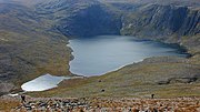
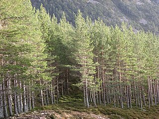
The Cairngorms consists of high plateaux at about 1,000–1,200m (3,300–3,900ft) above sea level, above which domed summits (the eroded stumps of once much higher mountains [4]) rise to around 1,300m (4,300ft). Many of the summits have tors, free-standing rock outcrops that stand on top of the boulder-strewn landscape.[5] In places, the edges of the plateau form steep cliffs of granite and they are excellent for skiing, rock climbing and ice climbing. The Cairngorms form an arctic-alpine mountain environment, with tundra-like characteristics and long-lasting snow patches.[5] This area is home to bird species such as ptarmigan, dotterel, snow bunting, curlew and red grouse, as well as mammals such as mountain hare.[6] The plateau also supports Britain's only herd of reindeer (albeit semi-domesticated).[7] Surrounding the central massif are many remnants of the Caledonian forest in straths and glens of the Rivers Spey and Dee.[8] These forests support many species that are rare elsewhere in Britain, including red squirrels, pine marten, wood ants, Scottish crossbill, capercaillie and crested tit.[9]
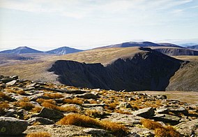
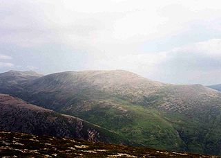
Sgor Gaoith (1,118m (3,668ft)). Cairn Gorm (1,245m (4,085ft)) can be seen to the right.
The original Gaelic name for the range is Am Monadh Ruadh (the red hills), distinguishing them from Am Monadh Liath (the grey hills), which lie to the west of the River Spey:
If you look from Aviemore on a clear evening, the granite screes of Lairig Ghru and Braeriach do glow a warm red in the sun. The name Am Monadh Ruadh still lives among the oldest folk of Strath Spey, but long ago, outsiders had replaced it with 'the Cairngorms', on maps and in guide books.
The English language name for the range is Cairngorms, and is derived from Cairn Gorm, which is prominent in the view of the mountains from Speyside. The earliest reference to this name appears to be from a Colonel T. Thornton, who visited the area in about 1786:[13][14]
The use of the term "Cairngorms" as applied to the group must have become well established early in the nineteenth century, for we find it in Col Thornton's Sporting Tour (1804), where there is a reference to "Aurora peeping over the immense Cairngorms."
Cairn Gorm is generally translated as Blue Cairn, although the Gaelic gorm is also used as an adjective and verb, meaning green or greening and is often seen in connection with growing grass.[15] Thus, there is a contradiction or confusion, because the original Scottish Gaelic name of the mountains translates to English as the "red hills" whilst their English name is the "blue hills" or the "green hills".
Geography
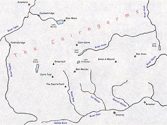
Sketch map showing villages, mountains, lochs, and rivers of The Cairngorms.
The Cairngorms consist of three large elevated plateaux adorned with low, rounded glacial mountains, and divided by the passes of the Lairig an Laoigh and the Lairig Ghru.[16] The range gives the sense of being a single plateau, because the passes that cut through them are not very deep: the summit of Lairig an Laoigh lies at 740m (2,430ft),[12] whilst the summit of the Lairig Ghru is at 835m (2,740ft) above sea level at the Pools of Dee, where the water may be frozen over even in mid-summer.[17][18] This means a walker could cross between the Cairntoul (1,293m (4,242ft)) – Braeriach (1,296m (4,252ft)) massif to the Ben Macdui (1,309m (4,295ft)) – Cairn Gorm (1,245m (4,085ft)) massif and thence onto the Beinn a' Bhùird (1,196m (3,924ft)) – Ben Avon (1,171m (3,842ft)) massif without descending below the 740m (2,430ft) summit of the Lairig an Laoigh.[12] The range is drained by the Rivers Dee and Spey; and the latter's two tributaries: the Rivers Feshie and Avon.[12]
The approximate southern boundary of the Cairngorm range is generally reckoned to run from slightly east of Braemar, west along the Dee and Glen Geldie to the head of Glen Feshie. The western edge of the range is defined by Glen Feshie and the River Spey as far as Aviemore, with the northern boundary running roughly eastward from Aviemore through Glenmore to Glen Avon. The eastern boundary is defined by Glen Avon and the Am Bealach Dearg, thus ending slightly east of Braemar.[13]
There are no public roads through the Cairngorms, and all the public roads in the general area either skirt the Cairngorms or stop short, providing access to them only. From the south and south-east, motorised access ends at Linn of Dee, or Allanaquoich. From the north-west, a road passes Coylumbridge, Glenmore and the Sugarbowl to end at the car park at the Cairngorm Mountain ski resort.[12] The majority of hill-walkers access the range from these road ends.[16]
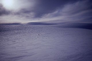
In terms of height, remoteness and the severe and changeable weather, the Cairngorms are the most arduous area in the United Kingdom.[20] The plateau area has a Tundra climate (KöppenET),[21] and the shattered terrain is more like the high ground in high-arctic Canada or northern Norway than what is often observed in the European Alps or Rockies.[22] The weather often deteriorates rapidly with altitude so that, when there are moderate conditions 150m (490ft) below the plateau, the top can be stormy or misty, and there can be icy or powdery snow. Even when no snow is falling, the wind can whip up lying snow to produce white-out conditions for a few metres above the surface, and snowdrifts can build up rapidly in sheltered places. Gravel can be blown through the air, and walking can be impossible.[23][24]
When a gale is accompanied by thick storms of ground drift, or worse, by heavy falling blizzards plus ground drift, or worse still by mist as well, conditions can be extremely serious on the plateau, making it suffocating and difficult to breathe, hard to open your eyes, impossible to see anything beyond your own feet, and unable to communicate with your party except one at a time by cupping an ear and shouting into it.
The lowest recorded temperature in the United Kingdom has twice been recorded in the Cairngorms, at Braemar, where a temperature of −27.2°C (−17.0°F), was recorded on 11 February 1895 and 10 January 1982.[26] The greatest British wind speed of 176mph (283km/h) was measured at Cairngorm summit weather station in January 1993.[note 1][27][28] The weather can be very hazardous at times, with dangerous and unpredictable conditions. What is often described as Britain's worst mountaineering tragedy, the Cairngorm Plateau Disaster, left five children and one adult dead in November 1971.[29]
Cairn Gorm gets 320cm (130in) of snow annually according to snowforecast.com.
Climate data for Cairn Gorm Summit, Elevation: 1,245m (4,085ft), 1991–2020
On Ben Macdui, snow has been known to persist at a few locations from one winter to the next.[32]
Lying at the north-eastern shoulder of Cairn Gorm is Ciste Mhearad. This hollow contains a patch which, hitherto, was known to persist through many years, but has not done so since 2000.[32] Observations in 2007 and 2008 revealed that September was the month when final melting occurred for this patch.[33] It sits at an altitude of 1,095m (3,593ft) and is located at approximately grid referenceNJ011046.
Braeriach's Garbh Choire Mòr is the location of Scotland's most persistent snow beds. Snow has been absent from this corrie just five times in the last century: 1933, 1959, 1996, 2003 and 2006.[34] Sitting at an altitude of about 1140m, these patches are located around grid referenceNN940980; the two most long-lasting patches are known as "the Pinnacles" and "the Sphinx" after the rock climbs lying above them.[35] Recent studies based on morraine, avalanche debris fields and climate models suggest it is likely that Garbh Choire Mòr (as well as Coire an Lochain in the northern corries) contained glaciers as recently as the 19th century.[36][37]
In 1994, the Cairngorms and surrounding mountains of north-east Scotland had 55 surviving patches, an exceptional number.[32]
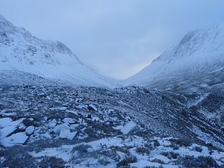
The Cairngorms were formed 40 million years before the last ice age, when slight uplift raised an eroded peneplain based on an exposed granitepluton. The highest present-day peaks represent eroded monadnock hills. During the ice ages, the ice caps that covered most of northern Scotland remained static—frozen to the ground for long periods—and actually protected the rounded summits and valleys and deep, weathered granite of the mountains of the area. Glacial erosion is represented in deep valleys which dissect the area. Many valleys are littered with glacial deposits from the period of glacial retreat. The most famous valley is the Lairig Ghru pass, a gouge through the centre of the mountains—a u-shaped valley, now partly filled with extensive scree produced by intense frost action during ice-free periods. Many parts of the Cairngorms exhibit classic periglacialweathering which occurred during cold periods in ice-free areas.[38][39]
Tors are a common feature of the Cairngorm granite massif, being especially frequent on Ben Avon and Beinn Mheadhoin and impressively high on Bynack More. They represent masses of granite which are less closely jointed than surrounding rock and which have therefore been less susceptible to underground weathering associated with fluid percolation along joints. The present tors have been exhumed over a long period of time, not least by periglacial processes associated with ice ages during the Quaternary period.[40]
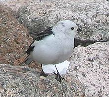
The Cairngorms provide a unique alpinesemi-tundramoorland habitat, home to many rare plants, birds and animals. Speciality bird species on the plateaux include breeding ptarmigan, dotterel, snow bunting, golden eagle, ring ouzel and red grouse,[6] with snowy owl, twite, purple sandpiper and Lapland bunting seen on occasion.[41] Mammal species include red deer and mountain hare,[6] as well as the only herd of reindeer in the British Isles. They now roam the high Cairngorms, after being reintroduced in 1952 by a Swedish herdsman. The herd is now stable at around 150 individuals, some born in Scotland and some introduced from Sweden; since the individuals depend on humans for food and come from domesticated stock, they are not considered wild.[7]
The Cairngorms were declared a national nature reserve (NNR) in 1954, being the largest NNR in Britain. In 2006 Scottish Natural Heritage (SNH) reviewed the Cairngorms NNR, and it was decided that the reserve should be broken up into separate, smaller reserves that reflected existing management units.[47] There now are four NNRs within the core mountain area of the Cairngorms.[45]Mar Lodge Estate, which covers the south side of the plateau and the watershed of the upper Dee has been classified as a national nature reserve since May 2017.[48] The Abernethy Forest National Nature Reserve covers a stretch of land from the plateau down to Loch Garten on the north side of the range, and Glenmore Forest Park, covering a remnant of the Caledonian Forest surrounding Loch Morlich, is also designated as a national nature reserve.[45] The Invereshie and Inshriach National Nature Reserve lies on the western flanks of the range, and extends to the summit of Sgòr Gaoith.[49]
Threats to the ecosystem
The Cairngorms represents an unusually cold area of mountains in a maritime climate at 57 degrees north. The climate is projected to warm—and precipitation patterns to change—under present climate change models. This is an over-riding concern for the long-term conservation of this area. Ptarmigan has been considered as an indicator species for this process, although the natural population cycles of this bird do not seem to have been disrupted as yet.[citation needed]
Other man-made threats include the problems of popularity in a country with limited wilderness resources and a large, relatively affluent urban population. These include various types of recreation and the associated trampling damage and erosion, disturbance, litter and threats to water quality.[50]
Human habitation and ownership
Corrour Bothy in October 2009
The valleys between the individual plateaux were used as drove roads by cattle drovers who built rough protective shelters for their arduous journeys. At about the same time that droving was dying out towards the end of the 19th century, deer stalking estates were flourishing, and so the shelters were developed into bothies to provide improved, though still primitive, accommodation for gamekeepers.[24] In modern times, these bothies have been taken over by the Mountain Bothies Association for use by walkers and climbers to provide shelter and rough sleeping accommodation.[24] With the exception of the bothies, there are no buildings or settlements within the Cairngorms, nor is there evidence for historic settlement, except in the uppermost reaches of the Derry and Gairn rivers.[3] In the surrounding areas, villages such as Aviemore and Braemar provide a base for visitors to the core mountain area.[8]
Much of the core mountain area is owned by conservation bodies, with the National Trust for Scotland owning Mar Lodge Estate, and the RSPB'sAbernethy Estate stretching from the lower slopes up to the plateau. The main private landowners are the Glenavon Estate in the northeast, the Invercauld Estate in the southeast, the Glen Feshie Estate to the southwest and the Rothiemurchus Estate in the northwest.[51]
Leisure
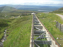
The funicular track in summer
There is a funicular railway on Cairn Gorm serving the Cairn Gorm Ski Centre. The funicular opened in late 2001,[52] and runs from a base station at 637m up to the Ptarmigan Centre, situated at 1097m, 150m from the summit of Cairn Gorm.[12] It was built amidst some controversy, with supporters of the scheme claiming that it would bring valuable tourist income into the area, whilst opponents argued that such a development was unsuitable for a supposedly protected area. A condition was therefore imposed under which walkers were not allowed outside the top station if arriving by funicular, although this did not apply to skiers and snowboarders in the winter.[53] In 2010 the operating company proposed to modify this requirement to allow guided walks, whilst still preventing general access.[53] Guided walks continued to be the only way for walkers and summer visitors to access the plateau if arriving via the funicular as of 2017.[54]
The mountains are very popular for hill-walking, with eighteen Munros lying between Ben Avon in the east and Glen Feshie in the west.[16] In winter these summits can often be reached by ski touring. The Cairngorms have excellent climbing, and has long attracted winter climbers, especially in the northern corries. This area boasts what was for a time probably the world's hardest traditionally protected mixed climb: "The Hurting", grade XI.[55] As with all land in Scotland, there is a right of responsible access to the mountains for those wishing to participate in recreational pursuits,[56] although the restriction on access via the funicular means walkers and climbers cannot use the railway to access the hills.
↑ The Cairngorm weather station is at 1,245m (4,085ft) and hs been operating since 1977
Related Research Articles
The Cairngorm Mountain Railway, which opened in 2001, is the highest railway in the United Kingdom. The two-kilometre long funicular ascends the northern slopes of Cairn Gorm, the United Kingdom's seventh-highest mountain, serving the Cairngorm Mountain ski resort. The route and ski area are located within the Cairngorms National Park, the largest National Nature Reserve in Britain, located near Aviemore in the Highland area of Scotland. It is a Doppelmayr 120-SSB funicular railway.
The River Dee is a river in Aberdeenshire, Scotland. It rises in the Cairngorms and flows through southern Aberdeenshire to reach the North Sea at Aberdeen. The area it passes through is known as Deeside, or Royal Deeside in the region between Braemar and Banchory because Queen Victoria came for a visit there in 1848 and greatly enjoyed herself. She and her husband, Prince Albert, built Balmoral Castle there which replaced an older castle.
Cairngorms National Park is a national park in northeast Scotland, established in 2003. It was the second of two national parks established by the Scottish Parliament, after Loch Lomond and The Trossachs National Park, which was set up in 2002. The park covers the Cairngorms range of mountains, and surrounding hills. Already the largest national park in the United Kingdom, in 2010 it was expanded into Perth and Kinross.
Cairn Gorm is a mountain in the Scottish Highlands. It is part of the Cairngorms range and wider Grampian Mountains. With a summit elevation of 1,244.8 m (4,084 ft) above sea level, Cairn Gorm is classed as a Munro and is the sixth-highest mountain in the British Isles. The high, broad domed summit overlooking Strathspey is one of the most readily identifiable mountains from the nearby town and regional centre of Aviemore. Although it shares its name with the Cairngorm mountains, Ben Macdui is the highest mountain in the range.
Ben Macdui is the second-highest mountain in Scotland and all of the British Isles, after Ben Nevis, and the highest of the Cairngorm Mountains. The summit is 1,309 metres (4,295 ft) above sea level and it is classed as a Munro. Ben Macdui sits on the southwestern edge of the Cairngorm plateau, overlooking the Lairig Ghru pass to the west, and Loch Etchachan to the east. It lies on the boundary between the historic counties of Aberdeenshire and Banffshire.
The Lairig Ghru is one of the mountain passes through the Cairngorms of Scotland. The route and mountain pass partially lies on the Mar Lodge Estate.
Braeriach or Brae Riach is the third-highest mountain in Scotland and all of the British Isles, after Ben Nevis and Ben Macdui, rising 1,296 metres (4,252 ft) above sea level. It is in the Scottish Highlands and is the highest point in the western massif of the Cairngorms, separated from the central section by the Lairig Ghru pass. The summit is a crescent-shaped plateau, overlooking several corries.
Cairn Toul is the fourth-highest mountain in Scotland and all of the British Isles, after Ben Nevis, Ben Macdui and Braeriach. The summit is 1,291 metres above sea level. It is in the western massif of the Cairngorms, linked by a bealach at about 1125 m to Braeriach. The mountain towers above the Lairig Ghru pass.
Glenmore Forest Park is a remnant of the Caledonian Forest near Aviemore in the Badenoch and Strathspey district of Highland, Scotland. Owned and managed by Forestry and Land Scotland, it lies within the Cairngorms National Park, and is one of six forest parks in the country. The forest park, which was established in 1948, covers 35.7 km2, of which 21.1 km2 is designated as a national nature reserve (NNR). Glenmore surrounds Loch Morlich, and is below the rise of the Cairngorms to the south; to the north the park extends to the summit of Meall a' Bhuachaille. The forest forms part of an expanse of Caledonian Forest that stretches from Glen Feshie to Abernethy, and which as a whole forms the largest single area of this habitat remaining in Scotland. It is home to much wildlife including Scottish crossbills, crested tits, capercaillie, narrow-headed ants, red squirrels and red deer.
Beinn a' Chaorainn is a Scottish mountain in the heart of the Cairngorms range. It is quite a remote hill, being located roughly 19 kilometres south east of Aviemore and 14 kilometres north west of Braemar. The mountain stands on the border of the Moray and Aberdeenshire council areas. The hill's name used to be spelt as Beinn a' Chaoruinn, but the spelling of the word caorunn was altered to caorann by the Gaelic Orthographic Convention's attempts to standardise spelling.
Derry Cairngorm is a Scottish mountain in the Cairngorms range, 14 kilometres (8.7 mi) north west of Braemar in the county of Aberdeenshire.
Càrn a' Mhàim is a Scottish mountain situated in the inner part of the Cairngorms range, some 15 kilometres west of Braemar in the county of Aberdeenshire.
Mar Lodge Estate is the largest remnant of the ancient Earldom of Mar in Aberdeenshire, Scotland and is now owned by the National Trust for Scotland.
Coire an t-Sneachda is a glacial cirque or corrie landform in the Cairngorm or Am Monadh Ruadh mountain range in the Grampian Mountains of the Scottish Highlands.
Long-lying snow patches in Scotland have been noted from at least the 18th century, with snow patches on Ben Nevis being observed well into summer and autumn. Indeed, the summit observatory, which operated from 1883 to 1904, reported that snow survived on the north-east cliffs through more years than it vanished.
Adam Watson, FRSE, FRSB, FINA, FRMS, FCEH was a Scottish biologist, ecologist and mountaineer. He was one of the most recognisable scientific figures in Scotland due to his many appearances on TV and radio. His large academic output and contributions to the understanding of the flora and fauna in Scotland and elsewhere have been internationally recognised. Dr Watson was widely acknowledged as Scotland's pre-eminent authority on the Cairngorms mountain range.
Beinn Bhreac is a twin-peaked Scottish mountain located above Glen Derry in the Cairngorm Mountains approximately 11 kilometres (7 mi) north-west of Braemar.
The Cairngorm Plateau disaster, also known as the Feith Buidhe disaster, occurred in November 1971 when six fifteen-year-old Edinburgh school students and their two leaders were on a two-day navigational expedition in a remote area of the Cairngorms in the Scottish Highlands.
The Lairig an Laoigh is a mountain pass through the Highlands of Scotland. In speech and sometimes in writing the name is reduced to "Lairig Laoigh". It is of glacial origin, dissecting the Cairngorm plateau, and it runs roughly north–south from Speyside to Deeside at one time being used as a drove road. Between the public road in the Abernethy Forest and the one at Linn of Dee the trekking distance is 31 kilometres (19 mi).
Invereshie and Inshriach is a national nature reserve on the western flank of the Cairngorms in the Highland council area of Scotland. The reserve covers habitats at a range of different altitudes, ranging from Caledonian Forest beside the River Feshie in the west, via bog and open moorland, to an arctic-alpine environment on the Cairngorm plateau. The Munro summit of Sgòr Gaoith (1118 m) lies on the eastern boundary of the reserve. The forested areas of the reserve form part of an expanse of Caledonian pinewood that stretches from Glen Feshie to Abernethy, and which as a whole forms the largest single area of this habitat remaining in Scotland. The reserve is owned and managed jointly by NatureScot and Forestry and Land Scotland (FLS): NatureScot own the Invereshie portion of the reserve and FLS the Inshriach area.
↑ Harrison S., Rowan, A.V., Glasser, N.F., Knight, J., Plummer, M.A. and Mills, S.C. (2014): Little Ice Age glaciers in Britain: Glacier–climate modelling in the Cairngorm Mountains. The Holocene 24 (2), 135-140. doi:10.1177/0959683613516170.
↑ Kirkbride, M., Everest, J., Benn, D., Gheorghiu, D. and Dawson, A. (2014) Late-Holocene and Younger Dryas glaciers in the northern Cairngorm Mountains, Scotland. The Holocene 24 (2), 141-148.
Allen, John; Davidson, Robert (2012). Cairngorm John: A Life in Mountain Rescue (eBook). Dingwall: Sandstone Press. ISBN978-1-908737-48-9. John Allen joined the Cairngorm Mountain Rescue Team after the time of the disaster and went on to become its leader.
Watson, Adam (1992). The Cairngorms, Lochnagar and the Mounth (6thed.). Scottish Mountaineering Trust. ISBN0-907521-39-8. Adam Watson is an academic and hill walker with very great experience of the Cairngorms.
External links
Wikimedia Commons has media related to Cairngorms.
This page is based on this Wikipedia article Text is available under the CC BY-SA 4.0 license; additional terms may apply. Images, videos and audio are available under their respective licenses.