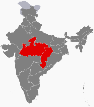
Madhya Pradesh is a state in central India. Its capital is Bhopal, and the largest city is Indore, with Gwalior, Jabalpur, Ujjain, Dewas, Sagar, Satna, and Rewa being the other major cities. Madhya Pradesh is the second largest Indian state by area and the fifth largest state by population with over 72 million residents. It borders the states of Uttar Pradesh to the northeast, Chhattisgarh to the east, Maharashtra to the south, Gujarat to the west, and Rajasthan to the northwest.

The Vindhya Range is a complex, discontinuous chain of mountain ridges, hill ranges, highlands and plateau escarpments in west-central India.

Madhya Bharat, also known as Malwa Union, was an Indian state in west-central India, created on 28 May 1948 from twenty-five princely states which until 1947 had been part of the Central India Agency, with Jiwajirao Scindia as its Rajpramukh.

Malwa is a historical region of west-central India occupying a plateau of volcanic origin. Geologically, the Malwa Plateau generally refers to the volcanic upland north of the Vindhya Range. Politically and administratively, it is also synonymous with the former state of Madhya Bharat which was later merged with Madhya Pradesh. At present the historical Malwa region includes districts of western Madhya Pradesh and parts of south-eastern Rajasthan. Sometimes the definition of Malwa is extended to include the Nimar region south of the Vindhyas.

Ujjain or Ujjayinī is a city in Ujjain district of the Indian state of Madhya Pradesh. It is the fifth-largest city in Madhya Pradesh by population and is the administrative centre of Ujjain district and Ujjain division. It is one of the Hindu pilgrimage centres of Sapta Puri famous for the Kumbh Mela (Simhastha) held there every 12 years. The famous temple of Mahakaleshwar Jyotirlinga is located in the center of the city. The city has been one of the most prominent trade and political centres of the Indian Subcontinent from the time of the ancient Mahājanapadas until the British colonisation of India.

The Central India Agency was created in 1854, by amalgamating the Western Malwa Agency with other smaller political offices which formerly reported to the Governor-General of India. The agency was overseen by a political agent who maintained relations of the Government of India with the princely states and influence over them on behalf of the Governor-General. The headquarters of the agent were at Indore.

The Hindi Belt, also known as the Hindi Heartland, is a linguistic region encompassing parts of northern, central, eastern, and western India where various Northern, Central, Eastern and Western Indo-Aryan languages are spoken, which in a broader sense is termed as Hindi languages, with Standard Hindi serving as the lingua franca of the region.

Mahakoshal or Mahakaushal is a region of central India. Mahakoshal lies in the upper or eastern reaches of the Narmada River valley in the Indian state of Madhya Pradesh. Jabalpur is the largest city in the region. Nimar region lies to the west, in the lower reaches of the Narmada valley.

The Central Provinces was a province of British India. It comprised British conquests from the Mughals and Marathas in central India, and covered parts of present-day Madhya Pradesh, Chhattisgarh and Maharashtra states. Nagpur was the primary winter capital while Pachmarhi served as the regular summer retreat. It became the Central Provinces and Berar in 1903.

The Narmada Valley dry deciduous forests are a tropical dry forest ecoregion of central India. The ecoregion lies mostly in Madhya Pradesh state, but extends into portions of Chhattisgarh, Maharashtra, Karnataka and Uttar Pradesh states.

The Western Hindi languages, also known as Shauraseni languages, are a branch of the Indo-Aryan language family spoken chiefly in Haryana, western Uttar Pradesh and Bundelkhand region of Madhya Pradesh, in Northwest and Central India. The Western Hindi languages evolved from Sauraseni Prakrit. The most-spoken language in the Western Hindi language family is Standard Hindi, one of the official languages of the Government of India and one of the 22 Scheduled Languages of India.

The history of Madhya Pradesh can be divided into three periods - the ancient period, the medieval period and modern period.

The Economy of Madhya Pradesh refers to the economic growth with respect to the Indian state of Madhya Pradesh. It grew 12% in GDP for the year of 2011–12, for which it received an award from the President Pranab Mukherjee in January 2013 for improving its tourism, medical and infrastructural growth. The economy of Madhya Pradesh is significantly agrarian which is reflecting rapid strides towards industrial and service sectors as well. The Indore, Bhopal and Jabalpur districts are the top 3 districts in terms of highest output generation in the state's economy.

The 18233/18234 Narmada Express is a daily express train which runs between Indore city of Madhya Pradesh and Bilaspur city of Chhattisgarh.

Indore Junction is one of the Railway junctions in Madhya Pradesh and serves Indore, the commercial capital of Central India. The railway station of Indore Junction BG falls under the administrative control of Western Railway zone of Indian Railways. It consists of six main railway platforms. The Ujjain–Indore route and Indore Junction was electrified in 2011. The Station is located 1 km away from the city centre. It is one of the ISO Certified Railway Stations of India.

The Central Indo-Aryan languages or Hindi languages are a group of Indo-Aryan languages spoken across Northern and Central India. These language varieties form the central part of the Indo-Aryan language family, itself a part of the Indo-European language family. They historically form a dialect continuum that descends from the Middle Prakrits. Located in the Hindi Belt, the Central Zone includes the Dehlavi (Delhi) dialect of the Hindustani language, the lingua franca of Northern India that is the basis of the Modern Standard Hindi and Modern Standard Urdu literary standards. In regards to the Indo-Aryan language family, the coherence of this language group depends on the classification being used; here only Eastern and Western Hindi languages will be considered.
The Eastern Hindi languages, also called Ardhamagadhi languages, are a branch of the Indo-Aryan language family spoken chiefly in Awadh region of Uttar Pradesh, Baghelkhand region of Madhya Pradesh, and Chhattisgarh, in Northern and Central India. Eastern Hindi languages evolved from Ardhamagadhi Prakrit.

The Central Highlands of India is a large geological structure and biogeographic region located between the Deccan plateau and the Indo-Gangetic plains consisting of number of mountain ranges, including Vindhya and Aravali ranges, and the Chota Nagpur and Malwa plateaus. It is the single most important feature of Central India. It extends over three linguistic sub-regions of the Indo-Aryan language family and the languages chiefly spoken here are, from west to east, Marwari, Malwi, Bundeli, Bagheli, Chhattisgarhi and Maithili. The population is primarily Indo-Aryan along with a large population of Aboriginal tribes.