Central Region, Singapore

Last updated
Central Region
Other transcription(s)
   Chinese 中央区域
   Malay Wilayah Tengah
   Tamil மத்திய மண்டலம்
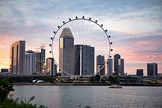
Singapore skyline at sunset viewed from Gardens by the Bay East - 20120426.jpg
Singapore Bishan Park.jpeg
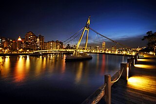
Reflections at Keppel Bay.JPG
Fusionopolis, One-North, Singapore (3321960431).jpg
Toa Payoh Town Centre 4, Aug 06.JPG
From top left to right: Skyline of the Downtown Core, Bishan-Ang Mo Kio Park, Reflections at Keppel Bay, Fusionopolis at One North, Toa Payoh Town Centre
Central Region locator map with label.png
Planning Areas in the Central Region, excluding PAs within the Central Area
Coordinates: 1°18′2″N103°49′18″E / 1.30056°N 103.82167°E / 1.30056; 103.82167
Country Flag of Singapore.svg  Singapore
Planning Areas
CDC
Regional centre Central Area ( de facto )
Largest PA Bukit Merah
Government
  MayorsCentral Singapore CDC

North West CDC

South East CDC

South West CDC

Area
[1]
  Total132.7 km2 (51.2 sq mi)
Population
 (2020) [1]
  Total922,580
  Density7,000/km2 (18,000/sq mi)

The Central Region is one of the five regions in the city-state of Singapore and the main metropolitan region surrounding the Central Area. Comprising 13,150 hectares of land area, [2] it includes 11 planning areas within the Central Area, as well as another 11 more outside it. The region is home to many of Singapore's national monuments as it was historically the site where the city was first founded and the country's only UNESCO World Heritage Site, the Singapore Botanic Gardens, a 164-year-old tropical garden is also located in the region.

Contents

Although the Central Area is by nature chiefly commercial, especially the area in the Downtown Core, it also includes 335,400 residential housing units [2] of various types, ranging from HDB flats to more exclusive forms of private housing, such as bungalows. There are also 1000 hectares of green spaces, including parks, gardens and other recreational spaces linked by 19 km of park connectors, which were built in order to make this area aesthetically pleasing.

History

Planning strategies

An ever-changing model at the URA Gallery. Model of central region.JPG
An ever-changing model at the URA Gallery.

Planning considerations for the URA Master Plan 2003 involving the Central Region took into consideration its existing strengths. Besides being the core area for business and entertainment in the city, it contains districts steeped in history, various housing types, and numerous institutions for education and community life. Despite the highly built-up character, it still boasts a rich variety of parks, open spaces, and other recreational areas. It is also well connected to the rest of the city through extensive road and rail connections, plus an international gateway to the world via the Maritime ports.

The Urban Redevelopment Authority envisaged the introduction of more homes of various types to the area, particularly in the Downtown Core which has been overwhelmingly commercial for the past decades. Supporting institutions and transport networks were upgraded or introduced to cater to the rising resident population in the area.

In terms of business, the New Downtown@Marina Bay was developed into an extension of the existing central business district. To encourage greater land-use flexibility, new business zones and white zones were also introduced. Business and research activities were promoted at the new one-north and medical park within the grounds of the Singapore General Hospital at Outram Park.

For recreation, plans were made to further extend the park connectors to new and existing parks in the region. New sporting facilities were also introduced, such as the redevelopment of the Kallang Sports Hub. Building conservation will continue to be enforced, and nodes for nidge activities will be provided for the masses. Plans for spaces catering specifically for youth activities near Orchard Road are a case in point.

Geography

With a land area of 132.7 km2 (51.2 sq mi), the Central Region is situated on the southern part of Singapore Island, constituting a total of 21 planning areas. It is the only region to border all the other regions and the Straits of Singapore to the south. The region is also home to the 3.2 kilometers long Singapore River, [3] from its source at Kim Seng Bridge to where it empties into Marina Bay. The region also features Singapore's natural tallest point - Bukit Timah Hill with a height of 163.63 metres (537 ft.) above ground level.

Planning Areas

Related Research Articles

<span class="mw-page-title-main">Woodlands, Singapore</span> Planning Area and Regional Centre in North Region, Singapore

Woodlands is a planning area and residential town located in the North of Singapore. As of 2019, the town has a population of 254,733. It is the densest planning area and is the regional centre for the North Region of the country.
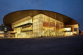
<span class="mw-page-title-main">Kallang</span> Planning Area and HDB Town in Central Region ----, Singapore

Kallang is a planning area and residential zone located in the Central Region of Singapore.

<span class="mw-page-title-main">Bukit Timah</span> Planning Area and HDB Estate in Central Region -----, Singapore

Bukit Timah, often abbreviated as Bt Timah, is a planning area and residential estate located in the westernmost part of the Central Region of Singapore. Bukit Timah lies roughly 10 kilometres (6.2 mi) from the Central Business District, bordering the Central Water Catchment to the north, Bukit Panjang to the northwest, Queenstown to the south, Tanglin to the southeast, Clementi to the southwest, Novena to the east and Bukit Batok to the west.

<span class="mw-page-title-main">Bukit Panjang</span> Planning Area and HDB Town in West Region, Singapore

Bukit Panjang is a planning area and residential town located in the West Region of Singapore. A portion of this town is situated on a low-lying elongated hill. The planning area is bounded by Bukit Batok to the west, Choa Chu Kang to the northwest, Sungei Kadut to the north, the Central Water Catchment to the east and Bukit Timah to the south. Bukit Panjang New Town is located at the northern portion of the planning area. Bukit Panjang has an average elevation of 36m/118 ft.

<span class="mw-page-title-main">Kallang River</span> Longest river in Singapore

The Kallang River is the longest river in Singapore, flowing for 10 kilometers. from the Lower Peirce Reservoir to the Kallang Basin. It originates in the planning area of Central Water Catchment, flows in a southeast direction through Bishan and Toa Payoh, before finally arriving in Kallang.

<span class="mw-page-title-main">Singapore River</span> River in Singapore

The Singapore River is a river that flows parallel to Alexandra Road and feeds into the Marina Reservoir in the southern part of Singapore. The immediate upper watershed of the Singapore River is known as the Singapore River Planning Area, although the western part of the watershed is classified under the River Valley planning area.

<span class="mw-page-title-main">Bukit Timah Nature Reserve</span> Nature reserve in Singapore

The Bukit Timah Nature Reserve is a 1.7-square-kilometre (0.66 sq mi) nature reserve near the geographic centre of Singapore, located on the slopes of Bukit Timah Hill, the country's highest natural peak standing at a height of approximately 165-metre (541 ft), and parts of the surrounding area. The nature reserve is about 15 kilometres from the Downtown Core, Singapore's central business district (CBD).

<span class="mw-page-title-main">Marina Bay, Singapore</span> Place in Singapore

Marina Bay is a bay located in the Central Area of Singapore, surrounded by the perimeter of four other planning areas, the Downtown Core, Marina East, Marina South and Straits View. The area surrounding the bay itself, also called Marina Bay, is a 360 hectare extension to the adjacent Central Business District. It is also the new downtown of Singapore, built on reclaimed land.

<span class="mw-page-title-main">Central Area, Singapore</span> City centre in Central Region, Singapore

The Central Area, also called the City Area, and informally The City, is the main commercial city centre of Singapore. Located in the south-eastern part of the Central Region, the Central Area consists of eleven constituent planning areas: the Downtown Core, Marina East, Marina South, the Museum Planning Area, Newton, Orchard, Outram, River Valley, Rochor, the Singapore River and Straits View, as defined by the Urban Redevelopment Authority. The term Central Business District (CBD) has also been used to describe most of the Central Area as well, although its boundaries lie within the Downtown Core.

<span class="mw-page-title-main">Downtown Core</span> Planning Area in Central Region, Singapore

The Downtown Core is the historical and downtown centre of the city-state of Singapore and the main commercial area in Singapore excluding reclaimed lands with many integrated resorts such as the Marina Bay Sands, one of the most expensive buildings in the world, with a luxurious standalone casino at Bayfront Avenue. There are many skyscrapers in Raffles Place, Tanjong Pagar and Marina Bay CBD with a height limit of 280m. It is one of the eleven planning areas located within the most urbanised Central Area, forming the latter's dense urban core. It is bounded by Rochor to the north, Kallang to the northeast, Marina East and Marina South to the east, Straits View to the southeast, Bukit Merah to the south, as well as Outram, Museum and Singapore River to the west.
<span class="mw-page-title-main">North Region, Singapore</span> Region in Singapore

The North Region of Singapore is one of the five regions in the city-state. The region is the second largest region in terms of land area, and has a population of 582,330. Woodlands is the regional centre and also the most populous town with 255,130 residents living in the area. Comprising 13,500 hectares of land area, it includes eight planning areas.
<span class="mw-page-title-main">Future developments in Singapore</span>

This article shows the notable future developments in Singapore. Majority of them are currently under construction with most to be completed within the next five years.

<span class="mw-page-title-main">Museum Planning Area</span> Planning Area in Central Region ----, Singapore

The Museum Planning Area is a planning area located in the Central Area of the Central Region of Singapore. The area plays a "bridging role" between the Orchard area and the Downtown Core, which necessitates proper transport networks for vehicles, pedestrians and public transport. Due to the sheer size of green areas in the district, the Urban Redevelopment Authority (URA) has designated it a 'green lung' in the Central Area. However, the Museum Planning Area is also home to cultural and commercial activities. Around 65% of the area is available for future development, making it a hotbed for new infrastructure and buildings.
<span class="mw-page-title-main">Farrer Park</span> Subzone of Rochor Planning Area in Singapore

Farrer Park is a subzone of the Rochor planning area in the Central Region of Singapore, bounded by Serangoon Road, Rangoon Road, Race Course Road, Northumberland Road, Tekka Lane and Bukit Timah Road.

<span class="mw-page-title-main">Rochor River</span> River in Singapore

The Rochor River is a canalised river in Kallang of the Central Region in Singapore. The river is about 0.8 km in length.

Teban Gardens is a residential precinct located in Jurong East, Singapore. Immediately north of Pandan Reservoir, it comprises exclusively public housing built by the JTC Corporation and Housing and Development Board.
<span class="mw-page-title-main">Marina East</span> Planning Area in Central ----, Singapore

Marina East is a planning area located in the Central Area of the Central Region of Singapore, covering 140 hectares of reclaimed land.

<span class="mw-page-title-main">Rochor</span> Planning area within the Central Region of Singapore

Rochor is a planning area located within the Central Area of the Central Region of Singapore. Rochor shares boundaries with the following planning areas – Kallang to the north and east, Newton to the west, as well as Museum and the Downtown Core to the south.

Yuhua is a subzone region located in the town of Jurong East, Singapore. Yuhua comprises two subzones, Yuhua East and Yuhua West. The area's HDB flats are under the management of Jurong-Clementi Town Council and the people of this precinct are represented in parliament by either Grace Fu or Rahayu Mahzam, depending on where they stay.

References

  1. 1 2 "Singapore: Regions & Major Planning Areas - Population Statistics, Maps, Charts, Weather and Web Information". www.citypopulation.de.
  2. 1 2 "Draft Master Plan 2008 - Central Region". Archived from the original on 2008-10-22. Retrieved 2008-05-25.
  3. Leary, Michael E.; McCarthy, John (2013-10-30). The Routledge Companion to Urban Regeneration. Routledge. p. 132. ISBN   9781136266546.