The Paya Lebar Air Base is a military airbase of the Republic of Singapore Air Force (RSAF) and United States Air Force in Singapore located at Airport Road in Paya Lebar, in the eastern region of Singapore. The airbase goes by the motto of Strength Through Readiness.

Geylang is a planning area and township located on the eastern fringe of the Central Region of Singapore, bordering Hougang and Toa Payoh in the north, Marine Parade in the south, Bedok in the east, and Kallang in the west.

Pasir Ris is a planning area and residential town located in the East Region of Singapore. It is bordered by Tampines and Paya Lebar to the south, Sengkang to the southwest and Changi to the east. The planning area also shares riverine boundary with Punggol to the west, separated by the Serangoon River, as well as having a maritime boundary with the North-Eastern Islands planning area, across the Straits of Johor.

Kallang is a planning area and residential zone located in the Central Region of Singapore.

Tampines is the regional centre of the East Region of Singapore. With a population of 265,340 living across its five subzones, it is the second-most populous planning area in Singapore, according to the DOS Population Trends 2022. It is home to approximately 5% of Singapore's population. Tampines is bordered to the west by Bedok and Paya Lebar, to the north by Pasir Ris, to the east by Changi, and to the south by the Straits of Singapore. Situated in the historical region of Tanah Merah, its present-day terrain is particularly flat due to the large-scale sand quarrying in the 1960s.

Serangoon is a planning area and residential town located in the North-East Region of Singapore.

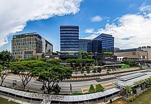
Paya Lebar MRT station is a Mass Rapid Transit (MRT) interchange station on the East West line (EWL) and Circle line (CCL) in Geylang, Singapore. Despite the name, this station is not located in Paya Lebar but rather along Paya Lebar Road, near the junction with Sims Avenue. It is located among the developments of the Paya Lebar Central commercial hub and near the Geylang Serai district.
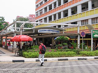
Hougang, or Aukang, is a planning area and mature residential town located in the North-East Region of Singapore. The town is the most populous in the region, being home to 247,528 residents as of 2018. Hougang planning area is bordered by Sengkang to the north, Geylang and Serangoon to the south, Bedok to the southeast, Toa Payoh to the southwest, Paya Lebar to the east, Ang Mo Kio to the west and Bishan to the southwest.

Bedok is a planning area and residential town located in the geographical region of Tanah Merah along the south-eastern coast of the East Region of Singapore. Bedok is bounded by five other planning areas: Paya Lebar to the north, Hougang to the northwest, Tampines to the northeast and east, Geylang to the west and Marine Parade to the southwest. It also shares a maritime boundary with the Singapore Strait to the south and southeast.

The Kallang–Paya Lebar Expressway (KPE) is the third newest of Singapore's network of expressways. The southern (Kallang) section of the expressway opened first, on 26 October 2007, with the remaining section opened on 20 September 2008.
The Pan Island Expressway is the oldest and longest expressway in Singapore. It is also Singapore's longest road. The expressway runs from the East Coast Parkway near Changi Airport in the east to Tuas in the west and has a total length of 42.8 kilometres (26.6 mi).

Jalan Besar Group Representation Constituency is a four-member Group Representation Constituency composed of several city suburbs along with the Central Area of Singapore. The Jalan Besar GRC is the electoral division representing the largest area of the downtown city centre of Singapore, followed by Tanjong Pagar GRC. There are four wards in the GRC: Kreta Ayer-Kim Seng, Kolam Ayer, Whampoa and lastly Kampong Glam. The current Members of Parliament are Denise Phua, Wan Rizal Wan Zakariah, Josephine Teo and Heng Chee How from the People's Action Party (PAP).

Kallang Airport was the first purpose-built civil international airport in Singapore, opened officially on 12 June 1937 and ceased operations in 1955, when it was relocated to Paya Lebar. Situated on the eastern shore of the Kallang Basin, the Kallang Airport spanned the modern planning areas of Kallang and Geylang at its greatest extent. The conserved complex, including the airport's terminal building, is located wholly within Kallang.

Sengkang is a planning area and residential town located in the North-East Region of Singapore. The town is the second most populous in the region, being home to 249,370 residents in 2020. Sengkang shares boundaries with Seletar and Punggol in the north, Pasir Ris and Paya Lebar in the east, Hougang and Serangoon to the south, as well as Yishun and Ang Mo Kio to the west.

The East Region of Singapore is one of the five regions in the city-state. The region is the 2nd most densely populated among the five, and has the smallest land area. Bedok is the region's most populous town and Tampines is the regional centre of the area. Comprising 11,000 hectares, it includes six planning areas and is also home to Singapore's Changi Airport and Paya Lebar Airbase

The Aljunied Group Representation Constituency is a five-member group representation constituency (GRC) in the north-eastern and eastern region of Singapore. It consists of a large part of Hougang, Paya Lebar, Serangoon Gardens, the southern half of Serangoon North as well as a portion of Bedok and a very small section of Tampines. The GRC consists of five divisions: Eunos, Bedok Reservoir-Punggol, Kaki Bukit, Serangoon and Paya Lebar. The current members of parliament are Gerald Giam, Pritam Singh, Muhamad Faisal Manap and Sylvia Lim from the Worker's Party (WP).

The North-East Region of Singapore is one of the five regions in the country. The region is the most densely populated and has the highest population among the five, with Sengkang being its most populous town as of 2020 and Seletar as the regional centre. Comprising 13,810 hectares, it includes seven planning areas and is largely a residential region with 217,120 homes. Housing largely consists of high-density HDB public housing estates, however private housing is also present in the region. As its name implies, it is located in the north-eastern part of Singapore.
Cynthia Phua Siok Gek is a Singaporean business executive and former politician. She was a Member of Parliament of Aljunied GRC for the Paya Lebar Ward from 25 October 2001 to 19 April 2011.
Bartley Road is a major road in Singapore extending from Upper Serangoon Road to Tampines Avenue 10. The road has a distance span of 5.8km. En route, it passes through the areas of Serangoon, Bartley, Paya Lebar, Defu, Kaki Bukit and Bedok Reservoir.

Kampong Bugis is a subzone within the planning area of Kallang, Singapore, as defined by the Urban Redevelopment Authority (URA). This subzone is bounded by Kallang Road and Sims Avenue in the north; the Kallang–Paya Lebar Expressway (KPE) and Sims Way in the east; Nicoll Highway in the south; and Crawford Street in the west.