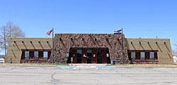
Strasburg is an unincorporated town located just 30 minutes east of downtown Denver along the I-70 corridor. It is home to Strasburg School District 31-J, and there are several small businesses, medical clinics, and a post office. Strasburg is a census-designated place (CDP) located in and governed by Adams and Arapahoe counties, Colorado, United States. The CDP is a part of the Denver–Aurora–Lakewood, CO Metropolitan Statistical Area. The Strasburg post office has the ZIP Code 80136. At the United States Census 2020, the population of the Strasburg CDP was 3,307.
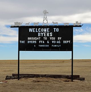
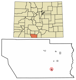
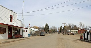
Byers is an unincorporated town, a post office, and a census-designated place (CDP) located in and governed by Arapahoe County, Colorado, United States. The CDP is a part of the Denver–Aurora–Lakewood, CO Metropolitan Statistical Area. The Byers post office has the ZIP Code 80103. At the United States Census 2020, the population of the Byers CDP was 1,322.
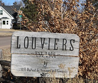
Louviers is an unincorporated town, a post office, and a census-designated place (CDP) located in and governed by Douglas County, Colorado, United States. The CDP is a part of the Denver–Aurora–Lakewood, CO Metropolitan Statistical Area. The Louviers post office has the ZIP Code 80131. At the United States Census 2020, the population of the Louviers CDP was 293.

Sedalia is an unincorporated town, a post office, and a census-designated place (CDP) located in and governed by Douglas County, Colorado, United States. The CDP is a part of the Denver–Aurora–Lakewood, CO Metropolitan Statistical Area. The Sedalia post office has the ZIP Code 80135. At the United States Census 2020, the population of the Sedalia CDP was 177.

Edwards is an unincorporated town, a post office, and a census-designated place (CDP) located in and governed by Eagle County, Colorado, United States. Edwards is the principal town of the Edwards, CO Micropolitan Statistical Area. The Edwards post office has the ZIP Code 81632. At the United States Census 2020, the population of the Edwards CDP was 11,246. The Edwards Metropolitan District provides services.

Kittredge is an unincorporated town, a post office, and a census-designated place (CDP) located in and governed by Jefferson County, Colorado, United States. The CDP is a part of the Denver–Aurora–Lakewood, CO Metropolitan Statistical Area. The Kittredge post office has the ZIP code 80457. At the United States Census 2020, the population of the Kittredge CDP was 1,308.

Padroni is an unincorporated town, a census-designated place (CDP), and a post office located in and governed by Logan County, Colorado, United States. The CDP is a part of the Sterling, CO Micropolitan Statistical Area. The Padroni post office has the ZIP Code 80745. At the United States Census 2020, the population of the Padroni CDP was 75.

Clifton is a census-designated place (CDP) and post office in and governed by Mesa County, Colorado, United States. It is part of the Grand Junction, CO Metropolitan Statistical Area. The Clifton post office has the ZIP Code 81520. As of the 2020 census, the population of the Clifton CDP was 20,413.

Watkins is an unincorporated town and a census-designated place (CDP) located in and governed by Arapahoe and Adams counties, Colorado, United States. The CDP is a part of the Denver–Aurora–Lakewood, CO Metropolitan Statistical Area. The town is surrounded by Aurora and its post office, which lies within the Aurora city limits, has the ZIP Code 80137. At the United States Census 2020, the population of the Watkins CDP was 682.

Capulin is an unincorporated town, a post office, and a census-designated place (CDP) located in and governed by Conejos County, Colorado, United States. The Capulin post office has the ZIP Code 81124. At the United States Census 2020, the population of the Capulin CDP was 134.

Cope is an unincorporated town, a post office, and a census-designated place (CDP) located in and governed by Washington County, Colorado, United States. The population was 53 at the 2020 census. The Cope post office has the ZIP Code 80812.
Lazear is an unincorporated town, a census-designated place (CDP), and a post office located in and governed by Delta County, Colorado, United States. The Lazear post office has the ZIP Code 81420. The population was 168 at the 2020 census.
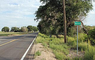
McClave is an unincorporated community in Bent County, Colorado, United States. The population was 725 at the 2020 census.

McCoy is an unincorporated town, a census-designated place (CDP), and a post office located in and governed by Eagle County, Colorado, United States. The CDP is a part of the Edwards, CO Micropolitan Statistical Area. The McCoy post office has the ZIP Code 80463. At the United States Census 2020, the population of the McCoy CDP was 30.

Vernon is an unincorporated town, a post office, and a census-designated place (CDP) located in and governed by Yuma County, Colorado, United States. The Vernon post office has the ZIP Code 80755. At the United States Census 2020, the population of the Vernon CDP was 38.

Weldona is an unincorporated town, a post office, and a census-designated place (CDP) located in and governed by Morgan County, Colorado, United States. The CDP is a part of the Fort Morgan, CO Micropolitan Statistical Area. The Weldona post office has the ZIP Code 80653. At the United States Census 2020, the population of the Weldona CDP was 113.

Weston is an unincorporated town, a post office, and a census-designated place (CDP) located in and governed by Las Animas County, Colorado, United States. The Weston post office has the ZIP Code 81091. At the United States Census 2020, the population of the Weston CDP was 53.

Wolcott is an unincorporated town, a post office, and a census-designated place (CDP) located in and governed by Eagle County, Colorado, United States. The CDP is a part of the Edwards, CO Micropolitan Statistical Area. The Wolcott post office has the ZIP Code 81655. At the United States Census 2020, the population of the Wolcott CDP was 20.

Laird is an unincorporated community and a census-designated place (CDP) located in and governed by Yuma County, Colorado, United States. The population of the Laird CDP was 46 at the United States Census 2020. The Wray post office (Zip Code 80758) serves Laird postal addresses. Laird has the lowest elevation of any community in Colorado at 3,402 feet (1,037 m).

San Acacio is an unincorporated community and a census-designated place (CDP) located in and governed by Costilla County, Colorado, United States. The population of the San Acacio CDP was 56 at the 2020 United States census. The Sanford post office serves San Acacio postal addresses.