Westcliffe, Colorado

Last updated

Westcliffe, Colorado
Hornpeak.JPG
Horn Peak of the Sangre de Cristo Range viewed from Westcliffe
Custer County Colorado Incorporated and Unincorporated areas Westcliffe Highlighted 0883450.svg
Location of Westcliffe in Custer County, Colorado.
Coordinates: 38°7′58″N105°27′57″W / 38.13278°N 105.46583°W / 38.13278; -105.46583
Country Flag of the United States.svg  United States
State Flag of Colorado.svg  State of Colorado
County [1] Custer County - seat [2]
Incorporated November 21, 1887 [3]
Government
  Type Statutory Town [1]
   Mayor Paul Wenke
Area
[4]
  Total1.24 sq mi (3.20 km2)
  Land1.24 sq mi (3.20 km2)
  Water0.00 sq mi (0.00 km2)
Elevation
[5]
7,867 ft (2,398 m)
Population
 (2020) [6]
  Total435
  Density350/sq mi (140/km2)
Time zone UTC-7 (Mountain (MST))
  Summer (DST) UTC-6 (MDT)
ZIP code [7]
81252
Area code 719
FIPS code 08-83450
GNIS feature ID 0192151
Website townofwestcliffe.com

Westcliffe is a statutory town that is the county seat of Custer County, Colorado, United States. [8] [2] At the 2020 U.S. Census, the population was 435. [6]

Contents

History

Westcliffe had its start in 1881 when the Denver and Rio Grande Western Railroad was extended to that point. [9] In 1976, Sangre de Cristo Seminary was founded near Westcliffe, where it still operates.

The restored D&RGW depot in August of 2022 D&RGW Train Depot In Westcliffe, Colorado.jpg
The restored D&RGW depot in August of 2022

Geography

Westcliffe is located west of the geographic center of Custer County at 38°7′58″N105°27′57″W / 38.13278°N 105.46583°W / 38.13278; -105.46583 (38.132874, -105.465920). [10] It lies in the Wet Mountain Valley, between the Wet Mountains to the east and the Sangre de Cristo Range to the west. The town of Silver Cliff is immediately to the east of Westcliffe.

According to the United States Census Bureau, the town has a total area of 1.2 square miles (3.2 km2), all of it land. [11]

Shopping lane in downtown Westcliffe Westcliffe CO Main Street 2006 09 01.jpg
Shopping lane in downtown Westcliffe

Climate

Climate data for Westcliffe, Colorado, 1991–2020 normals, extremes 1895present
MonthJanFebMarAprMayJunJulAugSepOctNovDecYear
Record high °F (°C)65
(18)
69
(21)
74
(23)
78
(26)
88
(31)
95
(35)
96
(36)
94
(34)
90
(32)
82
(28)
79
(26)
72
(22)
96
(36)
Mean maximum °F (°C)55.3
(12.9)
56.5
(13.6)
64.6
(18.1)
70.4
(21.3)
78.4
(25.8)
86.3
(30.2)
88.1
(31.2)
85.1
(29.5)
81.4
(27.4)
74.9
(23.8)
64.4
(18.0)
56.2
(13.4)
88.9
(31.6)
Mean daily maximum °F (°C)39.6
(4.2)
41.7
(5.4)
49.6
(9.8)
56.4
(13.6)
65.8
(18.8)
76.9
(24.9)
80.6
(27.0)
78.0
(25.6)
72.4
(22.4)
61.3
(16.3)
48.9
(9.4)
39.8
(4.3)
59.2
(15.1)
Daily mean °F (°C)23.9
(−4.5)
26.9
(−2.8)
34.6
(1.4)
41.0
(5.0)
49.5
(9.7)
58.7
(14.8)
62.8
(17.1)
61.1
(16.2)
54.7
(12.6)
43.7
(6.5)
32.8
(0.4)
23.9
(−4.5)
42.8
(6.0)
Mean daily minimum °F (°C)8.3
(−13.2)
12.1
(−11.1)
19.6
(−6.9)
25.7
(−3.5)
33.3
(0.7)
40.6
(4.8)
44.9
(7.2)
44.1
(6.7)
37.0
(2.8)
26.1
(−3.3)
16.7
(−8.5)
8.0
(−13.3)
26.4
(−3.1)
Mean minimum °F (°C)−13.7
(−25.4)
−12.6
(−24.8)
−3.1
(−19.5)
5.2
(−14.9)
19.8
(−6.8)
30.3
(−0.9)
37.9
(3.3)
35.8
(2.1)
23.9
(−4.5)
5.6
(−14.7)
−7.6
(−22.0)
−15.9
(−26.6)
−19.8
(−28.8)
Record low °F (°C)−41
(−41)
−46
(−43)
−31
(−35)
−25
(−32)
−2
(−19)
17
(−8)
25
(−4)
20
(−7)
4
(−16)
−12
(−24)
−29
(−34)
−39
(−39)
−46
(−43)
Average precipitation inches (mm)0.48
(12)
0.58
(15)
1.06
(27)
1.56
(40)
1.41
(36)
0.79
(20)
2.66
(68)
1.98
(50)
0.90
(23)
0.95
(24)
0.69
(18)
0.53
(13)
13.59
(346)
Average snowfall inches (cm)8.4
(21)
10.4
(26)
15.0
(38)
19.6
(50)
4.3
(11)
0.0
(0.0)
0.0
(0.0)
0.0
(0.0)
0.9
(2.3)
8.4
(21)
8.5
(22)
8.8
(22)
84.3
(213.3)
Average precipitation days (≥ 0.01 in)3.74.76.66.86.95.811.611.65.95.14.14.377.1
Average snowy days (≥ 0.1 in)3.74.65.74.41.20.00.00.00.31.83.44.129.2
Source 1: NOAA [12]
Source 2: National Weather Service [13]

Dark skies

Westcliffe, and neighboring Silver Cliff, Colorado, are recognized as IDA International Dark Sky Communities by The International Dark-Sky Association. Gentle persuasion has resulted in residents and business in the towns and surrounding ranch land reducing the amount of light pollution. [14]

Locals have set up a free observatory in an old period building with a "roll-off" roof to open up the 14-inch Schmidt-Cassegrain telescope with computer-guided pointing and tracking to the skies overhead. Named the Smokey Jack Observatory, it was built in 2015. [15] [16]

Demographics

Historical population
CensusPop.Note
1890 192
1900 25633.3%
1910 232−9.4%
1920 33845.7%
1930 335−0.9%
1940 42928.1%
1950 390−9.1%
1960 306−21.5%
1970 243−20.6%
1980 32433.3%
1990 312−3.7%
2000 41733.7%
2010 56836.2%
2020 435−23.4%

Notable people

See also

Related Research Articles

<span class="mw-page-title-main">Saguache County, Colorado</span> County in Colorado, United States

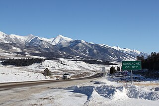
Saguache County is a county located in the U.S. state of Colorado. As of the 2020 census, the population was 6,368. The county seat is Saguache.

<span class="mw-page-title-main">Huerfano County, Colorado</span> County in Colorado, United States

Huerfano County is a county located in the U.S. state of Colorado. As of the 2020 census, the population was 6,820. The county seat is Walsenburg. The county, whose name comes from the Spanish huérfano meaning "orphan", was named for the Huerfano Butte, a local landmark. The area of Huerfano County boomed early in the 1900s with the discovery of large coal deposits. After large scale World War II coal demand ended in the 1940s Walsenburg and Huerfano saw a steady economic decline through 2015.

<span class="mw-page-title-main">Fremont County, Colorado</span> County in Colorado, United States

Fremont County is a county located in the U.S. state of Colorado. As of the 2020 census, the population was 48,939. The county seat is Cañon City. The county is named for 19th-century explorer and presidential candidate John C. Frémont.

<span class="mw-page-title-main">Custer County, Colorado</span> County in Colorado, United States

Custer County is a county located in the U.S. state of Colorado. As of the 2020 census, the population was 4,704. The county seat is Westcliffe.

<span class="mw-page-title-main">Silver Cliff, Colorado</span> Town in Custer County, Colorado, United States

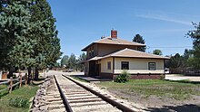
The Town of Silver Cliff is the Statutory Town that is the most populous municipality in Custer County, Colorado, United States. The population was 609 at the 2020 census, up from 587 in 2010.

<span class="mw-page-title-main">Norwood, Colorado</span> Town in San Miguel County, Colorado, United States

Norwood is a Statutory Town in San Miguel County, Colorado, United States. The population was 535 at the 2020 census.

<span class="mw-page-title-main">Wet Mountain Valley</span>

The Wet Mountain Valley is a high elevation mountain valley mostly located in Custer County but extending southward into Huerfano County in south-central Colorado. Westcliffe and Silver Cliff are the two towns in the valley which is mostly devoted to cattle ranching.

<span class="mw-page-title-main">Blanca Peak</span> Mountain in Colorado, United States

Blanca Peak is the fourth highest summit of the Rocky Mountains of North America and the U.S. state of Colorado. The ultra-prominent 14,351-foot (4,374 m) peak is the highest summit of the Sierra Blanca Massif, the Sangre de Cristo Range, and the Sangre de Cristo Mountains. The fourteener is located 9.6 miles (15.5 km) north by east of the Town of Blanca, on the drainage divide separating Rio Grande National Forest and Alamosa County from the Sangre de Cristo Land Grant and Costilla County. The summit is the highest point of both counties and the entire drainage basin of the Rio Grande. Below the steep North Face of Blanca Peak two live Glaciers once developed, until extinction sometime after 1903. North & South Blanca Glaciers were located at 37° 35N.,longitude 105° 28W. Blanca Peak is higher than any point in the United States east of its longitude.

<span class="mw-page-title-main">Humboldt Peak (Colorado)</span> Mountain in the state of Colorado

Humboldt Peak is a high mountain summit of the Crestones in the Sangre de Cristo Range of the Rocky Mountains of North America. The 14,070-foot (4,289 m) fourteener is located in the Sangre de Cristo Wilderness of San Isabel National Forest, 11.9 miles (19.2 km) south-southwest of the Town of Westcliffe in Custer County, Colorado, United States.

<span class="mw-page-title-main">Wet Mountains</span> Mountain range in southern Colorado, United States

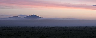
The Wet Mountains are a small mountain range in southern Colorado, named for the amount of snow they receive in the winter as compared to the dry Great Plains to the east. They are a sub-range of the Sangre de Cristo Mountains, in the southern Rocky Mountains System. There are three variant names of mountain range: Cuerno Verde, Greenhorn Mountains, and Sierra Mojada.

Rosita was a silver mining town — now a ghost town — in Custer County, Colorado, United States. Rosita is Spanish for little rose. Although the old town has almost entirely disappeared, the surrounding area has been largely developed into semi-rural home sites.

Custer County High School is a public high school located in Westcliffe, Colorado, United States.

<span class="mw-page-title-main">Grape Creek (Colorado)</span> Stream in south-central Colorado, US

Grape Creek is a tributary of the Arkansas River that flows through Custer and Fremont counties in South-Central Colorado. The creek drains much of the Wet Mountain Valley, located between the Sangre de Cristo Mountains and the Wet Mountains in Custer County.

The Frontier Pathways is a 103-mile (166 km) National Scenic Byway and Colorado Scenic and Historic Byway located in Custer and Pueblo counties, Colorado, US.

<span class="mw-page-title-main">Horn Peak</span> Mountain in the state of Colorado

Horn Peak is a 13,450-foot (4,100 m) mountain summit in Custer County, Colorado, United States.

<span class="mw-page-title-main">Spread Eagle Peak</span> Mountain in the state of Colorado

Spread Eagle Peak is a 13,423-foot (4,091 m) mountain summit in Custer County, Colorado, United States.

<span class="mw-page-title-main">Eureka Mountain (Colorado)</span> Mountain in the state of Colorado

Eureka Mountain is a 13,507-foot (4,117 m) mountain summit on the boundary shared by Custer and Saguache counties, in Colorado, United States.

<span class="mw-page-title-main">Electric Peak (Sangre de Cristo)</span> Mountain in the state of Colorado

Electric Peak is a 13,598-foot (4,145 m) mountain summit on the boundary shared by Custer and Saguache counties, in Colorado, United States.

References

  1. 1 2 "Active Colorado Municipalities". State of Colorado, Department of Local Affairs. Archived from the original on December 12, 2009. Retrieved September 1, 2007.
  2. 1 2 "Colorado County Seats". State of Colorado, Department of Public Health and Environment. Retrieved December 31, 2007.
  3. "Colorado Municipal Incorporations". State of Colorado, Department of Personnel & Administration, Colorado State Archives. December 1, 2004. Retrieved September 2, 2007.
  4. "2019 U.S. Gazetteer Files". United States Census Bureau. Retrieved July 1, 2020.
  5. "US Board on Geographic Names". United States Geological Survey. October 25, 2007. Retrieved January 31, 2008.
  6. 1 2 United States Census Bureau. "Westcliffe town, Colorado" . Retrieved March 31, 2023.
  7. "ZIP Code Lookup". United States Postal Service. Archived from the original (JavaScript/HTML) on November 22, 2010. Retrieved January 8, 2008.
  8. "Find a County". National Association of Counties. Retrieved June 7, 2011.
  9. Fielder, John (2002). "John Fielder's Best of Colorado". Big Earth Publishing. p. 297. Retrieved November 4, 2013.
  10. "US Gazetteer files: 2010, 2000, and 1990". United States Census Bureau. February 12, 2011. Retrieved April 23, 2011.
  11. "Geographic Identifiers: 2010 Demographic Profile Data (G001): Westcliffe town, Colorado". U.S. Census Bureau, American Factfinder. Archived from the original on February 12, 2020. Retrieved June 24, 2014.
  12. "U.S. Climate Normals Quick Access – Station: Westcliffe, CO". National Oceanic and Atmospheric Administration. Retrieved March 8, 2023.
  13. "NOAA Online Weather Data – NWS Pueblo". National Weather Service. Retrieved March 8, 2023.
  14. Jack Healy (August 12, 2016). "Colorado Towns Work to Preserve a Diminishing Resource: Darkness". The New York Times . Retrieved August 13, 2016.
  15. "WATCH: Visit a dark sky observatory for free stargazing in southern Colorado". July 18, 2019. Retrieved August 26, 2019.
  16. Smokey Jack Observatory, Dark skies of the Wet Mountain Valley, www.darkskiescolorado.org, accessed 21 July 2019.
  17. "Stage and screen star Anne Kimbell Relph dies". Wet Mountain Tribune. June 1, 2017. Retrieved June 11, 2017.