Elgin, Arizona

Last updated

Elgin, Arizona
Elgin Arizona 2016.jpg
View across Babocomari Creek toward the site of the railroad depot.
Santa Cruz County Incorporated and Unincorporated areas Elgin highlighted.svg
Location in Santa Cruz County and the state of Arizona
Usa edcp location map.svg
Red pog.svg
Elgin
Location in the United States
USA Arizona location map.svg
Red pog.svg
Elgin
Elgin (Arizona)
Coordinates: 31°37′45″N110°34′19″W / 31.62917°N 110.57194°W / 31.62917; -110.57194
Country United States
State Arizona
County Santa Cruz
Area
[1]
  Total5.95 sq mi (15.41 km2)
  Land5.95 sq mi (15.40 km2)
  Water0.00 sq mi (0.00 km2)
Elevation
[2]
4,728 ft (1,441 m)
Population
 (2020)
  Total162
  Density27.24/sq mi (10.52/km2)
Time zone UTC-7 (MST (no DST))
ZIP code
85611
Area code 520
FIPS code 04-22150
GNIS feature ID28852 [2]

Elgin is a census-designated place (CDP) in Santa Cruz County, Arizona, United States. The population was 161 at the 2010 census. [3]

Contents

Geography

Elgin is located along the Babocomari River at 31°37′45″N110°34′19″W / 31.62917°N 110.57194°W / 31.62917; -110.57194 (31.629095, -110.571951). [4] The Babocomari is known to harbor a unique species of fish, belonging to the family Characidae. They are incredibly rare and little is known about them. According to the United States Census Bureau, the CDP has a total area of 5.9 square miles (15.4 km2), all land. [3]

Climate

According to the Köppen Climate Classification system, Elgin has a semi-arid climate, abbreviated "BSk" on climate maps. [5]

Demographics

Historical population
CensusPop.Note
2020 162
U.S. Decennial Census [6]

As of the census [7] of 2000, there were 309 people, 123 households, and 86 families residing in the CDP. The population density was 6.4 inhabitants per square mile (2.5/km2). There were 153 housing units at an average density of 3.2 per square mile (1.2/km2). The racial makeup of the CDP was 92% White, 3% Native American, 3% from other races, and 2% from two or more races. 14% of the population were Hispanic or Latino of any race.

There were 123 households, out of which 29% had children under the age of 18 living with them, 64% were married couples living together, 4% had a female householder with no husband present, and 29% were non-families. 24% of all households were made up of individuals, and 3% had someone living alone who was 65 years of age or older. The average household size was 2.5 and the average family size was 3.0.

In the CDP, the population was spread out, with 27% under the age of 18, 4% from 18 to 24, 25% from 25 to 44, 32% from 45 to 64, and 13% who were 65 years of age or older. The median age was 43 years. For every 100 females, there were 116 males. For every 100 females age 18 and over, there were 100 males.

The median income for a household in the CDP was $64,167, and the median income for a family was $66,250. Males had a median income of $38,500 versus $21,250 for females. The per capita income for the CDP was $27,909. About 10% of families and 13% of the population were below the poverty line, including 21% of those under the age of eighteen and 7% of those 65 or over.

Film

The train station sequence in the 1955 film classic Oklahoma! , with Gene Nelson singing and dancing the song "Kansas City" partly atop a moving train, was filmed in Elgin, and the railroad scenes in the 1957 western 3:10 to Yuma , with Glenn Ford and Van Heflin, were filmed in Elgin. The 1948 film “Red River” starring John Wayne and Montgomery Clift used Elgin as the site of most of the exterior shots of the cattle drive. The opening scene of the 1965 movie, “The Sons of Katie Elder,” which also starred John Wayne, used the same train station and a few of the same camera angles as the Oklahoma film

Winemaking

Elgin is the first location in Arizona to engage in commercial scale winemaking. In the 1970s, Gordon Dutt, Ph.D., a soil scientist from the University of Arizona, was intrigued with the similarity between the soil of the Elgin-Sonoita area and that of Burgundy, France. In partnership with A. Blake Brophy, he developed an experimental winery that later developed into the Sonoita Vineyards and that encouraged other vineyards in the area. Presently, growers in the area produce Chardonnay, Sauvignon Blanc, Cabernet Sauvignon, Merlot, Pinot Noir, Mission, and Syrah grapes. In 2009 there were nine vineyards in the region, producing about 50,000 gallons of wine yearly. [8]

Elgin hosts several wine festivals throughout the year, most notably the St. Martin's Day festival and the Fall festival.

The expansion of winemaking in the Elgin-Sonoita area has led to establishment of fine restaurants and bed and breakfasts and has regenerated the economy of this lightly populated, rural area. [9]

Related Research Articles

<span class="mw-page-title-main">Santa Cruz County, Arizona</span> County in Arizona, United States

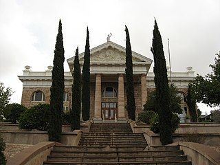
Santa Cruz is a county in southern Arizona, United States. As of the 2020 census, the population is 47,669. The county seat is Nogales. The county was established in 1899. It borders Pima County to the north and west, Cochise County to the east, and the Mexican state of Sonora to the south.

<span class="mw-page-title-main">Lukachukai, Arizona</span> CDP in Apache County, Arizona

Lukachukai is a census-designated place (CDP) in Apache County, Arizona, United States. The population was 1,701 at the 2010 census. It is within the Navajo Nation.

<span class="mw-page-title-main">Sierra Vista Southeast, Arizona</span> CDP in Cochise County, Arizona

Sierra Vista Southeast, often referred to as Hereford or Nicksville, is a census-designated place (CDP) in Cochise County, Arizona, United States. The population was 14,797 at the 2010 census. It includes the neighborhoods Ramsey Canyon, and Sierra Vista Estates within its boundaries.

<span class="mw-page-title-main">Kachina Village, Arizona</span> CDP in Coconino County, Arizona

Kachina Village is a census-designated place (CDP) in Coconino County, Arizona, United States. The population was 2,622 at the 2010 census. Kachina Village is primarily a bedroom community for Flagstaff.

<span class="mw-page-title-main">Mountainaire, Arizona</span> CDP in Coconino County, Arizona

Mountainaire is a census-designated place (CDP) in Coconino County, Arizona, United States. The population was 1,119 at the 2010 census.

<span class="mw-page-title-main">Tonalea, Arizona</span> CDP in Coconino County, Arizona

Tonalea is a census-designated place (CDP) in Coconino County, Arizona, United States. The population was 549 at the 2010 census. It has also been known as Red Lake.

<span class="mw-page-title-main">Winslow West, Arizona</span> CDP in Coconino County, Arizona

Winslow West is a census-designated place (CDP) in Coconino and Navajo counties in Arizona, United States. The population was 438 at the 2010 census. The entire community is off-reservation trust land belonging to the Hopi Tribe of Arizona. It lies just west of the city of Winslow, and is more than 50 km (31 mi) south of the main Hopi Reservation.

<span class="mw-page-title-main">Canyon Day, Arizona</span> CDP in Gila County, Arizona

Canyon Day is a census-designated place (CDP) in Gila County, Arizona, United States, on the Fort Apache Indian Reservation. The population was 1,209 at the 2010 census.

<span class="mw-page-title-main">Claypool, Arizona</span> CDP in Gila County, Arizona

Claypool is a census-designated place (CDP) in Gila County, Arizona, United States. The population was 1,538 at the 2010 census, down from 1,794 at the 2000 census. It was named after W. D. Claypool, a member of both the State House of Representatives and State Senate in the 1910s and 1920s.

<span class="mw-page-title-main">San Carlos, Arizona</span> CDP in Gila County, Arizona

San Carlos is a census-designated place (CDP) in Gila County, Arizona, United States. The population was 4,038 at the 2010 census, up from 3,716 in 2000.

<span class="mw-page-title-main">Cibecue, Arizona</span> Fort Apache Indian Reservation community

Cibecue is a census-designated place (CDP) in Navajo County, Arizona, United States, on the Fort Apache Indian Reservation. The population was 1,713 in the 2010 United States Census.

<span class="mw-page-title-main">Jeddito, Arizona</span> CDP in Navajo County, Arizona

Jeddito is a census-designated place (CDP) in Navajo County, Arizona, United States. The population was 293 at the 2010 census.

<span class="mw-page-title-main">Pinon, Arizona</span> Place in Arizona, United States

Pinon is a census-designated place (CDP) in Navajo County, Arizona, United States, and located in the Navajo Nation. The population was 904 at the 2010 census.

<span class="mw-page-title-main">Second Mesa, Arizona</span> CDP in Navajo County, Arizona

Second Mesa is a census-designated place (CDP) in Navajo County, Arizona, on the Hopi Reservation, atop the 5,700-foot mesa. As of the 2020 census, the CDP population was 843, spread among three Hopi Indian villages, Musungnuvi, Supawlavi, and Songoopavi. The Hopi Cultural Center is on Second Mesa.

<span class="mw-page-title-main">Drexel-Alvernon, Arizona</span> CDP in Pima County, Arizona

Drexel-Alvernon was a census-designated place (CDP) in Pima County, Arizona, United States. The population was 4,192 at the 2000 census.

<span class="mw-page-title-main">Sonoita, Arizona</span> CDP in Santa Cruz County, Arizona

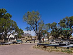
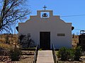
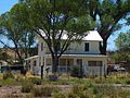
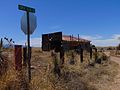
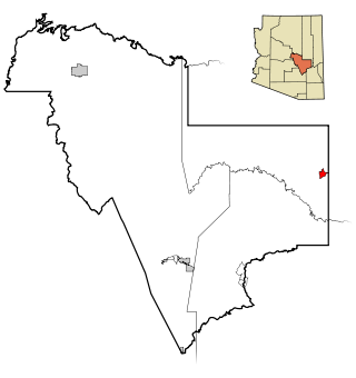
Sonoita is a census-designated place (CDP) in Santa Cruz County, Arizona, United States. The population was 803 at the 2020 census.

<span class="mw-page-title-main">Glen Ellen, California</span> Census designated place in California, United States

Glen Ellen is a census-designated place (CDP) in Sonoma Valley, Sonoma County, California, United States. The population was 784 at the 2010 census, down from 992 at the 2000 census. Glen Ellen is the location of Jack London State Historic Park, Sonoma Valley Regional Park, and a former home of Hunter S. Thompson.

<span class="mw-page-title-main">Aquebogue, New York</span> Hamlet and census-designated place in New York, United States

Aquebogue is a census-designated place (CDP) roughly corresponding to the hamlet by the same name in the Town of Riverhead in Suffolk County, on Long Island, in New York, United States. The CDP's population was 2,438 at the 2010 census.

<span class="mw-page-title-main">Crab Orchard, West Virginia</span> Census-designated place in West Virginia, United States

Crab Orchard is a census-designated place (CDP) in Raleigh County, West Virginia, United States. The population was 2,678 at the 2010 census.

<span class="mw-page-title-main">Oljato-Monument Valley, Arizona</span> CDP in Navajo County, Arizona

Oljato-Monument Valley is a census-designated place (CDP) in Navajo County, Arizona, United States. The population was 154 at the 2010 census.

References

  1. "2020 U.S. Gazetteer Files". United States Census Bureau. Retrieved October 29, 2021.
  2. 1 2 U.S. Geological Survey Geographic Names Information System: Elgin, Arizona
  3. 1 2 "Geographic Identifiers: 2010 Demographic Profile Data (G001): Elgin CDP, Arizona". U.S. Census Bureau, American Factfinder. Archived from the original on February 12, 2020. Retrieved December 4, 2012.
  4. "US Gazetteer files: 2010, 2000, and 1990". United States Census Bureau. February 12, 2011. Retrieved April 23, 2011.
  5. Climate Summary for Elgin, Arizona
  6. "Census of Population and Housing". Census.gov. Retrieved June 4, 2016.
  7. "U.S. Census website". United States Census Bureau . Retrieved January 31, 2008.
  8. "Wineries Near 85611".
  9. "お酒の友、オルニチン".