This is a list of the extreme points on land of Estonia : the points that are farther north, south, east or west than any other location.
This is a list of the extreme points on land of Estonia : the points that are farther north, south, east or west than any other location.

A municipality is the smallest administrative subdivision of Estonia. Each municipality is a unit of self-government with its representative and executive bodies. The municipalities in Estonia cover the entire territory of the country.

Lääne County is one of the 15 counties of Estonia. It is located in western Estonia and borders the Baltic Sea to the north, Harju County to the north-east, Rapla County to the east, Pärnu County to the south, and the island counties of Saare and Hiiu to the west. In January 2009 Lääne County had a population of 23,810 – constituting 2.0% of the total population in Estonia.
Võru County is a county in southern Estonia. It is bordered by Valga and Põlva counties, Latvia's Alūksne and Ape municipalities, and Russia's Pskov Oblast.

Kihelkonna Parish was a municipality in Saare County, Estonia.
Leisi Parish was a municipality in Saare County, Estonia.

Mustjala Parish was a municipality in Saare County, Estonia. The municipality had a population of 755 and covered an area of 235.97 km².

Pihtla Parish was a municipality in Saare County, Estonia. The municipality had a population of 1,400 and covered an area of 228.11 km².

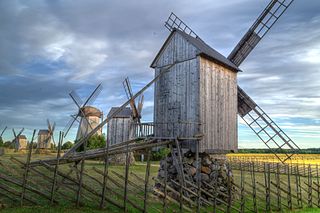
Salme Parish was a municipality in Saare County, Estonia. It contained the northern half of the Sõrve Peninsula of the island of Saaremaa.

Torgu Parish was a rural municipality at the tip of the Sõrve Peninsula on the island of Saaremaa in western Estonia. It is a part of Saare County.
The coats of arms of the 15 counties of Estonia are presented below.

Haanja Parish was a rural municipality in Võru County, southeastern Estonia.

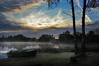
Rõuge Parish is a rural municipality of Estonia, in Võru County. In 2019, it had a population of 5,427 and an area of 933 km².

Misso Parish was a rural municipality of Estonia, in Võru County. It had a population of 780 and an area of 189.35 km2.
Laheküla is a village in Saaremaa Parish, Saare County in western Estonia.
Laoküla is a village in Saaremaa Parish, Saare County in western Estonia.
Kotsma is a village in Saaremaa Parish, Saare County in western Estonia.
Kuusnõmme is a village in Saaremaa Parish, Saare County in western Estonia.
Vahva is a village in Saaremaa Parish, Saare County in western Estonia.
Võrkrahu is a small islet belonging to the country of Estonia off the west coast of the larger island of Saaremaa in the Kuusnõmme Gulf of the Baltic Sea. It is administered by Lääne-Saare Parish. Võrkrahu lies in an oblong north–south direction and is covered in pine and junipers. It covers an area of 6.07618 hectares and a circumference of 1.32628 kilometers and is part of Vilsandi National Park.