Structure to allow fish to migrate upriver around barriers
This article's lead sectionmay be too short to adequately summarize the key points. Please consider expanding the lead to provide an accessible overview of all important aspects of the article.(April 2024)
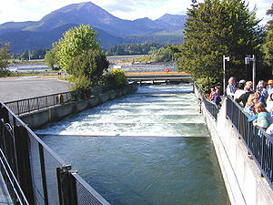
Pool-and-weir fish ladder at Bonneville Dam on the Columbia RiverDrone video of a fish way in Estonia, on the river JägalaFERC Fish Ladder Safety Sign
A fish ladder, also known as a fishway, fish pass, fish steps, or fish cannon is a structure on or around artificial and natural barriers (such as dams, locks and waterfalls) to facilitate diadromous fishes' natural migration as well as movements of potamodromous species.[1] Most fishways enable fish to pass around the barriers by swimming and leaping up a series of relatively low steps (hence the term ladder) into the waters on the other side. The velocity of water falling over the steps has to be great enough to attract the fish to the ladder, but it cannot be so great that it washes fish back downstream or exhausts them to the point of inability to continue their journey upriver.
Written reports of rough fishways date to 17th-century France, where bundles of branches were used to make steps in steep channels to bypass obstructions.
A 1714 construction of an old channel bypassing a dam, "originally cut for the passage of fish up and down the river", is mentioned in the 1823 U.S. Circuit Court Case Tyler v. Wilkinson. This example predates the 1880 fish ladder at Pawtuxet Falls. The 1714 channel "wholly failed for this purpose" and, in 1730, a mill was built in its place. The channel and its mill usage became an important legal case in U.S. water law.[2]
A pool and weir salmon ladder was built around 1830 by James Smith, a Scottish engineer on the River Teith, near Deanston, Perthshire in Scotland. Both the weir and salmon ladder are there today and many subsequent salmon ladders built in Scotland were inspired by it.[3]
A version was patented in 1837 by Richard McFarlan of Bathurst, New Brunswick, Canada, who designed a fishway to bypass a dam at his water-powered lumber mill.[4] In 1852–1854, the Ballisodare Fish Pass was built in County Sligo in Ireland to draw salmon into a river that had not supported a fishery. In 1880, the first fish ladder was built in Rhode Island, United States, on the Pawtuxet Falls Dam. The ladder was removed in 1924, when the City of Providence replaced the wood dam with a concrete one. USA legislated fishways in 1888.[5]
As the Industrial Age advanced, dams and other river obstructions became larger and more common, leading to the need for effective fish by-passes.[6]
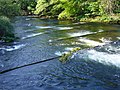
One of the oldest styles of fish ladders. It uses a series of small dams and pools of regular length to make a long, sloping channel for fish to travel around the obstruction. The channel acts as a fixed lock to gradually step down the water level; to head upstream, fish must jump over from box to box in the ladder.
Baffle fishway
Uses a series of symmetrical close-spaced baffles in a channel to redirect the flow of water, allowing fish to swim around the barrier. Baffle fishways need not have resting areas, although pools can be included to provide a resting area or to reduce the velocity of the flow. Such fishways can be built with switchbacks to minimize the space needed for their construction. Baffles come in variety of designs. The most common design is the Larinier pass, named after the French engineer who designed them. They are suitable for coarse fish as well as salmonids, and can be built large enough to be used by canoes.[7] The original design for a Denil fishway was developed in 1909 by a Belgian scientist, G. Denil; it has since been adjusted and adapted in many ways. The Alaskan Steeppass, for example, is a modular prefabricated Denil-fishway variant originally designed for remote areas of Alaska. Baffles have been installed by Project Maitai in several waterways in Nelson, New Zealand, to improve fish passage as part of general environmental restoration.
Fish elevator (or fish lift)
Breaks with the ladder design by providing a sort of elevator to carry fish over a barrier. It is well suited to tall barriers. With a fish elevator, fish swim into a collection area at the base of the obstruction. When enough fish accumulate in the collection area, they are nudged into a hopper that carries them into a flume that empties into the river above the barrier. On the Connecticut River, for example, two fish elevators lift up to 500 fish at a time, 52 feet (15.85 m), to clear the Holyoke Dam. In 2013, the elevator carried over 400,000 fish.[8]
Rock-ramp fishway
Uses large rocks and timbers to make pools and small falls that mimic natural structures. Because of the length of the channel needed for the ladder, such structures are most appropriate for relatively short barriers. They have a significant advantage in that they can provide fish spawning habitat.[9]
Vertical-slot fish passage
Similar to a pool-and-weir system, except that each "dam" has a narrow slot in it near the channel wall. This allows fish to swim upstream without leaping over an obstacle. Vertical-slot fish passages also tend to handle reasonably well the seasonal fluctuation in water levels on each side of the barrier. Recent studies suggest that navigation locks have a potential to be operated as vertical slot fishways to provide increased access for a range of biota, including poor swimmers.[10][11]
Fish siphon
Allows the pass to be installed parallel to a water course and can be used to link two watercourses. The pass utilises a syphon effect to regulate its flow. This style is particularly favoured to aid flood defence.
Fish cannon
A wet, flexible pneumatic tube uses air pressure to suck in salmon one at a time and gently shoot them out into the destination water. The system was originally designed by Bellevue, Washington company Whooshh to safely move apples.[12][13][14]
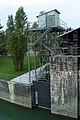
Borland Fish Lift
This is similar to a canal lock. At the downstream end of the obstruction, fish are attracted to a collecting pool by an outflow of water through a sluice gate. At fixed intervals, the gate is closed, and water from the upper level fills the collecting pool and an inclined shaft, lifting the fish up to the upstream level. Once the shaft is full, a sluice at the top level opens, to allow fish to continue their journey upstream. The top sluice then closes, and the shaft empties for the process to begin again. A number of Borland fish lifts have been built in Scotland, associated with hydro-electric dams, including one at Aigas Dam on the River Beauly.[15]
Fish ladder access point (from the downriver side of the power generator-lock complex): Mosel at Koblenz
Effectiveness
This fish failed to enter the narrow opening in the fish ladder in Akerselva, Norway
Fish ladders have a mixed record of effectiveness. They vary in effectiveness for different types of species, with one study showing that only three percent of American Shad make it through all the fish ladders on the way to their spawning ground.[16] Effectiveness depends on the fish species' swimming ability, and how the fish moves up and downstream. A fish passage that is designed to allow fish to pass upstream may not allow passage downstream, for instance.[17] Fish passages do not always work. In practice a challenge is matching swimming performance data to hydrodynamic measurements.[18][19] Swim tests rarely use the same protocol and the output is either a single-point measurement or a bulk velocity. In contrast, physical and numerical modelling of fluid flow (i.e. hydrodynamics) deliver a detailed flow map, with a fine spatial and temporal resolution. Regulatory agencies face a difficult task to match hydrodynamic measurements and swimming performance data.
During the last three decades,[when?] the ecological impact of culverts on natural streams and rivers has been recognised. While the culvert discharge capacity derives from hydrological and hydraulic engineering considerations,[20] this results often in large velocities in the barrel, which may prevent fish from passing through.
Baffles may be installed along the barrel invert to provide some fish-friendly alternative.[21][22][23] For low discharges, the baffles decrease the flow velocity and increase the water depth to facilitate fish passage. At larger discharges, baffles induce lower local velocities and generate recirculation regions. However, baffles can reduce drastically the culvert discharge capacity for a given afflux,[24] thus increasing substantially the total cost of the culvert structure to achieve the same design discharge and afflux. It is believed that fish-turbulence interplay may facilitate upstream migration, albeit an optimum design must be based upon a careful characterisation of both hydrodynamics and fish kinematics.[19][25][26] Finally the practical engineering design implications cannot be ignored, while a solid understanding of turbulence typology is a basic requirement to any successful boundary treatment conducive of upstream fish passage.[27]
↑ Chanson, H. (2004). The Hydraulics of Open Channel Flow: An Introduction. Butterworth-Heinemann, 2nd edition, Oxford, UK. ISBN978-0-7506-5978-9.
↑ Olsen, A.; Tullis, B. (2013). "Laboratory Study of Fish Passage and Discharge Capacity in Slip-Lined, Baffled Culverts". Journal of Hydraulic Engineering. 139 (4): 424–432. doi:10.1061/(asce)hy.1943-7900.0000697. ISSN0733-9429.
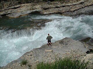
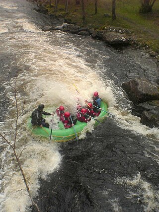
Whitewater forms in the context of rapids, in particular, when a river's gradient changes enough to generate so much turbulence that air is trapped within the water. This forms an unstable current that froths, making the water appear opaque and white.
A hydraulic jump is a phenomenon in the science of hydraulics which is frequently observed in open channel flow such as rivers and spillways. When liquid at high velocity discharges into a zone of lower velocity, a rather abrupt rise occurs in the liquid surface. The rapidly flowing liquid is abruptly slowed and increases in height, converting some of the flow's initial kinetic energy into an increase in potential energy, with some energy irreversibly lost through turbulence to heat. In an open channel flow, this manifests as the fast flow rapidly slowing and piling up on top of itself similar to how a shockwave forms.
A weir or low-head dam is a barrier across the width of a river that alters the flow characteristics of water and usually results in a change in the height of the river level. Weirs are also used to control the flow of water for outlets of lakes, ponds, and reservoirs. There are many weir designs, but commonly water flows freely over the top of the weir crest before cascading down to a lower level. There is no single definition as to what constitutes a weir.
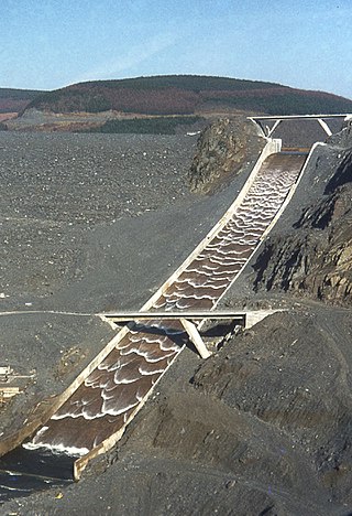
A spillway is a structure used to provide the controlled release of water downstream from a dam or levee, typically into the riverbed of the dammed river itself. In the United Kingdom, they may be known as overflow channels. Spillways ensure that water does not damage parts of the structure not designed to convey water.
A culvert is a structure that channels water past an obstacle or to a subterranean waterway. Typically embedded so as to be surrounded by soil, a culvert may be made from a pipe, reinforced concrete or other material. In the United Kingdom, the word can also be used for a longer artificially buried watercourse.
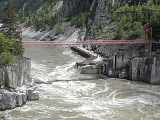
Hells Gate is an abrupt narrowing of British Columbia's Fraser River, located immediately downstream of Boston Bar in the southern Fraser Canyon. The towering rock walls of the Fraser River plunge toward each other forcing the waters through a passage only 35 metres (115 ft) wide. It is also the name of the rural locality at the same location.
Schwatka Lake is a reservoir created by the damming of the Yukon River in Whitehorse, Yukon, completed in 1958. The dam provides electrical power generation and is operated by the Yukon Energy Corporation. The White Horse Rapids, which gave the city its name, are now under the lake. The lake was named after Frederick Schwatka, a US Army Lieutenant who was first to explore the total length of the Yukon River.
The Similkameen River runs through southern British Columbia, Canada, eventually discharging into the Okanagan River near Oroville, Washington, in the United States. Through the Okanagan River, it drains to the Columbia River. The river is said to be named for an indigenous people called Similkameigh, meaning "treacherous waters".
A low-water crossing is a low-elevation roadway traversing over a waterbody that stays dry above the water when the flow is low, but is designed to get submerged under high-flow conditions such as floods. This type of crossing is much cheaper to build than a high bridge that keeps the road surface consistently above the highest water level, and is usually deployed in semi-arid areas where high-volume rainfall is rare and the existing channel is shallow, particularly in developing countries.
Alameda Creek is a large perennial stream in the San Francisco Bay Area. The creek runs for 45 miles (72 km) from a lake northeast of Packard Ridge to the eastern shore of San Francisco Bay by way of Niles Canyon and a flood control channel. Along its course, Alameda Creek provides wildlife habitat, water supply, a conduit for flood waters, opportunities for recreation, and a host of aesthetic and environmental values. The creek and three major reservoirs in the watershed are used as water supply by the San Francisco Public Utilities Commission, Alameda County Water District and Zone 7 Water Agency. Within the watershed can be found some of the highest peaks and tallest waterfall in the East Bay, over a dozen regional parks, and notable natural landmarks such as the cascades at Little Yosemite and the wildflower-strewn grasslands and oak savannahs of the Sunol Regional Wilderness. After an absence of half a century, ocean-run steelhead trout are able to return to Alameda Creek to mingle with remnant rainbow trout populations. Completion of a series of dam removal and fish passage projects, along with improved stream flows for cold-water fish and planned habitat restoration, enable steelhead trout and Chinook salmon to access up to 20 miles (32 km) of spawning and rearing habitat in Alameda Creek and its tributaries. The first juvenile trout migrating downstream from the upper watershed through lower Alameda Creek toward San Francisco Bay was detected and documented in April 2023.
San Francisquito Creek is a creek that flows into southwest San Francisco Bay in California, United States. Historically it was called the Arroyo de San Francisco by Juan Bautista de Anza in 1776. San Francisquito Creek courses through the towns of Portola Valley and Woodside, as well as the cities of Menlo Park, Palo Alto, and East Palo Alto. The creek and its Los Trancos Creek tributary define the boundary between San Mateo and Santa Clara counties.
A drop structure, also known as a grade control, sill, or weir, is a manmade structure, typically small and built on minor streams, or as part of a dam's spillway, to pass water to a lower elevation while controlling the energy and velocity of the water as it passes over. Unlike most dams, drop structures are usually not built for water impoundment, diversion, or raising the water level. Mostly built on watercourses with steep gradients, they serve other purposes such as water oxygenation and erosion prevention.
The Paradise Dam, also known as the Burnett River Dam, is a roller compacted concrete (RCC) gravity dam across the Burnett River, located between Coringa and Good Night northwest Biggenden and 80 kilometres (50 mi) southwest of Bundaberg in the Wide Bay-Burnett region of Queensland, Australia. Built for irrigation, the impoundment created by the dam is called Lake Paradise.
Hubert Chanson is a professional engineer and academic in hydraulic engineering and environmental fluid mechanics. Since 1990 he has worked at the University of Queensland.
Savage Rapids Dam was an approximately 39-foot-high (12 m), 500-foot-long (150 m) irrigation diversion dam spanning the mainstem of the Rogue River in Josephine County, Oregon. The dam was demolished and removed in 2009. From 1921 until the spring of 2009, the Savage Rapids Dam almost entirely functioned for irrigation purposes, and it did not provide any flood control, hydro-electric power, inland waterway, or other significant beneficial uses. It only provided very minor recreational or wildlife benefits.
Marsh Creek is a stream in east Contra Costa County, California in Northern California which rises on the eastern side of Mount Diablo and flows 30 miles (48 km) to the Sacramento–San Joaquin River Delta at Oakley, California, near Big Break Regional Shoreline. The creek flows through Marsh Creek State Park (California), where water is impounded to form Marsh Creek Reservoir, then through the city of Brentwood, California.
Red Bluff Diversion Dam is a disused irrigation diversion dam on the Sacramento River in Tehama County, California, United States, southeast of the city of Red Bluff. Until 2013, the dam provided irrigation water for two canals that serve 150,000 acres (61,000 ha) of farmland on the west side of the Sacramento Valley. The dam and canals are part of the Sacramento Canals Unit of the Central Valley Project, operated by the U.S. Bureau of Reclamation. In 2013, the dam was decommissioned and the river allowed to flow freely through the site in order to protect migrating fish. A pumping plant constructed a short distance upstream now supplies water to the canal system.
The Nimbus Fish Hatchery is located in eastern Sacramento County, built on the downstream side of the Nimbus Dam. It is one of the 21 fish hatcheries the California Department of Fish and Wildlife oversees. Chinook salmon and steelhead are raised, and about 4 million Chinook salmon and 430,000 steelheads released each year.
Craven Dam is at the confluence of the Qu'Appelle River and Last Mountain Creek and immediately east of the village of Craven on the Qu'Appelle River at LSD SW 24-20-21 W2. It is in the Canadian province of Saskatchewan in the RM of Longlaketon No. 219. The dam does not create a reservoir as its purpose is to regulate water flow along the Qu'Appelle River. The dam is operated by the Saskatchewan Water Security Agency and can be accessed on the north side by Highway 99.
Ecohydraulics is an interdisciplinary science studying the hydrodynamic factors that affect the survival and reproduction of aquatic organisms and the activities of aquatic organisms that affect hydraulics and water quality. Considerations include habitat maintenance or development, habitat-flow interactions, and organism responses. Ecohydraulics assesses the magnitude and timing of flows necessary to maintain a river ecosystem and provides tools to characterize the relation between flow discharge, flow field, and the availability of habitat within a river ecosystem. Based on this relation and insights into the hydraulic conditions optimal for different species or communities, ecohydraulics-modeling predicts how hydraulic conditions in a river change, under different development scenarios, the aquatic habitat of species or ecological communities. Similar considerations also apply to coastal, lake, and marine eco-systems.
This page is based on this Wikipedia article Text is available under the CC BY-SA 4.0 license; additional terms may apply. Images, videos and audio are available under their respective licenses.