Related Research Articles

A geographic information system (GIS) consists of integrated computer hardware and software that store, manage, analyze, edit, output, and visualize geographic data. Much of this often happens within a spatial database, however, this is not essential to meet the definition of a GIS. In a broader sense, one may consider such a system also to include human users and support staff, procedures and workflows, the body of knowledge of relevant concepts and methods, and institutional organizations.
Environmental Systems Research Institute, Inc., doing business as Esri, is an American multinational geographic information system (GIS) software company headquartered in Redlands, California. It is best known for its ArcGIS products. With a 40% market share, Esri is the world's leading supplier of GIS software, web GIS and geodatabase management applications.
A GIS file format is a standard for encoding geographical information into a computer file, as a specialized type of file format for use in geographic information systems (GIS) and other geospatial applications. Since the 1970s, dozens of formats have been created based on various data models for various purposes. They have been created by government mapping agencies, GIS software vendors, standards bodies such as the Open Geospatial Consortium, informal user communities, and even individual developers.
A GIS software program is a computer program to support the use of a geographic information system, providing the ability to create, store, manage, query, analyze, and visualize geographic data, that is, data representing phenomena for which location is important. The GIS software industry encompasses a broad range of commercial and open-source products that provide some or all of these capabilities within various information technology architectures.

Jack Dangermond is an American billionaire businessman and environmental scientist, who in 1969 co-founded, with Laura Dangermond, the Environmental Systems Research Institute (Esri), a privately held geographic information systems (GIS) software company. As of July 2023, his net worth was estimated at US$9.3 billion.

ArcView GIS was a geographic information system software product produced by ESRI. It was replaced by new product line, ArcGIS, in 2000. Regardless of it being discontinued and replaced, some users still find the software useful and hold the opinion it is a superior product for some tasks.
ArcSDE is a server-software sub-system that aims to enable the usage of Relational Database Management Systems for spatial data. The spatial data may then be used as part of a geodatabase.
ArcGIS is a family of client, server and online geographic information system (GIS) software developed and maintained by Esri.
ArcInfo is a full-featured geographic information system produced by Esri, and is the highest level of licensing in the ArcGIS Desktop product line. It was originally a command-line based system. The command-line processing abilities are now available through the GUI of the ArcGIS Desktop product.
ArcGIS Server is the core server geographic information system (GIS) software made by Esri. ArcGIS Server is used for creating and managing GIS Web services, applications, and data. ArcGIS Server is typically deployed on-premises within the organization’s service-oriented architecture (SOA) or off-premises in a cloud computing environment.
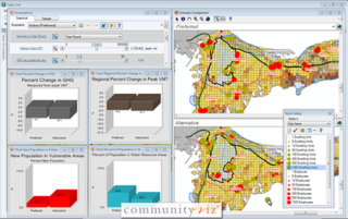
CommunityViz is the name of a group of extensions to ArcGIS Geographic Information System software. CommunityViz is an analysis tool used for, among other applications, urban planning, land use planning, geodesign, transportation planning and resource management applications. It also provides options for 3D visualization in the Scenario 3D and Scenario 360 plugins. CommunityViz also allows users to export and view their work in ArcGIS Online, Google Earth and other KML/KMZ viewers such as ArcGIS Explorer. The software was originally produced by the Orton Family Foundation and in 2005 was handed off to Placeways LLC. In 2017, the software was purchased by City Explained, Inc. where its development continues.
ArcView is the entry level licensing level of ArcGIS Desktop, a geographic information system software product produced by Esri. It is intended by Esri to be the logical migration path from ArcView 3.x.
A georelational data model is a geographic data model that represents geographic features as an interrelated set of spatial and attribute data. The georelational model was the dominant form of vector file format during the 1980s and 1990s, including the Esri coverage and Shapefile.
In geographic information systems (GIS) and spatial analysis, buffer analysis is the determination of a zone around a geographic feature containing locations that are within a specified distance of that feature, the buffer zone. A buffer is likely the most commonly used tool within the proximity analysis methods.
A geographic data model, geospatial data model, or simply data model in the context of geographic information systems, is a mathematical and digital structure for representing phenomena over the Earth. Generally, such data models represent various aspects of these phenomena by means of geographic data, including spatial locations, attributes, change over time, and identity. For example, the vector data model represents geography as collections of points, lines, and polygons, and the raster data model represent geography as cell matrices that store numeric values. Data models are implemented throughout the GIS ecosystem, including the software tools for data management and spatial analysis, data stored in a variety of GIS file formats, specifications and standards, and specific designs for GIS installations.

ArcGIS CityEngine is a commercial three-dimensional (3D) modeling program developed by Esri R&D Center Zurich and specialises in the generation of 3D urban environments. Using a procedural modeling approach, it supports the creation of detailed large-scale 3D city models. CityEngine works with architectural object placement and arrangement in the same manner that software like VUE manages terrain, ecosystems and atmosphere mapping. Unlike the traditional 3D modeling methodology which uses Computer-Aided Design (CAD) tools and techniques, CityEngine takes a different approach to shape generation via a rule-based system. It can also use Geographic Information System (GIS) datasets due to its integration with the wider Esri/ArcGIS platform. Due to this unique feature set, CityEngine has been used in academic research and built environment professions, e.g., urban planning, architecture, visualization, game development, entertainment, archeology, military and cultural heritage. CityEngine can be used within Building Information Model (BIM) workflows as well as visualizing the data of buildings in a larger urban context, enhancing its working scenario toward real construction projects.
Geographic information systems (GIS) play a constantly evolving role in geospatial intelligence (GEOINT) and United States national security. These technologies allow a user to efficiently manage, analyze, and produce geospatial data, to combine GEOINT with other forms of intelligence collection, and to perform highly developed analysis and visual production of geospatial data. Therefore, GIS produces up-to-date and more reliable GEOINT to reduce uncertainty for a decisionmaker. Since GIS programs are Web-enabled, a user can constantly work with a decision maker to solve their GEOINT and national security related problems from anywhere in the world. There are many types of GIS software used in GEOINT and national security, such as Google Earth, ERDAS IMAGINE, GeoNetwork opensource, and Esri ArcGIS.
GeoSUR is a regional initiative led by spatial data producers in Latin America and the Caribbean to implement a regional geospatial network and to help establish the basis of a spatial data infrastructure in the region. GeoSUR supports the development of free access geographic services useful to find, view and analyze spatial information through maps, satellite images, and geographic data.

Pattern-of-life analysis is a method of surveillance that documents or understands the habits of a person or population. Motives may include security, profit, scientific research, regular censuses, and traffic analysis. The data of interest may reflect anything in a person or persons' life: their travels, purchases, internet browsing habits, choices, and so forth. The data is used to predict a subject's future action or to detect anomalous behavior.

Web GIS, or Web Geographic Information Systems, are GIS that employ the World Wide Web to facilitate the storage, visualization, analysis, and distribution of spatial information over the Internet. The World Wide Web, or the Web, is an information system that uses the internet to host, share, and distribute documents, images, and other data. Web GIS involves using the World Wide Web to facilitate GIS tasks traditionally done on a desktop computer, as well as enabling the sharing of maps and spatial data. While Web GIS and Internet GIS are sometimes used interchangeably, they are different concepts. Web GIS is a subset of Internet GIS, which is itself a subset of distributed GIS, which itself is a subset of broader Geographic information system. The most common application of Web GIS is Web mapping, so much so that the two terms are often used interchangeably in much the same way as Digital mapping and GIS. However, Web GIS and web mapping are distinct concepts, with web mapping not necessarily requiring a Web GIS.
References
- ↑ "Oculus GeoTime™ Enables Visualization for Concurrent Spatial and Temporal Analysis". Oculus Info Inc. 18 May 2005. Archived from the original on 4 March 2016. Retrieved 29 May 2013.
- ↑ "GeoTime® Blog | GeoTime® by Uncharted™". geotime.com. Retrieved 2021-04-09.
- 1 2 "System Requirements for GeoTime® | GeoTime® by Uncharted™". geotime.com. Retrieved 2021-04-09.
- 1 2 "GeoTime Overview - Oculus". Oculus Info Inc. Archived from the original on 21 September 2014. Retrieved 29 May 2013.
- ↑ "GeoTime: Features". Oculus Info Inc. Archived from the original on 11 May 2013. Retrieved 29 May 2013.
- ↑ "GeoTime for ArcGIS". Oculus Info Inc. Archived from the original on 1 June 2013. Retrieved 29 May 2013.
- ↑ "GeoTime ArcGIS Compatibility". Oculus Info Inc. Retrieved 29 May 2013.[ permanent dead link ]
- ↑ "GeoTime: Industries". Oculus Info Inc. Archived from the original on 25 August 2011. Retrieved 29 May 2013.
- ↑ "Analysis of GPS data from a downhill skier - new feature sneak peek". Oculus Info Inc. 30 January 2012. Archived from the original on 27 May 2013. Retrieved 29 May 2013.
- ↑ "Demos: Tracking the H1N1 (Swine Flu) Pandemic". Oculus Info Inc. Archived from the original on 13 November 2012. Retrieved 29 May 2013.
- ↑ "US Geological Survey - wildlife tracking analysis webinar". Oculus Info Inc. 5 April 2012. Archived from the original on 27 May 2013. Retrieved 29 May 2013.
- ↑ "GeoTime: Customers". Oculus Info Inc. Archived from the original on 30 May 2013. Retrieved 29 May 2013.
- ↑ "Campaigners angry at new British police tracking system". Wikinews. 12 May 2011. Retrieved 29 May 2013.