Related Research Articles

Geotechnical engineering is the branch of civil engineering concerned with the engineering behavior of earth materials. It uses the principles of soil mechanics and rock mechanics for the solution of its respective engineering problems. It also relies on knowledge of geology, hydrology, geophysics, and other related sciences. Geotechnical (rock) engineering is a subdiscipline of geological engineering.

Geophysics is a subject of natural science concerned with the physical processes and physical properties of the Earth and its surrounding space environment, and the use of quantitative methods for their analysis. The term geophysics sometimes refers only to solid earth applications: Earth's shape; its gravitational and magnetic fields; its internal structure and composition; its dynamics and their surface expression in plate tectonics, the generation of magmas, volcanism and rock formation. However, modern geophysics organizations and pure scientists use a broader definition that includes the water cycle including snow and ice; fluid dynamics of the oceans and the atmosphere; electricity and magnetism in the ionosphere and magnetosphere and solar-terrestrial physics; and analogous problems associated with the Moon and other planets.
An inverse problem in science is the process of calculating from a set of observations the causal factors that produced them: for example, calculating an image in X-ray computed tomography, source reconstruction in acoustics, or calculating the density of the Earth from measurements of its gravity field. It is called an inverse problem because it starts with the effects and then calculates the causes. It is the inverse of a forward problem, which starts with the causes and then calculates the effects.

A porous medium or a porous material is a material containing pores (voids). The skeletal portion of the material is often called the "matrix" or "frame". The pores are typically filled with a fluid. The skeletal material is usually a solid, but structures like foams are often also usefully analyzed using concept of porous media.

Geologic modelling,geological modelling or geomodelling is the applied science of creating computerized representations of portions of the Earth's crust based on geophysical and geological observations made on and below the Earth surface. A geomodel is the numerical equivalent of a three-dimensional geological map complemented by a description of physical quantities in the domain of interest. Geomodelling is related to the concept of Shared Earth Model; which is a multidisciplinary, interoperable and updatable knowledge base about the subsurface.
Petrophysics is the study of physical and chemical rock properties and their interactions with fluids.

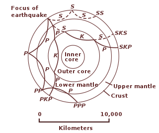
Geodynamics is a subfield of geophysics dealing with dynamics of the Earth. It applies physics, chemistry and mathematics to the understanding of how mantle convection leads to plate tectonics and geologic phenomena such as seafloor spreading, mountain building, volcanoes, earthquakes, faulting. It also attempts to probe the internal activity by measuring magnetic fields, gravity, and seismic waves, as well as the mineralogy of rocks and their isotopic composition. Methods of geodynamics are also applied to exploration of other planets.

Geophysical imaging is a minimally destructive geophysical technique that investigates the subsurface of a terrestrial planet. Geophysical imaging is a noninvasive imaging technique with a high parametrical and spatio-temporal resolution. Geophysical imaging has evolved over the last 30 years due to advances in computing power and speed. It can be used to model a surface or object understudy in 2D or 3D as well as monitor changes.
Computational geophysics is the field of study that uses any type of numerical computations to generate and analyze models of complex geophysical systems. It can be considered an extension, or sub-field, of both computational physics and geophysics. In recent years, computational power, data availability, and modelling capabilities have all improved exponentially, making computational geophysics a more populated discipline. Due to the large computational size of many geophysical problems, high-performance computing can be required to handle analysis. Modeling applications of computational geophysics include atmospheric modelling, oceanic modelling, general circulation models, and geological modelling. In addition to modelling, some problems in remote sensing fall within the scope of computational geophysics such as tomography, inverse problems, and 3D reconstruction.
A synthetic seismogram is the result of forward modelling the seismic response of an input earth model, which is defined in terms of 1D, 2D or 3D variations in physical properties. In hydrocarbon exploration this is used to provide a 'tie' between changes in rock properties in a borehole and seismic reflection data at the same location. It can also be used either to test possible interpretation models for 2D and 3D seismic data or to model the response of the predicted geology as an aid to planning a seismic reflection survey. In the processing of wide-angle reflection and refraction (WARR) data, synthetic seismograms are used to further constrain the results of seismic tomography. In earthquake seismology, synthetic seismograms are used either to match the predicted effects of a particular earthquake source fault model with observed seismometer records or to help constrain the Earth's velocity structure. Synthetic seismograms are generated using specialized geophysical software.

Near-surface geophysics is the use of geophysical methods to investigate small-scale features in the shallow subsurface. It is closely related to applied geophysics or exploration geophysics. Methods used include seismic refraction and reflection, gravity, magnetic, electric, and electromagnetic methods. Many of these methods were developed for oil and mineral exploration but are now used for a great variety of applications, including archaeology, environmental science, forensic science, military intelligence, geotechnical investigation, treasure hunting, and hydrogeology. In addition to the practical applications, near-surface geophysics includes the study of biogeochemical cycles.
The following outline is provided as an overview of and topical guide to geophysics:

Inverse modeling is a mathematical technique where the objective is to determine the physical properties of the subsurface of an earth region that has produced a given seismogram. Cooke and Schneider (1983) defined it as calculation of the earth's structure and physical parameters from some set of observed seismic data. The underlying assumption in this method is that the collected seismic data are from an earth structure that matches the cross-section computed from the inversion algorithm. Some common earth properties that are inverted for include acoustic velocity, formation and fluid densities, acoustic impedance, Poisson's ratio, formation compressibility, shear rigidity, porosity, and fluid saturation.
Vijay Prasad Dimri is an Indian geophysical scientist, known for his contributions in opening up a new research area in Earth sciences by establishing a parallelism between deconvolution and inversion, the two vital geophysical signal processing tools deployed in minerals and oil and gas exploration. In 2010, the Government of India awarded him with the Padma Shri, India's fourth highest civilian award, for his contributions to the fields of science and technology.
Michael Ghil is an American and European mathematician and physicist, focusing on the climate sciences and their interdisciplinary aspects. He is a founder of theoretical climate dynamics, as well as of advanced data assimilation methodology. He has systematically applied dynamical systems theory to planetary-scale flows, both atmospheric and oceanic. Ghil has used these methods to proceed from simple flows with high temporal regularity and spatial symmetry to the observed flows, with their complex behavior in space and time. His studies of climate variability on many time scales have used a full hierarchy of models, from the simplest ‘toy’ models all the way to atmospheric, oceanic and coupled general circulation models. Recently, Ghil has also worked on modeling and data analysis in population dynamics, macroeconomics, and the climate–economy–biosphere system.

In geology, numerical modeling is a widely applied technique to tackle complex geological problems by computational simulation of geological scenarios.
Alik Ismail-Zadeh is a mathematical geophysicist known for his contribution to computational geodynamics and natural hazard studies, pioneering work on data assimilation in geodynamics as well as for outstanding service to the Earth and space science community. He is Senior Research Fellow at the Karlsruhe Institute of Technology in Germany.

Baddari Kamel was born in 1960 in Biskra, an Algerian city located in east-central of Algeria at the gates of the Sahara. He is a physicist and mathematician occupying the position of rector of the University of M'sila, Algeria. He is the president-representative of the Algerian Minister of Higher Education and Scientific Research, of the national steering and monitoring committee for the implementation of the pedagogical accompaniment program for the benefit of the teacher-researcher in Algeria.

Gabor Korvin is a Hungarian Mathematician. He served as a professor at the Department of Earth Sciences, King Fahd University of Petroleum and Minerals. His main areas of research interest include fractal geometry in the earth sciences, statistical rock physics and mathematical geophysics. He is a well-known Applied Mathematician, Geophysicist, Petrophysicist, Historian. At KFUPM he was Coordinator of the Reservoir Characterization Research Group. As Professor, he taught Reservoir Characterization, Seismic Stratigraphy, Petrophysics & Well logging, Solid Earth Geophysics, Geoelectric Exploration, Reflection Seismology, Inverse Problems, Geostatistics and Reservoir Characterization. Fractal Models in the Earth Sciences by Gabor Korvin was one of the earlier books on the application of Fractals in the Earth Sciences.
References
- ↑ Pedlosky 2005
- ↑ Parker 1994
- ↑ Tarantola 1987
- ↑ Parker 1994 , chapter 2
- ↑ Turcotte 1997
- ↑ Korvin G. (1992). Fractal Methods in the Earth Science. Amsterdam: Elsevier.
- ↑ Wang, Zou & Zhu 2000
- 1 2 Gibbs, G. V. The Metrical Matrix in Teaching Mineralogy. Virginia Polytechnic Institute and State University. pp. 201–212.
- 1 2 3 Telford, W. M.; Geldart, L. P.; Sheriff, R. E. (1990-10-26). Applied Geophysics (2 ed.). Cambridge University Press. ISBN 9780521339384.
- 1 2 Hillel, Daniel (2003-11-05). Introduction to Environmental Soil Physics (1 ed.). Academic Press. ISBN 9780123486554.
- ↑ Liu, Cheng; Ph.D, Jack Evett (2008-04-16). Soil Properties: Testing, Measurement, and Evaluation (6 ed.). Pearson. ISBN 9780136141235.
- ↑ Ferguson, John (2013-12-31). Mathematics in Geology (Softcover reprint of the original 1st ed. 1988 ed.). Springer. ISBN 9789401540117.
- 1 2 3 4 5 6 7 8 9 Hutter, K. (1983-08-31). Theoretical Glaciology: Material Science of Ice and the Mechanics of Glaciers and Ice Sheets (Softcover reprint of the original 1st ed. 1983 ed.). Springer. ISBN 9789401511698.