
The Texas Longhorn is an American breed of beef cattle, characterized by its long horns, which can span more than 8 ft (2.4 m) from tip to tip. It derives from cattle brought from the Iberian Peninsula to the Americas by Spanish conquistadores from the time of the Second Voyage of Christopher Columbus until about 1512. For hundreds of years the cattle lived a semi-feral existence on the rangelands; they have a higher tolerance of heat and drought than most European breeds. It can be of any color or mix of colors. In some 40% of the cattle it is some shade of red, often a light red; the only shade of red not seen is the deep color typical of the Hereford.

Hansford County is a county located in the U.S. state of Texas. As of the 2020 census, its population was 5,285. Its county seat is Spearman. The county was created in 1876 and organized in 1889. It is named for John M. Hansford, a Texas state congressman and judge.

Chase County is a county in the U.S. state of Nebraska. As of the 2020 United States Census, the population was 3,893. Its county seat is Imperial.

Dodge City is a city in, and the county seat of, Ford County, Kansas, United States. As of the 2020 census, the population of the city was 27,788. It was named after nearby Fort Dodge, which was named in honor of Grenville Dodge. The city is known in American culture for its history as a wild frontier town of the Old West.
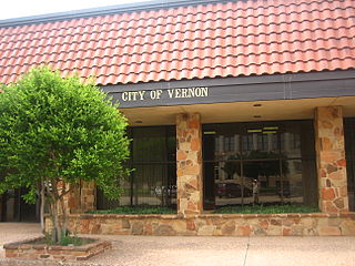
Vernon is a city and the county seat of Wilbarger County, Texas, United States. and as of the 2010 Census had a population of 11,002.
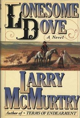
Lonesome Dove is a 1985 Western novel by American writer Larry McMurtry. It is the first published book of the Lonesome Dove series and the third installment in the series chronologically. It was a bestseller and won the 1986 Pulitzer Prize for Fiction. In 1989, it was adapted as a TV miniseries starring Tommy Lee Jones and Robert Duvall, which won both critical and popular acclaim. McMurtry went on to write a sequel, Streets of Laredo (1993), and two prequels, Dead Man's Walk (1995) and Comanche Moon (1997), all of which were also adapted as TV series.
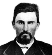
Charles Goodnight, also known as Charlie Goodnight, was a rancher in the American West. In 1955, he was inducted into the Hall of Great Westerners of the National Cowboy & Western Heritage Museum.

The XIT Ranch was a cattle ranch in the Texas Panhandle which operated from 1885 to 1912. Comprising over 3,000,000 acres (12,000 km2) of land, it ran for 200 miles (300 km) along the border with New Mexico, varying in width from 20 to 30 miles. The massive ranch stretched through ten counties in Texas and at its peak regularly handled 150,000 head of cattle. The brand "XIT" was chosen for its difficulty to alter thus thwarting rustlers.

The Chisholm Trail was a trail used in the post-Civil War era to drive cattle overland from ranches in southern Texas, crossed the Red River into Indian Territory, and ended at Kansas rail stops. The trail encompassed a pathway established by Black Beaver in 1861, and a wagon road established by Jesse Chisholm around 1864. "The Chisholm Wagon Road went from Chisholm's trading post on the South Canadian (north of Fort Arbuckle to the Cimarron River crossing, to the Arkansas River at the future site of Wichita where Chisholm had another trading post and on north to Abilene," according to the Kraisingers. By 1869, the entire trail from Texas to Kansas became known as the Chisholm Trail.
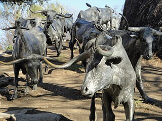
The Texas Road, also known as the Shawnee Trail, or Shawnee-Arbuckle Trail, was a major trade and emigrant route to Texas across Indian Territory. Established during the Mexican War by emigrants rushing to Texas, it remained an important route across Indian Territory until Oklahoma statehood. The Shawnee Trail was the earliest and easternmost route by which Texas Longhorn cattle were taken to the north. It played a significant role in the history of Texas, Oklahoma, Missouri, and Kansas in the early and mid-1800s.
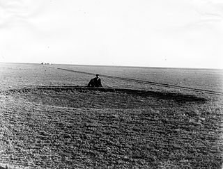
The High Plains are a subregion of the Great Plains, mainly in the Western United States, but also partly in the Midwest states of Nebraska, Kansas, and South Dakota, generally encompassing the western part of the Great Plains before the region reaches the Rocky Mountains. The High Plains are located in eastern Montana, southeastern Wyoming, southwestern South Dakota, western Nebraska, eastern Colorado, western Kansas, eastern New Mexico, the Oklahoma Panhandle, and the Texas Panhandle. The southern region of the Western High Plains ecology region contains the geological formation known as Llano Estacado which can be seen from a short distance or on satellite maps. From east to west, the High Plains rise in elevation from around 1,800 to 7,000 ft.
The Abilene Trail was a cattle trail leading from Texas to Abilene, Kansas. Its exact route is disputed owing to its many offshoots, but it crossed the Red River just east of Henrietta, Texas, and continued north across the Indian Territory to Caldwell, Kansas and on past Wichita and Newton to Abilene. The first herds were probably driven over it in 1866, though it was not named until Abilene was established in 1867.

Cattle drives were a major economic activity in the 19th and early 20th century American West, particularly between 1850s and 1910s. In this period, 27 million cattle were driven from Texas to railheads in Kansas, for shipment to stockyards in St. Louis and points east, and direct to Chicago. The long distances covered, the need for periodic rests by riders and animals, and the establishment of railheads led to the development of "cow towns" across the frontier.
Harold Dow Bugbee was an American Western artist, illustrator, painter, and curator of the Panhandle-Plains Historical Museum in Canyon, Texas. Bugbee sought with considerable success to become the dominant artist of the Texas South Plains, as his role model, Charles M. Russell of Montana, accordingly sketched life of the northern Great Plains.

Friendship is an incorporated town in Jackson County, Oklahoma, United States. The population was 23 as of the 2020 United States census, just down one person from the 2010 census figure of 24.

The Goodnight–Loving Trail was a trail used in the cattle drives of the late 1860s for the large-scale movement of Texas Longhorns. It is named after cattlemen Charles Goodnight and Oliver Loving.

Black Beaver or Se-ket-tu-may-qua was a trapper and interpreter who worked for the American Fur Company. He served as a scout and guide as he was fluent in English, as well as several European and Native American languages. He is credited with establishing the California and Chisholm trails.
A cattle town was a frontier settlement in the Midwestern United States that catered to the cattle industry. The economies of these communities were heavily dependent on the seasonal cattle drives from Texas, which brought the cowboys and the cattle that these towns relied upon. Cattle towns were found at the junctions of railroads and livestock trails. These towns were the destination of the cattle drives, the place where the cattle would be bought and shipped off to urban meatpackers, midwestern cattle feeders, or to ranchers on the central or northern plains. Cattle towns were made famous by popular accounts of rowdy cowboys and outlaws who were kept under control by local lawmen, but those depictions were mostly exaggeration and myth.
The Texas Trail, another name for the Great Western Cattle Trail, was used to drive cattle from Texas to Ogallala, Nebraska. This emerged as an alternative to the Chisholm Trail.

Doan's Adobe House, in Wilbarger County, Texas near Odell, Texas, was built around 1880. It was listed on the National Register of Historic Places in 1979.


