Much of Northamptonshire's countryside appears to have remained somewhat intractable with regards to early human occupation, resulting in an apparently sparse population and relatively few finds from the Palaeolithic, Mesolithic and Neolithic periods.[1] In about 500 BC the Iron Age was introduced into the area by a continental people in the form of the Hallstatt culture,[2] and over the next century a series of hill-forts were constructed at Arbury Camp, Rainsborough camp, Borough Hill, Castle Dykes, Guilsborough, Irthlingborough, and most notably of all, Hunsbury Hill. There are two more possible hill-forts at Arbury Hill (Badby) and Thenford.[2]
Roman occupation
In the 1st century BC, most of what later became Northamptonshire became part of the territory of the Catuvellauni, a Belgic tribe, the Northamptonshire area forming their most northerly possession.[2] The Catuvellauni were in turn conquered by the Romans in 43 AD.[3]
After the Romans left, the area eventually became part of the Anglo-Saxon kingdom of Mercia, and Northampton functioned as an administrative centre. The Mercians converted to Christianity in 654 AD with the death of the pagan king Penda.[4]
At some time in the 7th century the district which is now Northamptonshire suffered a simultaneous invasion by the West Saxons from the south and the Anglian tribes from the north. Relics discovered in the county testify to a mingling of people, at the same time showing that West Saxon influence never spread farther north than a line from Daventry to Warwick, and with the extension of the Mercian kingdom under Penda and the conversion of the midland districts ceased altogether.[5]
From about 889 the area was conquered by the Danes (as at one point almost all of England was, except for Athelney marsh in Somerset) and became part of the Danelaw – with Watling Street serving as the boundary – until being recaptured by the English under the Wessex king Edward the Elder, son of Alfred the Great, in 917. Northamptonshire was conquered again in 940, this time by the Vikings of York, who devastated the area, only for the county to be retaken by the English in 942.[6] Consequently, it is one of the few counties in England to have both Saxon and Danish town-names and settlements.[citation needed]
The county was first recorded in the Anglo-Saxon Chronicle (1011), as Hamtunscire: the scire (shire) of Hamtun (the homestead). The "North" was added to distinguish Northampton from the other important Hamtun further south: Southampton – though the origins of the two names are in fact different.[7]
As a shire Northamptonshire was probably of Danish origin, representing in the 10th century the area which owed allegiance to Northampton as a political and administrative centre. In 921 this area extended to the River Welland, the present northern limit of the county. In the 11th century Northamptonshire was included in Tostig's northern earldom; but in 1065, together with Huntingdonshire, it was detached from Northumbria and bestowed on Waltheof.[5]
Norman conquest and later middle ages
The only monastic foundation which survived the Conquest was Peterborough. At the time of the Domesday Survey the boundaries of Northamptonshire were approximately the same as the present day. Northamptonshire is first mentioned by name in the Historia Eliensis, in connection with events which occurred at the close of the 10th century. At the time of the Domesday survey the chief lay-tenant in Northamptonshire was Robert, earl of Mortain, whose fiefescheated to the crown in 1106. The estates of William Peverel, founder of the Abbey of St James at Northampton, also escheated to the crown in the 12th century.[5]
The Geld roll of the time of William I and the Domesday Survey of 1086 mention 28 hundreds in Northamptonshire, and part of Rutland is assessed under this county. By 1316 the divisions had undergone considerable changes, both in name and in extent, and had been reduced to their present number, 20, since which date they have remained practically unaltered. The names of the hundreds point to primitive meeting-places gradually superseded by villages and towns. For example, the court for Fawsley hundred met under a large beech tree in Fawsley Park until the beginning of the 18th century, when it was transferred to Everdon. The shire court originally met at Northampton.[5]
Northampton was a favourite meeting-place of the councils and parliaments of the Norman and Plantagenet kings. In 1215 John was besieged in Northampton Castle by the barons, and in 1264, Henry III captured the castle from the younger Simon de Montfort.[5]
In the Civil War of the 17th century, the county declared almost unanimously for the parliament. Although a royalistgarrison was placed at Towcester by Prince Rupert in 1644, it was almost immediately withdrawn.[5]
19th century
In 1875, the archdeaconry of Oakham was formed and included in this county the first and second deaneries of Peterborough and the deaneries of Oundle, Weldon and Higham Ferrers. By 1900 the Northampton archdeaconry included the first, second and third deaneries of Brackwell and Rothwell, the first and second deaneries of Haddon and Preston, and the deaneries of Daventry, Northampton and Weldon.[5]
In 1290 Northamptonshire returned two members to parliament, and in 1295 Northampton also returned two members. In 1547 Brackley and Peterborough returned each two members, and in 1557 Higham Ferrers returned one member. Following the Reform act of 1832, the county returned four members in two divisions; both Brackley and Higham Ferrers were disfranchised.[8]
Economic history
The iron-mines and stone-quarries of Northamptonshire were worked in Roman times, but the former were entirely neglected from the Plantagenet period until their rediscovery in 1850, while the two most famous quarries, those of Barnack and Stanion, were exhausted about the 16th century. The wool and leather industries flourished in Norman times.[5]
In the 17th century the weaving industry declined in the Northampton district, but flourished around Kettering. Other early industries were charcoal-burning, brick and tile manufacture and brewing. The industries of whip-making, pipe-making, silk-weaving and paper-making were introduced in the 17th and 18th centuries.[5] Tanning was a flourishing industry, and provided the materials for shoemaking which became a principal industry in the county. Northamptonshire made boots for Oliver Cromwell's New Model Army, and the making of army boots continued to be an important feature of the economy until the 20th century, as well as boots and shoes of other kinds.[citation needed]
Relics
Although Northamptonshire was rich in monastic foundations, remains, except of the abbey-church of Peterborough, afterwards the cathedral, are of small importance. At Geddington, and also at Hardingstone, near Northampton, there is an Eleanor cross, erected by Edward I to the memory of his queen, in good preservation.[8]
For the architecture of its churches, Northampton holds a place scarcely inferior to any other English county. To the Saxon period belong the tower of Earls Barton church, which stands on what is probably the mound of an old English strong-house; the tower and other portions at Brigstock; the ground plan and other portions at Wittering; the remarkable tower at Barnack; and Brixworth church, constructed in part of Roman materials, and by some believed to include part of a Roman basilica.[8]
A gateway at Rockingham, leading to the castle, which is still lived in, and earth-works at Higham Ferrers and Brackley are worthy of mention. Only a large mound and visible earthworks remain of the castle at Fotheringhay, famous as the scene of the imprisonment, trial and execution of Mary, Queen of Scots.[8] Part of the house which was the birthplace of Richard III still stands and is now a private dwelling.
Barnwell Castle, founded by William the Conqueror, an interesting example of the defensive construction of the period, is still a fine ruin, which includes four of the round towers and an imposing gateway.[8]
Northamptonshire is a ceremonial county in the East Midlands of England. It is bordered by Leicestershire, Rutland, and Lincolnshire to the north, Cambridgeshire to the east, Bedfordshire, Buckinghamshire, Oxfordshire to the south, and Warwickshire to the west. Northampton is the largest settlement and the county town.
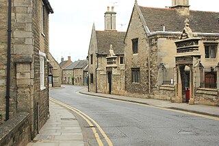
Fotheringhay is a village and civil parish in North Northamptonshire, England. It is 4 miles (6.4 km) north-east of Oundle and around 13 miles (21 km) west of Peterborough. It is most noted for being the site of Fotheringhay Castle which was razed in 1627. There is nothing left of the castle to be seen today other than the motte on which it was built that provides excellent views of the River Nene. The Nene Way long distance footpath runs through the village.
Wellingborough is a market town and civil parish in the North Northamptonshire unitary authority area of Northamptonshire, England. It is 65 miles (105 km) from London and 11 miles (18 km) from Northampton, and is on the north side of the River Nene.
Sir Christopher Hatton KG was an English politician, Lord Chancellor of England and a favourite of Elizabeth I of England. He was one of the judges who found Mary, Queen of Scots guilty of treason.
Raunds is a market town in North Northamptonshire, England. It had a population of 9,379 at the 2021 census.
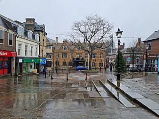
Kettering is a market and industrial town in the North Northamptonshire unitary authority area of Northamptonshire, England. It forms a civil parish called Kettering Town. Kettering is located 67 miles (108 km) north of London and 15 miles (24 km) north-east of Northampton, west of the River Ise, a tributary of the River Nene. The name means "the place of Ketter's people ".
Oundle is a market town and civil parish on the left bank of the River Nene in North Northamptonshire, England, which had a population of 6,254 at the time of the 2021 census. It is 69 miles north of London and 12 mi (19 km) south-west of Peterborough. The town is home to Oundle School.
East Northamptonshire was a local government district in Northamptonshire, England, from 1974 to 2021. Its council was based in Thrapston and Rushden. Other towns included Oundle, Raunds, Irthlingborough and Higham Ferrers. The town of Rushden was by far the largest settlement in the district. The population of the district at the 2011 Census was 86,765.
Staffordshire is a landlocked county in the West Midlands of England. It adjoins Cheshire to the north west, Derbyshire and Leicestershire to the east, Warwickshire to the south east, West Midlands and Worcestershire to the south, and Shropshire to the west. The historic county of Staffordshire includes Wolverhampton, Walsall, and West Bromwich, these three being removed for administrative purposes in 1974 to the new West Midlands authority. The resulting administrative area of Staffordshire has a narrow southwards protrusion that runs west of West Midlands to the border of Worcestershire. The city of Stoke-on-Trent was removed from the admin area in the 1990s to form a unitary authority, but is still part of Staffordshire for ceremonial and traditional purposes.
Badby is a village and a rural parish of about 2,020 acres (820 ha) in West Northamptonshire, England.
Farthingstone is a village in West Northamptonshire in England. It is close to the major trunk routes of the M1 junction 16, M40 motorway, and A5 road, at the head of a valley and is 7 miles (11 km) south of Daventry and 3.5 miles (5.6 km) south west of Weedon Bec.
Benefield is a civil parish in North Northamptonshire, England, along the A427 road and about 6 miles (9.7 km) east of Corby and 3 miles (4.8 km) west of Oundle.
Wadenhoe is a village and civil parish in North Northamptonshire. The population of the civil parish at the 2011 Census was 244. It is on the River Nene, approximately 4 miles from Thrapston and 10 miles from Corby. The Nene Way long-distance footpath passes through the village.
Lower Benefield is a village on the A427 road in North Northamptonshire, England, near Oundle. It is part of the civil parish of Benefield.
The A605 road is a main road in the English counties of Northamptonshire and Cambridgeshire.
North Northamptonshire is one of two local government districts in Northamptonshire, England. It is a unitary authority area forming about one half of the ceremonial county of Northamptonshire. It was created in 2021. Its council is based in Corby, the district's largest town. Other notable towns are Kettering, Wellingborough, Rushden, Raunds, Desborough, Rothwell, Irthlingborough, Thrapston and Oundle.
The Northamptonshire Football Association, also simply known as the Northamptonshire FA, is the governing body of football in the English county of Northamptonshire.
The East Midlands Rugby Football Union (EMRFU) is a governing body for rugby union in part of The Midlands, England. The union is the constituent body of the Rugby Football Union for the counties of Bedfordshire and Northamptonshire and the Huntingdonshire and Peterborough districts of Cambridgeshire and administers and organises rugby union clubs and competitions in those areas. It also administers the East Midlands county rugby representative teams.
References
Greenall, R. L. (1979), A History of Northamptonshire, Phillimore & Company, ISBN1-86077-147-5
This page is based on this Wikipedia article Text is available under the CC BY-SA 4.0 license; additional terms may apply. Images, videos and audio are available under their respective licenses.