
Ithaca is a city and the county seat of Tompkins County, New York, United States. Situated on the southern shore of Cayuga Lake in the Finger Lakes region of New York, Ithaca is the largest community in the Ithaca metropolitan statistical area. It is named after the Greek island of Ithaca.

Libby is a city in northwestern Montana, United States and the county seat of Lincoln County. The population was 2,775 at the 2020 census.
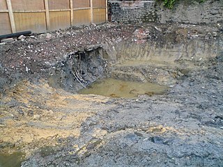
Brownfield refers to land that is abandoned or underutilized due to pollution from industrial use. The specific definition of brownfield land varies and is decided by policy makers and/or land developers within different countries. The main difference in definitions of whether a piece of land is considered a brownfield or not depends on the presence or absence of pollution. Overall, brownfield land is a site previously developed for industrial or commercial purposes and thus requires further development before reuse.

The Cuyahoga River is a river located in Northeast Ohio that bisects the City of Cleveland and feeds into Lake Erie.

The Housatonic River is a river, approximately 149 miles (240 km) long, in western Massachusetts and western Connecticut in the United States. It flows south to southeast, and drains about 1,950 square miles (5,100 km2) of southwestern Connecticut into Long Island Sound.
Buttermilk Falls State Park is a 811-acre (3.28 km2) state park located southwest of Ithaca, New York, United States. Like Robert H. Treman State Park, a portion of the land that was to become the state park came from Robert and Laura Treman in 1924.

The Pit River is a major river draining from northeastern California into the state's Central Valley. The Pit, the Klamath and the Columbia are the only three rivers in the U.S. that cross the Cascade Range.

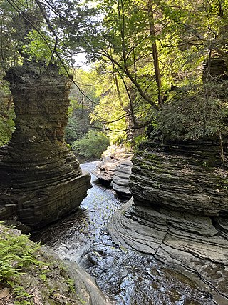
Taughannock Falls State Park is a 750-acre (3.0 km2) state park located in the town of Ulysses in Tompkins County, New York in the United States. The park is northwest of Ithaca near Trumansburg.

Robert H. Treman State Park is a 1,110-acre (4.5 km2) state park located in Tompkins County, in the Finger Lakes region of New York in the United States. The park is situated in the towns of Ithaca, Enfield and Newfield.

Fall Creek Falls State Resort Park is a state park in Van Buren and Bledsoe counties, in the U.S. state of Tennessee. The over 30,638-acre (123.99 km2) park is centered on the upper Cane Creek Gorge, an area known for its unique geological formations and scenic waterfalls. The park's namesake is the 256-foot (78 m) Fall Creek Falls, the highest free-fall waterfall east of the Mississippi River.

The Ithaca Gun Company is a manufacturer of shotguns and rifles originally established in Ithaca, New York, in 1880.

The Cornell Botanic Gardens is a botanical garden located adjacent to the Cornell University campus in Ithaca, New York. The Botanic Gardens proper consist of 25 acres (10 ha) of botanical gardens and 150 acres (61 ha) of the F. R. Newman Arboretum. The greater Botanic Gardens includes 40 different nature areas around Cornell and Ithaca, covering 4,300 acres (1,700 ha).
This is a list of trails in Ithaca, New York.

Ozone Falls State Natural Area is a state natural area in Cumberland County, Tennessee in the southeastern United States. It consists of 43 acres (0.17 km2) centered on Ozone Falls, a 110-foot (34 m) plunge waterfall, and its immediate gorge along Fall Creek. Because of its picturesque beauty and easy access, Disney selected Ozone Falls for scenes for their live-action film "Rudyard Kipling's The Jungle Book". The area is managed by the Tennessee Department of Environment and Conservation and maintained by Cumberland Mountain State Park. It is also part of Cumberland Trail State Park.
In 1990, the Allied Paper, Inc./Portage Creek/Kalamazoo River in southwestern Michigan was declared by the Environmental Protection Agency (EPA) to be a Superfund site – in other words, an abandoned industrial site containing significant amounts of toxic waste. The EPA and companies responsible for the waste in this area, which includes a three-mile section of Portage Creek as well as part of the Kalamazoo River, into which it flows, are currently involved in an effort to reduce the amount of toxic waste at the site, which is contaminated by PCBs from paper mills and other factories.
The Capitol City Plume, which also is referred to as the Capital City Plume, is an area of contaminated groundwater located beneath the western downtown area of Montgomery, Alabama. The contamination was discovered in 1993 by the Alabama Department of Environmental Management (ADEM) which was investigating soil contamination at the Retirement Systems of Alabama Energy Plant in the city. After assessment by the United States Environmental Protection Agency (EPA) it was proposed for inclusion in the National Priorities List (NPL) in May 2000.
The Atlas Asbestos Mine Superfund Site is located within the Clear Creek Management Area near Fresno County, eighteen miles northwest of Coalinga, California. The mine started operating in 1963, covering 435 acres of a large naturally occurring asbestos deposit. The mine closed in 1979 and was placed in the EPA's National Priorities List (NPL) in 1983 due to the pollution of asbestos in the surrounding soil, air and water creating potential health hazards for local populations and environment.

Between 1947 and 1977, General Electric polluted the Hudson River by discharging polychlorinated biphenyls (PCBs) causing a range of harmful effects to wildlife and people who eat fish from the river. Other kinds of pollution, including mercury contamination and cities discharging untreated sewage, have also caused problems in the river.

Whetstone Brook is a tributary of the Connecticut River that runs through the heart of Brattleboro, Vermont, in the United States. It flows into the Connecticut at an elevation of 250 feet (76 m) above sea level. The headwater for the brook is at Hidden Lake, which is 1,500 feet (460 m) above sea level in the town of Marlboro. Of the 28-square-mile (73 km2) watershed, over two thirds is contained within Brattleboro, while another 30 percent is in Marlboro. The remaining 2% is within the town of Dummerston. The brook is crossed by Creamery Covered Bridge in West Brattleboro, which was built in 1879. The original Abenaki name for the waterway is Kitadowôganisibosis.

Warren Creek Falls was a waterfall located in Starvation Creek State Park at the north skirt of the Columbia River Gorge, in Hood River County in the U.S. state of Oregon. It was located in a privileged area along the Historic Columbia River Highway, where several waterfalls are located in Starvation Creek State Park, including Cabin Creek Falls, Lancaster Falls, and Starvation Creek Falls—all within 2 miles (3 km) of each other. It is frequently referred to as the name for Hole-in-the-Wall Falls, a few yards downstream of Warren Creek.


