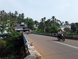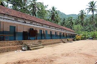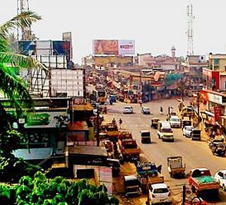
Thiruvambady is a major hill town and a suburb in southeastern Kozhikode district in Kerala, India. Thiruvambady is a Panchayat headquarters, and a legislative assembly constituency, situated 35 kilometres (22 mi) from the district headquarters of Kozhikode.

Peravoor is a town and Grama Panchayat in Kannur district of Kerala state in India. It is located 50 km (31 mi) east of Kannur and 40 km (25 mi) north east of Thalassery. And Iritty, the nearest municipality is 14 km (8.7 mi) north of Peravoor. Peravoor is situated in the Western Ghats mountain range.

Cherupuzha is a town in Kannur district, Kerala, India. It is the headquarters of the Cherupuzha Panchayat which is a special grade panchayat in Kerala.

Karuvarakundu is a semi-urban area in the eastern part of Malappuram district, Kerala, India. It is situated 32 kilometres (20 mi) east of Manjeri, 26 kilometres (16 mi) northeast of Perinthalmanna and 30 km southeast of Nilambur. The Olippuzha River, a tributary of the Kadalundipuzha, flows through the town. Karuvarakundu is close to the Western Ghats and hence prone to landslides.

Kodiyathur is a gram panchayat in Kozhikode district in the state of Kerala, India.

Maniyur Grama Panchayat is located in Vadakara Taluk, in the Kozhikode district in the state of Kerala, India. It covers an area of 31.03 km2.
Maruthonkara is a village and grama panchayat in Kozhikode district in the state of Kerala, India. The nearest town situated near by here is Kuttiyadi. Adukkath,Peruvannamuzhi, Thottilpalam, Chempanoda, kunduthode, chengaroth and Passukkadavu are near by places from here.and best tourist place in kozhikkode district
Nellipoyil is a village and is part of Kodancherry Panchayat in Kozhikode district in the state of Kerala, India. Nearest Places are Kodencheri, Thiruvambady, Thamarassery, Thusharagiri Falls. It is under Thiruvambady Assembly Constituency. Areeppara and Thusharagiri are the main tourist spots in Nellipoyil village, Kerala. Two streams originating from the Western Ghats meet in Thusharagiri to form the River Challipuzha and the river has three waterfalls in it: two of which are in the forest and the third right at the border of the forest. The other river, Iruvanjipuzha of the Ennu Ninte Moideen movie fame, has two waterfalls: Arippara and Pathankayam, with both being utilized for hydro electric projects also. Both are famous tourist attractions.

Puthuppadi is a village and Panchayath located in Kozhikode district of Kerala, India. Puthuppadi Grama Panchayat covers an area of 64.75 km2 and is spread over the villages of Engapuzha and Puthuppadi. The panchayat is bounded on the north by Thamarassery, Kattippara, Kodenchery, Vythiri (Wayanad) panchayats, on the east by Vythiri (Wayanad) and Kodancheri panchayats, on the south by Thamarassery and Kodancheri panchayats and on the west by Kattippara panchayat. Famous Wayandan Churam or Wayandan Pass, which has nine hairpins between Adivaram of Puthuppady Panchayath and Lakkidi of Vythri Panchayath, is in Puthuppadi Panchayat.

Thamarassery, formerly known as Thazhmalachery, is one of the taluks and a major hill town in the Kozhikode district of Kerala, India, 30 km north-east of Kozhikode (Calicut) city and 29 km east of Koyilandy. The town lies on National highway 766.

Koduvally is a major municipal town in Kozhikode district in the Indian state of Kerala. It is located on the National Highway 766 and is about 21 km northeast of Kozhikode (Calicut) city. koduvally is known as the city of gold for its gold trade legacy since 18s and 19s. Koduvally is one of the 140 assembly constituencies in Kerala and One of the 12 block panchayats in kozhikode.The nearest local bodies are Kizhakkoth, Madavoor, kunnamangalam, Omassery, Mukkam, and Thamarassery. Koduvally also gives its name to the Koduvally River which flows west into the sea.

Mukkam is a major municipality town in Kozhikode, state of Kerala, India. Mukkam is one of the major regional suburb of the Kozhikode district. Mukkam is located about 27 km east of Calicut city on the bank of river Iruvanjippuzha, one of the major tributaries of river Chaliyar. Mukkam is also well knows for its secularistic features. The urban region of Mukkam is spread across Mukkam Municipality and the North Karassery region of Karassery Grama Panchayath. The town begins from North Karassery junction region and runs till Agasthianmuzhi Junction region.

Omassery is a town in Kozhikode district, Kerala, India and it is a junction between Thiruvambady, Thamarassery, Mukkam, Koduvally, Kodenchery and Kattangal. Omassery is located 29 kilometers southeast of Kozhikode in the eastern part of Kerala; better known as Malabar. Omassery is a fast developing place and is well connected to the other parts of the state. Besides that, it is known as the gateway to the hill ranges of Western Ghats in Malabar.

Aripara Falls [alternate spelling: Arippara Falls (അരിപ്പാറ)] is a tourist spot in Anakkampoyil near Thiruvambady Town in Kozhikode district, Kerala. It is located on the Thiruvambady - Anakkampoyil route, 15 km from Thiruvambadi. The waterfall is a tributary of Iruvanjippuzha. There is a proposal for implementing a hydro power project on the Arippara waterfall.

Kakkadampoyil, is a small village in Kozhikode district, Kerala, India bordered with Malappuram district. The village has recently emerged as a major tourist destination in the district.

Kattippara often called as Kattipara, is a Panchayat in Kozhikode district, Kerala. It is located about 10 km from Thamarassery town. It is a village with a lot of hilly areas. As the name indicates, it is famous for hard rocks which we can find everywhere in this village. The adjacent villages are Thalayad, Chamal, Kolikkal, Unnikulam, Puthupadi and Thamarassery.
Pullurampara, is a village situated near the town of Thiruvambady in the Calicut district of the Indian state of Kerala. It is approximately 42 km from Calicut and is in two panchayats, Thiruvambady and Kodencheri. Iruvanjippuzha river flows through Pullurampara. The main junction in Pullurampara is Pullurampara Town Junction
Chembukadavu is a village situated near to Thiruvambady and Kodanchery in Kozhikode district of Kerala. Thusharagiri Falls is near to here. The Chembukadavu Dam project I in Kozhikode, North Kerala, India is the first of the string of 14 small hydroelectric projects undertaken by the Kerala State Electricity Board (KSEB), in collaboration with Hang Tso International Centre in China.It is located about 50 km east of Kozhikode in the foothills of Western ghats
Chakkalakkal is a place in Kozhikode district in Kerala, India, located about 20 km east of Kozhikode city on the Kunnamangalam-Nanminda road or Kappad-Thusharagiri-Adivaram road. Nearby places are Koduvally, Narikkuni, and Arambram. The only government-aided higher secondary school in Madavoor village is situated in Chakkalakkal. Chakalakal is a populous place with a population of over 1000. This place has come into news due to the protest against destruction of knolls for the Chakkalakkal higher secondary school.

Athavanad is a village and Grama Panchayat in the Malappuram district, the Indian state of Kerala.


