Melrose is a mostly residential neighborhood in the southwestern section of the New York City borough of the Bronx. It adjoins the business and one-time theater area known as The Hub. Melrose is rectangular-shaped, being bordered by Saint Anns Avenue on the east, 149th Street on the south, Park Avenue on the west, and 163rd Street to the north. Melrose Avenue and Third Avenue are the primary thoroughfares through Melrose.
The neighborhood is part of Bronx Community Board 1, and its ZIP Codes include 10451, 10455, and 10456. The area is patrolled by the New York City Police Department's 40th Precinct.[3] New York City Housing Authority (NYCHA) property in the area is patrolled by P.S.A. 7 at 737 Melrose Avenue.
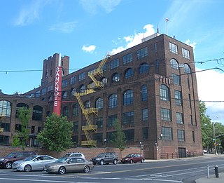
Predominantly German American in the 19th century it was home to Haffen Brewing Company. The German population waned especially post-World War II. The neighborhood until the 1960s was mostly Irish and Italian.[4] It is now primarily Latino.
Grupo TACA operates a Bronx-area TACA Satellite at 570 Melrose Avenue.[5] Melrose is considered part of the socioeconomic South Bronx.
History
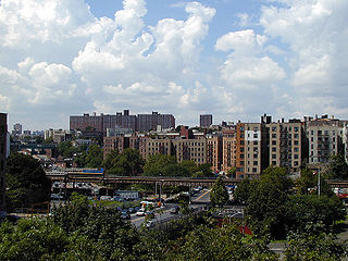
Looking northwest at apartment building on Melrose Avenue and E 154th Street
Melrose was a village in the town of Morrisania,[6] in the county of Westchester before being incorporated into New York City in 1874 as part of the Twenty-Third Ward. Originally a dense working-class neighborhood, the housing that was often hastily built to capitalize on the turn of the 20th century immigrant escape from Manhattan soon became unsuitable to all but the poorest. A mass exodus soon took place as New York City policy–induced arson soon ravaged the neighborhood throughout the 1960s and 1970s. In 1973, the City of New York dismantled the Third Avenue El (an original draw to the neighborhood) due to low ridership. By the 1980s the neighborhood had decayed severely, and much of the original housing stock was lost. Vacant buildings and then lots became commonplace.[7]
Since the mid-1990s, but especially in the 2000s, significant renewal has taken place. A prominent player in the revitalization efforts has been the group Nos Quedamos which in English means "we stay". Many abandoned structures have been renovated and many lots have been constructed on. In most recent years the area has seen a significant "Green" construction boom. Leading the borough in the number of LEED certified apartment buildings, the largest being Via Verde, winner of the 2013 Rudy Bruner Award for Urban Excellence silver medal. Melrose is also home to The Bronx campus of Boricua College. Despite lingering social problems due to a continued significant poverty presence, Melrose has come a long way from a previously "forgotten" neighborhood.[4][8]
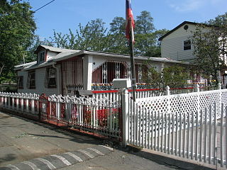
Four historic Melrose churches date to before 1900. The German Methodist Church (1878) 790 Elton Ave., The German Reformed Church (1885) (seen in the distance with white steeple picture above) 744 Elton Ave., Immaculate Conception Church (1887) 389 E. 150th St. and the German Lutheran Church (1895) 376 E. 156th St.
The Melrose neighborhood has grown since Jimmy Carter's famous visit to the Bronx in 1977[9] and will continue to do so as the city's last parcels are sold for development. Many parcels are still in the development phase but will skyrocket the Melrose population.[10]
In 2012, residents expressed concern regarding the MelroseMetro-North station in the neighborhood. Residents would like to see more frequent service, but track and capacity limitations hinder the amount of service available for the stop. Other concerns regarded the lack of handicap access, and the past closure of the main entrance to the stop. The main entrance was closed when the community was at the height of its turmoil, but as the community has regained its footing the desire to have the station open to the primary commercial street, East 161st Street, has grown.
Demographics
Melrose is a high-density neighborhood with a population consisting primarily of Latin Americans and African Americans. Almost half of the population lives below the federal poverty line.[11][12]
Based on data from the 2010 United States Census, the population of Melrose, including northeastern Mott Haven, was 39,214, a change of 6,019 (15.3%) from the 33,195 counted in 2000. Covering an area of 396.81 acres (160.58ha), the neighborhood had a population density of 98.8 inhabitants per acre (63,200/sqmi; 24,400/km2).[13]
The entirety of Community District 1, which comprises Melrose and Mott Haven, had 98,403 inhabitants as of NYC Health's 2018 Community Health Profile, with an average life expectancy of 77.6 years.[15]:2,20 This is lower than the median life expectancy of 81.2 for all New York City neighborhoods.[16]:53 (PDF p. 84)[17] Most inhabitants are youth and middle-aged adults: 28% are between the ages of between 0–17, 28% between 25–44, and 21% between 45–64. The ratio of college-aged and elderly residents was lower, at 12% and 10% respectively.[15]:2
As of 2017, the median household income in Community Districts 1 and 2, including Longwood, was $20,966.[18] In 2018, an estimated 29% of Melrose and Mott Haven residents lived in poverty, compared to 25% in all of the Bronx and 20% in all of New York City. One in eight residents (12%) were unemployed, compared to 13% in the Bronx and 9% in New York City. Rent burden, or the percentage of residents who have difficulty paying their rent, is 58% in Melrose and Mott Haven, compared to the boroughwide and citywide rates of 58% and 51% respectively. Based on this calculation, as of 2018[update], Melrose and Mott Haven are considered to be low-income relative to the rest of the city and is gentrifying.[15]:7
Land use and terrain
Melrose Community Reformed Church
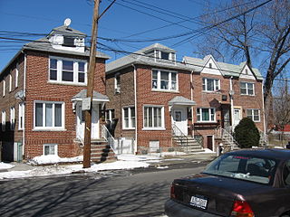
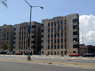
Melrose is dominated by large residential housing complexes of various types, primarily public housing, and tenement style apartment buildings. Most of the original housing stock which consisted of older multi-unit homes and tenements were structurally damaged by arson during the citywide fiscal crisis and eventually razed by the city. In the last decade, construction of modern 2- and 3-unit row-houses and apartment buildings have increased the percentage of owners versus renters. The neighborhood contains one of the highest concentrations of NYCHA projects in the Bronx. The terrain is somewhat hilly.
The Third Avenue Business Improvement District
The Hub-Third Avenue BID is a major local retail district located where five major thoroughfares converge: East 149th Street, Westchester, Willis, Melrose and Third Avenues. The area is served by the 2 and 5 lines at East 149th Street and Third Avenue. One of The Bronx's largest shopping areas (eclipsed only by Fordham Road).[19]
Low-income public housing projects
There are five NYCHA developments located in Melrose.[20]
East 152nd Street-Courtlandt Avenue; two buildings, 11 and 12 stories tall.
Jackson Houses; seven 16-story buildings.
Melrose Houses; eight 14-story buildings.
Morrisania Air Rights; three buildings, 19, 23, and 29 stories.
South Bronx Area (Site 402); four buildings, 3 stories tall.
Park Avenue Green, the largest certified Passive House in North America, opened in 2019.[21]
Melrose and Mott Haven are patrolled by the 40th Precinct of the NYPD, located at 257 Alexander Avenue.[3] The 40th Precinct ranked 59th safest out of 69 patrol areas for per-capita crime in 2010.[22]As of 2018[update], with a non-fatal assault rate of 186 per 100,000 people, Melrose and Mott Haven's rate of violent crimes per capita is greater than that of the city as a whole. The incarceration rate of 1,214 per 100,000 people is higher than that of the city as a whole.[15]:8
The 40th Precinct has a lower crime rate than in the 1990s, with crimes across all categories having decreased by 60.2% between 1990 and 2022. The precinct reported 15 murders, 31 rapes, 559 robberies, 850 felony assaults, 365 burglaries, 753 grand larcenies, and 306 grand larcenies auto in 2022.[23]
Also FDNY EMS Station 55 is located at 3134 Park Avenue.
Health
As of 2018[update], preterm births and births to teenage mothers are more common in Melrose and Mott Haven than in other places citywide. In Melrose and Mott Haven, there were 95 preterm births per 1,000 live births (compared to 87 per 1,000 citywide), and 35.1 births to teenage mothers per 1,000 live births (compared to 19.3 per 1,000 citywide).[15]:11 Melrose and Mott Haven has a relatively high population of residents who are uninsured. In 2018, this population of uninsured residents was estimated to be 14%, slightly higher than the citywide rate of 12%.[15]:14
The concentration of fine particulate matter, the deadliest type of air pollutant, in Melrose and Mott Haven is 0.0086 milligrams per cubic metre (8.6×10⁻⁹oz/cuft), more than the city average.[15]:9 Fifteen percent of Melrose and Mott Haven residents are smokers, which is higher than the city average of 14% of residents being smokers.[15]:13 In Melrose and Mott Haven, 42% of residents are obese, 20% are diabetic, and 38% have high blood pressure—compared to the citywide averages of 24%, 11%, and 28% respectively.[15]:16 In addition, 24% of children are obese, compared to the citywide average of 20%.[15]:12
Eighty-two percent of residents eat some fruits and vegetables every day, which is less than the city's average of 87%. In 2018, 72% of residents described their health as "good", "very good", or "excellent", lower than the city's average of 78%.[15]:13 For every supermarket in Melrose and Mott Haven, there are 25 bodegas.[15]:10
Melrose is covered by multiple ZIP Codes. Most of the neighborhood is located in 10451, but the southeastern corner is part of 10455 and the northeastern corner is part of 10456.[28] The United States Postal Service operates two post offices in Melrose: The Melcourt Station at 860 Melrose Avenue,[29] and the Bronx Station at 558 Grand Concourse.[30]
Education
Melrose and Mott Haven generally have a lower rate of college-educated residents than the rest of the city as of 2018[update]. While 16% of residents aged 25 and older have a college education or higher, 41% have less than a high school education and 43% are high school graduates or have some college education. By contrast, 26% of Bronx residents and 43% of city residents have a college education or higher.[15]:6 The percentage of Melrose and Mott Haven students excelling in math rose from 18% in 2000 to 37% in 2011, though reading achievement decreased slightly from 25% to 24% during the same time period.[31]
Melrose and Mott Haven's rate of elementary school student absenteeism is more than the rest of New York City. In Melrose and Mott Haven, 32% of elementary school students missed twenty or more days per school year, higher than the citywide average of 20%.[16]:24 (PDF p. 55)[15]:6 Additionally, 62% of high school students in Melrose and Mott Haven graduate on time, lower than the citywide average of 75%.[15]:6
Schools
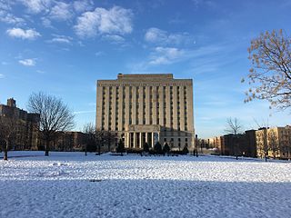
Alfred E. Smith High School on East 151st Street
Public schools:
PS 1: Courtlandt (East 152nd St and Courtlandt Avenue)
PS 29: Melrose (East 156th St and Courtlandt Avenue)
The New York Public Library operates the Melrose branch at 910 Morris Avenue. The branch, a two-story, 10,000-square-foot (930m2)Carnegie library, opened in 1914. It originally had four stories, but the top two floors were removed in a 1959 renovation.[32]
Notable current and former residents of Melrose include:
B-Lovee (born 2000), drill rapper affiliated with the OGz group
Louis F. Haffen (1854–1935), engineer and politician who was the first Bronx Borough President[35]
Sha EK (born 2003), drill artist affiliated with the OGz group[36]
Related Research Articles
Morrisania is a residential neighborhood in the southwestern Bronx, New York City, New York. Its boundaries are the Cross-Bronx Expressway to the north, Crotona-Prospect Avenue to the east, East 163rd Street to the south, and Webster Avenue to the west. Third Avenue is the primary thoroughfare through Morrisania.
Hunts Point is a neighborhood located on a peninsula in the South Bronx of New York City. It is the location of one of the largest food distribution facilities in the world, the Hunts Point Cooperative Market. Its boundaries are the Bruckner Expressway to the west and north, the Bronx River to the east, and the East River to the south. Hunts Point Avenue is the primary street through Hunts Point.
Pelham Bay is a middle class residential neighborhood in the borough of the Bronx, in New York City. It is named for Pelham Bay Park, New York City's largest park, which lies on the neighborhood's northeastern border; and for Pelham Bay, a body of water in that park. The neighborhood is bounded roughly by Pelham Parkway on the north, the New England Thruway (I-95) on the east, the Bruckner Expressway (I-95) on the south, and the Hutchinson River Parkway on the west.
Baychester is a neighborhood geographically located in the northeast part of the Bronx, New York City. Its boundaries are East 222nd Street to the northeast, the New England Thruway (I-95) to the east, Gun Hill Road to the southwest, and Boston Road to the northwest. Eastchester Road is the primary thoroughfare through Baychester.
Longwood is a mixed-use neighborhood in the southwest Bronx in New York City. Its boundaries, starting from the north and moving clockwise are East 167th Street to the north, the Bronx River and the Bruckner Expressway to east, East 149th Street to the south, and Saint Anns Avenue to the west. Southern Boulevard is the primary thoroughfare through Longwood.
Allerton is a working-class neighborhood geographically located in the East Bronx section of the Bronx, New York City. It is named in honor of Daniel Allerton, an early Bronx settler who purchased and farmed this area with his wife Hustace. It consists of two subsections called Bronxwood and Laconia. Its boundaries, starting from the north and moving clockwise, are Adee Avenue, Boston Road, and Gun Hill Road to the northeast; the IRT Dyre Avenue Line to the east; Waring Avenue to the south; and Bronx River Parkway to the west. White Plains Road and Boston Road are the primary thoroughfares through Allerton.
Soundview is a neighborhood on the Clason Point peninsula, on the southern section of the borough of the Bronx in New York City. Its boundaries, starting from the north and moving clockwise, are the Cross-Bronx Expressway to the north, White Plains Road to the east, Lacombe Avenue to the south, and the Bronx River to the west. The Bruckner Expressway bisects the neighborhood horizontally along the center and the Bronx River Parkway runs north to south. Soundview Avenue is the primary thoroughfare through Soundview.
Fordham Manor is a neighborhood located in the western Bronx, New York City. Fordham is roughly bordered by East 196th Street to the north, the Harlem River to the west, Fordham Road to the south, and Southern Boulevard to the east. The neighborhood's primary thoroughfares are Fordham Road and Grand Concourse.
Tremont is a residential neighborhood in the West Bronx, New York City. Its boundaries are East 181st Street to the north, Third Avenue to the east, the Cross-Bronx Expressway to the south, and the Grand Concourse to the west. East Tremont Avenue is the primary thoroughfare through Tremont.
Mott Haven is a primarily residential neighborhood in the southwestern section of the New York City borough of the Bronx. It is generally bounded by East 149th Street to the north, the Bruckner Expressway to the east and south, and the Harlem River to the west, although these boundaries are not precise. East 138th Street is the primary east–west thoroughfare through Mott Haven.
Country Club is a residential neighborhood located in the East Bronx in New York City. The neighborhood's boundaries are Middletown Road and Watt Avenue to the north, Eastchester Bay to the east, Layton Avenue and the Throggs Neck neighborhood to the south, and the New England Thruway and Pelham Bay neighborhood to the west. Pelham Bay Park, the largest public park in New York City, is located just north of Country Club.
East Tremont is a residential neighborhood located in the West Bronx, New York City. From the north and moving clockwise, it is bounded by East 180th Street, Southern Boulevard, the Cross-Bronx Expressway and Third Avenue. East Tremont Avenue is the primary thoroughfare through the neighborhood.
Eastchester is a working-class neighborhood in the northeast Bronx in New York City. Its boundaries, starting from the north and moving clockwise are the Bronx-Westchester County border to the north, the New England Thruway to the east, Baychester Avenue to the south, and the intersection of 233rd Street and Baychester Avenue to the west. Boston Road is the primary thoroughfare through Eastchester and Dyre Avenue is the main commercial street. Eastchester includes the sub-neighborhood of Edenwald.
University Heights is a neighborhood of the West Bronx in New York City. Its boundaries, starting from the north and moving clockwise, are: West Fordham Road to the north, Jerome Avenue to the east, West Burnside Avenue to the south and the Harlem River to the west. University Avenue is the primary thoroughfare in University Heights.
Crotona Park East, also known as Crotona or East Morrisania, is a residential neighborhood geographically located in the southwest Bronx in New York City. Crotona Park East is considered part of the South Bronx. Its boundaries, starting from the north and moving clockwise are the Cross-Bronx Expressway to the north, the Bronx River to the east, East 167th Street to the south, and Crotona/Prospect Avenues to the west. Southern Boulevard is the primary thoroughfare through the area. The neighborhood is adjacent to, but distinct from, the nearby park named Crotona Park.
Morris Heights is a residential neighborhood located in the West Bronx. Its boundaries, starting from the north and moving clockwise are: West Burnside Avenue to the north, Jerome Avenue to the east, the Cross-Bronx Expressway to the south, and the Harlem River to the west. University Avenue is the primary thoroughfare through Morris Heights.
West Farms is a residential neighborhood in The Bronx, New York City. Its boundaries, are: Bronx Park to the north, the Bronx River Parkway to the east, the Cross-Bronx Expressway to the south, and Southern Boulevard to the west. East Tremont Avenue is the primary thoroughfare through West Farms.
Castle Hill is a neighborhood located in the southeast section of the borough of the Bronx in New York City. Its boundaries are Waterbury Avenue and Westchester Avenue to the north, Westchester Creek to the east, the East River to the south, and White Plains Road to the west. Unionport is a subsection of Castle Hill, typically considered north of Lafayette Avenue.
Clason Point is a peninsula and a neighborhood in the East Bronx, New York City. The area includes a collection of neighborhoods including Harding Park, and Soundview. Its boundaries, starting from the north and moving clockwise, are: Lafayette Avenue to the north, White Plains Road/Pugsley Creek Park to the east, the East River to the south, and the Bronx River to the west.
Concourse is a neighborhood in the southwestern section of the New York City borough of the Bronx which includes the Bronx County Courthouse, the Bronx Museum of the Arts, and Yankee Stadium. Its boundaries, starting from the north and moving clockwise, are East 169th Street to the north, Webster Avenue to the east, East 149th Street to the south, and Jerome Avenue and Harlem River to the west. The neighborhood is divided into three subsections: West Concourse, East Concourse, and Concourse Village with the Grand Concourse being its main thoroughfare.
↑ Haffen Park, New York City Department of Parks and Recreation. Accessed January 2, 2024. "Louis F. Haffen (1854-1935) was the first Borough President of the Bronx. The son of a German dairy farmer and beer brewer, he was born on November 6, 1854 in Melrose, Westchester County (now the Bronx) at Courtlandt Avenue and Elton Street (now 152nd Street)."
This page is based on this Wikipedia article Text is available under the CC BY-SA 4.0 license; additional terms may apply. Images, videos and audio are available under their respective licenses.